Category:Balmaghie
English: Balmaghie (from the Scottish Gaelic Baile Mac Aoidh) is a civil parish in Dumfries and Galloway, Scotland and was the seat of the McGhee family. It is bordered by the River Dee to the north and east. The River Dee is commonly known as the Black Water of Dee on the northern border, the name changes with the meeting of the Water of Ken to the north west and is then known as Loch Ken along the eastern border. Balmaghie parish borders Girthon to the west and Tongland and Twynholm to the south. The closest market town is Castle Douglas about 6 miles from Balmaghie Kirk.
village in Dumfries and Galloway, Scotland, UK  | |||||
| Upload media | |||||
| Instance of | |||||
|---|---|---|---|---|---|
| Location |
| ||||
 | |||||
Media in category "Balmaghie"
The following 139 files are in this category, out of 139 total.
-
 An old sheep pen - geograph.org.uk - 484891.jpg 640 × 480; 110 KB
-
 Auchenhay - geograph.org.uk - 690613.jpg 640 × 480; 91 KB
-
 Bargatton, Laurieston - geograph.org.uk - 886465.jpg 640 × 480; 90 KB
-
 Barnboard farm - geograph.org.uk - 463881.jpg 640 × 480; 60 KB
-
 Blates Mill - geograph.org.uk - 1219547.jpg 640 × 388; 107 KB
-
 Blates Mill, near Laurieston - geograph.org.uk - 261347.jpg 640 × 407; 91 KB
-
 Braefoot - geograph.org.uk - 444255.jpg 640 × 480; 151 KB
-
 Braefoot House - geograph.org.uk - 547706.jpg 640 × 427; 117 KB
-
 Bridge over the Kenick Burn - geograph.org.uk - 1362531.jpg 640 × 480; 131 KB
-
 Bridgestone - geograph.org.uk - 321980.jpg 640 × 480; 195 KB
-
 Bridgestone Farm - geograph.org.uk - 546499.jpg 640 × 427; 112 KB
-
 Bridgestone Hill and Long Hill - geograph.org.uk - 546497.jpg 640 × 213; 44 KB
-
 Campdouglas Farm - geograph.org.uk - 546506.jpg 640 × 324; 67 KB
-
 Car park at the Kenick Burn - geograph.org.uk - 1348417.jpg 640 × 480; 126 KB
-
 Cattle grid - geograph.org.uk - 1362631.jpg 640 × 480; 85 KB
-
 Country Road - geograph.org.uk - 546478.jpg 427 × 640; 141 KB
-
 Country Road - geograph.org.uk - 546502.jpg 427 × 640; 106 KB
-
 Country Road - geograph.org.uk - 546503.jpg 427 × 640; 88 KB
-
 Country Road - geograph.org.uk - 546504.jpg 427 × 640; 80 KB
-
 Country Road - geograph.org.uk - 546505.jpg 640 × 252; 61 KB
-
 Craig Farm - geograph.org.uk - 546474.jpg 640 × 173; 37 KB
-
 Craig Farm - geograph.org.uk - 546475.jpg 640 × 427; 121 KB
-
 Creochs Farm - geograph.org.uk - 444239.jpg 640 × 480; 123 KB
-
 Daffodils at Threave House - geograph.org.uk - 250890.jpg 640 × 480; 139 KB
-
 Darngarroch Bridge - geograph.org.uk - 1309551.jpg 640 × 480; 128 KB
-
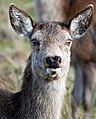 Deer - geograph.org.uk - 413816.jpg 515 × 640; 98 KB
-
 Deer grazing - geograph.org.uk - 413820.jpg 640 × 428; 105 KB
-
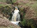 Derrygown Linn waterfall - geograph.org.uk - 1309561.jpg 640 × 480; 139 KB
-
 Disused quarry near Stroan Hill - geograph.org.uk - 551065.jpg 640 × 480; 144 KB
-
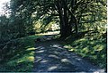
 Dornell Estate road - geograph.org.uk - 704983.jpg 640 × 480; 127 KB
-
 Dornell Wood, Kirk Road - geograph.org.uk - 704899.jpg 640 × 480; 119 KB
-
 Driveway to Hensol House - geograph.org.uk - 263582.jpg 640 × 439; 127 KB
-
 Drumglass - geograph.org.uk - 690568.jpg 640 × 480; 85 KB
-
 Drumlane Farm - geograph.org.uk - 444242.jpg 640 × 480; 135 KB
-
 Dry stone wall - geograph.org.uk - 1475590.jpg 640 × 480; 87 KB
-
 Easter Urioch - geograph.org.uk - 696645.jpg 640 × 480; 114 KB
-
 Entrance to Balmaghie House - geograph.org.uk - 444260.jpg 640 × 480; 163 KB
-
 Entrance to Balmaghie house - geograph.org.uk - 463878.jpg 640 × 480; 83 KB
-

-
-
 Entrance to the Kenick Burn car park. - geograph.org.uk - 1362580.jpg 640 × 480; 152 KB
-
 Entrance to Whitehill of Balmaghie - geograph.org.uk - 444277.jpg 640 × 480; 153 KB
-
 Finniness Plantation (Wood Hill) - geograph.org.uk - 546477.jpg 640 × 427; 133 KB
-
 Footbridge over the Kenick Burn - geograph.org.uk - 1348430.jpg 640 × 480; 140 KB
-
 Forest edge - geograph.org.uk - 966639.jpg 640 × 426; 59 KB
-
 Forest track near the Kenick Burn - geograph.org.uk - 1362522.jpg 640 × 480; 128 KB
-
 Forest walk at Kenick Burn - geograph.org.uk - 1362471.jpg 640 × 480; 148 KB
-
 Forestry Operations - geograph.org.uk - 967418.jpg 640 × 426; 94 KB
-

-
 Forestry Road into Laurieston Forest - geograph.org.uk - 484042.jpg 640 × 480; 90 KB
-
 Forestry Road, Laurieston Forest - geograph.org.uk - 484869.jpg 640 × 480; 125 KB
-
 Forestry Road, Laurieston Forest - geograph.org.uk - 484882.jpg 640 × 480; 96 KB
-
 Forestry Track in Laurieston Forest - geograph.org.uk - 484860.jpg 640 × 480; 137 KB
-
 Gate entrance and gatehouse - geograph.org.uk - 263581.jpg 640 × 445; 111 KB
-
-

-
 Gateside - geograph.org.uk - 690620.jpg 640 × 480; 62 KB
-
 Gravestones at Balmaghie Churchyard.jpg 684 × 327; 24 KB
-
 Greylag at Livingstone - geograph.org.uk - 690592.jpg 640 × 480; 70 KB
-
 Grobdale - geograph.org.uk - 726538.jpg 640 × 480; 61 KB
-
 Grobdale of Balmaghie - geograph.org.uk - 726530.jpg 640 × 480; 57 KB
-
 Grobdale of Balmaghie farm - geograph.org.uk - 1362609.jpg 640 × 480; 69 KB
-

-
 Hensol House - geograph.org.uk - 263579.jpg 640 × 426; 140 KB
-
 Junction on an unclassified road. - geograph.org.uk - 1362555.jpg 640 × 480; 140 KB
-
 Junction with A75 - geograph.org.uk - 444283.jpg 640 × 480; 126 KB
-
 Ken Dee Marshes - geograph.org.uk - 263585.jpg 640 × 438; 144 KB
-
 Ken-Dee Farmland - geograph.org.uk - 321902.jpg 640 × 480; 160 KB
-
 Kenick Burn - geograph.org.uk - 690.jpg 426 × 640; 285 KB
-
 Kenick Burn in Laurieston Forest - geograph.org.uk - 484857.jpg 640 × 480; 112 KB
-
 Kenick Wood South - geograph.org.uk - 752681.jpg 640 × 480; 102 KB
-
 Kirk Road from Dornell - geograph.org.uk - 704968.jpg 640 × 480; 90 KB
-
 Kirk Road, Laurieston. - geograph.org.uk - 523617.jpg 640 × 480; 128 KB
-
 Kites at the table. - geograph.org.uk - 582274.jpg 640 × 469; 113 KB
-
 Knockmurry Hill - geograph.org.uk - 546501.jpg 640 × 427; 97 KB
-
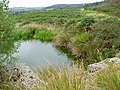
 Lochan behind Blates Mill - geograph.org.uk - 263504.jpg 640 × 406; 93 KB
-
 Lochenbreck bridge - geograph.org.uk - 1309580.jpg 640 × 480; 117 KB
-

-
 Looking at Glentoo - geograph.org.uk - 463896.jpg 640 × 480; 55 KB
-
 Looking from the RSPB Hide - geograph.org.uk - 321914.jpg 640 × 395; 98 KB
-
 Looking North from Balmaghie Churchyard - geograph.org.uk - 321951.jpg 640 × 477; 206 KB
-
 Mains of Duchrae - geograph.org.uk - 321910.jpg 640 × 480; 183 KB
-
 Marshland near Camelon Bridge - geograph.org.uk - 406559.jpg 640 × 480; 90 KB
-
 Marshland Scrub - geograph.org.uk - 321924.jpg 640 × 480; 136 KB
-
 Marshy ground, behind Blates Mill - geograph.org.uk - 261363.jpg 640 × 407; 72 KB
-
 Minor road near Balmaghie - geograph.org.uk - 444262.jpg 640 × 480; 117 KB
-
 Moorland near Laurieston Forest - geograph.org.uk - 263589.jpg 640 × 444; 93 KB
-
 Moorland track - geograph.org.uk - 1463147.jpg 640 × 480; 99 KB
-
 Neuk Farm Pylon - geograph.org.uk - 966681.jpg 640 × 426; 53 KB
-
 New forest growth - geograph.org.uk - 1373730.jpg 640 × 391; 77 KB
-
 New Life - geograph.org.uk - 704468.jpg 640 × 480; 101 KB
-
 Old Farm Track near Hensol Bridge. - geograph.org.uk - 532155.jpg 640 × 480; 118 KB
-
 Old track - geograph.org.uk - 1475617.jpg 640 × 451; 118 KB
-
 Old, ruined wall - geograph.org.uk - 1362538.jpg 640 × 480; 157 KB
-
 Overgrown Forest Stream - geograph.org.uk - 965390.jpg 426 × 640; 99 KB
-

-
-
 Postcard from South Quintinespie - geograph.org.uk - 704496.jpg 640 × 480; 89 KB
-
 Red Kite - geograph.org.uk - 581922.jpg 640 × 504; 34 KB
-
 Red Kite - geograph.org.uk - 687761.jpg 640 × 465; 30 KB
-
 Red Kite at Bellymack Hill - geograph.org.uk - 322008.jpg 640 × 436; 63 KB
-
 Red Kite Feeding Table - geograph.org.uk - 321998.jpg 640 × 480; 105 KB
-
 Red Kites Feeding - geograph.org.uk - 322004.jpg 640 × 452; 96 KB
-

-
 Rev. Professor H. M. B. Reid.jpg 942 × 1,416; 253 KB
-
 River Dee from bird hide - geograph.org.uk - 1202628.jpg 640 × 285; 37 KB
-

-
 River Dee, Netherhall - geograph.org.uk - 1075929.jpg 640 × 429; 26 KB
-
 Riverside Cottage - geograph.org.uk - 263578.jpg 640 × 430; 105 KB
-
 Road sign - geograph.org.uk - 1309592.jpg 640 × 460; 65 KB
-

-

-
 Road to Neuk - geograph.org.uk - 463887.jpg 640 × 480; 60 KB
-
 Rock wall near Lochenbreck Loch - geograph.org.uk - 484879.jpg 640 × 480; 106 KB
-
 Sheep grazing and rocky outcrop - geograph.org.uk - 444231.jpg 640 × 480; 153 KB
-
 Slogarie Farm - geograph.org.uk - 868253.jpg 640 × 480; 97 KB
-
 Small burn in the Kenick forest. - geograph.org.uk - 1362528.jpg 640 × 480; 146 KB
-
 Stroan Bridge over Stroan Burn - geograph.org.uk - 261991.jpg 640 × 480; 105 KB
-
 Stroan viaduct - geograph.org.uk - 1426389.jpg 640 × 426; 92 KB
-
 The beginning of Laurieston Forest - geograph.org.uk - 1383202.jpg 640 × 480; 73 KB
-
 The best side of Stroan Bridge - geograph.org.uk - 551008.jpg 640 × 480; 119 KB
-
 The edge of the forest - geograph.org.uk - 1362498.jpg 640 × 480; 152 KB
-
 The Galloway Kite Trail at Bellymack Hill - geograph.org.uk - 322011.jpg 640 × 459; 150 KB
-
 The Ken-Dee Marshes at Duchrae Mains - geograph.org.uk - 321514.jpg 640 × 480; 110 KB
-

-
 The Rare White Red Kite - geograph.org.uk - 687755.jpg 510 × 640; 79 KB
-
 The River Dee from Balmaghie Church. View of Crossmichael.jpg 4,896 × 3,672; 4.28 MB
-
 The Road to Laurieston - geograph.org.uk - 321987.jpg 640 × 480; 116 KB
-

-
 Towards Bellymack - geograph.org.uk - 322015.jpg 640 × 452; 138 KB
-
 Track leading to Threave Mains - geograph.org.uk - 444273.jpg 640 × 480; 144 KB
-
 Track on the dismantled railway - geograph.org.uk - 1463141.jpg 640 × 480; 90 KB
-

-
 View From Balmaghie Churchyard - geograph.org.uk - 321964.jpg 640 × 467; 120 KB
-
 View towards Creochs - geograph.org.uk - 463891.jpg 640 × 480; 47 KB
-
 View towards Edgarton - geograph.org.uk - 406542.jpg 640 × 480; 83 KB
-
 Wet Road to Laurieston - geograph.org.uk - 704490.jpg 640 × 480; 58 KB
-
 Winter Farmland - geograph.org.uk - 321527.jpg 640 × 480; 120 KB
-
 Winter Scene - geograph.org.uk - 321943.jpg 640 × 448; 110 KB


_-_geograph.org.uk_-_546477.jpg)


_Minister_of_Balmaghie_Parish,_Kirkcudbrightshire,_Scotland.jpg)


_at_Ballymach_-_geograph.org.uk_-_582262.jpg)


