Category:Barbed wire fences in England

Media in category "Barbed wire fences in England"
The following 67 files are in this category, out of 67 total.
-
 A laneside at the north of Nuthurst, West Sussex, England ~ posts and wire.JPG 3,648 × 5,472; 11.42 MB
-
 Field fingerpost and barbed wire fence, Nuthurst, West Sussex, England.jpg 3,648 × 5,472; 22.27 MB
-
 A Thames footbridge between fields of Cricklade (geograph 2393879).jpg 1,024 × 680; 288 KB
-
 Apperley Bridge to Esholt (34481883961).jpg 6,000 × 4,000; 10.64 MB
-
 Aylesham August field Kent England field looking northwest 01.jpg 5,472 × 3,648; 15.62 MB
-
 A much used old fence post - geograph.org.uk - 724676.jpg 480 × 640; 175 KB
-
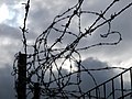
 Barbed wire - geograph.org.uk - 658327.jpg 427 × 640; 93 KB
-
 Barbed wire - geograph.org.uk - 732715.jpg 640 × 480; 50 KB
-
 Barbed wire and blue sky 01.JPG 4,320 × 3,240; 4.83 MB
-
 Barbed wire and blue sky 02.JPG 4,320 × 3,240; 4.84 MB
-
 Barbed wire and blue sky 03.JPG 3,240 × 4,320; 4.62 MB
-
 Barbed wire and blue sky 04.JPG 3,240 × 4,320; 3.43 MB
-
 Barbed wire and blue sky with broken glass 02.JPG 4,320 × 3,240; 4.74 MB
-
 Barbed wire and blue sky with broken glass.JPG 4,320 × 3,240; 4.76 MB
-
 Barbed wire and blue sky with green.JPG 4,320 × 3,240; 4.72 MB
-
 Barbed wire and blue sky with hair.JPG 3,240 × 4,320; 4.89 MB
-
 Barbed wire and poppies. - geograph.org.uk - 507836.jpg 640 × 480; 127 KB
-
 Barbed wire fence across Elland FP80 (E10), Greetland - geograph.org.uk - 4512890.jpg 2,000 × 1,457; 1.69 MB
-
 Barbed wire fence Hatfield Forest Essex England 1.jpg 3,000 × 2,000; 6.39 MB
-
 Barbed wire fence Hatfield Forest Essex England 2.jpg 3,000 × 2,000; 8.4 MB
-
 Baxenden Chemicals, Droitwich - geograph.org.uk - 1154355.jpg 640 × 480; 77 KB
-
 Benkid77 Brimstage-Parkgate footpath 9 240709.JPG 3,648 × 2,736; 3.54 MB
-
 Between a hedge and a barbed wire fence - geograph.org.uk - 1334228.jpg 640 × 480; 131 KB
-
 Beware the barbed wire - geograph.org.uk - 495466.jpg 480 × 640; 165 KB
-
 Blackberries and barbed wire.jpg 4,128 × 3,096; 4.34 MB
-
 A beech woodland - geograph.org.uk - 1088261.jpg 640 × 480; 163 KB
-

-
 Canopied lane of laurels, Nuthurst, West Sussex, England 1.jpg 5,259 × 3,506; 21.25 MB
-
 Canopied lane of laurels, Nuthurst, West Sussex, England 10.jpg 5,472 × 3,648; 22.1 MB
-
 Canopied lane of laurels, Nuthurst, West Sussex, England 2.jpg 3,506 × 5,259; 20.39 MB
-
 Canopied lane of laurels, Nuthurst, West Sussex, England 3.jpg 5,472 × 3,648; 21.55 MB
-
 Canopied lane of laurels, Nuthurst, West Sussex, England 4.jpg 5,472 × 3,648; 23.34 MB
-
 Canopied lane of laurels, Nuthurst, West Sussex, England 6.jpg 5,472 × 3,648; 22.2 MB
-
 Cattle on Portesham Hill - geograph.org.uk - 242795.jpg 640 × 480; 142 KB
-
 Don't Fence Me In - geograph.org.uk - 507801.jpg 640 × 480; 112 KB
-
 Foxglove and barbed wire - geograph.org.uk - 869580.jpg 640 × 480; 121 KB
-
 German Prisoners of War in Britain H6292.jpg 800 × 793; 144 KB
-
 A well-weathered fence post - geograph.org.uk - 666453.jpg 480 × 640; 194 KB
-
 Illegal barbed wire fence across Elland FP80 (E2), Greetland - geograph.org.uk - 4512796.jpg 2,048 × 1,536; 1.32 MB
-
 Inquisitive Bullocks - geograph.org.uk - 523788.jpg 640 × 480; 135 KB
-
 An empty feeder - geograph.org.uk - 1025983.jpg 480 × 640; 189 KB
-
 Jericho StBarnabas 2006-01.JPG 2,850 × 1,900; 439 KB
-
 Jericho StBarnabas 2006-02.JPG 1,950 × 2,600; 380 KB
-
 Keep out ! (6654866377).jpg 2,736 × 3,648; 1.08 MB
-
 Magpies on Road to Geltsdale House - geograph.org.uk - 461852.jpg 480 × 640; 107 KB
-
 On the very minor road. - geograph.org.uk - 21643.jpg 640 × 480; 144 KB
-
 Overgrown Hedge, Lough Bank - geograph.org.uk - 428582.jpg 640 × 427; 82 KB
-
 Potter Fell Fence - geograph.org.uk - 507806.jpg 640 × 480; 89 KB
-
 Public Footpath near Wotton - geograph.org.uk - 35469.jpg 640 × 480; 196 KB
-
 Railway Fence Post - geograph.org.uk - 544554.jpg 640 × 487; 179 KB
-
 Sheep's wool caught in barbed wire fence - geograph.org.uk - 1632542.jpg 480 × 640; 190 KB
-
 Stone wall and fence - geograph.org.uk - 303844.jpg 640 × 427; 82 KB
-
 The Beehive Flash - geograph.org.uk - 714340.jpg 640 × 480; 81 KB
-
 The entrance to the Silver Seal Mine - geograph.org.uk - 1750820.jpg 640 × 480; 84 KB
-
 The Headland Way - geograph.org.uk - 835190.jpg 538 × 640; 234 KB
-
 The P.o.w. Bathing Section Art.IWMART17059.jpg 800 × 478; 59 KB
-

-
 The Thames floodplain, Sonning - geograph.org.uk - 671117.jpg 640 × 480; 79 KB
-
 The Yorkshire Wolds Way, Brantingham - geograph.org.uk - 787026.jpg 640 × 427; 181 KB
-
 Eyes Left^ - geograph.org.uk - 442479.jpg 640 × 480; 117 KB
-

-
 A Horizontal Fence - geograph.org.uk - 524639.jpg 640 × 427; 126 KB
-
 Victoria Avenue airport viewing area (24th July 2010) 001.jpg 3,648 × 2,736; 1.57 MB
-

-
 A broken fence - geograph.org.uk - 1080827.jpg 640 × 480; 93 KB
-
 Wind Blown Fleece - geograph.org.uk - 705269.jpg 640 × 480; 101 KB
-
 Woodland behind barbed wire fence - geograph.org.uk - 918113.jpg 480 × 640; 200 KB


.jpg)
.jpg)


,_Greetland_-_geograph.org.uk_-_4512890.jpg)


,_Greetland_-_geograph.org.uk_-_4512796.jpg)


.jpg)


_001.jpg)


