Category:Barnet Town
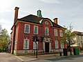
High Barnet or Chipping Barnet is a place in the London Borough of Barnet, North London, England. It is a suburban development built around a 12th-century settlement and is located 10 miles (16.1 km) north north-west of Charing Cross. Its name is traditionally abbreviated to Barnet, the name also of the larger w:en:London borough (1965) of which it forms a part, and under this name it is also a postal town. Chipping Barnet is the name of the Parliamentary constituency.
area in the London Borough of Barnet, England, United Kingdom  | |||||
| Upload media | |||||
| Instance of | |||||
|---|---|---|---|---|---|
| Location | London Borough of Barnet, Greater London, London, England | ||||
| Different from | |||||
| official website | |||||
 | |||||
Subcategories
This category has the following 23 subcategories, out of 23 total.
B
- Barnet Fair (10 F)
- Barnet Hospital (14 F)
- Barnet Southgate College (8 F)
C
- Chipping Barnet War Memorial (10 F)
H
- Hadley Cote (4 F)
L
- Leather Sellers Almshouses (5 F)
O
- Ossulston House (13 F)
P
Q
- Queen Elizabeth's Girls' School (11 F)
S
W
Media in category "Barnet Town"
The following 83 files are in this category, out of 83 total.
-
 29 Wood Street, Barnet.jpg 3,821 × 2,865; 2.24 MB
-
 Audi car north London.JPG 4,000 × 3,000; 4.32 MB
-
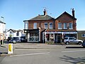
 Barnet Antique & Vintage Centre 1.JPG 4,000 × 3,000; 4.01 MB
-
 Barnet Antique & Vintage Centre 2.JPG 4,000 × 3,000; 4 MB
-
 Barnet Antique & Vintage Centre 3.JPG 4,000 × 3,000; 4.12 MB
-
 Barnet Market (16344894897).jpg 4,608 × 2,592; 3.61 MB
-
-
 Belgravia Close, Chipping Barnet (2).JPG 4,000 × 3,000; 4.1 MB
-
 Belgravia Close, Chipping Barnet.JPG 4,000 × 3,000; 4.05 MB
-
 Boundary stone by entrance to Ravenscroft Park, Chipping Barnet, August 2021.jpg 3,024 × 4,032; 6.46 MB
-
 Bulwer Gardens, Barnet.JPG 4,000 × 3,000; 3.92 MB
-
 Bulwer Road in Barnet.JPG 4,000 × 3,000; 4.19 MB
-
 Bulwer Road, Barnet.JPG 4,000 × 3,000; 4.24 MB
-
 Byng Rd - geograph.org.uk - 2405026.jpg 640 × 430; 51 KB
-
 Chipping Barnet cropped from Map of Hertfordshire Sheet 045, Ordnance Survey, 1873-1885.jpg 5,035 × 3,245; 3.66 MB
-
 Christ Church Lane, Chipping Barnet.JPG 4,000 × 3,000; 4.28 MB
-
 Christ Church Passage, Chipping Barnet.JPG 4,000 × 3,000; 4.07 MB
-
 Clyde Villas, Hadley Green Road.JPG 4,000 × 3,000; 4.01 MB
-
 Coe's Alley houses, Chipping Barnet.JPG 4,000 × 3,000; 4.16 MB
-
 Coe's Alley, Chipping Barnet 2 January 2016 (2).JPG 3,000 × 4,000; 4.22 MB
-
 Coe's Alley, Chipping Barnet 2 January 2016.JPG 3,000 × 4,000; 4.04 MB
-
 Cornerways, Prospect Road, Barnet.JPG 4,000 × 3,000; 4.12 MB
-
 Craigmar map.jpg 2,279 × 1,546; 2.37 MB
-
 Detail of old shop sign - geograph.org.uk - 3223039.jpg 2,560 × 1,920; 978 KB
-
 Drayton House, Potters Lane, Barnet.JPG 4,000 × 3,000; 4.19 MB
-
 Drinking fountain and cattle trough, The Avenue, Chipping Barnet.JPG 4,000 × 3,000; 4.44 MB
-
 Electrical equipment, north London.JPG 3,000 × 4,000; 4.48 MB
-
 EU flag Barnet.png 749 × 1,025; 1.5 MB
-
 Galley Ashdon House Chipping Barnet.JPG 4,000 × 3,000; 4.1 MB
-
 Green in front of Barnet Church - geograph.org.uk - 4013525.jpg 2,266 × 1,674; 2.01 MB
-
 Guns and Smoke Bar, Chipping Barnet (2).jpg 3,456 × 4,608; 4.38 MB
-
 Guns and Smoke Bar, Chipping Barnet.jpg 4,608 × 3,456; 4.68 MB
-
 Hadley Grove, Chipping Barnet.JPG 4,000 × 3,000; 4.22 MB
-
 Hadley Manor map 1910s.jpg 875 × 506; 121 KB
-
 Hadley Ridge & Wyburn Avenue, Chipping Barnet.JPG 4,000 × 3,000; 4.12 MB
-
 High Barnet from Barnet Hill.jpg 665 × 400; 24 KB
-
 High Barnet Methodist Church.jpg 603 × 719; 133 KB
-
 House in Sunset View, Chipping Barnet.JPG 4,000 × 3,000; 4.36 MB
-
 House near Christ Church, Barnet.JPG 4,000 × 3,000; 4.12 MB
-
 Houses off Christ Church Lane, Chipping Barnet (2).JPG 4,000 × 3,000; 4.07 MB
-
 Houses off Christ Church Lane, Chipping Barnet.JPG 4,000 × 3,000; 4.11 MB
-
 Jubilee Cottage, Nesbitts Alley, Chipping Barnet.JPG 4,000 × 3,000; 4.1 MB
-
 Livingstone Court, Christ Church Lane, Chipping Barnet.JPG 4,000 × 3,000; 4.12 MB
-
 Love & Hate Cottage, Nesbitts Alley, Chipping Barnet.JPG 4,000 × 3,000; 4.17 MB
-
 Manor Road house, Chipping Barnet (2).JPG 4,000 × 3,000; 4.18 MB
-
 Manor Road house, Chipping Barnet.JPG 4,000 × 3,000; 4.01 MB
-
 Mayhill Road, Barnet - geograph.org.uk - 2655298.jpg 1,600 × 1,200; 664 KB
-
 Mayhill Road, Barnet - geograph.org.uk - 2655386.jpg 1,600 × 1,200; 587 KB
-
 Mays Lane at the junction of Althorp Close - geograph.org.uk - 2655267.jpg 1,600 × 1,200; 635 KB
-
 Mays Lane, Barnet - geograph.org.uk - 2655351.jpg 1,600 × 1,200; 621 KB
-
 Mays Lane, Barnet - geograph.org.uk - 2655379.jpg 1,600 × 1,200; 599 KB
-
 Middle Row, Barnet 18880s.jpg 1,161 × 698; 343 KB
-
 Middle Row, Chipping Barnet 1880s.jpg 700 × 450; 25 KB
-
 Moon Lane - Chipping Barnet.JPG 4,000 × 3,000; 4.05 MB
-
 Moon Lane, Chipping Barnet.JPG 4,000 × 3,000; 4.07 MB
-
 North London Hospice shop Chipping Barnet.jpg 4,000 × 2,992; 4.02 MB
-

-
 Path between Fitzjohn Av and Manor Road - geograph.org.uk - 2992789.jpg 2,560 × 1,920; 1.04 MB
-
 Plantagenet Road, Barnet.JPG 4,000 × 3,000; 3.96 MB
-
 Potters Road shops, Barnet (cropped).JPG 2,338 × 1,980; 760 KB
-
 Potters Road shops, Barnet.JPG 4,000 × 3,000; 4.1 MB
-
 Potters Road, Barnet.JPG 4,000 × 3,000; 4.17 MB
-
 Prospect Road, Barnet.JPG 4,000 × 3,000; 4.15 MB
-
 Rear of Church House, Chipping Barnet.JPG 4,000 × 3,000; 4.21 MB
-
 Rear of the Hyde Institute, Chipping Barnet (2).JPG 4,000 × 3,000; 4.34 MB
-
 Rear of the Hyde Institute, Chipping Barnet.JPG 4,000 × 3,000; 4.12 MB
-
 South end of Nesbitts Alley, Chipping Barnet.JPG 4,000 × 3,000; 4.36 MB
-
 St. Albans Road - geograph.org.uk - 1577944.jpg 640 × 403; 206 KB
-
 Sunset View, Chipping Barnet.JPG 4,000 × 3,000; 4.25 MB
-
 Sunset View, High Barnet - geograph.org.uk - 2400739.jpg 640 × 430; 49 KB
-
 The Croft, Chipping Barnet.JPG 4,000 × 3,000; 3.98 MB
-
 The Laurels, The Croft, Chipping Barnet.JPG 4,000 × 3,000; 4.19 MB
-
 Union Street, Chipping Barnet.JPG 4,000 × 3,000; 3.83 MB
-
 Valeside Court Barnet.JPG 4,000 × 3,000; 4.05 MB
-
 Victors Way, Chipping Barnet.JPG 4,000 × 3,000; 4.05 MB
-
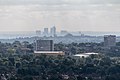
 View from John the Baptist Church, Barnet - geograph.org.uk - 4122083.jpg 1,024 × 683; 166 KB
-
 View from John the Baptist Church, Barnet - geograph.org.uk - 4122092.jpg 683 × 1,024; 189 KB
-
 View from John the Baptist Church, Barnet - geograph.org.uk - 4122094.jpg 1,024 × 683; 186 KB
-
 View from John the Baptist Church, Barnet - geograph.org.uk - 4122106.jpg 1,024 × 683; 165 KB
-
 View from St John the Baptist Church, Barnet - geograph.org.uk - 4122016.jpg 1,024 × 683; 99 KB
-
 View from St John the Baptist Church, Barnet - geograph.org.uk - 4122053.jpg 1,024 × 683; 113 KB
-
 View from St John the Baptist Church, Barnet - geograph.org.uk - 4122058.jpg 1,024 × 683; 281 KB
-
 Warwick Road, Barnet.JPG 4,000 × 3,000; 4.14 MB


.jpg)

.JPG)


.JPG)


.jpg)


.JPG)


.JPG)


.jpg)


.JPG)


.JPG)


