Category:Beckingham, Lincolnshire
village and civil parish in Lincolnshire, UK  | |||||
| Upload media | |||||
| Instance of | |||||
|---|---|---|---|---|---|
| Location | North Kesteven, Lincolnshire, East Midlands, England | ||||
 | |||||
Subcategories
This category has the following 3 subcategories, out of 3 total.
Media in category "Beckingham, Lincolnshire"
The following 181 files are in this category, out of 181 total.
-
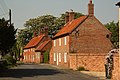
 1 and 2 Hillside Beckingham (geograph 6429208).jpg 1,024 × 768; 239 KB
-
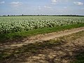 A field of beans from the bridleway - geograph.org.uk - 412536.jpg 640 × 480; 129 KB
-
 A path near Beckingham Training Camp - geograph.org.uk - 3089563.jpg 800 × 600; 339 KB
-
 A path on Woodgate Lane - geograph.org.uk - 3089573.jpg 800 × 600; 271 KB
-

-
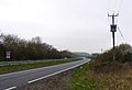
 A17 East of Beckingham - geograph.org.uk - 4934508.jpg 640 × 427; 408 KB
-
 A17 east of Beckingham - geograph.org.uk - 5672365.jpg 640 × 480; 34 KB
-
 A17 eastbound near Beckingham Bridge - geograph.org.uk - 5672355.jpg 640 × 482; 50 KB
-
 A17 from Newark - geograph.org.uk - 389982.jpg 640 × 439; 54 KB
-
 A17 lay-by - geograph.org.uk - 4733422.jpg 640 × 480; 42 KB
-
 A17 lay-by - geograph.org.uk - 4741217.jpg 640 × 473; 47 KB
-
 A17 near Highfield House Farm - geograph.org.uk - 5672379.jpg 640 × 480; 45 KB
-
 A17 towards Newark - geograph.org.uk - 2910037.jpg 640 × 480; 68 KB
-
 A17 towards Newark - geograph.org.uk - 2910048.jpg 640 × 480; 89 KB
-
 A17 towards Sleaford - geograph.org.uk - 214091.jpg 640 × 560; 129 KB
-
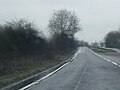
 A17 westbound - geograph.org.uk - 3768704.jpg 640 × 453; 40 KB
-
 A17 westbound - geograph.org.uk - 3768710.jpg 640 × 489; 53 KB
-
 A17 westbound - geograph.org.uk - 3768712.jpg 640 × 400; 52 KB
-

-
 A631 at Beckingham - geograph.org.uk - 1322665.jpg 640 × 480; 54 KB
-
 A631 Roundabout - geograph.org.uk - 1322607.jpg 640 × 480; 49 KB
-

-

-

-
 Apricot Hall (geograph 6225586).jpg 1,024 × 768; 137 KB
-
 Autumn sown cereal - geograph.org.uk - 6321280.jpg 1,024 × 768; 85 KB
-
 Awaiting the harvest - geograph.org.uk - 6225578.jpg 1,024 × 768; 182 KB
-
 Barnby Hall seen across the River Witham - geograph.org.uk - 6033779.jpg 1,024 × 768; 226 KB
-
 Barnby in the Willows at sunset - geograph.org.uk - 6222235.jpg 1,024 × 768; 90 KB
-
 Be very, very careful - geograph.org.uk - 1999217.jpg 1,024 × 768; 279 KB
-
 Bean Field - geograph.org.uk - 1944494.jpg 800 × 600; 83 KB
-
 Beckingham Bridge - geograph.org.uk - 2164177.jpg 640 × 427; 126 KB
-
 Beckingham farmland - geograph.org.uk - 3482037.jpg 640 × 427; 140 KB
-
 Beckingham Range - geograph.org.uk - 2164192.jpg 640 × 427; 47 KB
-
 Beckingham School - geograph.org.uk - 2384318.jpg 640 × 480; 71 KB
-
 Beckingham Village Hall (former Methodist Chapel) - geograph.org.uk - 4081921.jpg 3,776 × 2,520; 4.05 MB
-
 Bridge over the River Witham - geograph.org.uk - 6321275.jpg 1,024 × 768; 274 KB
-
 Bridge to Barnby in the Willows - geograph.org.uk - 4067303.jpg 3,776 × 2,520; 3.97 MB
-
 Bridleway to Stragglethorpe - geograph.org.uk - 6225558.jpg 1,024 × 768; 153 KB
-
 Bridleway to Stragglethorpe - geograph.org.uk - 6225564.jpg 1,024 × 768; 191 KB
-
 Bridleway to Stragglethorpe - geograph.org.uk - 6225567.jpg 1,024 × 768; 183 KB
-
 Burning farmyard waste - geograph.org.uk - 6299301.jpg 1,024 × 768; 179 KB
-
 Cottage, Beckingham - geograph.org.uk - 2909941.jpg 640 × 480; 68 KB
-
 Cottages in Beckingham - geograph.org.uk - 1999142.jpg 1,024 × 768; 169 KB
-
 Cottages, Chapel Street, Beckingham - geograph.org.uk - 1999175.jpg 1,024 × 768; 243 KB
-
 Date stone, Beckingham School - geograph.org.uk - 2384338.jpg 640 × 480; 84 KB
-
 Decaying shed, Beckingham playing field - geograph.org.uk - 1910476.jpg 1,600 × 1,200; 562 KB
-
 Derelict Barns at the former Woodgate Farm - geograph.org.uk - 1999210.jpg 1,024 × 768; 181 KB
-
 East end of Beckingham bypass - geograph.org.uk - 3519638.jpg 640 × 467; 97 KB
-
 End of the path - geograph.org.uk - 412538.jpg 640 × 480; 121 KB
-
 Entrance to Footpath off Woodgate Lane - geograph.org.uk - 3782003.jpg 2,256 × 1,504; 2.26 MB
-
 Farm buildings, Barnby Hall - geograph.org.uk - 1910677.jpg 1,600 × 1,200; 562 KB
-
 Farm track through rape - geograph.org.uk - 389742.jpg 640 × 427; 110 KB
-
 Farmland near Woodgate House - geograph.org.uk - 2909933.jpg 640 × 480; 57 KB
-
 Farmland towards Lodge Farm - geograph.org.uk - 2909926.jpg 640 × 480; 71 KB
-
 Fen Farm, Claypole - geograph.org.uk - 1944497.jpg 800 × 600; 67 KB
-
 Field boundary and Manor Farm - geograph.org.uk - 6299423.jpg 1,024 × 768; 191 KB
-
 Field drain beside Green Lane - geograph.org.uk - 2909930.jpg 640 × 480; 120 KB
-
 Fields off the A17 near Torry's Plantation - geograph.org.uk - 3295978.jpg 2,256 × 1,504; 1.77 MB
-
 Flooding by The Spinney - geograph.org.uk - 6299263.jpg 1,024 × 768; 137 KB
-
 Footpath Entrance off Sutton Road - geograph.org.uk - 3295959.jpg 2,256 × 1,504; 1.75 MB
-
 Footpath from Sutton - geograph.org.uk - 3482043.jpg 640 × 427; 107 KB
-
 Footpath off Woodgate Lane - geograph.org.uk - 2909922.jpg 640 × 480; 95 KB
-
 Footpath off Woodgate Lane - geograph.org.uk - 2909938.jpg 640 × 480; 92 KB
-
 Footpath to Brant Broughton - geograph.org.uk - 6333915.jpg 1,024 × 768; 139 KB
-
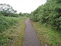
 Footpath to Sutton - geograph.org.uk - 6321269.jpg 1,024 × 768; 165 KB
-
 Former Beckingham School - geograph.org.uk - 4452458.jpg 1,024 × 696; 162 KB
-
 Former council houses, Beckingham - geograph.org.uk - 1910465.jpg 1,600 × 1,200; 427 KB
-
 Former Farmhouse, Hillside, Beckingham - geograph.org.uk - 1999151.jpg 1,024 × 768; 122 KB
-
 Former school, Beckingham - geograph.org.uk - 1910487.jpg 1,600 × 1,200; 368 KB
-
 Glebe Farmhouse, Rectory Street, Beckingham (geograph 6726379).jpg 1,024 × 768; 168 KB
-
 Gravestone, All Saints Church - geograph.org.uk - 2382747.jpg 480 × 640; 77 KB
-
 Green Lane running east - geograph.org.uk - 2909928.jpg 640 × 480; 60 KB
-
 Green Lane, Beckingham - geograph.org.uk - 1999197.jpg 1,024 × 768; 222 KB
-
 Harvested field - geograph.org.uk - 6225566.jpg 1,024 × 768; 184 KB
-
 Hedgerow near Woodgate House - geograph.org.uk - 2909932.jpg 640 × 480; 87 KB
-
 Holme Spinney - geograph.org.uk - 1910448.jpg 1,600 × 1,200; 452 KB
-
 Houses at Sutton Lane end - geograph.org.uk - 1910453.jpg 1,600 × 1,200; 431 KB
-
 Houses on Sutton Road - geograph.org.uk - 2909951.jpg 640 × 480; 89 KB
-
 Isthmus at Barnby - geograph.org.uk - 6321273.jpg 1,024 × 768; 175 KB
-
 It's been a bit wet of late - geograph.org.uk - 6225561.jpg 1,024 × 768; 148 KB
-
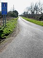
 Junction for Beckingham - geograph.org.uk - 3519626.jpg 640 × 358; 101 KB
-
 Layby on the Eastbound A17 - geograph.org.uk - 4934530.jpg 640 × 427; 459 KB
-
 Layby on the Westbound Side of the A17 - geograph.org.uk - 4934535.jpg 640 × 480; 466 KB
-
 Little Syke - geograph.org.uk - 6225574.jpg 1,024 × 768; 264 KB
-
 Middle Buildings - geograph.org.uk - 1910605.jpg 1,600 × 1,200; 432 KB
-
 New houses, Beckingham - geograph.org.uk - 1910588.jpg 1,600 × 1,200; 435 KB
-

-

-
 Old Sleaford Road - geograph.org.uk - 2164171.jpg 427 × 640; 130 KB
-
 Old Sleaford Road - geograph.org.uk - 2164180.jpg 640 × 427; 111 KB
-
 Old Sleaford Road - geograph.org.uk - 2164183.jpg 427 × 640; 138 KB
-
 Old Sleaford Road - geograph.org.uk - 2164189.jpg 640 × 427; 134 KB
-
 Ordnance Survey Cut Mark - geograph.org.uk - 4982670.jpg 640 × 594; 144 KB
-
 Ordnance Survey Flush Bracket S0633 - geograph.org.uk - 4558954.jpg 4,000 × 3,000; 4.18 MB
-

-
 Passable with care - geograph.org.uk - 6321277.jpg 1,024 × 768; 165 KB
-
 Pond - geograph.org.uk - 1910658.jpg 1,600 × 1,200; 543 KB
-
 Public bridleway - geograph.org.uk - 389771.jpg 640 × 427; 91 KB
-
 Rectory Farm - geograph.org.uk - 389789.jpg 640 × 427; 83 KB
-
 Rectory Street, Beckingham - geograph.org.uk - 1910493.jpg 1,600 × 1,200; 342 KB
-
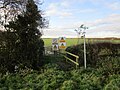
 Riders on the bridleway to Stragglethorpe - geograph.org.uk - 6225557.jpg 1,024 × 768; 181 KB
-
 Ridge and Furrow - geograph.org.uk - 81062.jpg 640 × 427; 72 KB
-
 Ridge and Furrow near Beckingham - geograph.org.uk - 1999227.jpg 1,024 × 768; 177 KB
-
 River Witham - geograph.org.uk - 1910638.jpg 1,600 × 1,200; 600 KB
-
 River Witham - geograph.org.uk - 2164174.jpg 640 × 427; 96 KB
-
-
 Sleaford Road - geograph.org.uk - 4452441.jpg 1,024 × 683; 206 KB
-
 Sleaford Road cottages - geograph.org.uk - 2975897.jpg 640 × 427; 110 KB
-
 Sleaford Road, Beckingham - geograph.org.uk - 1999185.jpg 1,024 × 768; 141 KB
-

-

-
 Stubble field and Barnby in the Willows - geograph.org.uk - 6070067.jpg 1,024 × 768; 129 KB
-
 Stubble field and the Middle Buildings - geograph.org.uk - 6070057.jpg 1,024 × 768; 159 KB
-
 Sutton Road - geograph.org.uk - 2163860.jpg 640 × 427; 77 KB
-
 Sutton Road heading south - geograph.org.uk - 2909946.jpg 640 × 480; 48 KB
-
 Sutton Road leads to Sutton^ - geograph.org.uk - 389797.jpg 480 × 640; 142 KB
-
 Swan Lake - geograph.org.uk - 6299299.jpg 1,024 × 747; 188 KB
-
 The beginning of a footpath to Beckingham - geograph.org.uk - 6333908.jpg 1,024 × 768; 253 KB
-
 The bridleway to Stragglethorpe - geograph.org.uk - 3008733.jpg 1,024 × 768; 257 KB
-
 The end of the footpath - geograph.org.uk - 3109367.jpg 1,024 × 768; 268 KB
-
 The end of the road - geograph.org.uk - 2164186.jpg 640 × 427; 133 KB
-
 The entrance to Beckingham Training Camp - geograph.org.uk - 3089579.jpg 800 × 600; 210 KB
-
 The Old Rectory, Beckingham - geograph.org.uk - 1910580.jpg 1,600 × 1,200; 511 KB
-
 The Old Smithy - geograph.org.uk - 4452255.jpg 1,024 × 683; 348 KB
-
 The River Witham and Skerries Plantation - geograph.org.uk - 6299411.jpg 1,024 × 768; 259 KB
-
 The River Witham at Barnby in the Willows - geograph.org.uk - 5564427.jpg 1,024 × 768; 270 KB
-
 The River Witham at Beckingham - geograph.org.uk - 4081848.jpg 3,776 × 2,520; 4.07 MB
-
 The River Witham below Beckingham Bridge - geograph.org.uk - 4081871.jpg 3,776 × 2,520; 4.3 MB
-
 The track leading towards Sutton - geograph.org.uk - 1910613.jpg 1,600 × 1,200; 370 KB
-
 Track near Beckingham - geograph.org.uk - 1999370.jpg 1,024 × 768; 282 KB
-
 Track to Black Sykes - geograph.org.uk - 2910046.jpg 640 × 480; 102 KB
-
 Track to Field Farm, Sutton - geograph.org.uk - 6225581.jpg 1,024 × 768; 182 KB
-
 Track to rifle ranges - geograph.org.uk - 2910031.jpg 640 × 480; 96 KB
-
 Track towards Barnby - geograph.org.uk - 1910667.jpg 640 × 480; 88 KB
-
 Track towards the Middle Buildings - geograph.org.uk - 1910622.jpg 1,600 × 1,200; 400 KB
-
 Track towards the Middle Buildings - geograph.org.uk - 1910648.jpg 1,600 × 1,200; 480 KB
-

-
 View towards Sutton from the Middle Buildings - geograph.org.uk - 6070070.jpg 1,024 × 768; 140 KB
-
 View towards the Middle Buildings - geograph.org.uk - 2192798.jpg 1,024 × 768; 86 KB
-
 Village Hall, Beckingham - geograph.org.uk - 1999163.jpg 1,024 × 768; 162 KB
-
 VW Camper Van - geograph.org.uk - 2975905.jpg 640 × 427; 115 KB
-

-
 Waterlogged field - geograph.org.uk - 6225571.jpg 1,024 × 768; 207 KB
-
 Webbs Garage, Beckingham - geograph.org.uk - 1910482.jpg 1,600 × 1,200; 362 KB
-
 Wheat to the horizon - geograph.org.uk - 6247312.jpg 1,024 × 768; 228 KB
-
 Witham bridge looking towards Fenton - geograph.org.uk - 1910338.jpg 3,264 × 2,448; 3.28 MB
-
 Woodgate House, Beckingham - geograph.org.uk - 1999206.jpg 1,024 × 768; 192 KB
-
 Woodgate Lane - geograph.org.uk - 4081925.jpg 3,776 × 2,520; 4.26 MB
-
 Woodgate Lane - geograph.org.uk - 4810920.jpg 3,309 × 2,176; 4.41 MB
-
 Woodgate Lane towards Beckingham - geograph.org.uk - 2909927.jpg 640 × 480; 70 KB
-
 Woodland beside the A17 - geograph.org.uk - 2910042.jpg 640 × 480; 106 KB
-
 Yew Tree Farm - geograph.org.uk - 2163856.jpg 640 × 427; 124 KB
-
 Yew Tree Farmhouse, Sutton (geograph 6764936).jpg 1,024 × 768; 229 KB
-
 A pleasant spot - geograph.org.uk - 412541.jpg 640 × 480; 107 KB
-
 A17 eastbound near Holmes farm - geograph.org.uk - 1404121.jpg 640 × 480; 54 KB
-
 Beckingham Grange, A17 - geograph.org.uk - 116531.jpg 640 × 426; 40 KB
-
 Clay Lane near Stapleford - geograph.org.uk - 439655.jpg 640 × 427; 87 KB
-

-
 Country road near Fenton - geograph.org.uk - 389753.jpg 640 × 427; 105 KB
-

-

-
 Footpath through army training area - geograph.org.uk - 439556.jpg 640 × 427; 106 KB
-
 Footpath to Barnby in the Willows - geograph.org.uk - 412546.jpg 640 × 480; 127 KB
-
 Highfield House - geograph.org.uk - 439613.jpg 640 × 427; 104 KB
-
 Lodge Farm, A17 - geograph.org.uk - 116525.jpg 640 × 450; 82 KB
-
 Military Firing Range - geograph.org.uk - 389978.jpg 640 × 480; 59 KB
-
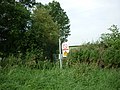
 Military range sign - geograph.org.uk - 389979.jpg 480 × 640; 57 KB
-
 Pasture land near Beckingham - geograph.org.uk - 280844.jpg 640 × 427; 65 KB
-
 Public footpath at Stapleford House - geograph.org.uk - 439570.jpg 640 × 427; 97 KB
-
 Public footpath off Clay Lane - geograph.org.uk - 439643.jpg 640 × 427; 115 KB
-

-
 River Witham - geograph.org.uk - 77742.jpg 640 × 480; 103 KB
-
 Sign on Clay Lane - geograph.org.uk - 439657.jpg 640 × 545; 97 KB
-
 Stapleford Grange - geograph.org.uk - 439560.jpg 640 × 427; 104 KB
-
 Stapleford House - geograph.org.uk - 439473.jpg 640 × 427; 68 KB
-
 Stapleford House - geograph.org.uk - 439478.jpg 640 × 427; 96 KB
-
 Stapleford House - geograph.org.uk - 439483.jpg 640 × 479; 106 KB
-
 Stile and signs at Stapleford House - geograph.org.uk - 439581.jpg 616 × 640; 150 KB
-
 Stubble and tracks - geograph.org.uk - 214088.jpg 640 × 480; 80 KB
-
 Track to rifle range - geograph.org.uk - 389976.jpg 640 × 480; 116 KB
.jpg)


.jpg)


_-_geograph.org.uk_-_4081921.jpg)


.jpg)


_Eastbound_near_to_Beckingham_-_geograph.org.uk_-_4934505.jpg)


.jpg)


