Category:Beit Ur al-Tahta
municipality in Ramallah and al-Bireh Governorate  | |||||
| Upload media | |||||
| Instance of | |||||
|---|---|---|---|---|---|
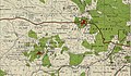
| Location | Ramallah and al-Bireh Governorate, West Bank, Southern Levant, Fertile Crescent | ||||
| Elevation above sea level |
| ||||
 | |||||
Media in category "Beit Ur al-Tahta"
The following 19 files are in this category, out of 19 total.
-
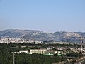
 Burj 1945.jpg 575 × 297; 115 KB
-
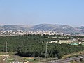
 Beit Ur al-Tahta1.jpg 974 × 648; 352 KB
-
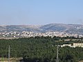
 Beit Ur al-Tahta2.jpg 472 × 591; 173 KB
-
 Beit Ur ElTahta or Safa1542.jpg 5,184 × 3,888; 7.65 MB
-
 Beit Ur ElTahta, Fuqqa and Horon1536.jpg 5,184 × 3,888; 6.59 MB
-
 Beit Ur ElTahta1537.jpg 5,184 × 3,888; 7.42 MB
-
 Beit Ur ElTahta1538.jpg 5,184 × 3,888; 7.24 MB
-
 Beit Ur ElTahta1539.jpg 5,184 × 3,888; 6.88 MB
-
 Beit Ur ElTahta1547.jpg 5,184 × 3,888; 6.63 MB
-
 Beit Ur ElTahta1548.jpg 5,183 × 1,386; 1.1 MB
-
 Beit Ur ElTahta1549.jpg 5,183 × 2,629; 2.4 MB
-
 El Misbah 1944.jpg 2,954 × 1,725; 1.7 MB
-
 HPIMbeit-ur-a-tachta4505.jpg 2,608 × 1,952; 1.13 MB
-
 LiqyaMabachNimeBeitilu2804 l03.JPG 4,608 × 3,072; 3.33 MB
-
 LiqyaMabachNimeBeitiluEgoz2803 r67.JPG 4,608 × 3,072; 3.35 MB
-
 LiqyaMasbachTahtaNimeBetilu2845.JPG 4,608 × 3,072; 3.39 MB
-
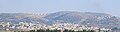
 Safa and Tahta3454.jpg 5,184 × 3,888; 6.24 MB
-
 Safa and Tahta3473.jpg 5,184 × 3,888; 6.46 MB
-
 TachtaNimeEgoz2843.JPG 4,608 × 3,072; 3.92 MB


