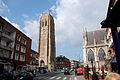
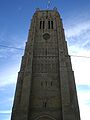
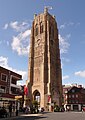
Category:Belfry of Dunkerque
| Object location | | View all coordinates using: OpenStreetMap |
|---|
|
This building is classé au titre des monuments historiques de la France. It is indexed in the base Mérimée, a database of architectural heritage maintained by the French Ministry of Culture, under the references IA00075022
|
 | |||||
| Upload media | |||||
| Instance of | |||||
|---|---|---|---|---|---|
| Part of | |||||
| Location | Dunkirk, Communauté urbaine de Dunkerque, arrondissement of Dunkirk, Nord, Hauts-de-France, Metropolitan France, France | ||||
| Street address |
| ||||
| Architectural style | |||||
| Heritage designation |
| ||||
 | |||||
Media in category "Belfry of Dunkerque"
The following 95 files are in this category, out of 95 total.
-
 BeffroiDunkerque.JPG 278 × 313; 25 KB
-
 Belfortduinkerke.jpg 407 × 638; 46 KB
-
 Beffroi de Dunkerque - Carillon-7592.jpg 4,089 × 3,456; 7.3 MB
-
 Beffroi de Dunkerque - Carillon-7594.jpg 5,184 × 3,456; 7.01 MB
-
 Beffroi de Dunkerque, cénotaphe-7683.jpg 3,376 × 3,452; 8.29 MB
-
 Beffroi de Dunkerque.jpg 1,504 × 3,264; 1.55 MB
-
 Beffroi de St Eloi.jpg 4,446 × 12,669; 6.39 MB
-
 Beffroi dunkerque.jpg 2,304 × 1,728; 734 KB
-
 Belfortduinkerke 11-03-2009 14-21-42.JPG 1,936 × 1,296; 1.33 MB
-
 Carte postale - Dunkerque - Beffroi de Dunkerque.jpg 3,943 × 6,499; 4.89 MB
-
 Dunkerque - Beffroi 20190314.jpg 2,976 × 3,968; 1.82 MB
-
 Dunkerque beffroi 2.jpg 939 × 2,200; 2.56 MB
-
 Dunkerque beffroi de l'église de Saint-Eloi en 2020.jpg 2,702 × 3,359; 5.74 MB
-
 Dunkerque beffroi nuit.jpg 2,112 × 2,816; 1.43 MB
-
 Dunkerque beffroi.jpg 1,728 × 2,304; 678 KB
-
 Dunkerque Belfort perpend.jpg 1,565 × 2,201; 2.35 MB
-
 Dunkerque Belfort.JPG 1,632 × 2,251; 2.23 MB
-
 Dunkerque Belfort1.JPG 3,168 × 2,376; 3.34 MB
-
 Dunkerque Belfried 01.jpg 3,280 × 3,900; 4.55 MB
-
 Dunkerque Belfried 02.jpg 3,380 × 4,542; 5.15 MB
-
 Dunkerque Belfried 03.jpg 2,591 × 4,354; 4.74 MB
-
 Dunkerque Belfried 04.jpg 3,336 × 4,510; 5.15 MB
-
 Dunkerque Belfried 05.jpg 2,279 × 3,775; 4.04 MB
-
 Dunkerque Belfried 06.jpg 2,760 × 4,257; 4.73 MB
-
 Dunkerque Belfried 07.jpg 3,226 × 4,524; 5.15 MB
-
 Dunkerque Belfried 08.jpg 2,819 × 4,301; 5.25 MB
-
 Dunkerque Belfried 09.jpg 3,111 × 4,353; 6.1 MB
-
 Dunkerque Belfried 10.jpg 3,216 × 4,201; 6.75 MB
-
 Dunkerque Belfried 11.jpg 3,274 × 4,483; 7.43 MB
-
 Dunkerque Belfried Blick auf die Tour de Reuze 1.jpg 3,397 × 4,069; 4.48 MB
-
 Dunkerque Belfried Blick auf die Tour de Reuze 2.jpg 3,386 × 4,546; 5.52 MB
-
 Dunkerque Belfried Blick aufs Rathaus & die Tour de Reuze 1.jpg 4,553 × 2,762; 4.97 MB
-
 Dunkerque Belfried Blick aufs Rathaus & die Tour de Reuze 2.jpg 4,529 × 2,709; 5.08 MB
-
 Dunkerque Belfried Blick vom Turm 1.jpg 4,559 × 2,965; 5.22 MB
-
 Dunkerque Belfried Blick vom Turm 2.jpg 4,583 × 3,112; 5.35 MB
-
 Dunkerque Belfried Blick vom Turm 3.jpg 4,553 × 2,768; 5 MB
-
 Dunkerque Belfried Blick vom Turm 4.jpg 4,564 × 3,217; 5.97 MB
-
 Dunkerque Belfried Blick vom Turm 5.jpg 4,559 × 3,108; 5.89 MB
-
 Dunkerque Belfried Blick vom Turm 7.jpg 4,298 × 3,319; 4.95 MB
-
 Dunkerque Belfried Blick vom Turm 8.jpg 3,380 × 4,542; 5.93 MB
-
 Dunkerque Belfried Blick vom Turm 9.jpg 4,380 × 2,525; 5.26 MB
-
 Dunkerque Belfried Blick vom Turm auf die Raffinerien 1.jpg 4,573 × 2,487; 4.16 MB
-
 Dunkerque Belfried Blick vom Turm auf die Raffinerien 2.jpg 4,554 × 2,426; 2.98 MB
-
 Dunkerque Belfried Blick vom Turm auf Duchesse Anne.jpg 4,592 × 3,448; 7.62 MB
-
 Dunkerque Belfried Blick vom Turm auf Sandettié.jpg 4,592 × 3,448; 7.74 MB
-
 Dunkerque Belfried Blick vom Turm auf St. Éloi 1.jpg 4,436 × 3,262; 7.32 MB
-
 Dunkerque Belfried Blick vom Turm auf St. Éloi 2.jpg 4,162 × 3,186; 6.65 MB
-
 Dunkerque Belfried Blick vom Turm auf St. Éloi 3.jpg 4,532 × 3,167; 7.01 MB
-
 Dunkerque Belfried Blick vom Turm auf St. Éloi 4.jpg 4,549 × 3,389; 7.21 MB
-
 Dunkerque Belfried Blick vom Turm auf St. Éloi 5.jpg 3,107 × 4,539; 5.8 MB
-
 Dunkerque Belfried Blick vom Turm aufs Rathaus 1.jpg 3,426 × 4,069; 5.06 MB
-
 Dunkerque Belfried Blick vom Turm aufs Rathaus 2.jpg 3,350 × 4,520; 4.8 MB
-
 Dunkerque dzwonnica 01.jpg 1,943 × 2,816; 2.92 MB
-
 Dunkerque dzwonnica 01b.jpg 1,943 × 2,816; 3.84 MB
-
 Dunkerque dzwonnica 02.jpg 1,405 × 2,816; 2.38 MB
-
 Dunkerque dzwonnica 03.jpg 2,112 × 2,816; 3.91 MB
-
 Dunkerque dzwonnica 04.jpg 2,816 × 2,112; 4.15 MB
-
 Dunkerque dzwonnica 05.jpg 1,588 × 2,816; 2.93 MB
-
 Dunkerque dzwonnica 06.jpg 2,112 × 2,816; 3.83 MB
-
 Dunkerque dzwonnica 07.jpg 2,816 × 2,112; 3.44 MB
-
 Dunkerque dzwonnica 08.jpg 2,816 × 2,112; 3.3 MB
-
 Dunkerque dzwonnica 09.jpg 2,816 × 2,112; 3.79 MB
-
 Dunkerque dzwonnica 10.jpg 2,816 × 2,112; 3.86 MB
-
 Dunkerque F PM 001772.jpg 400 × 600; 231 KB
-
 Dunkerque F PM 001775.jpg 400 × 600; 263 KB
-
 Dunkerque Monument aux Morts R01.jpg 3,226 × 4,873; 13.08 MB
-
 Dunkerque monument aux morts.JPG 1,885 × 2,776; 5.12 MB
-
 Dunkerque.Marché aux Poissons et beffroi.jpg 1,190 × 789; 197 KB
-
 Dunkerque.Place Jean-Bart et beffroi.jpg 1,192 × 767; 200 KB
-

-

-

-

-
-

-

-
 Jielbeaumadier Dunkerque 2007 03.jpeg 1,704 × 2,272; 890 KB
-
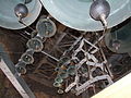
 Le Carillon du beffroi de Dunkerque 01 - Bedienpunt.JPG 3,488 × 2,616; 2.24 MB
-
 Le Carillon du beffroi de Dunkerque 02.JPG 3,488 × 2,616; 2.18 MB
-
 Le Carillon du beffroi de Dunkerque 03.JPG 3,488 × 2,616; 2.16 MB
-
 Le Carillon du beffroi de Dunkerque 04.JPG 3,488 × 2,616; 2.19 MB
-
 Le Carillon du beffroi de Dunkerque 05.JPG 3,488 × 2,616; 2.16 MB
-
 Le Carillon du beffroi de Dunkerque 06.JPG 3,488 × 2,616; 2.15 MB
-
 LL 275 - DUNKERQUE - Place Jean Bart et le Beffroi.JPG 1,638 × 1,035; 427 KB
-
 P 20200721 175815.jpg 3,136 × 4,224; 2.42 MB
-
 P 20200721 175822.jpg 3,136 × 4,224; 2.41 MB
-
 P 20200721 175826.jpg 3,136 × 4,224; 2.49 MB
-
 P 20200721 175901.jpg 3,000 × 4,000; 3.31 MB
-
 Panoramblick vom Beffroi de Dunkerque 01 - Blick Richtung Osten - Hotel de Ville.JPG 3,488 × 2,616; 2.2 MB
-
-
-
 Panoramblick vom Beffroi de Dunkerque 04 - Blick Richtung Hafen.JPG 3,488 × 2,616; 2.26 MB
-
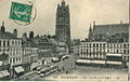
 Postcard- Dunkerque - Le Beffroi, sent April 1915 (6274150948).jpg 804 × 1,280; 134 KB
-
 Saint Eloi von Belfried von Dünkirchen aus gesehen.JPG 3,488 × 2,616; 2.18 MB
-
 The Place Jean Bart, Dunkirk, France-LCCN2001698118.jpg 3,440 × 2,592; 2.38 MB


,_RP-F-2001-7-1219B-17.jpg)


.jpg)

