Category:Bell (Hunsrück)
municipality in Rhein-Hunsrück district, Germany   _in_SIM.svg) | |||||
| Upload media | |||||
| Instance of |
| ||||
|---|---|---|---|---|---|
| Location | Kastellaun, Rhein-Hunsrück-Kreis, Rhineland-Palatinate, Germany | ||||
| Population |
| ||||
| Area |
| ||||
| Elevation above sea level |
| ||||
| official website | |||||
 | |||||
Subcategories
This category has the following 12 subcategories, out of 12 total.
A
B
- Evangelische Kirche (Bell) (6 F)
- Beller Markt (24 F)
C
F
- Freizeitpark Bell (8 F)
H
- Hundheim (Hunsrück) (20 F)
K
- Krastel (4 F)
L
P
- Pydna (rocket station) (14 F)
V
- Völkenroth (7 F)
W
- Wagengrab von Bell (3 F)
- Wohnroth (7 F)
Media in category "Bell (Hunsrück)"
The following 16 files are in this category, out of 16 total.
-
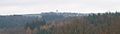
 20150711-Bell.jpg 4,438 × 2,161; 1.49 MB
-
 Bell (Hunsrück) in SIM.svg 889 × 903; 574 KB
-
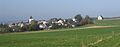
 Bell im Hunsrück.jpg 2,264 × 875; 215 KB
-
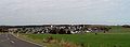
 Bell09.jpg 2,046 × 795; 982 KB
-
 Bell12.jpg 1,647 × 461; 380 KB
-
 Bell15.jpg 1,842 × 670; 143 KB
-
 Beller Bahnhof.jpg 1,495 × 1,094; 227 KB
-
 Beller Bahnhof1.jpg 1,862 × 1,006; 243 KB
-
 DEU Bell (Hunsrueck) COA.jpg 480 × 540; 58 KB
-
 Einwohnerentwicklung von Bell (Hunsrück).svg 800 × 400; 53 KB
-
 Feldscheune.jpg 800 × 600; 85 KB
-
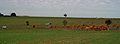 Kuhweide20.jpg 2,247 × 831; 231 KB
-
 Manganerzbergwerk-ilse.jpg 2,048 × 1,536; 2.06 MB
-
 Naturdenkmal Galgeneiche bei Bell.jpg 3,200 × 4,800; 18.59 MB
-
 Radweg an der B 327.jpg 800 × 600; 82 KB
-
 Ramserhof bei Bell.jpg 2,048 × 1,536; 290 KB


_COA.jpg)
.svg)


