Category:Benchmarks in the Royal Borough of Greenwich

Media in category "Benchmarks in the Royal Borough of Greenwich"
The following 15 files are in this category, out of 15 total.
-
 Benchmark on Bayeux House, Victoria Way - geograph.org.uk - 2177192.jpg 600 × 800; 172 KB
-
-
 Benchmark on St Luke's Church - geograph.org.uk - 2177733.jpg 600 × 800; 175 KB
-

-

-
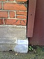
 Benchmark on wall of ^121 Charlton Road - geograph.org.uk - 2175993.jpg 800 × 600; 163 KB
-

-
 Benchmark on ^122 Wyndcliff Road - geograph.org.uk - 2174875.jpg 600 × 800; 136 KB
-

-
 Benchmark on ^29 Nadine Street - geograph.org.uk - 2177722.jpg 600 × 800; 133 KB
-
 Benchmark on ^44 Reynolds Place - geograph.org.uk - 2176977.jpg 600 × 800; 130 KB
-
 Benchmark on ^69 Bramshot Avenue - geograph.org.uk - 2174805.jpg 600 × 800; 117 KB
-
 Flush Bracket, Greenwich - geograph.org.uk - 4597810.jpg 640 × 615; 188 KB
-
 Ordnance Survey Flush Bracket G1692 - geograph.org.uk - 4588257.jpg 2,988 × 5,312; 3.7 MB
-
 The benchmark on the wall by the 24-hour clock - geograph.org.uk - 2337938.jpg 987 × 1,500; 222 KB


