Category:Bengeo Rural
English: Bengeo Rural is a civil parish in the East Hertfordshire district of Hertfordshire, England. According to the 2001 census it had a population of 601. The parish includes the villages of Tonwell and Chapmore End.
civil parish in Hertfordshire, United Kingdom | |||||
| Upload media | |||||
| Instance of | |||||
|---|---|---|---|---|---|
| Location | East Hertfordshire, Hertfordshire, East of England, England | ||||
 | |||||
Subcategories
This category has the following 2 subcategories, out of 2 total.
C
- Chapmore End (7 F)
T
Media in category "Bengeo Rural"
The following 38 files are in this category, out of 38 total.
-
 Anchor Lane, Thundridge - geograph.org.uk - 4831576.jpg 2,268 × 1,680; 872 KB
-
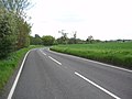
 Approaching Bengeo on the B158 - geograph.org.uk - 2975625.jpg 2,560 × 1,920; 994 KB
-
 Approaching the roundabout on Ware Road - geograph.org.uk - 2835975.jpg 1,600 × 1,200; 557 KB
-
 Burrs Green Farm, Stonyhills - geograph.org.uk - 4674584.jpg 2,466 × 1,788; 1.16 MB
-
 Byway north from Anchor Lane - geograph.org.uk - 4627309.jpg 640 × 480; 102 KB
-
 Chelsing Farm Cottages - geograph.org.uk - 3299100.jpg 640 × 480; 76 KB
-
 Cottage on Stony Hills - geograph.org.uk - 4665458.jpg 2,560 × 1,920; 2.03 MB
-
 Crouchfield Lane, Chapmore End - geograph.org.uk - 6272599.jpg 1,852 × 1,170; 1.27 MB
-
 Crouchfield Lane, Chapmore End - geograph.org.uk - 6285055.jpg 1,920 × 1,280; 1.28 MB
-
 Crouchfield Lane, Chapmore End - geograph.org.uk - 6285059.jpg 1,920 × 1,280; 1.99 MB
-
 House on Stony Hills - geograph.org.uk - 4665466.jpg 2,528 × 1,876; 1.56 MB
-
 Houses on Crouchfield Lane, Chapmore End - geograph.org.uk - 6272589.jpg 1,892 × 1,236; 1.4 MB
-
-
 Lane from Chapmore End to B158 - geograph.org.uk - 4627318.jpg 640 × 480; 125 KB
-
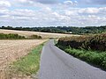
 Looking towards Flowersash Wood - geograph.org.uk - 3986987.jpg 4,320 × 3,240; 4.77 MB
-
 Morning Rush Hour on B158 East - geograph.org.uk - 2985609.jpg 2,560 × 1,920; 1.08 MB
-
 Old Milestone - geograph.org.uk - 3650918.jpg 1,024 × 768; 232 KB
-
 Old Milestone - geograph.org.uk - 3650920.jpg 768 × 1,024; 313 KB
-
 Roundabout on the B158, Wadesmill - geograph.org.uk - 4829802.jpg 2,238 × 1,636; 945 KB
-
 Snowy field next to Sacombe Road, Hertfordshire - geograph.org.uk - 3339547.jpg 2,048 × 1,536; 651 KB
-
 Snowy fields - geograph.org.uk - 3299096.jpg 640 × 480; 97 KB
-
 Stony Hills - geograph.org.uk - 4674592.jpg 2,560 × 1,920; 1.98 MB
-
 Stony Hills - geograph.org.uk - 4674596.jpg 2,560 × 1,920; 2 MB
-
 Stony Hills by Ware Road, Tonwell - geograph.org.uk - 4664941.jpg 2,560 × 1,920; 1.4 MB
-
 Sunset looking towards Tonwell - geograph.org.uk - 3278139.jpg 2,141 × 1,315; 574 KB
-
 The entrance to Swift Horsman on Stony Hills - geograph.org.uk - 4665484.jpg 2,560 × 1,920; 2 MB
-
 Tonwell - "Robin Hood & Little John" public house (geograph 7041055).jpg 1,600 × 1,143; 356 KB
-
 Tonwell, Bourne Honour - geograph.org.uk - 5652194.jpg 1,024 × 1,024; 1.15 MB
-
 Tonwell, Temple Lane - geograph.org.uk - 5652201.jpg 1,024 × 732; 928 KB
-
 Tonwell, Ware Road - geograph.org.uk - 5652197.jpg 1,024 × 768; 962 KB
-

-
 Village sign and pond, Chapmore End - geograph.org.uk - 4627328.jpg 640 × 480; 176 KB
-
 Wadesmill Road at the junction of Westmill Road - geograph.org.uk - 4829701.jpg 2,304 × 1,728; 868 KB
-
 Wadesmill Road, Chapmore End - geograph.org.uk - 6272609.jpg 1,892 × 1,236; 1.81 MB
-
 Wadesmill Road, Chapmore End - geograph.org.uk - 6272639.jpg 1,834 × 1,134; 1.71 MB
-
 Ware Road, Tonwell - geograph.org.uk - 4664938.jpg 2,560 × 1,920; 1.49 MB
-
 Ware Road, Tonwell - geograph.org.uk - 4664939.jpg 2,560 × 1,920; 1.57 MB
-
 Ware Road, Tonwell - geograph.org.uk - 4664940.jpg 2,560 × 1,920; 1.44 MB


.jpg)


