Category:Benson, Oxfordshire
village and civil parish in South Oxfordshire, England  View to Castle Square, Benson | |||||
| Upload media | |||||
| Instance of | |||||
|---|---|---|---|---|---|
| Location | South Oxfordshire, Oxfordshire, South East England, England | ||||
| Located in or next to body of water | |||||
| Area |
| ||||
| official website | |||||
 | |||||
Subcategories
This category has the following 10 subcategories, out of 10 total.
B
- Benson Lock (28 F)
- Benson War Memorial (6 F)
- Benson Weir (11 F)
H
- Houses in Benson, Oxfordshire (18 F)
P
- Preston Crowmarsh (46 F)
R
Media in category "Benson, Oxfordshire"
The following 200 files are in this category, out of 423 total.
(previous page) (next page)-
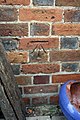
 1850s benchmark on ^2 Gould's Grove Cottages - geograph.org.uk - 2754679.jpg 683 × 1,024; 254 KB
-
 A fork in the footpath - geograph.org.uk - 5032150.jpg 1,500 × 1,000; 285 KB
-
 A look inside - geograph.org.uk - 1177601.jpg 640 × 426; 49 KB
-
 A slipway at Benson - geograph.org.uk - 1959318.jpg 1,500 × 1,000; 204 KB
-
 A stream flows through the grass to the Thames - geograph.org.uk - 1959345.jpg 1,000 × 1,500; 491 KB
-
 A.B. Jones - geograph.org.uk - 5364456.jpg 533 × 800; 97 KB
-

-
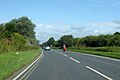
 A4074 entering Benson - geograph.org.uk - 3672601.jpg 640 × 482; 58 KB
-
 A4074 heading north - geograph.org.uk - 6236490.jpg 1,024 × 684; 282 KB
-
 A4074 heading north - geograph.org.uk - 6236495.jpg 1,024 × 684; 210 KB
-
 A4074 heading north - geograph.org.uk - 6236499.jpg 1,024 × 684; 298 KB
-

-
 Access Road - geograph.org.uk - 5373326.jpg 1,024 × 683; 245 KB
-
 Across the East End - geograph.org.uk - 5364422.jpg 1,024 × 683; 202 KB
-
 Across the road - geograph.org.uk - 1617975.jpg 640 × 427; 69 KB
-
 Aircraft Warning, Preston Crowmarsh - geograph.org.uk - 2778356.jpg 1,600 × 1,059; 313 KB
-
 Alcove in the arch - geograph.org.uk - 5356263.jpg 1,024 × 683; 97 KB
-
 Aldgate at Benson - geograph.org.uk - 2330686.jpg 3,420 × 2,468; 2.46 MB
-
 Allotments and Dead Sunflower - geograph.org.uk - 2765017.jpg 1,600 × 950; 338 KB
-
 Almost hidden - geograph.org.uk - 1594105.jpg 640 × 480; 160 KB
-
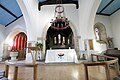
 Altar in the Chancel - geograph.org.uk - 5355960.jpg 533 × 800; 68 KB
-
 Altar ^ Rails - geograph.org.uk - 5355824.jpg 1,024 × 683; 111 KB
-
 And another next door - geograph.org.uk - 1177230.jpg 640 × 426; 97 KB
-
 Angel on a Beam - geograph.org.uk - 5356276.jpg 533 × 800; 50 KB
-
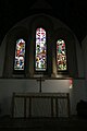
 Annunciation Window - geograph.org.uk - 5356961.jpg 533 × 800; 90 KB
-
 Approaching Braze Lane crossroads - geograph.org.uk - 3923805.jpg 640 × 419; 52 KB
-
 Arch on the gateway - geograph.org.uk - 1616570.jpg 640 × 427; 74 KB
-
 Ash Stump in Mogpits Wood - geograph.org.uk - 2648456.jpg 3,648 × 2,736; 2.32 MB
-
 Back by the chalets - geograph.org.uk - 1225209.jpg 640 × 426; 74 KB
-
 Barley near Hale Farm - geograph.org.uk - 1878571.jpg 1,980 × 1,470; 437 KB
-
 Beggarsbush Hill - geograph.org.uk - 1308572.jpg 640 × 480; 67 KB
-
 Beggarsbush Hill by RAF Benson - geograph.org.uk - 5247090.jpg 1,500 × 1,125; 204 KB
-
 Beggarsbush Hill by RAF Benson - geograph.org.uk - 5247092.jpg 1,500 × 1,125; 132 KB
-
 Beggarsbush Hill near RAF Benson - geograph.org.uk - 5247075.jpg 1,500 × 1,125; 112 KB
-
 Beggarsbush Hill Reservoir - geograph.org.uk - 2754399.jpg 1,600 × 1,014; 476 KB
-
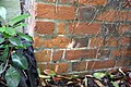
 Benchmark on barn at Hale Farm - geograph.org.uk - 2439975.jpg 683 × 1,024; 285 KB
-

-
 Benchmark on Benson Lock keeper's house - geograph.org.uk - 5581758.jpg 1,024 × 649; 167 KB
-
 Benchmark on Crowmarsh Battle Farm House - geograph.org.uk - 3769622.jpg 683 × 1,024; 209 KB
-

-
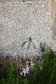 Benchmark on St Helen's Church - geograph.org.uk - 2440157.jpg 683 × 1,024; 300 KB
-

-
-
 Benchmark on ^2 Castle Square - geograph.org.uk - 2439186.jpg 683 × 1,024; 273 KB
-
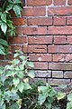
 Benchmark on ^24 Oxford Road - geograph.org.uk - 2439631.jpg 683 × 1,024; 216 KB
-
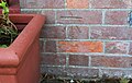
 Benchmark on ^3 Brook Street - geograph.org.uk - 2439584.jpg 683 × 1,024; 244 KB
-
 Benchmark on ^75 Brook Street - geograph.org.uk - 2439551.jpg 1,024 × 683; 229 KB
-
 Benchmarked barn at Hale Farm - geograph.org.uk - 2440733.jpg 1,024 × 683; 203 KB
-
 Bend and bridge in footpath to St Helens Avenue - geograph.org.uk - 2439359.jpg 683 × 1,024; 339 KB
-
 Bend by the house - geograph.org.uk - 1614241.jpg 640 × 427; 78 KB
-
 Bend on B4009 by recreation ground - geograph.org.uk - 3923798.jpg 640 × 434; 49 KB
-
 Benefactors Plaque 1 - geograph.org.uk - 5355843.jpg 533 × 800; 103 KB
-
 Benefactors Plaque 2 - geograph.org.uk - 5355846.jpg 533 × 800; 112 KB
-
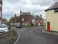
 Castle on the corner - geograph.org.uk - 1614355.jpg 640 × 427; 78 KB
-
 Fyfield Manor.jpg 1,500 × 1,110; 543 KB
-
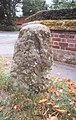 Old Milestone (geograph 6114712).jpg 922 × 1,458; 227 KB
-
 Phone box in the garden - geograph.org.uk - 1615435.jpg 426 × 640; 117 KB
-
 Trees round the tractor - geograph.org.uk - 1617959.jpg 640 × 427; 115 KB
-
 Benson and Benson Airfield - geograph.org.uk - 3640858.jpg 3,264 × 2,448; 3.67 MB
-
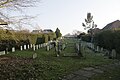 Benson Cemetery - geograph.org.uk - 5373332.jpg 1,024 × 683; 155 KB
-
 Benson in the Snow - geograph.org.uk - 1571253.jpg 640 × 480; 128 KB
-
 Benson in the snow - geograph.org.uk - 1571259.jpg 640 × 480; 132 KB
-
 Benson Library - geograph.org.uk - 1616606.jpg 640 × 427; 65 KB
-
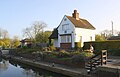 Benson Lock - geograph.org.uk - 5581844.jpg 1,024 × 653; 133 KB
-
 Benson Lock and weir - geograph.org.uk - 1960087.jpg 1,500 × 1,000; 188 KB
-
 Benson Mill - geograph.org.uk - 1959399.jpg 1,500 × 1,000; 265 KB
-
 Benson Parish Hall - geograph.org.uk - 1614076.jpg 640 × 427; 49 KB
-
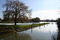
 Benson riverside park - geograph.org.uk - 1218361.jpg 640 × 426; 57 KB
-
 Benson Road, Preston Crowmarsh - geograph.org.uk - 4982650.jpg 2,304 × 1,728; 825 KB
-
 Benson Weir - geograph.org.uk - 5218504.jpg 1,600 × 1,200; 379 KB
-
 Benson, Brook Street - geograph.org.uk - 6129720.jpg 768 × 1,024; 155 KB
-
 Benson, centre - geograph.org.uk - 3905619.jpg 4,320 × 3,240; 2.97 MB
-
 Lamppost by the garage - geograph.org.uk - 1615423.jpg 426 × 640; 100 KB
-
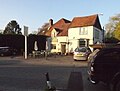 Benson, The Three Horseshoes - geograph.org.uk - 6119519.jpg 1,024 × 774; 162 KB
-
 Beside the Thames at Benson - geograph.org.uk - 1571276.jpg 640 × 480; 74 KB
-
 Between the gardens - geograph.org.uk - 1218318.jpg 400 × 600; 68 KB
-
 Bikes at the cafe - geograph.org.uk - 2410945.jpg 1,024 × 768; 155 KB
-
 Bit of renovation - geograph.org.uk - 2406162.jpg 1,024 × 768; 162 KB
-
 Boat by the farm - geograph.org.uk - 1176180.jpg 640 × 426; 56 KB
-
 Boat in the wall - geograph.org.uk - 1225245.jpg 640 × 426; 63 KB
-
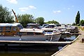
 Boats at the marina - geograph.org.uk - 1218419.jpg 640 × 426; 73 KB
-
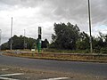
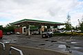 BP Benson - geograph.org.uk - 1279843.jpg 640 × 426; 52 KB
-
 BP Filling Station at Benson - geograph.org.uk - 1408350.jpg 640 × 480; 52 KB
-
 Branch across the entrance - geograph.org.uk - 1177587.jpg 640 × 426; 63 KB
-
 Braze Lane junction - geograph.org.uk - 3923808.jpg 640 × 454; 68 KB
-
 Bridge on the path - geograph.org.uk - 1218489.jpg 640 × 426; 74 KB
-
 Bridge over the mill stream - geograph.org.uk - 1179151.jpg 640 × 426; 95 KB
-
 Bridge to the walkway - geograph.org.uk - 1180146.jpg 640 × 426; 105 KB
-
 British Legion Flag - geograph.org.uk - 5357476.jpg 1,024 × 683; 71 KB
-
 Brook along the street - geograph.org.uk - 1615368.jpg 426 × 640; 122 KB
-
 Brothers Together - geograph.org.uk - 5373475.jpg 1,024 × 683; 164 KB
-
 Buildings at Hale Farm - geograph.org.uk - 2440651.jpg 1,024 × 683; 205 KB
-
 Bungalow on Beggarsbush Hill - geograph.org.uk - 2754866.jpg 1,024 × 683; 182 KB
-
 By the Church - geograph.org.uk - 5363998.jpg 1,024 × 683; 167 KB
-
 By the entrance - geograph.org.uk - 1594147.jpg 480 × 640; 84 KB
-
 Candelabra in the Nave - geograph.org.uk - 5355838.jpg 533 × 800; 67 KB
-
 Candles on the Chandelier - geograph.org.uk - 5356147.jpg 1,024 × 683; 105 KB
-
 Caravan Park by the Thames - geograph.org.uk - 1959325.jpg 1,500 × 1,000; 261 KB
-
 Cart in the showroom - geograph.org.uk - 2404768.jpg 1,024 × 768; 157 KB
-
 Carving in the Roof Beams - geograph.org.uk - 5356265.jpg 1,024 × 683; 66 KB
-
 Castle Square - geograph.org.uk - 2894658.jpg 3,648 × 2,736; 1.56 MB
-
 Chains across the stream - geograph.org.uk - 1228223.jpg 640 × 426; 99 KB
-
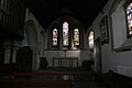 Chancel at Sty Helens - geograph.org.uk - 5355963.jpg 1,024 × 683; 83 KB
-
 Chiltern Way - geograph.org.uk - 1270153.jpg 640 × 480; 110 KB
-
 Churchyard near the Wall - geograph.org.uk - 5363997.jpg 1,024 × 683; 208 KB
-
 Clack's Farm - geograph.org.uk - 2827173.jpg 3,648 × 2,736; 2.53 MB
-
 Clack's Lane - geograph.org.uk - 1308541.jpg 640 × 480; 81 KB
-
 Clacks Farm from Clack's Lane - geograph.org.uk - 2755484.jpg 1,024 × 683; 145 KB
-
 Classics in the showroom - geograph.org.uk - 2404766.jpg 1,024 × 768; 207 KB
-
 Clay Lane through RAF Benson - geograph.org.uk - 5248958.jpg 1,500 × 1,127; 246 KB
-
 Clean inscription - geograph.org.uk - 5373191.jpg 533 × 800; 99 KB
-
 Clear entrance - geograph.org.uk - 2408781.jpg 600 × 800; 146 KB
-
 Cleared away - geograph.org.uk - 2408775.jpg 1,024 × 768; 235 KB
-
 Commonwealth War Graves - geograph.org.uk - 5374672.jpg 1,024 × 683; 169 KB
-
 Corner of the Park - geograph.org.uk - 2190545.jpg 3,316 × 2,484; 1.75 MB
-
 Couple of Harleys - geograph.org.uk - 2410934.jpg 1,024 × 768; 218 KB
-
 Couple of Tombs - geograph.org.uk - 5364449.jpg 1,024 × 683; 175 KB
-
 Crash Exit, RAF Benson - geograph.org.uk - 2747347.jpg 1,024 × 727; 196 KB
-
 Cross in the Headstones - geograph.org.uk - 5364446.jpg 1,024 × 683; 199 KB
-
 Crowmarsh Battle Farm House, Preston Crowmarsh - geograph.org.uk - 3769623.jpg 1,024 × 683; 153 KB
-
 Crown Lane - geograph.org.uk - 1615294.jpg 640 × 427; 66 KB
-
 Crown Square - geograph.org.uk - 1616549.jpg 640 × 427; 72 KB
-
 Cruisers at the marina - geograph.org.uk - 1959322.jpg 1,500 × 1,000; 185 KB
-
 Cycling in the Sun - geograph.org.uk - 1878568.jpg 2,048 × 1,536; 438 KB
-
 Day's Lane climbs Rabbits Hill - geograph.org.uk - 2827793.jpg 3,524 × 2,542; 1.15 MB
-
 Devil on a Stop - geograph.org.uk - 5357480.jpg 533 × 800; 43 KB
-
 Ducks on the river - geograph.org.uk - 1594210.jpg 640 × 480; 117 KB
-
 Dustcart in the showroom - geograph.org.uk - 2404789.jpg 1,024 × 768; 150 KB
-
 Empty Moorings at Benson Marina - geograph.org.uk - 5218501.jpg 4,000 × 3,000; 2.56 MB
-
 Empty seats - geograph.org.uk - 1279829.jpg 640 × 426; 45 KB
-
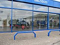
 Empty showroom - geograph.org.uk - 1279838.jpg 640 × 426; 52 KB
-
 Empty sign - geograph.org.uk - 1614588.jpg 426 × 640; 99 KB
-
 Entrance to Clacks Farm from Clack's Lane - geograph.org.uk - 2754939.jpg 1,024 × 683; 206 KB
-
 Evening Colours at Benson - geograph.org.uk - 5218512.jpg 3,811 × 2,794; 2.61 MB
-
 Ewelme brook - geograph.org.uk - 1011846.jpg 640 × 480; 90 KB
-
 Ewelme brook - geograph.org.uk - 1011856.jpg 640 × 480; 92 KB
-
 Far end of the Cemetery - geograph.org.uk - 5374501.jpg 1,024 × 683; 165 KB
-
 Farmland south-east of Clack's Lane - geograph.org.uk - 5513515.jpg 640 × 480; 104 KB
-
 Farmland, Benson - geograph.org.uk - 1081350.jpg 640 × 480; 90 KB
-
 Farmland, Benson - geograph.org.uk - 1081916.jpg 640 × 480; 166 KB
-
 Farmland, Benson - geograph.org.uk - 6081525.jpg 1,024 × 768; 176 KB
-
 Farmland, Benson, Oxfordshire - geograph.org.uk - 4555506.jpg 800 × 600; 218 KB
-

-
 Fifield Farmhouse - geograph.org.uk - 6129662.jpg 805 × 1,024; 211 KB
-
 Final look - geograph.org.uk - 1177748.jpg 640 × 426; 74 KB
-
 Fishing in the weir pool - geograph.org.uk - 1178813.jpg 640 × 426; 63 KB
-
 Flood marks on the wall - geograph.org.uk - 1178881.jpg 640 × 426; 92 KB
-
 Flowers by the chancel - geograph.org.uk - 5355953.jpg 533 × 800; 94 KB
-
 Font in St Helens - geograph.org.uk - 5356272.jpg 533 × 800; 86 KB
-
 Footbridge at Benson weir - geograph.org.uk - 3176287.jpg 640 × 480; 158 KB
-
 Footbridge from the weir - geograph.org.uk - 1959408.jpg 1,500 × 1,000; 284 KB
-
 Footbridge on the Thames Path - geograph.org.uk - 5032151.jpg 1,500 × 1,000; 281 KB
-
 Footbridge over Benson Weir - geograph.org.uk - 2536404.jpg 1,024 × 680; 194 KB
-
 Footpath from Warborough to Rokemarsh - geograph.org.uk - 2440813.jpg 1,024 × 683; 239 KB
-
 Footpath past the houses - geograph.org.uk - 1614267.jpg 640 × 427; 105 KB
-
 Footpath through patch of yellow flowers - geograph.org.uk - 2440578.jpg 1,024 × 683; 219 KB
-
 Footpath to the lock - geograph.org.uk - 1180435.jpg 400 × 600; 99 KB
-
 Footpath to the road - geograph.org.uk - 1223891.jpg 400 × 600; 113 KB
-
 Forgotten corner - geograph.org.uk - 1617955.jpg 640 × 427; 128 KB
-
 Former Telephone Exchange, Benson - geograph.org.uk - 3683424.jpg 3,072 × 2,304; 1.79 MB
-
 Garage on High Street - geograph.org.uk - 1614591.jpg 640 × 427; 77 KB
-
 Gate on the Thames Path - geograph.org.uk - 1959335.jpg 1,500 × 1,000; 347 KB
-
 Gate to St Helens - geograph.org.uk - 5373328.jpg 1,024 × 683; 152 KB
-
 George Henry Whitaker - geograph.org.uk - 5356145.jpg 1,024 × 683; 103 KB
-
 Getting a covering - geograph.org.uk - 1593950.jpg 640 × 480; 99 KB
-
 Gould's Grove cottages - geograph.org.uk - 2754726.jpg 1,024 × 683; 161 KB
-
 Graffiti by the embrasure - geograph.org.uk - 1177731.jpg 640 × 426; 47 KB
-
 Grave in the corner - geograph.org.uk - 1617953.jpg 426 × 640; 102 KB
-
 Graves near the Wall - geograph.org.uk - 5373184.jpg 1,024 × 683; 218 KB
-
 Green Pointy Compost Makers - geograph.org.uk - 3364201.jpg 1,600 × 1,235; 378 KB
-
 Group Captain Jeremy .F.Billings Jones - geograph.org.uk - 5374545.jpg 533 × 800; 108 KB
-
 Grundon waste depot and transfer station - geograph.org.uk - 5513524.jpg 640 × 428; 105 KB
-
 Gwendolyn Salter - geograph.org.uk - 5374497.jpg 533 × 800; 110 KB
-
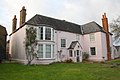
 Hall from the road - geograph.org.uk - 1614156.jpg 640 × 427; 64 KB
-
 Headstones at St Helens - geograph.org.uk - 5364001.jpg 1,024 × 683; 192 KB
-
 Headstones in a line - geograph.org.uk - 5364004.jpg 1,024 × 683; 177 KB
-
 Hedgerow in flower near Benson - geograph.org.uk - 1959361.jpg 1,500 × 1,000; 325 KB
-
 Henley Road, Benson - geograph.org.uk - 5865887.jpg 2,048 × 1,536; 1.65 MB
-
 Hidden in the ivy - geograph.org.uk - 1312865.jpg 640 × 426; 84 KB
-
 High and dry - geograph.org.uk - 1225226.jpg 640 × 426; 58 KB
-
 Hire cruisers at Benson Waterfront - geograph.org.uk - 1234349.jpg 640 × 474; 263 KB
-
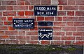 Historic flood levels recorded at Benson Lock - geograph.org.uk - 5581831.jpg 1,024 × 664; 263 KB
-
 I stood on this - geograph.org.uk - 1177522.jpg 640 × 426; 96 KB
-
 In the loophole - geograph.org.uk - 1593956.jpg 640 × 480; 122 KB
-
 In the Scrapyard - geograph.org.uk - 2767743.jpg 1,600 × 948; 515 KB
-
 Inside out - geograph.org.uk - 1594117.jpg 480 × 640; 86 KB
-
 Instructions on the side - geograph.org.uk - 1179107.jpg 400 × 600; 55 KB
-
 It's a Time of the Signs - geograph.org.uk - 2164668.jpg 3,428 × 2,320; 1.88 MB
-
 Ivy on the walls - geograph.org.uk - 1594144.jpg 640 × 480; 131 KB
-
 Jam on the Window Sill - geograph.org.uk - 5356270.jpg 1,024 × 683; 88 KB
-
 Junction of Beggarsbush Hill and Old London Road - geograph.org.uk - 2754622.jpg 1,024 × 683; 141 KB
-
 Junction of Braze Lane and Brook Street - geograph.org.uk - 2439404.jpg 1,024 × 683; 172 KB
-
 Junction on Benson Road, Preston Crowmarsh - geograph.org.uk - 4982644.jpg 2,304 × 1,728; 845 KB
-
 Junction on Benson Road, Preston Crowmarsh - geograph.org.uk - 4982646.jpg 2,304 × 1,728; 827 KB
-
 Kite with a twig - geograph.org.uk - 1177553.jpg 600 × 444; 30 KB
-
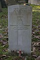
 L.Cpr A.W. Constable - geograph.org.uk - 5374483.jpg 533 × 800; 104 KB
-
 Littleworth Road - geograph.org.uk - 1614152.jpg 426 × 640; 64 KB
-
 Lock and weir - geograph.org.uk - 1177295.jpg 640 × 426; 62 KB
-
 Lock from the park - geograph.org.uk - 1218393.jpg 640 × 426; 54 KB
-
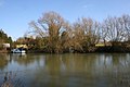
 Looking across the Thames at Benson - geograph.org.uk - 1960702.jpg 1,000 × 1,500; 347 KB


.jpg)


