Category:Bentley, South Yorkshire
village in South Yorkshire, UK | |||||
| Upload media | |||||
| Instance of | |||||
|---|---|---|---|---|---|
| Location | Doncaster, South Yorkshire, Yorkshire and the Humber, England | ||||
 | |||||
Subcategories
This category has the following 6 subcategories, out of 6 total.
Media in category "Bentley, South Yorkshire"
The following 58 files are in this category, out of 58 total.
-
 A19 towards Selby - geograph.org.uk - 2593059.jpg 1,600 × 1,200; 373 KB
-

-

-
 Bentley North End Sports ^ Social Club, Bentley - geograph.org.uk - 5689946.jpg 1,600 × 1,064; 570 KB
-
 Bin emptying day, Ings Road, Bentley - geograph.org.uk - 3217710.jpg 1,024 × 768; 171 KB
-
 Causeway, Bentley.jpg 1,024 × 768; 146 KB
-
 Chadwick Road, Bentley - geograph.org.uk - 1344322.jpg 640 × 480; 72 KB
-
 Church on Arksey Lane - geograph.org.uk - 2593144.jpg 1,600 × 1,200; 363 KB
-
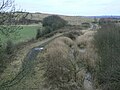
 Doncaster greenway Bentley - geograph.org.uk - 4542656.jpg 1,024 × 768; 164 KB
-
 Doncaster View from Bentley Ings - geograph.org.uk - 5124484.jpg 4,608 × 3,456; 4.05 MB
-
 Epworth Court, Bentley - geograph.org.uk - 381266.jpg 640 × 480; 83 KB
-
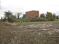
 Farm buildings, Stockbridge Farm.jpg 1,024 × 768; 150 KB
-
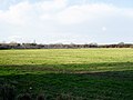
 Farmland, Bentley Common - geograph.org.uk - 2593048.jpg 1,600 × 1,200; 465 KB
-
 Fish and Chips anyone^ - geograph.org.uk - 556869.jpg 640 × 328; 69 KB
-
 Flood Bank and Footpath at Bentley Ings - geograph.org.uk - 5124489.jpg 4,608 × 3,456; 3.56 MB
-
 Footpath along the levee at Bentley Common - geograph.org.uk - 3759412.jpg 1,600 × 1,200; 419 KB
-
 Footpath and Flood Bank at Bentley Ings - geograph.org.uk - 5124459.jpg 4,608 × 3,456; 3.45 MB
-
 Grafton Hall, Victoria Road, Bentley - geograph.org.uk - 5689939.jpg 1,600 × 1,064; 549 KB
-
 Grassed area and St. Peter's church, Bentley - geograph.org.uk - 5717787.jpg 1,024 × 733; 163 KB
-

-
 Ings Road, Bentley - geograph.org.uk - 3217717.jpg 1,024 × 768; 169 KB
-
 Ings Road, Bentley Ings - geograph.org.uk - 3217725.jpg 1,024 × 768; 178 KB
-

-

-
 Level crossing, Fowler Bridge Road, Bentley - geograph.org.uk - 3759381.jpg 1,600 × 1,200; 683 KB
-
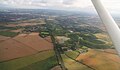
 Looking towards Bentley from Rostholme - geograph.org.uk - 3160621.jpg 4,000 × 2,248; 2.25 MB
-
 Milepost on Tadcaster and Doncaster Road at Bentley with Arksey (geograph 5093620).jpg 1,870 × 3,492; 1.56 MB
-
 Milestone near Junction with Pickerings Lane.jpg 480 × 640; 414 KB
-
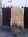
 Milestone near Lady Pitt's Bridge.jpg 393 × 732; 43 KB
-
 Milestone opposite Rosendale Road.jpg 480 × 640; 312 KB
-
 Mill Gate, Bentley - geograph.org.uk - 1344325.jpg 640 × 480; 79 KB
-
 Mini Adventure - geograph.org.uk - 197462.jpg 640 × 480; 64 KB
-
 Old milestone, Askern Road, Bentley (geograph 6765307).jpg 1,200 × 1,600; 266 KB
-
 Path in Bentley Community Woodland - geograph.org.uk - 4769683.jpg 4,608 × 3,456; 3.85 MB
-
 Pipering Lane Crossing - geograph.org.uk - 1092242.jpg 640 × 480; 130 KB
-
 Ploughing at Bentley Ings - geograph.org.uk - 5124513.jpg 4,488 × 3,306; 3.98 MB
-
 Pumping station, Bentley Ings - geograph.org.uk - 3217731.jpg 1,024 × 768; 214 KB
-
 Queen's Drive, Bentley - geograph.org.uk - 3759703.jpg 1,600 × 1,200; 538 KB
-
 Railway Tavern, Bentley - geograph.org.uk - 3758824.jpg 1,600 × 1,200; 406 KB
-
 Sculpture in Bentley Community Woodland - geograph.org.uk - 4769688.jpg 4,608 × 3,456; 3.71 MB
-
 Shaftholme, former colliery and Bentley - geograph.org.uk - 4100369.jpg 1,024 × 600; 114 KB
-
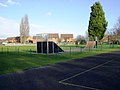 Skate park, Bentley Park - geograph.org.uk - 2738881.jpg 640 × 480; 64 KB
-
 Sports Ground, Bentley - geograph.org.uk - 2738876.jpg 640 × 480; 58 KB
-
 Stockbridge Farmhouse.jpg 1,024 × 768; 138 KB
-
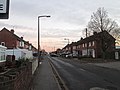
 The A19 at Bentley - geograph.org.uk - 3048280.jpg 1,024 × 661; 126 KB
-

-
 The Druids Arms on the A19, Bentley - geograph.org.uk - 287294.jpg 640 × 480; 57 KB
-
 The Drum - geograph.org.uk - 240904.jpg 640 × 427; 54 KB
-

-
 The Homestead in Bentley - geograph.org.uk - 4765837.jpg 4,457 × 3,272; 3.33 MB
-
 The Mallard - geograph.org.uk - 197846.jpg 640 × 480; 80 KB
-
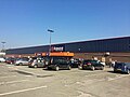 The Range Doncaster (geograph 5375828).jpg 1,024 × 768; 146 KB
-
 The start of Fowler Bridge Road Bentley - geograph.org.uk - 3048276.jpg 1,024 × 768; 163 KB
-
 The Trans Pennine Trail north of Bentley - geograph.org.uk - 3759682.jpg 1,600 × 1,200; 722 KB
-
 Train Passing Bentley Ings - geograph.org.uk - 5124473.jpg 4,608 × 3,456; 3.54 MB
-
 Transpennine Trail - geograph.org.uk - 1709182.jpg 1,280 × 959; 466 KB
-

-
 Mount Hermon Community Church - geograph.org.uk - 178092.jpg 640 × 427; 57 KB


.jpg)


.jpg)


.jpg)


