Category:Bentley, Warwickshire
English: Bentley is a village and civil parish in the North Warwickshire district of Warwickshire, England, about two miles south-west of Atherstone. According to the 2001 census it had a population of 101.
village and civil parish in Warwickshire, UK  | |||||
| Upload media | |||||
| Instance of | |||||
|---|---|---|---|---|---|
| Location | North Warwickshire, Warwickshire, West Midlands, England | ||||
 | |||||
Subcategories
This category has the following 2 subcategories, out of 2 total.
B
- Bentley Common (7 F)
- Holy Trinity Chapel, Bentley (3 F)
Media in category "Bentley, Warwickshire"
The following 60 files are in this category, out of 60 total.
-

-
 A couple of leaning pines - geograph.org.uk - 4144442.jpg 1,280 × 1,280; 818 KB
-
 A ploughed field - geograph.org.uk - 5577238.jpg 1,600 × 900; 459 KB
-

-
-
 B4116 south of Bentley in the snow - geograph.org.uk - 3385284.jpg 1,415 × 1,000; 1.36 MB
-
 Bentley Park Wood trig - geograph.org.uk - 5253888.jpg 1,469 × 1,102; 731 KB
-
 Birchley Heath Road - geograph.org.uk - 5253911.jpg 1,469 × 1,102; 756 KB
-
 Birmingham International Airport - geograph.org.uk - 5835498.jpg 1,470 × 1,106; 740 KB
-
 Bluebell time - geograph.org.uk - 1861721.jpg 1,536 × 2,048; 1.42 MB
-
 Bluebells in The Birchleys - geograph.org.uk - 1865441.jpg 640 × 480; 167 KB
-
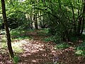
 Boggy track in Bentley Park Wood - geograph.org.uk - 4144182.jpg 1,280 × 853; 632 KB
-
 Bridleway through the wood - geograph.org.uk - 5253862.jpg 1,142 × 857; 588 KB
-
 Corn field - geograph.org.uk - 4144179.jpg 1,280 × 853; 441 KB
-
 Corner of field beside Bentley Park Wood - geograph.org.uk - 5253905.jpg 1,306 × 979; 702 KB
-
-
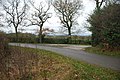
 Country roads meet - geograph.org.uk - 5577265.jpg 1,600 × 900; 396 KB
-

-

-
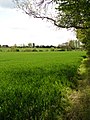
 Field beside Bentley Park Wood - geograph.org.uk - 5253898.jpg 1,306 × 979; 696 KB
-
 Field near Birchley Heath - geograph.org.uk - 1860395.jpg 480 × 640; 144 KB
-
 Five bar gate and footpath - geograph.org.uk - 2880376.jpg 640 × 425; 125 KB
-
 Footpath across field at Birchley Heath - geograph.org.uk - 5253909.jpg 1,469 × 1,102; 588 KB
-
 Footpath alongside Bentley Park Wood - geograph.org.uk - 5253902.jpg 1,469 × 1,102; 726 KB
-

-
 Kimberley Hall Farm - geograph.org.uk - 5577244.jpg 1,600 × 900; 625 KB
-
 Lane at Kimberley Hall Farm - geograph.org.uk - 5286232.jpg 1,600 × 901; 681 KB
-
 Lane junction at Wheatleys Wood - geograph.org.uk - 4844041.jpg 800 × 526; 131 KB
-
 Leafy Walk - geograph.org.uk - 1861715.jpg 1,536 × 2,048; 1.43 MB
-
-

-

-
 Minor road - geograph.org.uk - 5577235.jpg 900 × 1,600; 292 KB
-

-
 No Entry to Private Woodland - geograph.org.uk - 2729738.jpg 640 × 428; 125 KB
-
 OS benchmark - Ridge Lane, Birchley Heath Road - geograph.org.uk - 5253852.jpg 1,306 × 979; 639 KB
-
 OS flush bracket - Bentley Park Wood trig - geograph.org.uk - 5253878.jpg 1,102 × 1,469; 875 KB
-
 Pine lines - geograph.org.uk - 4144201.jpg 853 × 1,280; 651 KB
-
 Pine trunks - geograph.org.uk - 4144453.jpg 1,280 × 1,280; 1,020 KB
-
 Pond in the wood - geograph.org.uk - 5253867.jpg 1,142 × 857; 532 KB
-
 Private entrance to Swans Wood Farm - geograph.org.uk - 2881808.jpg 640 × 425; 109 KB
-

-
 Remnants of a more interesting wood - geograph.org.uk - 4144449.jpg 1,280 × 1,280; 702 KB
-
 Ripening corn - geograph.org.uk - 4144177.jpg 1,280 × 1,280; 483 KB
-
 Road junction - geograph.org.uk - 5577269.jpg 1,600 × 900; 280 KB
-
 Small pond in Bentley Park Wood - geograph.org.uk - 4144180.jpg 1,280 × 853; 465 KB
-
 Snowy track into Bentley Park Wood - geograph.org.uk - 3385252.jpg 1,000 × 1,333; 1.37 MB
-

-
 The entrance to Bentley woods - geograph.org.uk - 1865395.jpg 640 × 480; 132 KB
-
 The Rookery, Birchley Heath - geograph.org.uk - 1864258.jpg 640 × 480; 78 KB
-
 The south-east corner of Hoar Park Wood - geograph.org.uk - 1865487.jpg 640 × 480; 144 KB
-
 The White Hart, Ridge Lane - geograph.org.uk - 1864252.jpg 640 × 480; 70 KB
-
 Track and bridleway in Bentley Park Wood - geograph.org.uk - 5253860.jpg 857 × 1,142; 574 KB
-

-
 Track into a field west of Epps Farm - geograph.org.uk - 5253896.jpg 1,469 × 1,102; 578 KB
-
 Triangulation pillar - geograph.org.uk - 1181614.jpg 623 × 401; 21 KB
-
 Trig point and Epps Farm - geograph.org.uk - 5253874.jpg 1,142 × 857; 471 KB
-
 Where's my mummy^ - geograph.org.uk - 1861725.jpg 2,048 × 1,536; 1.35 MB
-
 Woodside cottages, Birchley Heath Lane - geograph.org.uk - 1865392.jpg 640 × 480; 119 KB
-
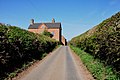
 The Jockey at Bentley - geograph.org.uk - 103691.jpg 480 × 640; 144 KB


