Category:Bernhardswald
municipality of Germany .JPG)   | |||||
| Upload media | |||||
| Instance of |
| ||||
|---|---|---|---|---|---|
| Part of |
| ||||
| Location | Regensburg, Upper Palatinate, Bavaria, Germany | ||||
| Head of government |
| ||||
| Population |
| ||||
| Area |
| ||||
| Elevation above sea level |
| ||||
| official website | |||||
 | |||||
Subcategories
This category has the following 3 subcategories, out of 3 total.
B
C
D
Media in category "Bernhardswald"
The following 28 files are in this category, out of 28 total.
-
 Amtliches Wappen via Bild.jpg 862 × 817; 68 KB
-
 Wappen Bernhardswald.png 280 × 293; 82 KB
-
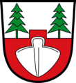 Wappen der Gemeinde Bernhardswald.png 800 × 873; 91 KB
-
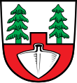 Wappen von Bernhardswald.svg 708 × 773; 19 KB
-
 Bernhardswald in R.svg 829 × 691; 689 KB
-
 BERNHARDSWALD KUERN nieder.png 480 × 360; 5 KB
-
 BERNHARDSWALD KUERN nieder.svg 512 × 427; 21 KB
-
 Freilichtmuseum mit Bahnartefakten in Lambertsneukirchen 1.jpg 6,000 × 4,000; 9.97 MB
-
 Freilichtmuseum mit Bahnartefakten in Lambertsneukirchen 10.jpg 4,000 × 6,000; 10.47 MB
-
 Freilichtmuseum mit Bahnartefakten in Lambertsneukirchen 11.jpg 6,000 × 4,000; 9.81 MB
-
 Freilichtmuseum mit Bahnartefakten in Lambertsneukirchen 12.jpg 6,000 × 4,000; 10.75 MB
-
 Freilichtmuseum mit Bahnartefakten in Lambertsneukirchen 2.jpg 4,000 × 6,000; 8.66 MB
-
 Freilichtmuseum mit Bahnartefakten in Lambertsneukirchen 3.jpg 6,000 × 4,000; 9.53 MB
-
 Freilichtmuseum mit Bahnartefakten in Lambertsneukirchen 4.jpg 4,000 × 6,000; 6.63 MB
-
 Freilichtmuseum mit Bahnartefakten in Lambertsneukirchen 5.jpg 6,000 × 4,000; 7.34 MB
-
 Freilichtmuseum mit Bahnartefakten in Lambertsneukirchen 6.jpg 4,000 × 6,000; 9.03 MB
-
 Freilichtmuseum mit Bahnartefakten in Lambertsneukirchen 7.jpg 6,000 × 4,000; 7.97 MB
-
 Freilichtmuseum mit Bahnartefakten in Lambertsneukirchen 8.jpg 4,000 × 6,000; 10.19 MB
-
 Freilichtmuseum mit Bahnartefakten in Lambertsneukirchen 9.jpg 6,000 × 4,000; 11.28 MB
-
 Freilichtmuseum mit Bahnartefakten in Lambertsneukirchen.jpg 6,000 × 4,000; 11.16 MB
-
 Hoher Stein Bernhardswald.jpg 2,400 × 1,350; 5.28 MB
-
 Karte der Bahnstrecke Regensburg - Falkenstein.png 2,180 × 1,311; 1.32 MB
-
 Kupferstich - Bernhardswald - Schloss Adlmannstain.jpg 3,999 × 1,462; 2.5 MB
-
 Tagesrueckfahrkarte Regensburg–Falkenstein.jpg 661 × 1,590; 1.08 MB
-
 Todesmarsch-Mahnmal bei Bernhardswald 1.jpg 4,000 × 6,000; 10.94 MB
-
 Todesmarsch-Mahnmal bei Bernhardswald 2.jpg 4,000 × 6,000; 8.38 MB
-
 Todesmarsch-Mahnmal bei Bernhardswald 3.jpg 6,000 × 4,000; 9.47 MB
-
 Turmhügel Kaltenherberg.PNG 595 × 457; 766 KB


