Category:Berwick Hill
village in Northumberland, England, UK  | |||||
| Upload media | |||||
| Instance of | |||||
|---|---|---|---|---|---|
| Location | Ponteland, Northumberland, North East England, England | ||||
 | |||||
English: Category:Villages in Northumberland
Media in category "Berwick Hill"
The following 29 files are in this category, out of 29 total.
-
 Arable land, Horton Grange - geograph.org.uk - 1193614.jpg 640 × 480; 101 KB
-
 Brenkley Hill Trig Pillar - geograph.org.uk - 358766.jpg 640 × 480; 93 KB
-
 Cottages, Berwick Hill - geograph.org.uk - 3057577.jpg 800 × 494; 81 KB
-
 Park House - geograph.org.uk - 296196.jpg 640 × 427; 33 KB
-
 Road to Make Me Rich - geograph.org.uk - 261161.jpg 640 × 480; 86 KB
-
 Trees in Sunset - geograph.org.uk - 128368.jpg 640 × 480; 49 KB
-
 Aberdeen Angus - geograph.org.uk - 128347.jpg 640 × 480; 99 KB
-
 Benridge Hall - geograph.org.uk - 119129.jpg 640 × 454; 102 KB
-
 Berwick Hill - geograph.org.uk - 117043.jpg 640 × 480; 111 KB
-
 Bridge over Duddo Burn - geograph.org.uk - 515775.jpg 640 × 480; 139 KB
-
 Bridleway - geograph.org.uk - 515756.jpg 640 × 480; 105 KB
-
 Deciduous Plantation - geograph.org.uk - 515712.jpg 640 × 480; 97 KB
-
 Duddo Burn - geograph.org.uk - 515767.jpg 640 × 480; 148 KB
-
 Field Boundary - geograph.org.uk - 117058.jpg 480 × 640; 114 KB
-
 Field Edge - geograph.org.uk - 515691.jpg 640 × 480; 98 KB
-
 Field Near Thorneyford - geograph.org.uk - 204427.jpg 640 × 480; 192 KB
-
 Footpath - geograph.org.uk - 515722.jpg 640 × 480; 112 KB
-

-
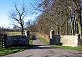 Gates and Drive to Benridge Hall - geograph.org.uk - 119127.jpg 640 × 444; 124 KB
-
 Grassy Track - geograph.org.uk - 79973.jpg 544 × 640; 124 KB
-
 Houses and trees, north of Smallburn - geograph.org.uk - 119122.jpg 640 × 491; 103 KB
-
 Kirkley Mill Bridge - geograph.org.uk - 117044.jpg 640 × 480; 103 KB
-
 Make me Rich - geograph.org.uk - 358876.jpg 640 × 488; 143 KB
-
 Milkhope - geograph.org.uk - 308012.jpg 640 × 462; 71 KB
-
 Narrow Road - geograph.org.uk - 115058.jpg 480 × 640; 122 KB
-
 North Carter Moor Farm - geograph.org.uk - 515732.jpg 640 × 480; 79 KB
-
 Rifle range near Berwick Hill - geograph.org.uk - 296192.jpg 640 × 427; 26 KB
-
 River Pont from Berwick Hill Bridge - geograph.org.uk - 296187.jpg 427 × 640; 81 KB
-
 Road Junction - geograph.org.uk - 117051.jpg 640 × 480; 150 KB


