Category:Beswick, East Riding of Yorkshire
English: Beswick is a village and civil parish in the East Riding of Yorkshire, England. The village is situated on the A164 road, about 6 miles (9.7 km) north of Beverley and 6 miles (9.7 km) south of Driffield.
village in the East Riding of Yorkshire, England, United Kingdom  | |||||
| Upload media | |||||
| Instance of | |||||
|---|---|---|---|---|---|
| Location | East Riding of Yorkshire, Yorkshire and the Humber, England | ||||
 | |||||
Subcategories
This category has the following 7 subcategories, out of 7 total.
Media in category "Beswick, East Riding of Yorkshire"
The following 200 files are in this category, out of 324 total.
(previous page) (next page)-
 A bridleway to Wilfholme Road - geograph.org.uk - 2247693.jpg 800 × 600; 321 KB
-
 A farm bridge off Wilfholme Road - geograph.org.uk - 2247708.jpg 800 × 600; 297 KB
-
 A farm track to Barff Hill Farm - geograph.org.uk - 2247763.jpg 800 × 600; 179 KB
-
 A field full of Life - geograph.org.uk - 2971456.jpg 4,000 × 3,000; 3.5 MB
-
 A field of plenty - geograph.org.uk - 2971466.jpg 4,000 × 3,000; 3 MB
-
 A minor road towards Aike - geograph.org.uk - 2247720.jpg 800 × 600; 228 KB
-
 A minor road towards Aike - geograph.org.uk - 2247748.jpg 800 × 600; 169 KB
-
 A walk to Beverley ^80 - geograph.org.uk - 1985098.jpg 800 × 600; 135 KB
-
 A walk to Beverley ^81 - geograph.org.uk - 1985359.jpg 800 × 600; 131 KB
-
 A164 Beverley Road, south of Watton (geograph 6494199).jpg 5,456 × 3,632; 2.71 MB
-
 A164 Road Junction - geograph.org.uk - 46099.jpg 640 × 480; 92 KB
-
 A164 towards Beverley - geograph.org.uk - 1453860.jpg 640 × 480; 106 KB
-
 A164 towards Driffield (geograph 5253578).jpg 640 × 480; 60 KB
-
 A164-Wilfholme Road junction near Beswick - geograph.org.uk - 972105.jpg 640 × 439; 174 KB
-
 Along southwestern edge of Southbelt Plantation - geograph.org.uk - 6206481.jpg 4,608 × 3,456; 4.52 MB
-
 Alongside Westbelt Plantation - geograph.org.uk - 3189721.jpg 1,024 × 768; 224 KB
-

-
 Animal pens, Wilfholme Carrs - geograph.org.uk - 4832662.jpg 1,024 × 768; 264 KB
-
 Approaching Beswick Heads (road) - geograph.org.uk - 2389658.jpg 800 × 600; 202 KB
-

-

-

-
 Araucaria and modernised cottage - geograph.org.uk - 4914224.jpg 1,024 × 768; 263 KB
-
 Barff Hill and Barff Hill Farm - geograph.org.uk - 4832656.jpg 1,024 × 768; 229 KB
-
 Barff Hill Farm - geograph.org.uk - 2247769.jpg 800 × 600; 218 KB
-
 Barff Hill, Aike - geograph.org.uk - 4080892.jpg 640 × 427; 64 KB
-
 Barffhill Causeway - geograph.org.uk - 2971453.jpg 4,000 × 3,000; 2.92 MB
-
 Barfhill Causeway - geograph.org.uk - 5249771.jpg 640 × 480; 77 KB
-
 Barfhill Causeway - geograph.org.uk - 5249776.jpg 640 × 480; 59 KB
-
 Barfhill Causeway and Low Farm - geograph.org.uk - 4833032.jpg 1,024 × 768; 166 KB
-
 Barn at Laurel House Farm - geograph.org.uk - 4914086.jpg 1,024 × 768; 208 KB
-
 Beswick - South - geograph.org.uk - 78066.jpg 640 × 480; 107 KB
-
 Beswick and Watton Primary School - geograph.org.uk - 2347783.jpg 3,264 × 2,448; 2.46 MB
-
 Beswick and Watton Primary School.jpg 640 × 503; 207 KB
-
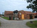
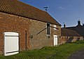 Beswick barn - geograph.org.uk - 972091.jpg 640 × 450; 174 KB
-
 Beswick exit south - geograph.org.uk - 2317915.jpg 3,264 × 2,448; 2.02 MB
-
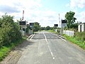
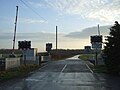 Beswick Gatehouse Level Crossing - geograph.org.uk - 5250083.jpg 640 × 480; 51 KB
-
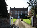 Beswick Hall - geograph.org.uk - 4914129.jpg 1,024 × 768; 222 KB
-
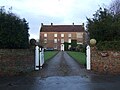
 Beswick Hall - geograph.org.uk - 4914158.jpg 1,024 × 768; 239 KB
-
 Beswick Hall 2016 - geograph.org.uk - 5250100.jpg 640 × 480; 74 KB
-
 Beswick Hall and Farm - geograph.org.uk - 2317878.jpg 3,264 × 2,448; 2.21 MB
-
 Beswick Hall Farm - geograph.org.uk - 4914208.jpg 1,024 × 768; 113 KB
-
 Beswick Hall, Main Street, Beswick - geograph.org.uk - 5624584.jpg 1,600 × 1,064; 1.03 MB
-
 Beswick Heads (road) towards Beswick - geograph.org.uk - 2460404.jpg 800 × 600; 201 KB
-
 Beswick Heads - geograph.org.uk - 1042613.jpg 640 × 427; 369 KB
-
 Beswick Heads - geograph.org.uk - 1042641.jpg 640 × 427; 310 KB
-
 Beswick Heads - geograph.org.uk - 1497157.jpg 640 × 480; 51 KB
-
 Beswick Heads - geograph.org.uk - 1497158.jpg 640 × 480; 40 KB
-
 Beswick Heads Junction - geograph.org.uk - 2336594.jpg 640 × 480; 35 KB
-
 Beswick Heads towards Pit Lane - geograph.org.uk - 5952306.jpg 1,600 × 1,064; 507 KB
-
 Beswick Heads, Beswick - geograph.org.uk - 4889650.jpg 640 × 493; 417 KB
-
 Beswick New Cut (geograph 5404045).jpg 640 × 426; 35 KB
-
 Beswick Rd - geograph.org.uk - 5379144.jpg 506 × 640; 45 KB
-
 Beswick Rd - geograph.org.uk - 5436283.jpg 640 × 426; 45 KB
-
 Beswick Road - geograph.org.uk - 1497161.jpg 640 × 480; 75 KB
-
 Beswick Road - geograph.org.uk - 5250060.jpg 640 × 480; 57 KB
-
 Beswick Road - geograph.org.uk - 5250066.jpg 640 × 480; 55 KB
-
 Beswick Road - geograph.org.uk - 5250091.jpg 640 × 480; 68 KB
-
 Beswick Road west towards Beswick - geograph.org.uk - 2247672.jpg 800 × 600; 212 KB
-
 Beswick Road, on the way to Aike - geograph.org.uk - 4889647.jpg 640 × 480; 413 KB
-
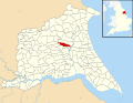 Beswick, East Riding of Yorkshire UK parish locator map.svg 1,425 × 1,107; 1.68 MB
-
 Beverley 6 Driffield 7 - geograph.org.uk - 1042567.jpg 518 × 640; 578 KB
-
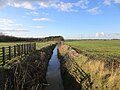
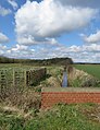
 Beverley and Barmston Drain from Wilfholme Bridge - geograph.org.uk - 2971469.jpg 4,000 × 3,000; 2.48 MB
-
 Beverley and Barmston Drain, Wilfholme - geograph.org.uk - 4889861.jpg 575 × 640; 504 KB
-
 Beverley Road (A164) (geograph 5253574).jpg 640 × 480; 57 KB
-
 Black Dike - geograph.org.uk - 4832664.jpg 1,024 × 768; 193 KB
-
 Blackdike Bridge near Aike - geograph.org.uk - 4888341.jpg 493 × 640; 413 KB
-
 Brickyard Farm on Beswick Road - geograph.org.uk - 2247677.jpg 800 × 600; 291 KB
-
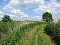
 Bridleway at Southbelt Plantation - geograph.org.uk - 5952288.jpg 1,600 × 1,064; 1.07 MB
-
 Bridleway fingerpost Southbelt Plantation - geograph.org.uk - 6206498.jpg 4,608 × 3,456; 5.82 MB
-
 Bridleway near Beswick - geograph.org.uk - 4889175.jpg 640 × 480; 365 KB
-
 Bridleway near Wilfholme - geograph.org.uk - 4888277.jpg 640 × 480; 434 KB
-
 Bridleway through Southbelt Plantation - geograph.org.uk - 6206502.jpg 4,608 × 3,456; 6.12 MB
-
 Bridleway to Beswick Heads (road) - geograph.org.uk - 5952295.jpg 1,600 × 1,064; 577 KB
-
 Bridleway to Kilnwick - geograph.org.uk - 4914021.jpg 1,024 × 768; 237 KB
-
 Bus stop and shelter on Beverley Road (A164) (geograph 5253572).jpg 640 × 480; 54 KB
-

-
 Carr Farm (in the trees) - geograph.org.uk - 5379053.jpg 640 × 426; 43 KB
-
 Carrs near Barff Hill - geograph.org.uk - 4834317.jpg 1,024 × 768; 241 KB
-
 Close up, Elizabeth II postbox on Beverley Road. Kilnwick Lodges (geograph 5249503).jpg 1,291 × 2,543; 728 KB
-
 Closed bridleway to Watton - geograph.org.uk - 4080945.jpg 640 × 427; 67 KB
-
 Cottage at Beswick - geograph.org.uk - 4914096.jpg 1,024 × 768; 109 KB
-
 Cottage in Beswick - geograph.org.uk - 4914116.jpg 1,024 × 768; 209 KB
-
 Country Lane over Lund Moor - geograph.org.uk - 2318035.jpg 3,264 × 2,448; 2.42 MB
-
 Coverdale Strip (geograph 5253563).jpg 640 × 480; 78 KB
-
 Crop field off Beswick Road - geograph.org.uk - 5250065.jpg 640 × 480; 82 KB
-
 Croplands - geograph.org.uk - 5436286.jpg 640 × 426; 65 KB
-
 Crops, Holderness - geograph.org.uk - 5379164.jpg 640 × 426; 41 KB
-
 Crops, Holderness - geograph.org.uk - 5404037.jpg 640 × 330; 27 KB
-
 Down the road to the mineral works - geograph.org.uk - 3959004.jpg 4,000 × 3,000; 4.68 MB
-
 Drain, Barf Hill - geograph.org.uk - 5249759.jpg 640 × 480; 89 KB
-
 Electricity poles and Barfhill Covert - geograph.org.uk - 4832357.jpg 1,024 × 717; 167 KB
-

-
 Elizabeth II postbox on Beverley Road. Kilnwick Lodges, (geograph 5249500).jpg 2,136 × 2,848; 1.44 MB
-
 Elizabeth II postbox on Main Street, Beswick - geograph.org.uk - 5250150.jpg 881 × 1,530; 286 KB
-
 Entering Beswick, East Yorkshire - geograph.org.uk - 2460409.jpg 800 × 600; 217 KB
-
 Entering Kilnwick, East Yorkshire - geograph.org.uk - 2460424.jpg 800 × 600; 247 KB
-
 Entrance to Mineral Works - geograph.org.uk - 3958970.jpg 4,000 × 3,000; 2.42 MB
-
 Farm track (footpath) beside Kilnwick New Cut (geograph 5253576).jpg 640 × 480; 85 KB
-

-
 Farm track towards Southbelt Plantation - geograph.org.uk - 5952278.jpg 1,600 × 1,064; 689 KB
-
 Farmland near Watton - geograph.org.uk - 1454124.jpg 640 × 480; 99 KB
-
 Farmland off Beverley Road (A164) (geograph 5253573).jpg 640 × 480; 60 KB
-
 Farmland SE of Beswick - geograph.org.uk - 78068.jpg 640 × 480; 130 KB
-
 Farmland towards Barfhill Covert - geograph.org.uk - 5249761.jpg 640 × 480; 69 KB
-
 Farmland West of Beswick - geograph.org.uk - 1497160.jpg 640 × 480; 72 KB
-
 Farmland West of Beswick - geograph.org.uk - 82194.jpg 640 × 480; 146 KB
-
 Farmland, Brickyard Farm - geograph.org.uk - 1497169.jpg 640 × 480; 65 KB
-
 Farmland, Carr Farm - geograph.org.uk - 5436277.jpg 640 × 426; 42 KB
-
 Field at Moor Farm - geograph.org.uk - 2318054.jpg 3,264 × 2,448; 1.89 MB
-
 Field boundary east of Kilnwick (geograph 5253561).jpg 640 × 480; 61 KB
-
 Field drain - geograph.org.uk - 5449922.jpg 640 × 426; 62 KB
-
 Field Edge - geograph.org.uk - 2344808.jpg 3,264 × 2,448; 2 MB
-
 Field Edge Footpath - geograph.org.uk - 2347714.jpg 3,264 × 2,448; 2.66 MB
-
 Fields near Beswick Road - geograph.org.uk - 4889643.jpg 640 × 486; 472 KB
-
 Fieldside Footpath to A164 - geograph.org.uk - 2344460.jpg 3,264 × 2,448; 2.13 MB
-
 Fieldside Track - geograph.org.uk - 2344421.jpg 3,264 × 2,448; 2.19 MB
-
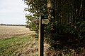 Fingerpost at Southbelt Plantation - geograph.org.uk - 5952291.jpg 1,600 × 1,064; 885 KB
-
 Fingerpost on Beswick Heads (road) - geograph.org.uk - 5952300.jpg 1,107 × 1,600; 773 KB
-
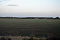 Flat farmland - geograph.org.uk - 5404040.jpg 640 × 426; 37 KB
-
 Flat farmland - geograph.org.uk - 5449921.jpg 640 × 425; 42 KB
-
 Flatlands of North Holderness - geograph.org.uk - 2347702.jpg 3,264 × 2,448; 2.13 MB
-
 Flat^ - geograph.org.uk - 5379159.jpg 640 × 426; 33 KB
-
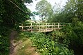
 Footbridge across the drain (geograph 6399125).jpg 1,024 × 768; 414 KB
-
 Footbridge on the path from Kilnwick to Watton (geograph 4512408).jpg 1,024 × 768; 356 KB
-
 Footbridge over Watton Beck (geograph 6494234).jpg 5,456 × 3,632; 3.53 MB
-
 Footpath alongside Beswickheads Plantation - geograph.org.uk - 4914037.jpg 1,024 × 768; 298 KB
-
 Footpath alongside Watton Beck (geograph 4510734).jpg 1,024 × 768; 261 KB
-
 Footpath and Lane Junction west of Kilnwick - geograph.org.uk - 2318064.jpg 3,264 × 2,448; 1.74 MB
-
 Footpath beside Beswick Heads Plantation - geograph.org.uk - 1042634.jpg 427 × 640; 510 KB
-
 Footpath entering Tall Trees Plantation (geograph 4512420).jpg 1,024 × 768; 384 KB
-
 Footpath near Brickyard Farm - geograph.org.uk - 1497165.jpg 640 × 480; 142 KB
-
 Footpath over fields to Lockington - geograph.org.uk - 6205552.jpg 4,608 × 3,456; 3.56 MB
-
 Footpath through Tall Trees Plantation (geograph 4511650).jpg 1,024 × 768; 193 KB
-
 Footpath to Lockington - geograph.org.uk - 1042608.jpg 640 × 417; 300 KB
-
 Footpath to Lockington - geograph.org.uk - 1497155.jpg 640 × 480; 54 KB
-
 Ford at Kilnwick (geograph 5532385).jpg 4,032 × 3,024; 4.84 MB
-
 Ford through Kilnwick Beck (geograph 4510781).jpg 1,024 × 768; 238 KB
-
 Former Primitive Methodist chapel - geograph.org.uk - 4914152.jpg 1,024 × 768; 214 KB
-
-
 From Beswick to Beverley - geograph.org.uk - 1042563.jpg 640 × 395; 283 KB
-

-
 Glebe Farm - geograph.org.uk - 2336597.jpg 640 × 480; 34 KB
-
 Glebe Farm - geograph.org.uk - 3186961.jpg 1,024 × 768; 184 KB
-
 Grass field next to Old Rush (geograph 5111725).jpg 1,024 × 768; 122 KB
-
 Heading east from Kilnwick (geograph 5253565).jpg 640 × 480; 60 KB
-
 Heading to the A164 near Watton - geograph.org.uk - 2139927.jpg 800 × 600; 316 KB
-
 Headland Strip - geograph.org.uk - 5379162.jpg 640 × 426; 33 KB
-
 Headland strip and ditch - geograph.org.uk - 5379142.jpg 640 × 425; 46 KB
-
 High water at Wilfholme Landing - geograph.org.uk - 4832802.jpg 1,024 × 768; 194 KB
-
 Highthorpe Farm over Kilnwick Beck - geograph.org.uk - 2344387.jpg 3,264 × 2,448; 1.8 MB
-
 Holderness farmland - geograph.org.uk - 5379158.jpg 640 × 426; 33 KB
-
 Holderness Scenery (geograph 5379029).jpg 640 × 426; 45 KB
-
 Holderness scenery - geograph.org.uk - 5436285.jpg 640 × 426; 48 KB
-
 Horn Hill Top - geograph.org.uk - 4511285.jpg 1,024 × 768; 200 KB
-
 Horn Hill, chalk pit (aerial) - geograph.org.uk - 3128339.jpg 640 × 427; 54 KB
-
 Hornhill Top farm - geograph.org.uk - 2389615.jpg 800 × 600; 298 KB
-
 Hornhill Top Farm - geograph.org.uk - 3235526.jpg 640 × 427; 155 KB
-
 Hotham Estate cottages - geograph.org.uk - 4914237.jpg 1,024 × 768; 201 KB
-
 House on Main Street, Beswick - geograph.org.uk - 5250151.jpg 640 × 498; 67 KB
-
 Is this a path^ I don't think so - geograph.org.uk - 4832824.jpg 1,024 × 768; 172 KB
-
 Kilnwick Lane towards Lockington - geograph.org.uk - 5952312.jpg 1,600 × 1,064; 538 KB
-
 Kilnwick Level Crossing - geograph.org.uk - 46092.jpg 640 × 480; 114 KB
-
 Kilnwick level crossing - geograph.org.uk - 4888011.jpg 640 × 480; 383 KB
-
 Kilnwick New Cut (geograph 5379034).jpg 640 × 426; 46 KB
-
 Kilnwick New Cut (geograph 5436275).jpg 640 × 394; 40 KB
-
 Kilnwick New Cut (geograph 5449925).jpg 640 × 443; 62 KB
-
 Kilnwick New Farm - geograph.org.uk - 2139882.jpg 800 × 600; 334 KB
-
 Lamb at Beswick - geograph.org.uk - 4889649.jpg 640 × 427; 476 KB
-
 Lane going south past Lund Moor Plantations - geograph.org.uk - 3959034.jpg 4,000 × 3,000; 2.76 MB
-
 Lane towards High Wood, Kilnwick - geograph.org.uk - 2336590.jpg 640 × 480; 44 KB
-
 Lane, Barf Hill - geograph.org.uk - 5249768.jpg 640 × 480; 71 KB
-
 Large Field at Beswick Heads - geograph.org.uk - 2344802.jpg 3,264 × 2,448; 1.87 MB
-
 Leaning in unison - geograph.org.uk - 4834301.jpg 1,024 × 768; 229 KB
-
 Left behind - geograph.org.uk - 5111713.jpg 1,024 × 768; 191 KB
-
 Level crossing at Kilnwick - geograph.org.uk - 2413650.jpg 3,648 × 2,736; 2.03 MB
-
 Level crossing Beswick Gate - geograph.org.uk - 5250075.jpg 640 × 480; 59 KB
-
 Level Crossing, Wilfholme Road - geograph.org.uk - 1454109.jpg 640 × 480; 83 KB
-
 LKAB Mineral Works (geograph 5251995).jpg 640 × 480; 56 KB
-
 Lockington, aerial 2018 - geograph.org.uk - 5764726.jpg 800 × 533; 85 KB
-
 Looking down towards Bracken Beck - geograph.org.uk - 4511282.jpg 1,024 × 768; 163 KB
-
-
 Low Farm - geograph.org.uk - 1497172.jpg 640 × 480; 76 KB
-
 Low Farm off Beswick Road - geograph.org.uk - 2247691.jpg 800 × 600; 258 KB
-
 Low Farm, 2016 - geograph.org.uk - 5249781.jpg 640 × 480; 83 KB
-
 Low Farm, near Aike - geograph.org.uk - 4889169.jpg 640 × 480; 569 KB
-
 Main Street, Beswick - geograph.org.uk - 2273094.jpg 640 × 480; 77 KB
-
 Manor Farm, Wilfholme - geograph.org.uk - 2247715.jpg 800 × 600; 248 KB
-
 Manor Farm, Wilfholme - geograph.org.uk - 4832667.jpg 1,024 × 768; 158 KB
-
 Mineral Works - geograph.org.uk - 1496414.jpg 640 × 480; 48 KB
-
 Mineral Works - geograph.org.uk - 3235558.jpg 640 × 571; 198 KB
-
 Mineral works, west of Kilnwick - geograph.org.uk - 2389608.jpg 800 × 600; 240 KB
-
 Minor road to Low Farm - geograph.org.uk - 1516588.jpg 640 × 427; 362 KB
-
 Minor Road Towards Barff Hill - geograph.org.uk - 1497175.jpg 640 × 480; 70 KB
-
 Minor Road Towards Beswick - geograph.org.uk - 1519124.jpg 640 × 480; 61 KB
-
 Minor road towards Kilnwick (geograph 5253544).jpg 640 × 480; 68 KB
-
 Minor road, Hornhill Top - geograph.org.uk - 5253546.jpg 640 × 480; 56 KB
-
 Minor weir on Watton Beck (geograph 4510741).jpg 1,024 × 768; 376 KB
-
 Mounting block and milestone Main Street Beswick - geograph.org.uk - 4574029.jpg 3,456 × 4,608; 6.47 MB
-
 Narrow path to Kilnwick - geograph.org.uk - 3186969.jpg 768 × 1,024; 232 KB


.jpg)


.jpg)


_-_geograph.org.uk_-_2389658.jpg)


_towards_Beswick_-_geograph.org.uk_-_2460404.jpg)


.jpg)


_(geograph_5253574).jpg)


_-_geograph.org.uk_-_5952295.jpg)

_(geograph_5253572).jpg)

_-_geograph.org.uk_-_5379053.jpg)

.jpg)


.jpg)


.jpg)
.jpg)


_beside_Kilnwick_New_Cut_(geograph_5253576).jpg)


_(geograph_5253573).jpg)


.jpg)


_-_geograph.org.uk_-_5952300.jpg)


.jpg)
.jpg)
.jpg)

.jpg)


.jpg)


.jpg)


.jpg)
.jpg)


.jpg)
.jpg)


.jpg)


_-_geograph.org.uk_-_3128339.jpg)


.jpg)
.jpg)
.jpg)


.jpg)


.jpg)

.jpg)

