Category:Bevercotes
English: Bevercotes is a hamlet and civil parish in the Bassetlaw district of Nottinghamshire, England, about six miles south of East Retford and five miles north-east of Ollerton. According to the 2001 census it had a population of 28.
village in United Kingdom  | |||||
| Upload media | |||||
| Instance of | |||||
|---|---|---|---|---|---|
| Location | Bassetlaw, Nottinghamshire, East Midlands, England | ||||
 | |||||
Media in category "Bevercotes"
The following 38 files are in this category, out of 38 total.
-
 Across Bevercotes Beck - geograph.org.uk - 4413067.jpg 3,878 × 2,000; 4.8 MB
-
 Bevercotes Beck - geograph.org.uk - 4322959.jpg 1,024 × 768; 187 KB
-

-
 Bevercotes Lane - geograph.org.uk - 2268849.jpg 640 × 427; 96 KB
-
 Bevercotes lane - geograph.org.uk - 2269001.jpg 640 × 427; 73 KB
-
 Bevercotes sheep - geograph.org.uk - 2269008.jpg 640 × 427; 71 KB
-
 Blue gate by Robin Hood Way - geograph.org.uk - 4413050.jpg 4,000 × 2,248; 5.62 MB
-
 Bridleway to Haughton Hall Farm - geograph.org.uk - 2269015.jpg 640 × 427; 96 KB
-
 Bridleway to Walesby - geograph.org.uk - 1319873.jpg 640 × 480; 66 KB
-
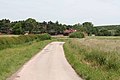
 Country road by the farm - geograph.org.uk - 848408.jpg 427 × 640; 81 KB
-
 Country road nr Bevercotes mine - geograph.org.uk - 849297.jpg 640 × 427; 87 KB
-
 Country road to Bevercotes - geograph.org.uk - 848403.jpg 640 × 427; 65 KB
-
 County lane to Bevercotes - geograph.org.uk - 848413.jpg 427 × 640; 82 KB
-
 Double divan and a footpath sign - geograph.org.uk - 4322924.jpg 1,024 × 768; 193 KB
-
 Farm buildings, Home Farm - geograph.org.uk - 2693837.jpg 640 × 480; 53 KB
-
 Farmland beside the Robin Hood Way - geograph.org.uk - 4409690.jpg 800 × 533; 129 KB
-
 Farmland near Bevercotes Park - geograph.org.uk - 2693839.jpg 640 × 480; 63 KB
-
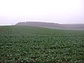 Farmland near Farleys Wood - geograph.org.uk - 2693823.jpg 640 × 480; 68 KB
-
 Fingerpost at Bevercotes - geograph.org.uk - 2269014.jpg 640 × 427; 72 KB
-
 Footpath alongside Bevercotes Beck - geograph.org.uk - 4322004.jpg 1,024 × 768; 243 KB
-
 Footpath at Bevercotes - geograph.org.uk - 2268999.jpg 427 × 640; 96 KB
-
 Grange Farm - geograph.org.uk - 2693827.jpg 640 × 480; 61 KB
-
 Leys Lane - geograph.org.uk - 2268853.jpg 640 × 427; 121 KB
-
 Long pool by Bevercotes Brook - geograph.org.uk - 5975129.jpg 5,184 × 3,888; 5.75 MB
-
 Lound Hall - geograph.org.uk - 848389.jpg 640 × 429; 52 KB
-
 Lound Hall Farm - geograph.org.uk - 2693829.jpg 640 × 480; 59 KB
-
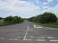
 Milton Road - geograph.org.uk - 1933203.jpg 640 × 426; 64 KB
-

-
 Minor road to Lound Hall Training Centre - geograph.org.uk - 3049936.jpg 800 × 600; 100 KB
-
 Minor road towards Walesby - geograph.org.uk - 2693825.jpg 640 × 480; 47 KB
-
 Muddy corner - geograph.org.uk - 4413072.jpg 4,000 × 2,248; 6.26 MB
-
 On the Robin Hood Way - geograph.org.uk - 4409688.jpg 800 × 533; 142 KB
-
 Path by Bevercotes Brook - geograph.org.uk - 5975123.jpg 5,184 × 3,888; 6.18 MB
-
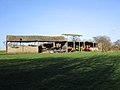 Ramshackle sheds - geograph.org.uk - 4321995.jpg 1,024 × 768; 136 KB
-
 Sunset over the meadow of Lound Hall Estate - geograph.org.uk - 4624887.jpg 4,000 × 2,656; 1.44 MB
-
 The beginning of a footpath near Bevercotes - geograph.org.uk - 4322936.jpg 1,024 × 768; 240 KB
-
 View towards Haughton - geograph.org.uk - 4322951.jpg 1,024 × 768; 176 KB
-
 Lound Hall, Bevercotes, Nottinghamshire - geograph.org.uk - 168173.jpg 640 × 480; 110 KB


