Category:Beverley Parks, East Riding of Yorkshire
English: Beveley Parks, open land south of Beverley, East Riding of Yorkshire, within civil parishes of Rowley and Woodmansey.
Media in category "Beverley Parks, East Riding of Yorkshire"
The following 19 files are in this category, out of 19 total.
-
 Beverley Parks (geograph 1981649).jpg 800 × 600; 198 KB
-
 Beverley Parks Crossing - geograph.org.uk - 1420959.jpg 640 × 445; 42 KB
-
 Beverley Parks Crossing - geograph.org.uk - 49273.jpg 640 × 480; 96 KB
-
 Danger, Live Bees - geograph.org.uk - 486580.jpg 480 × 640; 146 KB
-
 Hampston Hill Farm - geograph.org.uk - 828783.jpg 640 × 377; 172 KB
-
 Millennium Orchard, Beverley Parks - geograph.org.uk - 486575.jpg 454 × 640; 147 KB
-
 Millennium Orchard, Beverley Parks - geograph.org.uk - 629399.jpg 441 × 640; 188 KB
-
 Mouse Hill, Beverley Parks - geograph.org.uk - 879751.jpg 640 × 471; 103 KB
-
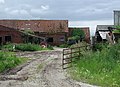 Old Hall Farm, Beverley Parks - geograph.org.uk - 486565.jpg 640 × 464; 112 KB
-
 Old Hall Farm, Beverley Parks - geograph.org.uk - 486568.jpg 494 × 640; 134 KB
-
 One Apple Tree in the Millennium Orchard - geograph.org.uk - 778108.jpg 475 × 640; 198 KB
-
 Poplar Farm, Beverley Parks - geograph.org.uk - 879739.jpg 640 × 415; 84 KB
-
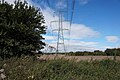 Pylons at Beverley Parks (geograph 5101442).jpg 1,600 × 1,065; 741 KB
-
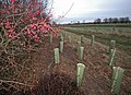 Saplings, Beverley Parks - geograph.org.uk - 629423.jpg 640 × 465; 188 KB
-
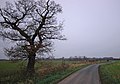 Shepherd Lane - geograph.org.uk - 629437.jpg 640 × 446; 169 KB
-
 Shepherd Lane and White Hall Farm - geograph.org.uk - 629449.jpg 640 × 459; 152 KB
-
 The Beverley 20 - geograph.org.uk - 486555.jpg 430 × 640; 113 KB
-
 The Line from Cottingham to Beverley - geograph.org.uk - 540326.jpg 640 × 480; 105 KB
-
 The road to Ross Farm - geograph.org.uk - 828773.jpg 640 × 340; 157 KB
.jpg)


.jpg)


