Category:Beverston
village and civil parish in Gloucestershire, United Kingdom  | |||||
| Upload media | |||||
| Instance of | |||||
|---|---|---|---|---|---|
| Location | Cotswold, Gloucestershire, South West England, England | ||||
 | |||||
English: Beverston is a village and civil parish in the Cotswold district of Gloucestershire, England. According to the 2001 census it had a population of 132. The village is about two miles west of Tetbury. Beverston (also spelled Beverstone) is an example of a typical unaltered Gloucestershire Cotswold village. It is home to Beverston Castle dating to the 12th Century, a Norman Church (worth the walk from the main road, the A4135 road) and some good examples of Cotswold architecture.
Subcategories
This category has the following 3 subcategories, out of 3 total.
Media in category "Beverston"
The following 97 files are in this category, out of 97 total.
-
 A4135 turning for Babdown Airfield - geograph.org.uk - 4275273.jpg 640 × 480; 55 KB
-
 A4135 westbound - geograph.org.uk - 4275278.jpg 640 × 480; 115 KB
-
 A4135beverston.jpg 2,816 × 2,112; 1.16 MB
-
 Avenue of lime trees - geograph.org.uk - 3507610.jpg 1,024 × 680; 284 KB
-
 Avenue of lime trees - geograph.org.uk - 3507619.jpg 1,024 × 680; 342 KB
-
 Babdown Airfield - geograph.org.uk - 5662441.jpg 4,032 × 3,024; 1.23 MB
-
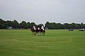 Beaufort Polo Club - geograph.org.uk - 16128.jpg 640 × 426; 53 KB
-
 Beverston Castle - geograph.org.uk - 4926847.jpg 4,252 × 3,030; 7.27 MB
-
 Beverston Castle - geograph.org.uk - 5334957.jpg 2,448 × 3,264; 3.85 MB
-
 Beverston, St. Mary's Church, Sundial on the south porch - geograph.org.uk - 4926851.jpg 4,352 × 2,857; 6.07 MB
-

-
 Bridleway near Babdown Farm - geograph.org.uk - 2915544.jpg 1,024 × 680; 396 KB
-
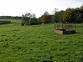 Cattle feeder beside Broad Newell Covert - geograph.org.uk - 270751.jpg 640 × 480; 126 KB
-
 Chapel at Chavenage - geograph.org.uk - 5910695.jpg 1,024 × 768; 305 KB
-
 Chavenage Chapel - geograph.org.uk - 3506719.jpg 680 × 1,024; 241 KB
-
 Chavenage Chapel - geograph.org.uk - 3507565.jpg 680 × 1,024; 200 KB
-
 Chavenage Church - Altar - geograph.org.uk - 3308500.jpg 831 × 583; 367 KB
-
 Chavenage House - geograph.org.uk - 5887935.jpg 1,600 × 1,200; 570 KB
-
 Chavenage House - geograph.org.uk - 5907018.jpg 1,024 × 768; 251 KB
-
 Chavenage House - geograph.org.uk - 5910685.jpg 1,024 × 768; 248 KB
-
 Chavenage house and chapel - geograph.org.uk - 5910706.jpg 1,024 × 768; 177 KB
-
 Chavenage House ^ Gardens (1) - geograph.org.uk - 6277411.jpg 4,223 × 3,167; 4.09 MB
-
 Chavenage House ^ Gardens (10) - geograph.org.uk - 6277428.jpg 4,320 × 3,240; 2.78 MB
-
 Chavenage House ^ Gardens (11) - geograph.org.uk - 6277429.jpg 3,240 × 4,320; 2.92 MB
-
 Chavenage House ^ Gardens (12) - geograph.org.uk - 6277434.jpg 4,145 × 3,109; 2.94 MB
-
 Chavenage House ^ Gardens (13) - geograph.org.uk - 6277436.jpg 3,240 × 4,320; 2.88 MB
-
 Chavenage House ^ Gardens (14) - geograph.org.uk - 6277437.jpg 4,223 × 3,167; 2.15 MB
-
 Chavenage House ^ Gardens (15) - geograph.org.uk - 6277439.jpg 4,320 × 3,240; 2.96 MB
-
 Chavenage House ^ Gardens (16) - geograph.org.uk - 6277442.jpg 4,320 × 3,240; 3.41 MB
-
 Chavenage House ^ Gardens (17) - geograph.org.uk - 6277444.jpg 4,320 × 3,240; 3.65 MB
-
 Chavenage House ^ Gardens (2) - geograph.org.uk - 6277413.jpg 4,320 × 3,240; 4.5 MB
-
 Chavenage House ^ Gardens (3) - geograph.org.uk - 6277415.jpg 4,209 × 3,157; 4.01 MB
-
 Chavenage House ^ Gardens (4) - geograph.org.uk - 6277418.jpg 4,320 × 3,240; 3.99 MB
-
 Chavenage House ^ Gardens (5) - geograph.org.uk - 6277419.jpg 3,815 × 2,861; 2.35 MB
-
 Chavenage House ^ Gardens (6) - geograph.org.uk - 6277420.jpg 4,320 × 3,240; 2.72 MB
-
 Chavenage House ^ Gardens (7) - geograph.org.uk - 6277422.jpg 3,159 × 4,213; 2.34 MB
-
 Chavenage House ^ Gardens (8) - geograph.org.uk - 6277425.jpg 4,038 × 3,029; 2.11 MB
-
 Chavenage House ^ Gardens (9) - geograph.org.uk - 6277426.jpg 4,247 × 3,184; 2.94 MB
-
 Chavenage near Tetbury - geograph.org.uk - 4082546.jpg 1,280 × 960; 1.13 MB
-
 Chavenage near Tetbury - geograph.org.uk - 4082550.jpg 1,280 × 960; 1.11 MB
-
 Clavenage Church - East end - geograph.org.uk - 3308469.jpg 831 × 583; 268 KB
-
 Clavenage Church - Font - geograph.org.uk - 3308503.jpg 530 × 777; 167 KB
-
 Clavenage Church - geograph.org.uk - 3308468.jpg 815 × 588; 335 KB
-
 Cotswold crossroads - geograph.org.uk - 320798.jpg 640 × 480; 34 KB
-
 Countryside near Beverston - geograph.org.uk - 3074896.jpg 640 × 480; 69 KB
-
 Drystone wall as soundwall - geograph.org.uk - 1439442.jpg 640 × 370; 187 KB
-
 Entrance drive, Chavenage - geograph.org.uk - 5907029.jpg 1,024 × 768; 295 KB
-
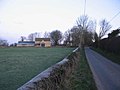
 Entrance to Beverston - geograph.org.uk - 4275262.jpg 640 × 480; 87 KB
-
 Farmland south of Chavange House - geograph.org.uk - 6013881.jpg 1,024 × 768; 304 KB
-
 Lodge Cottage, Nesley - geograph.org.uk - 5449085.jpg 1,280 × 960; 502 KB
-
 Macmillan Way near Beverston - geograph.org.uk - 488424.jpg 640 × 477; 144 KB
-
 Ordnance Survey Cut Mark - geograph.org.uk - 5116578.jpg 610 × 640; 138 KB
-
 Passing place - geograph.org.uk - 1137654.jpg 640 × 480; 102 KB
-
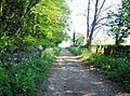
 Path from Beverston Church - geograph.org.uk - 5334970.jpg 3,264 × 2,448; 3.5 MB
-
 Path leaves the road - geograph.org.uk - 6277446.jpg 4,320 × 3,240; 4.39 MB
-
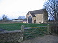
 Pilgrim's Barn, Beverston (geograph 7438794).jpg 1,024 × 768; 207 KB
-
 Power lines near Cranmore Farm - geograph.org.uk - 1137637.jpg 640 × 504; 38 KB
-

-
 Site of the former Babdown Airfield - geograph.org.uk - 2909596.jpg 1,024 × 680; 270 KB
-
 Site of the former Babdown Airfield - geograph.org.uk - 2911875.jpg 1,024 × 680; 234 KB
-

-
 The A4135 approaching Beverston - geograph.org.uk - 2990120.jpg 1,024 × 768; 120 KB
-
 The A4135 entering Beverston from the west - geograph.org.uk - 2990130.jpg 1,024 × 768; 223 KB
-
 The A4135 passing the site of Babdown Airfield - geograph.org.uk - 2990109.jpg 1,024 × 727; 111 KB
-
 The A4135 passing through Beverston - geograph.org.uk - 2990142.jpg 1,024 × 768; 144 KB
-
 Towards Beverston Castle - geograph.org.uk - 488415.jpg 640 × 477; 141 KB
-
 Track near Babdown Farm - geograph.org.uk - 2909569.jpg 1,024 × 680; 230 KB
-
 Track near Babdown Farm - geograph.org.uk - 2909608.jpg 1,024 × 680; 251 KB
-
 View from Chavenage House - geograph.org.uk - 3506731.jpg 1,024 × 680; 205 KB
-
 Wheat field near Charlton Brake - geograph.org.uk - 3074900.jpg 640 × 480; 71 KB
-
 Approaching Hookshouse - geograph.org.uk - 319255.jpg 640 × 480; 27 KB
-
 Approaching Nesley Farm. - geograph.org.uk - 320794.jpg 640 × 480; 53 KB
-
 Autumn gold in winter. - geograph.org.uk - 320061.jpg 640 × 480; 29 KB
-
 Chavenage Lane - geograph.org.uk - 488401.jpg 640 × 477; 115 KB
-
 Converted barn at Hookshouse - geograph.org.uk - 319259.jpg 640 × 480; 36 KB
-
 Cottage on Bowldown Road - geograph.org.uk - 343037.jpg 640 × 468; 77 KB
-
 Cranmore Cottages and Cranmore Dairy - geograph.org.uk - 269690.jpg 640 × 480; 142 KB
-
 Farmland - geograph.org.uk - 114642.jpg 640 × 427; 68 KB
-
 Field Barn Farm - geograph.org.uk - 488440.jpg 640 × 477; 117 KB
-
 Footpath north of Westonbirt - geograph.org.uk - 488592.jpg 640 × 477; 121 KB
-
 HMI warehouse, Babdown airfield - geograph.org.uk - 343019.jpg 640 × 480; 67 KB
-
 Hookshouse - geograph.org.uk - 488430.jpg 640 × 477; 118 KB
-
 Hookshouse Lane - geograph.org.uk - 320082.jpg 640 × 480; 45 KB
-
 House near Chavenage - geograph.org.uk - 488399.jpg 640 × 477; 87 KB
-
 Looking north from A4135 - geograph.org.uk - 488420.jpg 640 × 477; 130 KB
-
 Macmillan Way near Beverston - geograph.org.uk - 488422.jpg 640 × 477; 117 KB
-
 Nesley Farm - geograph.org.uk - 320787.jpg 640 × 480; 30 KB
-

-
 Oldown - geograph.org.uk - 320057.jpg 640 × 480; 35 KB
-
 Parkland near Westonbirt - geograph.org.uk - 488445.jpg 640 × 477; 120 KB
-
 Pig farm - geograph.org.uk - 342866.jpg 640 × 480; 66 KB
-
 Pig feeder - geograph.org.uk - 343020.jpg 640 × 480; 79 KB
-
 Road to Chavenage Green - geograph.org.uk - 269694.jpg 640 × 480; 123 KB
-
 Sale now on - geograph.org.uk - 343023.jpg 640 × 459; 70 KB
-
 Sneak preview of Westonbirt arboretum - geograph.org.uk - 488598.jpg 640 × 477; 120 KB
-
 The A4135 approaching Beverston - geograph.org.uk - 270279.jpg 640 × 480; 173 KB
-
 The Cotswold Collection - geograph.org.uk - 343016.jpg 640 × 480; 56 KB


_-_geograph.org.uk_-_6277411.jpg)
_-_geograph.org.uk_-_6277428.jpg)
_-_geograph.org.uk_-_6277429.jpg)
_-_geograph.org.uk_-_6277434.jpg)
_-_geograph.org.uk_-_6277436.jpg)
_-_geograph.org.uk_-_6277437.jpg)
_-_geograph.org.uk_-_6277439.jpg)
_-_geograph.org.uk_-_6277442.jpg)
_-_geograph.org.uk_-_6277444.jpg)
_-_geograph.org.uk_-_6277413.jpg)
_-_geograph.org.uk_-_6277415.jpg)
_-_geograph.org.uk_-_6277418.jpg)
_-_geograph.org.uk_-_6277419.jpg)
_-_geograph.org.uk_-_6277420.jpg)
_-_geograph.org.uk_-_6277422.jpg)
_-_geograph.org.uk_-_6277425.jpg)
_-_geograph.org.uk_-_6277426.jpg)


.jpg)


