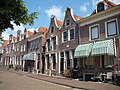
Category:Bierkade 2, Blokzijl
| Object location | | View all coordinates using: OpenStreetMap |
|---|
building in Steenwijkerland, Netherlands  | |||||
| Upload media | |||||
| Instance of | |||||
|---|---|---|---|---|---|
| Location | Blokzijl, Overijssel, Netherlands | ||||
| Street address |
| ||||
| Located on street |
| ||||
| Heritage designation |
| ||||
 | |||||
|
This is a category about rijksmonument number 10438
|
| Address |
|
Media in category "Bierkade 2, Blokzijl"
The following 17 files are in this category, out of 17 total.
-
 Bierkade 2 Blokzijl.jpg 2,736 × 3,648; 732 KB
-
 Bierkade Blokzijl.jpg 850 × 569; 120 KB
-
 Blokzijl 094.JPG 3,264 × 2,448; 1.99 MB
-
 Blokzijl 118.JPG 3,264 × 2,448; 2.07 MB
-
 Exterieur VOORGEVEL - Blokzijl - 20268095 - RCE.jpg 1,197 × 1,200; 390 KB
-
 Huizen aan de Haven - Blokzijl - 20036480 - RCE.jpg 904 × 1,200; 250 KB
-
 Overzicht - Blokzijl - 20036374 - RCE.jpg 1,200 × 836; 179 KB
-
 Overzicht - Blokzijl - 20036419 - RCE.jpg 1,200 × 798; 277 KB
-
 Overzicht - Blokzijl - 20036432 - RCE.jpg 1,200 × 808; 190 KB
-
 Overzicht haven met voorgevel huizen - Blokzijl - 20351689 - RCE.jpg 1,195 × 1,200; 362 KB
-
 Overzicht voorgevels vanaf steiger in haven - Blokzijl - 20351690 - RCE.jpg 1,200 × 1,194; 214 KB
-
 Vanaf Noorderkade - Blokzijl - 20036423 - RCE.jpg 1,200 × 1,196; 283 KB
-
 Vanuit het zuid-oosten - Blokzijl - 20036422 - RCE.jpg 1,200 × 1,169; 245 KB
-
 Voorgevel - Blokzijl - 20036436 - RCE.jpg 802 × 1,200; 208 KB
-
 Voorgevels in straatwand - Blokzijl - 20338856 - RCE.jpg 1,200 × 800; 214 KB
-
 Wand - Blokzijl - 20036483 - RCE.jpg 1,200 × 802; 199 KB
-
 Zeedijk - Blokzijl - 20036515 - RCE.jpg 1,200 × 954; 255 KB


