Category:Bierley, West Yorkshire
neighbourhood in Bradford, West Yorkshire, UK | |||||
| Upload media | |||||
| Instance of |
| ||||
|---|---|---|---|---|---|
| Location | Bradford, West Yorkshire, Yorkshire and the Humber, England | ||||
 | |||||
Subcategories
This category has the following 5 subcategories, out of 5 total.
Media in category "Bierley, West Yorkshire"
The following 36 files are in this category, out of 36 total.
-
 B ^ Q - Mountleigh Close - geograph.org.uk - 2469731.jpg 640 × 480; 69 KB
-
 Bierley Mini Market - Weardale Close - geograph.org.uk - 2289523.jpg 640 × 501; 73 KB
-
 Boundary Marker North Bierley-Bradford (3371066956).jpg 1,807 × 2,338; 3.49 MB
-

-
 Bridleway off Rockhill Lane - geograph.org.uk - 5621269.jpg 1,024 × 768; 211 KB
-
 Brogden House Farm - Greenfield Lane - geograph.org.uk - 2469475.jpg 640 × 479; 84 KB
-

-

-
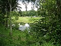
 Fish Pond - off Rockhill Lane - geograph.org.uk - 2469633.jpg 640 × 480; 105 KB
-
 Fish Pond - off Rockhill Lane - geograph.org.uk - 2469636.jpg 640 × 480; 60 KB
-
 Fish Pond - off Rockhill Lane - geograph.org.uk - 2469641.jpg 640 × 480; 75 KB
-
 Fish Pond - off Wharfedale Road - geograph.org.uk - 2469762.jpg 640 × 480; 134 KB
-
 Fish Pond off Rockhill Lane - geograph.org.uk - 5433295.jpg 5,184 × 3,456; 3.87 MB
-
 Footpath - near Gleneagles Close - geograph.org.uk - 2469455.jpg 640 × 480; 125 KB
-
 Footpath - off Wharfedale Road - geograph.org.uk - 2469754.jpg 480 × 640; 95 KB
-
 Footpath - off Wharfedale Road - geograph.org.uk - 2469758.jpg 480 × 640; 129 KB
-
 Footpath - Rockhill Lane - geograph.org.uk - 2469632.jpg 640 × 480; 90 KB
-
 Footpath - Rockhill Lane - geograph.org.uk - 2469645.jpg 480 × 640; 118 KB
-
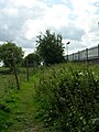
 Footpath - Shetcliffe Lane - geograph.org.uk - 2479447.jpg 480 × 640; 107 KB
-
 Footpath - Wharfedale Road - geograph.org.uk - 2469751.jpg 640 × 480; 70 KB
-

-

-
 Junction at the end of the M606 - geograph.org.uk - 718850.jpg 640 × 480; 236 KB
-
 M606 heading south - geograph.org.uk - 4066912.jpg 640 × 481; 62 KB
-
 M606 southbound near Oakenshaw - geograph.org.uk - 4066914.jpg 640 × 481; 54 KB
-
 Meadowland Near Bierley - geograph.org.uk - 905524.jpg 640 × 480; 148 KB
-
 Mill Carr Hill TP - geograph.org.uk - 1465658.jpg 640 × 480; 79 KB
-
 Outbuildings at Cheesecake House Farm - geograph.org.uk - 5432518.jpg 5,184 × 3,456; 7.67 MB
-
 Path between Newhall Way and Rooley Lane - geograph.org.uk - 5433301.jpg 5,184 × 3,456; 7 MB
-
 Playground - Coleshill Way - geograph.org.uk - 2479359.jpg 640 × 480; 66 KB
-
 Playground - Hopefield Way - geograph.org.uk - 1460835.jpg 640 × 472; 204 KB
-
 Pony - grazing off Coleshill Way - geograph.org.uk - 2479357.jpg 640 × 480; 101 KB
-
 The Cedar Hotel, Bradford - geograph.org.uk - 718843.jpg 640 × 480; 160 KB
-
 Very Edge Of Bradford - Industrial Estate - geograph.org.uk - 905504.jpg 640 × 480; 130 KB
-
 Footpath - Shetcliffe Lane - geograph.org.uk - 701335.jpg 519 × 640; 86 KB
-
 Footpath - Shetcliffe Lane - geograph.org.uk - 701340.jpg 552 × 640; 77 KB


.jpg)


