Category:Bigbury
English: Bigbury is a village and civil parish in the South Hams district of Devon, England. According to the 2001 census it had a population of 582. The Parish council meets on the second Wednesday of every month at 7.30pm in Bigbury Memorial Hall. (Excluding August & January)
village and civil parish in the United Kingdom  The Royal Oak Inn, à Big Bury | |||||
| Upload media | |||||
| Instance of | |||||
|---|---|---|---|---|---|
| Location | South Hams, Devon, South West England, England | ||||
 | |||||
Subcategories
This category has the following 6 subcategories, out of 6 total.
Media in category "Bigbury"
The following 200 files are in this category, out of 345 total.
(previous page) (next page)-
 A Coastal Path - geograph.org.uk - 5363502.jpg 5,472 × 3,648; 7.08 MB
-
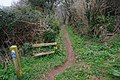
 A well-maintained permissive path south of Bigbury - geograph.org.uk - 5855993.jpg 1,200 × 1,600; 718 KB
-
 Above Boarshill - geograph.org.uk - 273386.jpg 640 × 480; 104 KB
-
 Above Boarshill - geograph.org.uk - 4634746.jpg 1,920 × 1,280; 719 KB
-
 Access road at Hexdown - geograph.org.uk - 5853325.jpg 1,600 × 1,200; 828 KB
-
 Across the Avon estuary at low tide - geograph.org.uk - 3887771.jpg 640 × 425; 79 KB
-
 Across the Avon Estuary from Ham's End - geograph.org.uk - 2441945.jpg 4,000 × 3,000; 3.92 MB
-
 Across the sea - geograph.org.uk - 3583392.jpg 800 × 600; 142 KB
-
 Agricultural buildings south of Bigbury - geograph.org.uk - 3925431.jpg 3,648 × 2,736; 1.81 MB
-
 Angels in the sea as two tides meet - geograph.org.uk - 3582607.jpg 800 × 600; 118 KB
-
 Apartments at Bigbury-on-Sea - geograph.org.uk - 4665095.jpg 1,600 × 934; 378 KB
-
 Apartments overlooking the sea, Bigbury-on-Sea - geograph.org.uk - 3859184.jpg 1,024 × 680; 276 KB
-
 Apartments, Bigbury-on-sea - geograph.org.uk - 3923838.jpg 640 × 425; 71 KB
-
 Approaching Frogland - geograph.org.uk - 282645.jpg 640 × 480; 171 KB
-
 Arriving at Burgh Island on the "Sea Tractor" - geograph.org.uk - 5422656.jpg 2,500 × 1,875; 1.44 MB
-
 Avon estuary - geograph.org.uk - 1510584.jpg 640 × 480; 96 KB
-
 Avon estuary - geograph.org.uk - 1510600.jpg 640 × 447; 77 KB
-
 Avon Estuary - geograph.org.uk - 1557505.jpg 640 × 480; 77 KB
-
 Avon estuary - geograph.org.uk - 2455495.jpg 1,024 × 768; 150 KB
-
 Avon Estuary - geograph.org.uk - 3887796.jpg 640 × 425; 44 KB
-
 Avon Estuary - geograph.org.uk - 585729.jpg 640 × 480; 102 KB
-
 Avon Estuary - geograph.org.uk - 585749.jpg 640 × 480; 122 KB
-
 Avon Estuary - geograph.org.uk - 5924169.jpg 1,024 × 681; 179 KB
-
 Avon Estuary - geograph.org.uk - 5924170.jpg 1,024 × 681; 167 KB
-
 Avon Estuary - geograph.org.uk - 5924216.jpg 1,024 × 681; 153 KB
-
 Avon estuary - geograph.org.uk - 6212904.jpg 3,264 × 1,832; 839 KB
-
 Avon Estuary at Doctor's Wood.jpg 4,176 × 2,848; 5.44 MB
-
 Avon Estuary at low tide - geograph.org.uk - 3887804.jpg 640 × 425; 82 KB
-
 Avon estuary from Cockleridge - geograph.org.uk - 5853308.jpg 1,600 × 1,200; 809 KB
-
 Avon Estuary pano.jpg 19,389 × 2,552; 21.22 MB
-
 Avon Estuary Walk - geograph.org.uk - 1510562.jpg 480 × 640; 128 KB
-
 Avon Estuary Walk - geograph.org.uk - 1589984.jpg 640 × 480; 108 KB
-
 Avon Estuary Walk - geograph.org.uk - 1590010.jpg 640 × 480; 100 KB
-
 Avon Estuary Walk - geograph.org.uk - 3885618.jpg 640 × 425; 106 KB
-
 Avon Estuary Walk in Doctor's Wood, Bigbury - geograph.org.uk - 5856014.jpg 1,600 × 1,200; 857 KB
-
 Avon Mouth - geograph.org.uk - 1476956.jpg 640 × 480; 74 KB
-
 Avon River Channel From Bigbury-on-Sea side - geograph.org.uk - 2441663.jpg 3,748 × 1,872; 3.8 MB
-
 B3392 descends Folly Hill - geograph.org.uk - 3865450.jpg 4,000 × 3,000; 1.98 MB
-
 B3392 passes Mount Folly Farm - geograph.org.uk - 3925769.jpg 3,582 × 2,615; 1.12 MB
-
 B3392 passes The Pickwick Inn - geograph.org.uk - 3927296.jpg 3,541 × 2,609; 1.39 MB
-
 B3392 south of Blackberry Lane junction - geograph.org.uk - 3927317.jpg 3,648 × 2,736; 1.32 MB
-
 B3392 south of Whympston - geograph.org.uk - 3927331.jpg 3,202 × 2,477; 875 KB
-

-
 Banks of pink thrift on the western edge of Burgh Island - geograph.org.uk - 5422600.jpg 2,500 × 1,875; 1.04 MB
-
 Bantham Quay from The Ferry Cottage - geograph.org.uk - 2441693.jpg 3,000 × 4,000; 3.6 MB
-
 Bantham Sand - geograph.org.uk - 5541038.jpg 640 × 360; 29 KB
-
 Bantham, at low tide - geograph.org.uk - 1813479.jpg 1,600 × 1,200; 403 KB
-
 Barn at Hexdown - geograph.org.uk - 3887704.jpg 640 × 425; 86 KB
-
 Barn by access road to Hexdown - geograph.org.uk - 5853322.jpg 1,600 × 1,200; 910 KB
-
 Beach at Bigbury-on-Sea - geograph.org.uk - 4874956.jpg 3,200 × 1,800; 1.13 MB
-
 Beach at Bigbury-on-Sea - geograph.org.uk - 4891124.jpg 4,896 × 3,672; 6.45 MB
-
 Beach at Bigbury-on-Sea, Devon - geograph.org.uk - 5422682.jpg 2,500 × 1,851; 1.35 MB
-
 Beach spades - geograph.org.uk - 3543502.jpg 1,280 × 856; 277 KB
-
 Beach, and Sharpland Point, Bigbury-on-Sea - geograph.org.uk - 5250814.jpg 4,000 × 3,000; 4.73 MB
-
 Beach, Challaborough - geograph.org.uk - 3923872.jpg 640 × 425; 69 KB
-
 Beacon Point, viewed from Burgh Island - geograph.org.uk - 1814920.jpg 1,024 × 778; 201 KB
-
 Beating the incoming tide - geograph.org.uk - 3583432.jpg 800 × 600; 100 KB
-
 Bend in River Avon - geograph.org.uk - 5856183.jpg 1,600 × 1,200; 775 KB
-
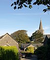
 Bigbury - geograph.org.uk - 218553.jpg 640 × 480; 84 KB
-
 Bigbury and Burgh Island - geograph.org.uk - 6211660.jpg 3,264 × 1,832; 700 KB
-
 Bigbury Bay - geograph.org.uk - 4665085.jpg 1,600 × 1,146; 431 KB
-
 Bigbury Bay - geograph.org.uk - 4665104.jpg 1,600 × 1,200; 422 KB
-
 Bigbury Bay, towards Beacon Point - geograph.org.uk - 4665092.jpg 1,600 × 1,178; 422 KB
-
 Bigbury Court - geograph.org.uk - 1510495.jpg 539 × 640; 80 KB
-
 Bigbury Golf Course - geograph.org.uk - 3887736.jpg 640 × 425; 58 KB
-
 Bigbury on Sea - geograph.org.uk - 5363474.jpg 5,472 × 3,648; 3.95 MB
-
 Bigbury on Sea Beach - geograph.org.uk - 3543510.jpg 1,280 × 856; 261 KB
-
 Bigbury on Sea Beach - geograph.org.uk - 3543516.jpg 1,280 × 856; 362 KB
-
 Bigbury on Sea Beach - geograph.org.uk - 3543992.jpg 1,280 × 856; 202 KB
-
 Bigbury on Sea Beach - geograph.org.uk - 5889437.jpg 1,280 × 851; 416 KB
-
 Bigbury on Sea car park - geograph.org.uk - 3543512.jpg 1,280 × 856; 344 KB
-
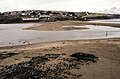
 Bigbury, River Avon - geograph.org.uk - 632487.jpg 640 × 427; 273 KB
-
 Bigbury, towards Aveton Gifford - geograph.org.uk - 632489.jpg 640 × 427; 182 KB
-
 Bigbury, towards Green Well - geograph.org.uk - 632481.jpg 640 × 427; 152 KB
-
 Bigbury, Villa Crusoe - geograph.org.uk - 632475.jpg 640 × 427; 175 KB
-
 Bigbury-on-Sea - geograph.org.uk - 4910513.jpg 800 × 600; 143 KB
-
 Bigbury-on-Sea, by the end of the car park - geograph.org.uk - 4665137.jpg 1,600 × 1,133; 625 KB
-
 Blackberry Lane - geograph.org.uk - 2004034.jpg 640 × 480; 113 KB
-
 Boarshill - geograph.org.uk - 281641.jpg 640 × 480; 85 KB
-
 Boat house by River Avon below Hexdown - geograph.org.uk - 5856186.jpg 1,600 × 1,200; 797 KB
-
 Boats moored on Avon estuary - geograph.org.uk - 4910572.jpg 800 × 600; 103 KB
-
 Bracken frond near Challon's Combe - geograph.org.uk - 282647.jpg 640 × 480; 137 KB
-
 Burgh Island - geograph.org.uk - 4874960.jpg 3,200 × 1,800; 825 KB
-
 Burgh Island - geograph.org.uk - 5030388.jpg 1,600 × 1,200; 688 KB
-
 Burgh Island - geograph.org.uk - 5541036.jpg 640 × 360; 46 KB
-
 Burgh Island - geograph.org.uk - 5889679.jpg 1,280 × 849; 378 KB
-
 Burgh Island - Huer's Lookout, Former St Michael's Chapel - geograph.org.uk - 6005135.jpg 1,377 × 1,000; 1.37 MB
-
 Burgh Island - Sea Tractor III - geograph.org.uk - 6005145.jpg 1,333 × 1,000; 1 MB
-
 Burgh Island - The Pilchard Inn - geograph.org.uk - 6005140.jpg 1,493 × 1,000; 1.18 MB
-
 Burgh Island and Bigbury-on-Sea - geograph.org.uk - 6212891.jpg 3,238 × 1,511; 1.46 MB
-
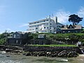
 Burgh Island and its famous hotel - geograph.org.uk - 5422548.jpg 2,500 × 1,875; 562 KB
-
 Burgh Island and its famous hotel, Bigbury-on-Sea , Devon - geograph.org.uk - 5422563.jpg 2,462 × 1,823; 1.42 MB
-

-
 Burgh Island and the "Sea Tractor" - geograph.org.uk - 5422669.jpg 2,500 × 1,868; 479 KB
-
 Burgh Island from Bigbury on Sea - geograph.org.uk - 5238758.jpg 1,280 × 960; 443 KB
-
 Burgh Island from Challaborough Bay, Devon - geograph.org.uk - 5422545.jpg 2,500 × 1,864; 601 KB
-
 Burgh Island Hotel - geograph.org.uk - 3923807.jpg 640 × 425; 99 KB
-
 Burgh Island Hotel - geograph.org.uk - 4665081.jpg 1,200 × 1,600; 368 KB
-
 Burgh Island Hotel - geograph.org.uk - 6003810.jpg 1,333 × 1,000; 1.21 MB
-
 Burgh Island Hotel - geograph.org.uk - 6230104.jpg 3,264 × 1,832; 918 KB
-
 Burgh Island Hotel, Bigbury-on-Sea, Devon - geograph.org.uk - 5422644.jpg 2,500 × 1,875; 1.56 MB
-
 Burgh Island Hotel, entrance gates - geograph.org.uk - 4665110.jpg 1,600 × 1,126; 417 KB
-
 Burgh Island Tidal Crossing - geograph.org.uk - 3683443.jpg 3,872 × 2,592; 1.09 MB
-

-
 Causeway to Burgh Island - geograph.org.uk - 5166552.jpg 800 × 526; 414 KB
-
 Challaborough - geograph.org.uk - 3546121.jpg 1,280 × 856; 317 KB
-

-
 Challaborough Bay, Devon - geograph.org.uk - 5422557.jpg 2,500 × 1,853; 658 KB
-
 Challaborough Bay, Devon - geograph.org.uk - 5423311.jpg 2,500 × 1,875; 1.53 MB
-
 Challaborough Bay, Devon, From the SW coastal path - geograph.org.uk - 5423287.jpg 2,468 × 1,833; 1.95 MB
-
 Challaborough Bay, from Burgh Island, Devon - geograph.org.uk - 5422599.jpg 2,454 × 1,813; 2.09 MB
-
 Challaborough Beach - geograph.org.uk - 3546117.jpg 1,280 × 856; 255 KB
-
 Challaborough Beach - geograph.org.uk - 5238778.jpg 1,280 × 960; 389 KB
-
 Challaborough Beach - geograph.org.uk - 5239739.jpg 1,280 × 960; 370 KB
-
 Challaborough from Burgh Island - geograph.org.uk - 4665118.jpg 1,600 × 1,200; 463 KB
-
 Challaborough village from the beach - geograph.org.uk - 4258226.jpg 2,560 × 1,920; 2.21 MB
-
 Challaborough's beach and caravans - geograph.org.uk - 1937418.jpg 1,024 × 768; 158 KB
-
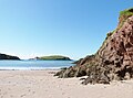
 Clear blue sea - geograph.org.uk - 1935160.jpg 1,024 × 768; 155 KB
-
 Clear blue sea - geograph.org.uk - 1935174.jpg 1,024 × 768; 187 KB
-
 Clearing a storm damaged tree No1 - geograph.org.uk - 3887761.jpg 640 × 425; 49 KB
-
 Clearing a storm damaged tree No2 - geograph.org.uk - 3887769.jpg 425 × 640; 72 KB
-
 Cliff Edge, Burgh Island - geograph.org.uk - 5111040.jpg 3,264 × 2,448; 2.93 MB
-
 Coast Path - geograph.org.uk - 3923858.jpg 640 × 425; 99 KB
-
 Coast Path to Challaborough - geograph.org.uk - 3923864.jpg 640 × 425; 95 KB
-
 Cockleridge and coastal path - geograph.org.uk - 5853301.jpg 1,200 × 1,600; 767 KB
-
 Cockleridge Point on north bank of River Avon - geograph.org.uk - 5029968.jpg 1,600 × 1,200; 789 KB
-
 Combe Cross - geograph.org.uk - 2003983.jpg 640 × 480; 72 KB
-
 Coming in - geograph.org.uk - 3583418.jpg 800 × 600; 94 KB
-
 Corner of Doctor's Wood above the Avon Valley - geograph.org.uk - 5856006.jpg 1,600 × 1,200; 781 KB
-
 Cows on the hillside above Challaborough - geograph.org.uk - 1939104.jpg 1,024 × 768; 147 KB
-
 Cows on the hillside, near Tapfield Cross - geograph.org.uk - 1939069.jpg 1,024 × 768; 141 KB
-
 Crossing Bigbury Golf Course - geograph.org.uk - 3887730.jpg 640 × 425; 43 KB
-

-
 Crossing The Sand - geograph.org.uk - 5363511.jpg 5,472 × 3,648; 3.64 MB
-
 Detail of the Burgh Ferry - geograph.org.uk - 4422508.jpg 2,399 × 1,599; 587 KB
-
 Doctor's Wood and the Avon Estuary - geograph.org.uk - 326492.jpg 640 × 480; 79 KB
-
 Down the hill to Hexdown - geograph.org.uk - 3887774.jpg 640 × 425; 74 KB
-
 Electric fence and gate - geograph.org.uk - 1477188.jpg 640 × 480; 129 KB
-
 Empty beach, 9 a.m. - geograph.org.uk - 1935153.jpg 1,024 × 768; 138 KB
-
 End of the track - geograph.org.uk - 3885783.jpg 640 × 425; 108 KB
-
 Entrance driveway, Burgh Island Hotel - geograph.org.uk - 1813928.jpg 1,024 × 768; 174 KB
-
 Entrance to the Avon Estuary at low tide - geograph.org.uk - 2304360.jpg 640 × 427; 125 KB
-
 Exposed rocks, on the Avon estuary - geograph.org.uk - 1813436.jpg 1,600 × 1,200; 516 KB
-
 Farm track, near Tapfield Cross - geograph.org.uk - 1939076.jpg 1,024 × 768; 182 KB
-
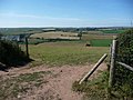
 Farmland at Knowle - geograph.org.uk - 4638078.jpg 1,920 × 1,280; 808 KB
-
 Feeding time - geograph.org.uk - 3928346.jpg 640 × 329; 59 KB
-
 Ferry across River Avon at Bantham - geograph.org.uk - 5853294.jpg 1,600 × 1,200; 737 KB
-
 Field access off the track to Green Well - geograph.org.uk - 5854248.jpg 1,600 × 1,200; 839 KB
-
 Field entrance from the footpath - geograph.org.uk - 1939066.jpg 1,024 × 768; 154 KB
-

-
 Field Gateway at the Top of Stakes Hill - geograph.org.uk - 1574772.jpg 640 × 426; 120 KB
-
 Field gateway by the road to Lincombe - geograph.org.uk - 5854273.jpg 1,600 × 1,200; 780 KB
-
 Field path to Ringmore - geograph.org.uk - 1477088.jpg 640 × 480; 88 KB
-
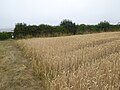 Footpath across a cornfield near Bigbury - geograph.org.uk - 5855999.jpg 1,600 × 1,200; 745 KB
-
 Footpath crossing B3392 - geograph.org.uk - 1476966.jpg 640 × 480; 79 KB
-
 Footpath emerging onto B3395 - geograph.org.uk - 1939085.jpg 1,024 × 768; 175 KB
-
 Footpath in Doctor's Wood, Bigbury - geograph.org.uk - 5856003.jpg 1,200 × 1,600; 826 KB
-
 Footpath junction, Cockleridge - geograph.org.uk - 3887749.jpg 640 × 425; 74 KB
-
 Footpath meets the B3392 to Bigbury - geograph.org.uk - 3885668.jpg 640 × 425; 79 KB
-
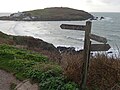
 Footpath sign above Folly Hill - geograph.org.uk - 1476989.jpg 640 × 480; 86 KB
-
 Footpath sign south of Bigbury - geograph.org.uk - 5855996.jpg 1,600 × 1,200; 763 KB
-
 Footpath to B3392 - geograph.org.uk - 1939079.jpg 1,024 × 768; 221 KB
-
 Footpath to Bigbury - geograph.org.uk - 3885643.jpg 640 × 425; 135 KB
-
 Footpath to the River Avon - geograph.org.uk - 2001155.jpg 640 × 480; 143 KB
-
 Footprints but no people - geograph.org.uk - 1933882.jpg 1,024 × 768; 98 KB
-
 Former lime kiln at Milburn Orchard - geograph.org.uk - 5856037.jpg 1,600 × 1,200; 719 KB
-
 From the beach at Challaborough Bay looking to Burgh Island - geograph.org.uk - 5422541.jpg 2,500 × 1,855; 1.18 MB
-
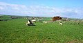
 Grazing sheep on hillside - geograph.org.uk - 1939113.jpg 1,024 × 768; 184 KB
-
 Gulls on the shoreline - geograph.org.uk - 1933887.jpg 1,024 × 768; 112 KB
-
 Gully at low tide, Warren Point - geograph.org.uk - 1933911.jpg 384 × 512; 156 KB
-
 Hexdown farm - geograph.org.uk - 3887698.jpg 640 × 425; 58 KB
-
 Hillside opposite Were Down - geograph.org.uk - 273405.jpg 640 × 480; 93 KB
-
 House at Bigbury-on-Sea - geograph.org.uk - 3859280.jpg 1,024 × 680; 288 KB
-
 Ideal conditions for kite surfing - geograph.org.uk - 3583369.jpg 800 × 600; 77 KB
-
 In the ferry crossing the Avon - geograph.org.uk - 2455491.jpg 1,024 × 768; 198 KB
-
 Isolated properties near Villa Crusoe - geograph.org.uk - 3885770.jpg 640 × 425; 121 KB
-
 Kissing gate by Doctor's Wood, Bigbury - geograph.org.uk - 5856009.jpg 1,600 × 1,200; 834 KB
-
 Landscaping a garden at Lincombe - geograph.org.uk - 5854255.jpg 1,600 × 1,200; 767 KB
-
 Lane heading to B3392 - geograph.org.uk - 2003997.jpg 640 × 480; 105 KB
-
 Lane passing Combe Farm Barns - geograph.org.uk - 2003961.jpg 640 × 480; 104 KB
-
 Lane to the Holy Well and Holwell Farm - geograph.org.uk - 1939127.jpg 1,024 × 768; 545 KB
-
 Lime kiln at Milburn Orchard.jpg 3,792 × 2,480; 5.66 MB
-
-
 Looking back at Green Well - geograph.org.uk - 3887778.jpg 640 × 425; 111 KB
-
 Looking back towards Aveton Gifford - geograph.org.uk - 3884205.jpg 640 × 425; 51 KB
-
-
 Looking down to part of Doctor's Wood - geograph.org.uk - 3887788.jpg 640 × 425; 127 KB
-

-
 Looking towards Warren Point - geograph.org.uk - 3923831.jpg 640 × 425; 68 KB
-

-

-
 Looking up the River Avon Estuary - geograph.org.uk - 3887782.jpg 640 × 425; 60 KB
-
 Marker buoy at low tide - geograph.org.uk - 1933895.jpg 1,024 × 768; 141 KB
-
 Meander, in the Avon estuary - geograph.org.uk - 1813749.jpg 1,024 × 768; 188 KB
-
 Milburn Orchard - geograph.org.uk - 1574743.jpg 640 × 426; 114 KB
-
 Mount Folly Farm - geograph.org.uk - 6212500.jpg 2,116 × 1,094; 1.02 MB
-
 Mouth of the Avon estuary - geograph.org.uk - 4910536.jpg 800 × 600; 136 KB
-
 Mouth of the Avon estuary - geograph.org.uk - 4910562.jpg 800 × 600; 118 KB
-
 Mouth of the River Avon - geograph.org.uk - 3546062.jpg 1,280 × 856; 322 KB
-
 Muddy path crossroads - geograph.org.uk - 3928339.jpg 640 × 346; 86 KB


