Category:Bikeways in Baden-Württemberg
Federal states of Germany:
Urban districts (cities): Freiburg · Heilbronn · Karlsruhe ·
Wikimedia category | |||||
| Upload media | |||||
| Instance of | |||||
|---|---|---|---|---|---|
| Category combines topics | |||||
| |||||
Subcategories
This category has the following 12 subcategories, out of 12 total.
Media in category "Bikeways in Baden-Württemberg"
The following 36 files are in this category, out of 36 total.
-
 170618-1 Radweg durchs Egautal.jpg 4,288 × 2,848; 9.43 MB
-
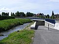 Bach+Radunterführung Denzlingen.jpg 1,088 × 816; 947 KB
-
 Bad Wurzach - Dietmanns, Radweg mit Rastplatz.JPG 3,584 × 2,016; 1.63 MB
-
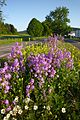 Bartholomä - Blumenbeet an der Straße.JPG 2,672 × 4,000; 2.81 MB
-
 D-BW-ZAK NSG Eselmühle 04.jpg 2,560 × 1,920; 682 KB
-
 D-UL-Böfingen.JPG 768 × 1,024; 181 KB
-
 DonauUlm.JPG 640 × 480; 200 KB
-
 Eine Fahrradstraße - panoramio.jpg 2,560 × 1,920; 704 KB
-
 Einer der schrecklichsten Radwege - panoramio.jpg 1,868 × 1,847; 459 KB
-
 Fahrradstraße Erbprinzenstraße Karlsruhe IMGP0493.JPG 1,024 × 747; 262 KB
-
 Feu-neu Radwegschwenk.jpg 1,920 × 1,200; 1.02 MB
-
 Filderbäumle mit Herz, City bike trail and loop road in Stuttgart (Germany), UTM 32.jpg 1,170 × 1,812; 519 KB
-
 Friedrichstaler Allee X K 3579VII17.jpg 4,000 × 3,000; 4.57 MB
-
 Friedrichstaler Allee315.JPG 4,000 × 3,000; 4.85 MB
-
 Friedrichstaler Allee317.JPG 4,000 × 3,000; 5.05 MB
-
 Karlsruhe Fahrradstraße Gartenstr.JPG 4,000 × 3,000; 5.11 MB
-
 Karlsruhe R-Frank-Str X Sophienstr.jpg 2,426 × 1,810; 3.24 MB
-
 Karlsruhe Sophienstr bei Waldstr.jpg 1,483 × 1,114; 738 KB
-
 Karlsruhe Sophienstr T Waldstr.jpg 2,704 × 2,013; 2.05 MB
-
 Karlsruhe321R-Frank-Str X Sophienstr.JPG 4,000 × 3,000; 4.63 MB
-
 Karlsruhe329Sophienstr T Waldstr.JPG 4,000 × 3,000; 4.78 MB
-
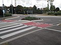 Kombinierte Querungsanlage Radweg Zebrastreifen.jpg 2,048 × 1,536; 790 KB
-
 Landappbw 439446 1823 Radspur Laupheim, Kapellenstraße.jpg 719 × 1,280; 182 KB
-
 Metzingen335Schutzstreifen neben NB Radweg.JPG 4,000 × 3,000; 4.78 MB
-
 RadNETZ BW Bodenmarkierung.jpg 4,000 × 3,000; 7.28 MB
-
 RadNETZ BW Pfeil-Wegweiser.jpg 4,000 × 3,000; 3.94 MB
-
 RadNETZ BW Standortaufkleber.jpg 4,000 × 3,000; 3.47 MB
-
 RadNETZ BW Tabellen-Wegweiser.jpg 4,000 × 3,000; 3.75 MB
-
 RadNETZ BW Ziel-Wegweiser.jpg 4,000 × 3,000; 4.42 MB
-
 Radweg Schumacherbruecke Mannheim.jpg 1,204 × 1,532; 300 KB
-
 Radweg westlich der Iller bei Wiblingen.JPG 3,584 × 2,016; 2 MB
-
 Radweg.gd-gp.JPG 768 × 1,152; 220 KB
-
 Schild Odenwald Madonnenradweg.gif 411 × 311; 77 KB
-

-
 Stutensee-Friedrichstal Unterführung Parkstr (still).jpg 2,593 × 2,130; 4.45 MB
-
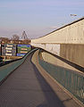
 Stutensee-Friedrichstal Unterführung Parkstraße.jpg 3,344 × 2,564; 6.01 MB


,_UTM_32.jpg)


.jpg)
