Category:Bikeways in Tyne and Wear

Media in category "Bikeways in Tyne and Wear"
The following 16 files are in this category, out of 16 total.
-
 Byker Link Cycle Path Facing North - geograph.org.uk - 197561.jpg 640 × 480; 126 KB
-
 Byker Link Cycle Path Facing South - geograph.org.uk - 197567.jpg 640 × 480; 85 KB
-
 Byker Link Near St Lawrence Square - geograph.org.uk - 197594.jpg 640 × 480; 78 KB
-
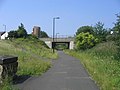
 Clifford Street Cycle Path - geograph.org.uk - 195997.jpg 640 × 480; 55 KB
-
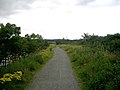
 Cycle path - geograph.org.uk - 515097.jpg 640 × 480; 57 KB
-
 Cycle path next to City Way - geograph.org.uk - 199613.jpg 640 × 480; 74 KB
-
 Cycle path towards Jarrow - geograph.org.uk - 2879413.jpg 640 × 480; 61 KB
-
 Cycle path towards Jarrow - geograph.org.uk - 2879441.jpg 640 × 480; 125 KB
-
 Cycle track beside River Tyne - geograph.org.uk - 2879445.jpg 640 × 480; 70 KB
-
 Cycle way - geograph.org.uk - 535821.jpg 640 × 480; 72 KB
-
 Footpath-Cycleway - geograph.org.uk - 197723.jpg 640 × 480; 134 KB
-
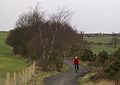 Great North Forest Trail - geograph.org.uk - 135635.jpg 640 × 451; 63 KB
-
 Jonadab Road - geograph.org.uk - 205415.jpg 640 × 480; 96 KB
-
 Keelmans way - geograph.org.uk - 515129.jpg 640 × 480; 78 KB
-
 Reiver's Cycle Route, Backworth - geograph.org.uk - 1735153.jpg 640 × 480; 123 KB
-


