Category:Biogeographical maps of the world
Subcategories
This category has only the following subcategory.
A
Media in category "Biogeographical maps of the world"
The following 145 files are in this category, out of 145 total.
-
 Worldecozones.pt.jpg 961 × 498; 54 KB
-
 Worldecozonesi.pt.jpg 961 × 498; 54 KB
-
 1783 map of the world showing the distribution of mammals.jpg 8,386 × 6,182; 8.43 MB
-
 20 Grad Isotherme.png 2,759 × 1,404; 103 KB
-
 338 of 'Eclectic Physical Geography' (11199735643).jpg 2,064 × 1,315; 573 KB
-
 340 of 'Eclectic Physical Geography' (11198522345).jpg 1,315 × 2,066; 690 KB
-

-
 A dictionary of birds BHL8664357.jpg 3,708 × 2,666; 1.05 MB
-
 Abrus precatorius DistMap.png 732 × 337; 65 KB
-
 Aglais urticae appearance.png 1,333 × 601; 31 KB
-
 Americana 1920 Zoogeography.jpg 1,132 × 640; 254 KB
-
 Animation Vegetation.gif 360 × 177; 215 KB
-
 Aquamap-mola-mola-20091106-med-res.png 3,600 × 1,800; 2.41 MB
-
 Badger genera map.png 1,480 × 625; 45 KB
-
 Badger range.png 1,480 × 625; 57 KB
-
 Badger species map.png 1,480 × 625; 45 KB
-
 Ballota nigra rangemap.png 400 × 201; 22 KB
-
 Biodiversity Hotspots 2015.svg 4,378 × 2,435; 742 KB
-
 Biodiversity Hotspots.svg 4,378 × 2,435; 758 KB
-
 Biodiversity-Zones (vascular plants).png 4,779 × 2,594; 2.38 MB
-
 Biogeography Newton.png 1,818 × 1,266; 2.23 MB
-
 Biogeography.jpg 1,280 × 496; 81 KB
-
 Biome map 02.svg 1,119 × 608; 5.27 MB
-
 Biome map 04.svg 1,119 × 608; 5.27 MB
-
 Biome map 05.svg 1,119 × 608; 5.27 MB
-
 Biome map 10.svg 1,119 × 608; 5.27 MB
-
 Biome map 11.png 1,119 × 608; 189 KB
-
 Biome map 11.svg 1,119 × 608; 5.27 MB
-
 Biome map 13.svg 1,119 × 608; 5.27 MB
-
 Biomes of the World - Retouched.png 3,000 × 1,630; 286 KB
-
 Biomes.jpg 1,385 × 622; 178 KB
-
 Bird regions.jpg 3,298 × 2,308; 7.49 MB
-
 Cacao species - World distribution map -blank.svg 800 × 400; 1.27 MB
-
 Camelid Fuller projection.svg 1,531 × 776; 612 KB
-
 Carte Chanvre.svg 792 × 612; 1.95 MB
-
 Carte de la distribution des maquereaux blancs en 2013.jpg 900 × 450; 84 KB
-
 Carte de répartition de Narcine timlei.jpg 2,000 × 1,000; 2.39 MB
-
 Carte de répartition Narcine breviliabiata .jpg 2,000 × 1,000; 2.39 MB
-
 Central Asian Flyway Map.png 490 × 333; 19 KB
-
 CFCWorldMap.PNG 800 × 364; 57 KB
-
 Columbina cyanopis distribution map.png 320 × 380; 19 KB
-
 Columbina passerina distribution map.png 655 × 940; 79 KB
-
 Correct owl range.png 1,425 × 745; 16 KB
-
 Countries with peat land.jpg 869 × 554; 73 KB
-
 Crop-Agicultural-Biome-Earth.png 1,119 × 608; 148 KB
-
 Cyanocorax morio map.jpg 700 × 382; 97 KB
-
 Cycads world distribution.png 1,350 × 625; 37 KB
-
 Distribution of tropical cloud forests.png 18,050 × 7,460; 1.45 MB
-
 Ecozones.jpg 1,096 × 744; 104 KB
-
 Elementary physical geography; (1908) (14597850430).jpg 2,480 × 1,576; 539 KB
-

-
 FAO-Ecozones.png 4,779 × 2,594; 3.16 MB
-
 Figure 28 (PeerJ 4672) - world map Bipalium.png 3,468 × 2,467; 248 KB
-
 FLORA REGIAO.jpg 664 × 409; 29 KB
-
 Global Camelid Distribution and Migration.svg 1,531 × 776; 783 KB
-
 Global distribution of seagrasses, tidal marshes, and mangroves.png 2,063 × 1,041; 1.85 MB
-
 Global patterns of terrestrial vertebrate diversity - journal.pbio.1001294.g001.png 2,049 × 880; 1.25 MB
-
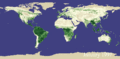
 Global Vegetation .jpg 3,600 × 1,800; 400 KB
-
 Global Vegetation map (16035993583).jpg 3,000 × 2,400; 6.93 MB
-
 Grazing-Biome-Map.png 1,119 × 608; 163 KB
-
 Griesebach and Drude.jpg 1,338 × 819; 109 KB
-
 Heinrich Berghaus - 1838 - Umrisse Der Pflanzengeographie.jpg 6,544 × 5,125; 6.75 MB
-
 Herbal Earth (9085871838).png 960 × 540; 333 KB
-
 Humidcontinentalworldwide.PNG 800 × 351; 60 KB
-
 Indo-Pacific biogeographic region map-en.png 1,950 × 1,200; 634 KB
-
 Indo-Pacific biogeographic region map-en.svg 1,950 × 1,200; 1.48 MB
-
 Indo-Pacific biogeographic region map-fr.png 1,950 × 1,200; 636 KB
-
 Indo-Pacific biogeographic region map-fr.svg 1,950 × 1,200; 1.48 MB
-
 Indo-Pacific biogeographic region map-sr.svg 1,950 × 1,200; 1.48 MB
-
 Insect biogeography.jpg 3,811 × 2,521; 6.31 MB
-
 Jellyfish population trends by LME.jpg 1,022 × 510; 310 KB
-
 Journal.pone.0043542.g001.TIF 2,063 × 1,041; 2.3 MB
-
 Kasvillisuus.png 1,425 × 753; 93 KB
-
 Land cover IGBP.png 3,600 × 1,800; 1.79 MB
-
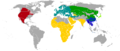
 Like-Minded Megadiverse Countries.svg 2,192 × 1,135; 1.64 MB
-
 Main cacao species - World distribution map - blank.svg 800 × 400; 1.27 MB
-
 Mangrove.png 3,504 × 1,096; 2.61 MB
-
 Map Halophytes.png 800 × 370; 78 KB
-
 Map latitudinal gradient of biodiversity mannion 2014.png 549 × 285; 192 KB
-
 Map of Refugia = Example 18000 BC to the present.png 4,779 × 2,594; 2.34 MB
-
 Map of temperate grasslands, savannas and shrublands biomes.svg 1,119 × 608; 5.27 MB
-
 Map of the megadiverse countries.svg 2,192 × 1,135; 1.64 MB
-
 Map-ecoregions-terrestres.gif 975 × 592; 80 KB
-
 Mapa del bioma de Taiga.png 1,080 × 536; 157 KB
-
 MapaSthAfk.jpg 335 × 207; 28 KB
-
 Mapo di klimati.png 727 × 470; 350 KB
-
 Martespennanti range.jpg 1,357 × 628; 47 KB
-
 MCD12C1 A2002001 051 2014274184219 LCT-1.png 7,200 × 3,600; 939 KB
-
 MCD12C1 A2003001 051 2012264185451 LCT-1.png 7,200 × 3,600; 920 KB
-
 MCD12C1 A2004001 051 2012264185523 LCT-1.png 7,200 × 3,600; 924 KB
-
 MCD12C1 A2005001 051 2013164180706 LCT-1.png 7,200 × 3,600; 930 KB
-
 MCD12C1 A2006001 051 2013164180709 LCT-1.png 7,200 × 3,600; 924 KB
-
 MCD12C1 A2007001 051 2012264190141 LCT-1.png 7,200 × 3,600; 919 KB
-
 MCD12C1 A2008001 051 2012283145256 LCT-1.png 7,200 × 3,600; 910 KB
-
 MCD12C1 A2009001 051 2013164180520 LCT-1.png 7,200 × 3,600; 911 KB
-
 MCD12C1 A2010001 051 2012264191019 LCT-1.png 7,200 × 3,600; 905 KB
-
 MCD12C1 A2011001 051 2012264191639 LCT-1.png 7,200 × 3,600; 903 KB
-
 MCD12C1 A2012001 051 2013178154403 LCT-1.png 7,200 × 3,600; 883 KB
-
 Megadiverse Countries.PNG 940 × 415; 101 KB
-
 Megadiversitätszentren.png 1,000 × 228; 180 KB
-
 Melinae range.png 1,272 × 622; 50 KB
-
 Meyers b12 s0960a.jpg 6,341 × 3,422; 5.11 MB
-
 Monsoon forest.png 1,357 × 628; 27 KB
-
 Nahkealehtinen kasvillisuus.png 1,262 × 628; 35 KB
-
 Narcine brasiliensis carte de répartition.jpg 2,000 × 1,000; 2.26 MB
-
 NASA 121557main landCover.jpg 2,702 × 1,939; 1.32 MB
-
 NOAA STAR IGBP LandType.png 2,560 × 969; 246 KB
-
 Obis-June 2004.jpg 854 × 548; 116 KB
-
 Oekozonen.png 4,779 × 2,594; 3.33 MB
-
 Pantala flavescens distribution map.svg 1,000 × 395; 3.89 MB
-
 Papageien Finsch.jpg 2,881 × 1,700; 3.78 MB
-
 Pinus range.png 2,752 × 1,396; 719 KB
-
 Polar bear vs brown bear.png 1,000 × 500; 117 KB
-
 Pterosaur Fossil Distribution Map.png 2,444 × 1,437; 13.4 MB
-
 Rain forest location map.png 1,425 × 625; 45 KB
-
 Regioes Takhtajan.jpg 1,207 × 676; 215 KB
-
 Reinos Takhtajan.png 1,529 × 792; 86 KB
-
 ReinosFLORALES.gif 613 × 409; 24 KB
-
 Rodent range.png 1,425 × 745; 29 KB
-
 Snake Range.png 1,425 × 745; 53 KB
-
 SWB wiki.png 3,543 × 2,530; 1.95 MB
-
 Taiga.png 1,262 × 628; 29 KB
-
 Vegetation FR.jpg 1,385 × 622; 470 KB
-
 Vegetation with cities.png 1,425 × 625; 88 KB
-
 Vegetation-no-legend.PNG 1,385 × 622; 61 KB
-
 Vegetation-no-legend.svg 3,177 × 1,664; 887 KB
-
 Vegetation-ukr.PNG 1,425 × 625; 72 KB
-
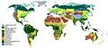
 Vegetation.png 1,385 × 622; 85 KB
-
 Vegetationsstufe Bergwälder.png 2,000 × 1,086; 777 KB
-
 Vegetationszone Borealer Nadelwald.png 2,000 × 1,086; 741 KB
-
 Vegetationszone Gemäßigter Regenwald.png 4,779 × 2,594; 2.24 MB
-
 Vegetationszone Kältewüste.png 2,000 × 1,086; 705 KB
-
 Vegetationszone Tropischer Regenwald.png 4,779 × 2,594; 2.15 MB
-
 Vegetationszone Tundra.png 2,000 × 1,086; 729 KB
-
 Vegetationszone Waldtundra.png 2,000 × 1,086; 702 KB
-
 Vegetationszonen 18.000 BC.png 4,779 × 3,657; 2.05 MB
-
 Vegetationszonen.png 4,779 × 2,594; 4.11 MB
-
 Williamsonia finds.png 863 × 449; 70 KB
-
 World centred on the Pacific Ocean locator map.svg 1,000 × 395; 3.17 MB
-
 World Map Biodiversity of Plants (1) © W. Barthlott, Lotus-Salvinia.de.jpg 3,502 × 2,001; 659 KB
-
 World Map Biodiversity of Plants (grids) (2) © W. Barthlott, Lotus-Salvinia.de.jpg 3,483 × 2,310; 783 KB
-
 Worldmap blue carbon habitats journal.pone.0043542.g001-en.png 2,063 × 1,041; 1.95 MB
-
 Zonobiome.png 4,779 × 2,594; 4.47 MB
-
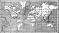
 Zoological Distribution map EB1911.png 1,036 × 827; 591 KB
-
 动物地理.jpg 2,000 × 1,000; 161 KB


.jpg)
.jpg)
.jpg)


.png)


_(14597850430).jpg)


_-_world_map_Bipalium.png)


.jpg)


.png)


_%C2%A9_W._Barthlott,_Lotus-Salvinia.de.jpg)
_(2)_%C2%A9_W._Barthlott,_Lotus-Salvinia.de.jpg)


