Category:Bircham
Cebuano: Bircham maoy parokya sa Hiniusang Gingharian. Ang Bircham nahimutang sa kondado sa Norfolk ug apil sa nasod sa Inglatera, sa habagatan-sidlakang bahin sa nasod, km sa amihanan sa ulohang dakbayan London. (→Bircham)
English: Bircham is a civil parish in the English county of Norfolk. It includes the three villages of Great Bircham, Bircham Newton and Bircham Tofts. The parish is located about 12 miles (20 km) north-east of the town of King's Lynn and 37 miles (60 km) north-west of the city of Norwich. (→Bircham)
Nederlands: Bircham is een plaats en civil parish in het bestuurlijke gebied King's Lynn and West Norfolk, in het Engelse graafschap Norfolk met 586 inwoners. (→Bircham)
Polski: Bircham – wieś w Anglii, w hrabstwie Norfolk, w dystrykcie King’s Lynn and West Norfolk. Leży 52 km na północny zachód od miasta Norwich i 160 km na północ od Londynu. Miejscowość liczy 586 mieszkańców. (→Bircham)
Svenska: Bircham är en parish i Storbritannien. Den ligger i grevskapet Norfolk och riksdelen England, i den sydöstra delen av landet, km norr om huvudstaden London. (→Bircham)

civil parish in Norfolk, UK  | |||||
| Upload media | |||||
| Instance of | |||||
|---|---|---|---|---|---|
| Location | King's Lynn and West Norfolk, Norfolk, East of England, England | ||||
| Area |
| ||||
 | |||||
Subcategories
This category has the following 3 subcategories, out of 3 total.
B
G
Media in category "Bircham"
The following 200 files are in this category, out of 355 total.
(previous page) (next page)-
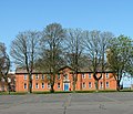
 1920s barrack block (detail) - geograph.org.uk - 4440869.jpg 617 × 640; 555 KB
-
 1920s barrack block - geograph.org.uk - 4437074.jpg 640 × 480; 379 KB
-
 1920s barrack block - geograph.org.uk - 4448573.jpg 640 × 480; 402 KB
-
 42 Church Lane - geograph.org.uk - 6211770.jpg 3,648 × 2,432; 3.94 MB
-
 46 Church Lane - geograph.org.uk - 6211763.jpg 3,648 × 2,432; 4.21 MB
-
 65 Docking Road - geograph.org.uk - 6211780.jpg 3,648 × 2,432; 3.16 MB
-
 A Bellman hangar - geograph.org.uk - 4436973.jpg 640 × 480; 323 KB
-
 A Bellman hangar - geograph.org.uk - 4436980.jpg 640 × 480; 318 KB
-
 A borehole pumphouse - geograph.org.uk - 4437047.jpg 640 × 507; 486 KB
-
 A green church - geograph.org.uk - 1990694.jpg 2,848 × 2,136; 3.16 MB
-
 A splash of green among the many browns of autumn - geograph.org.uk - 5616098.jpg 3,456 × 2,592; 3.89 MB
-
 A view of Bircham Windmill - geograph.org.uk - 5536123.jpg 3,888 × 5,184; 3.98 MB
-
 All Saints Church, Bircham Newton - geograph.org.uk - 5930569.jpg 800 × 1,200; 287 KB
-

-

-
 All Saints' church in Bircham Newton - geograph.org.uk - 2123562.jpg 640 × 517; 120 KB
-
 All Saints' church in Bircham Newton - geograph.org.uk - 2123573.jpg 504 × 640; 109 KB
-
 All Saints' church in Bircham Newton - geograph.org.uk - 2123574.jpg 500 × 640; 121 KB
-
 All Saints' church in Bircham Newton - geograph.org.uk - 2123576.jpg 640 × 499; 117 KB
-
 All Saints' church in Bircham Newton - geograph.org.uk - 2123577.jpg 640 × 480; 111 KB
-

-

-

-

-

-
 All Saints, Bircham Newton - geograph.org.uk - 5930549.jpg 1,600 × 1,066; 450 KB
-
 Ambulance shed and Mortuary - geograph.org.uk - 4437084.jpg 640 × 480; 56 KB
-
 Ambulance shed and Mortuary - geograph.org.uk - 4437090.jpg 640 × 480; 302 KB
-
 And some fell on stony ground .... - geograph.org.uk - 2908274.jpg 4,320 × 3,240; 5.7 MB
-
 Approaching Bircham Tofts - geograph.org.uk - 2077182.jpg 800 × 531; 136 KB
-
 Arable field near Great Bircham - geograph.org.uk - 4620602.jpg 1,024 × 680; 270 KB
-
-
 B1153 in Great Bircham - geograph.org.uk - 5452801.jpg 800 × 445; 113 KB
-
 B1153 near Heath House Farm - geograph.org.uk - 3840723.jpg 800 × 533; 81 KB
-
 B1153 passing through Great Bircham - geograph.org.uk - 4526760.jpg 1,024 × 768; 414 KB
-
 B1153 south of Great Bircham - geograph.org.uk - 4526742.jpg 1,024 × 768; 384 KB
-
 B1155 and pond at Bircham Tofts - geograph.org.uk - 3847663.jpg 800 × 544; 94 KB
-

-
 B1155 north of Bircham Tofts - geograph.org.uk - 3841894.jpg 800 × 532; 99 KB
-
 B1155 towards Stanhoe - geograph.org.uk - 5575109.jpg 640 × 480; 45 KB
-
 B1155, Bircham Tofts - geograph.org.uk - 5575083.jpg 640 × 480; 69 KB
-

-
 Bagthorpe Hall, aerial 2015 - geograph.org.uk - 4666254.jpg 640 × 427; 52 KB
-
 Barley field on Bircham Heath - geograph.org.uk - 2511031.jpg 4,320 × 3,240; 5.65 MB
-
 Barn by The Blackground - geograph.org.uk - 3459664.jpg 2,178 × 1,644; 663 KB
-
 Barrack blocks at RAF Bircham - geograph.org.uk - 5616137.jpg 3,456 × 2,592; 3.7 MB
-
 Bellman hangars - geograph.org.uk - 4436977.jpg 640 × 480; 313 KB
-
 Between The Blackground ^ The Mayflower - geograph.org.uk - 3459783.jpg 2,560 × 1,920; 1.27 MB
-
 Bircham from the Mill - geograph.org.uk - 2078459.jpg 800 × 532; 73 KB
-
 Bircham Newton All Saints church - geograph.org.uk - 2231700.jpg 640 × 480; 72 KB
-
 Bircham Newton Training Centre - geograph.org.uk - 6275148.jpg 1,600 × 1,054; 248 KB
-
 Bircham Newton Training Centre - geograph.org.uk - 6275160.jpg 1,600 × 1,067; 279 KB
-
 Bircham Stores - geograph.org.uk - 6210456.jpg 3,648 × 2,432; 3.11 MB
-
 Bircham Tofts - geograph.org.uk - 6275129.jpg 1,600 × 999; 374 KB
-
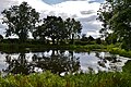
 Bircham Tofts Duck Pond - geograph.org.uk - 4645080.jpg 4,331 × 2,435; 7.31 MB
-
 Bircham Tofts Duck Pond - geograph.org.uk - 4645081.jpg 4,620 × 2,939; 7.52 MB
-
 Bircham Tofts Duck Pond - geograph.org.uk - 4645083.jpg 3,679 × 2,456; 5.21 MB
-
 Bircham Tofts Duck Pond - geograph.org.uk - 4645085.jpg 4,873 × 2,934; 7.23 MB
-
 Bircham Tofts Duck Pond, its location - geograph.org.uk - 4645089.jpg 3,679 × 2,456; 5.43 MB
-
 Bircham Tofts pond - geograph.org.uk - 6211832.jpg 4,032 × 3,024; 4.24 MB
-
 Bircham Tofts St Andrew's ruined church - geograph.org.uk - 2231704.jpg 640 × 480; 179 KB
-
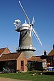
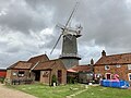
 Bircham Windmill - geograph.org.uk - 2396921.jpg 1,200 × 1,800; 181 KB
-
 Bircham Windmill - geograph.org.uk - 3208645.jpg 640 × 480; 45 KB
-
 Bircham Windmill - geograph.org.uk - 4619719.jpg 531 × 800; 92 KB
-
 Bircham Windmill - geograph.org.uk - 5033930.jpg 1,193 × 1,600; 400 KB
-
 Bircham windmill - geograph.org.uk - 5616068.jpg 2,592 × 3,456; 3.1 MB
-
 Bircham windmill - geograph.org.uk - 5616089.jpg 3,456 × 2,592; 3.85 MB
-
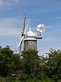
 Bircham Windmill - geograph.org.uk - 5930609.jpg 1,600 × 1,067; 534 KB
-
 Bircham Windmill and bakery - geograph.org.uk - 6211789.jpg 4,032 × 3,024; 3.46 MB
-
 Bircham Windmill, Great Bircham, Norfolk - geograph.org.uk - 5319981.jpg 4,320 × 3,240; 5.58 MB
-
 Block A "Mons" - geograph.org.uk - 4448574.jpg 591 × 640; 480 KB
-
 Bracken and conifers - geograph.org.uk - 2562022.jpg 640 × 480; 297 KB
-
 Bridleway to Bircham Newton - geograph.org.uk - 4620605.jpg 1,024 × 680; 278 KB
-
 Building number 122 - geograph.org.uk - 4439166.jpg 640 × 533; 545 KB
-
 Building on the Sick quarters site - geograph.org.uk - 4437094.jpg 640 × 495; 347 KB
-
 Bunker's Hill - geograph.org.uk - 1937795.jpg 640 × 480; 125 KB
-
 Bunkers Hill, part of the Houghton Hall estate - geograph.org.uk - 5616104.jpg 3,227 × 2,420; 2.08 MB
-
 C-Block accommodation - geograph.org.uk - 4437153.jpg 640 × 548; 473 KB
-
 C-type aircraft hangar (building no. 82) - geograph.org.uk - 4437219.jpg 640 × 480; 307 KB
-
 C-type aircraft hangar - geograph.org.uk - 4437197.jpg 640 × 480; 420 KB
-
 C-type aircraft hangar - geograph.org.uk - 4437216.jpg 640 × 480; 350 KB
-
 C-type aircraft hangar - geograph.org.uk - 4437224.jpg 640 × 480; 344 KB
-
 C-type aircraft hangar - geograph.org.uk - 4437243.jpg 640 × 629; 590 KB
-
 C-type aircraft hangars - geograph.org.uk - 4437205.jpg 640 × 548; 332 KB
-
 C-type aircraft hangars - geograph.org.uk - 4437277.jpg 640 × 557; 347 KB
-
 Chimney, Bircham Newton Training Centre - geograph.org.uk - 6275154.jpg 1,600 × 1,067; 314 KB
-

-
 Cobwebs at All Saints - geograph.org.uk - 5930588.jpg 800 × 1,200; 171 KB
-

-
 Cottage in Great Bircham - geograph.org.uk - 6211836.jpg 4,032 × 3,024; 5.39 MB
-
 Cottages in Bircham Newton - geograph.org.uk - 2123558.jpg 640 × 480; 110 KB
-
 Cottages in Bircham Newton - geograph.org.uk - 2123560.jpg 640 × 480; 142 KB
-
 Cottages on Stanhoe Road - geograph.org.uk - 6211834.jpg 4,032 × 3,024; 4.97 MB
-
 Country lane crossing Bircham Heath - geograph.org.uk - 2511024.jpg 4,320 × 3,240; 5.91 MB
-
 Cow parsley growing beside path - geograph.org.uk - 1299827.jpg 640 × 480; 131 KB
-

-
 Crop field near Great Bircham - geograph.org.uk - 5575061.jpg 640 × 480; 60 KB
-
 Crop field near pumping station - geograph.org.uk - 5575051.jpg 640 × 480; 53 KB
-
 Crop field west of Great Bircham - geograph.org.uk - 5575737.jpg 640 × 480; 66 KB
-
 Crop growing on stony ground - geograph.org.uk - 2328112.jpg 2,848 × 2,136; 3.08 MB
-
 Disused pit south of Great Bircham - geograph.org.uk - 2489273.jpg 4,320 × 3,240; 5.96 MB
-

-
 Elizabeth II postbox on Bagthorpe Road, Bircham Newton - geograph.org.uk - 5585223.jpg 2,848 × 2,136; 1.19 MB
-
 Elizabeth II postbox on the B1155, Bircham Tofts - geograph.org.uk - 5585166.jpg 1,852 × 1,939; 836 KB
-
 Entering Bircham - geograph.org.uk - 5575089.jpg 640 × 480; 74 KB
-

-
 Entrance to pumping station - geograph.org.uk - 5575052.jpg 640 × 480; 83 KB
-
 Extremes of nature in Norfolk - geograph.org.uk - 2908284.jpg 4,320 × 3,240; 6.08 MB
-
-
 Farm track by Bircham Newton - geograph.org.uk - 4435749.jpg 640 × 480; 373 KB
-
 Farm track east of Honey Hills - geograph.org.uk - 5536101.jpg 3,888 × 5,184; 5.04 MB
-
 Farm track north of Houghton Hall - geograph.org.uk - 3077210.jpg 4,320 × 3,240; 5.63 MB
-
 Farm vehicle trackway - geograph.org.uk - 6096836.jpg 3,264 × 2,448; 1.72 MB
-
 Farm vehicle trackway joining up with the Peddars Way - geograph.org.uk - 6096838.jpg 3,264 × 2,448; 1.79 MB
-
 Farmland and hedgerow near Caravan Pit - geograph.org.uk - 2600934.jpg 4,320 × 3,240; 5.75 MB
-
 Farmland track - geograph.org.uk - 4619683.jpg 800 × 531; 145 KB
-
 Farmland west of Great Bircham - geograph.org.uk - 4091688.jpg 4,320 × 3,240; 5.44 MB
-
-
 Fat sows near White Woman's Plantation - geograph.org.uk - 2908149.jpg 4,320 × 3,240; 5.48 MB
-
 Field and hedgerow off the B1155 - geograph.org.uk - 5575107.jpg 640 × 480; 51 KB
-
 Field boundary near Heath House Farm - geograph.org.uk - 2908138.jpg 4,320 × 3,240; 6.02 MB
-

-
 Field of pig sheds - geograph.org.uk - 4619691.jpg 800 × 531; 161 KB
-
 Field towards Great Bircham - geograph.org.uk - 5575066.jpg 640 × 480; 45 KB
-
 Field west of Great Bircham - geograph.org.uk - 5575733.jpg 640 × 480; 68 KB
-
 Fingerpost on the Peddars Way - geograph.org.uk - 1937790.jpg 640 × 480; 119 KB
-
 Fishing lakes north of Great Bircham, Norfolk - geograph.org.uk - 2633359.jpg 4,320 × 3,240; 5.85 MB
-
 Footpath and sugarbeet - geograph.org.uk - 5616077.jpg 3,456 × 2,592; 3.93 MB
-
 Footpath at the side of 40 acre plantation - geograph.org.uk - 3077196.jpg 4,320 × 3,240; 5.83 MB
-
 Footpath east of Bircham Newton - geograph.org.uk - 2908181.jpg 4,320 × 3,240; 5.91 MB
-
-
-

-
 Former R.A.F. Bircham Newton, aerial 2018 (1) - geograph.org.uk - 5835536.jpg 1,024 × 683; 121 KB
-
 Former R.A.F. Bircham Newton, aerial 2018 (2) - geograph.org.uk - 5835540.jpg 1,024 × 683; 137 KB
-
 Fox Covert Bircham, on the horizon - geograph.org.uk - 5616083.jpg 3,456 × 2,592; 3.92 MB
-
 Fring Road into Great Bircham - geograph.org.uk - 5575064.jpg 640 × 480; 63 KB
-
 Fring Road, Great Bircham - geograph.org.uk - 5575069.jpg 640 × 480; 49 KB
-

-
 Gap between two C-type hangars - geograph.org.uk - 4437235.jpg 640 × 480; 274 KB
-
 Gas Decontamination block and hospital - geograph.org.uk - 4437116.jpg 640 × 480; 302 KB
-
 Gated concrete track - geograph.org.uk - 4437176.jpg 640 × 480; 331 KB
-
 Great Bircham - geograph.org.uk - 4619701.jpg 800 × 531; 133 KB
-

-

-
 Great Bircham Social Club - geograph.org.uk - 6210459.jpg 3,648 × 2,432; 4.46 MB
-

-
 Great Bircham Tower Mill - geograph.org.uk - 4705489.jpg 480 × 640; 51 KB
-
 Great Bircham village sign (detail) - geograph.org.uk - 4526758.jpg 640 × 640; 148 KB
-
 Great Bircham village sign - geograph.org.uk - 4526751.jpg 1,024 × 768; 548 KB
-
 Great Bircham village sign - geograph.org.uk - 5452803.jpg 800 × 696; 172 KB
-
 Great Bircham War Memorial - geograph.org.uk - 4890702.jpg 3,456 × 2,592; 3.85 MB
-
 Great Bircham war memorial - geograph.org.uk - 6211773.jpg 2,432 × 3,648; 4.05 MB
-

-
 Great Bircham Windmill - Ancillary Drive - geograph.org.uk - 2078614.jpg 800 × 531; 101 KB
-

-
 Great Bircham Windmill - Brake Wheel - geograph.org.uk - 2078424.jpg 800 × 531; 110 KB
-

-
 Great Bircham Windmill - Cap - geograph.org.uk - 2078421.jpg 800 × 531; 83 KB
-
 Great Bircham Windmill - Cap - geograph.org.uk - 2078428.jpg 800 × 531; 89 KB
-
 Great Bircham Windmill - Cap - geograph.org.uk - 2078449.jpg 800 × 531; 84 KB
-
 Great Bircham Windmill - Cap - geograph.org.uk - 2078591.jpg 800 × 531; 84 KB
-

-

-
 Great Bircham Windmill - East - geograph.org.uk - 2078230.jpg 800 × 531; 96 KB
-
 Great Bircham Windmill - Fantail - geograph.org.uk - 2078472.jpg 800 × 531; 64 KB
-
 Great Bircham Windmill - Fantail - geograph.org.uk - 2078527.jpg 800 × 531; 47 KB
-

-
 Great Bircham windmill - geograph.org.uk - 2048418.jpg 640 × 480; 50 KB
-
 Great Bircham Windmill - geograph.org.uk - 2077185.jpg 800 × 531; 115 KB
-
 Great Bircham Windmill - geograph.org.uk - 2078072.jpg 800 × 496; 78 KB
-
 Great Bircham Windmill - geograph.org.uk - 2078643.jpg 800 × 531; 126 KB
-
 Great Bircham Windmill - geograph.org.uk - 5452736.jpg 800 × 509; 71 KB
-
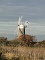
 Great Bircham windmill - geograph.org.uk - 6235068.jpg 2,000 × 1,377; 1.81 MB
-
 Great Bircham Windmill - Governor - geograph.org.uk - 2078166.jpg 800 × 531; 97 KB
-

-

-

-

-
 Great Bircham Windmill - Sack Hoist - geograph.org.uk - 2078407.jpg 800 × 531; 103 KB
-
-
 Great Bircham Windmill - Spider - geograph.org.uk - 2078296.jpg 800 × 531; 61 KB
-
 Great Bircham Windmill - Stone Crane - geograph.org.uk - 2078386.jpg 800 × 531; 109 KB
-
 Great Bircham Windmill - Stone Nut - geograph.org.uk - 2078372.jpg 800 × 507; 111 KB
-
 Great Bircham Windmill - Stones - geograph.org.uk - 2078133.jpg 800 × 531; 101 KB
-
 Great Bircham Windmill - The Bin Floor - geograph.org.uk - 2078397.jpg 800 × 531; 109 KB
-
 Great Bircham Windmill - The Governor - geograph.org.uk - 2078185.jpg 800 × 531; 100 KB
-

-

-
 Great Bircham Windmill - The Stones - geograph.org.uk - 2078328.jpg 800 × 531; 91 KB
-
 Great Bircham Windmill - Turning Cog - geograph.org.uk - 2078516.jpg 800 × 531; 92 KB
-
 Great Bircham Windmill - Turning Cog - geograph.org.uk - 2078537.jpg 800 × 531; 86 KB
-
-

-

-

-
 Great Bircham Windmill - View West - geograph.org.uk - 2078266.jpg 800 × 531; 85 KB
-
 Great Bircham Windmill -View North - geograph.org.uk - 2078284.jpg 800 × 531; 86 KB
-

-
 Great Bircham Windmill, aerial 2017 - geograph.org.uk - 5523907.jpg 800 × 533; 54 KB
_-_geograph.org.uk_-_4440869.jpg)


_-_geograph.org.uk_-_4437219.jpg)


_-_geograph.org.uk_-_4439176.jpg)


_-_geograph.org.uk_-_5835536.jpg)
_-_geograph.org.uk_-_5835540.jpg)


_-_geograph.org.uk_-_4526758.jpg)


_-_geograph.org.uk_-_2078416.jpg)


_-_geograph.org.uk_-_5523913.jpg)
