Category:Birkenhof Lipperswil
| Object location | | View all coordinates using: OpenStreetMap |
|---|
|
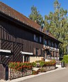
This is a category about a cultural property of regional significance in Switzerland with KGS number 13843
|
 | |||||
| Upload media | |||||
| Instance of | |||||
|---|---|---|---|---|---|
| Part of | |||||
| Location | Lipperswil, Wäldi, Kreuzlingen District, Thurgau, Switzerland | ||||
| Street address |
| ||||
| Heritage designation |
| ||||
 | |||||
Media in category "Birkenhof Lipperswil"
The following 2 files are in this category, out of 2 total.
-
 Birkenhof Postweg 40 in Lipperswil.jpg 3,500 × 4,200; 11.48 MB
-
 Wohntrakt Bauernhaus Postweg 40 in Lipperswil.jpg 3,000 × 4,200; 9.82 MB
