Category:Bishop's Hull
English: Bishop's Hull is a village and civil parish in Somerset, England, situated in the western suburbs of Taunton in the Taunton Deane district. It includes the areas of Rumwell, Rumwell Park, Roughmoor and Longaller and is close to the River Tone. The parish has a population of 3,694 in total.
Norsk bokmål: Bishops Hull er en landsby og et verdslig sogn i Somerset, England. Den ligger som en forstad til Taunton, omkring 3 km vest for byen, ved elven Tone. Sognet omfatter også Rumwell, Rumwell Park, Roughmoor og Longalier.
village in Somerset, England, UK  | |||||
| Upload media | |||||
| Instance of | |||||
|---|---|---|---|---|---|
| Location | Somerset West and Taunton, Somerset, South West England, England | ||||
| official website | |||||
 | |||||
Subcategories
This category has the following 2 subcategories, out of 2 total.
M
- Manor House, Bishop's Hull (2 F)
P
Media in category "Bishop's Hull"
The following 192 files are in this category, out of 192 total.
-
 'Living Light' church, Gipsy Lane, Taunton - geograph.org.uk - 3716454.jpg 1,024 × 768; 175 KB
-
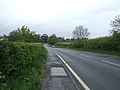
 A38 from Stonegallows - geograph.org.uk - 5148314.jpg 3,648 × 2,432; 2.91 MB
-
 A38 heading east - geograph.org.uk - 3461756.jpg 640 × 480; 60 KB
-
 A38 heading east - geograph.org.uk - 3461761.jpg 640 × 480; 63 KB
-
 A38, near Rumwell Farm Shop - geograph.org.uk - 4020686.jpg 640 × 425; 86 KB
-
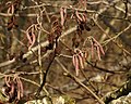 Alder catkins by the Tone - geograph.org.uk - 1745146.jpg 640 × 513; 83 KB
-
 Bakers Close, Taunton - geograph.org.uk - 3461770.jpg 640 × 480; 88 KB
-
 Bishop's Hull Butcher's and Stores - geograph.org.uk - 4265600.jpg 640 × 480; 80 KB
-
 Bishop's Hull Hill - geograph.org.uk - 1004569.jpg 640 × 487; 101 KB
-
 Bishop's Hull House, near Taunton - geograph.org.uk - 2643279.jpg 640 × 480; 88 KB
-
 Bishop's Hull post office - geograph.org.uk - 1000353.jpg 640 × 480; 69 KB
-
 Bishop's Hull Village Stores - geograph.org.uk - 3279608.jpg 640 × 480; 78 KB
-
 Bishops Hull Road, Bishops Hull, Taunton - geograph.org.uk - 5581352.jpg 1,600 × 1,200; 808 KB
-
 By the River Tone at Longaller - geograph.org.uk - 1000857.jpg 640 × 480; 160 KB
-
 Car for sale, near Fideoak - geograph.org.uk - 3742633.jpg 1,024 × 768; 294 KB
-
 Car restoration business, by A38 at Roundhill - geograph.org.uk - 5581346.jpg 1,600 × 1,200; 720 KB
-

-
 Cross-Country train approaches Taunton - geograph.org.uk - 5037036.jpg 1,024 × 768; 222 KB
-
 Cycle route 3 in Bishops Hull - geograph.org.uk - 1978942.jpg 640 × 480; 186 KB
-
 Devonia Park - geograph.org.uk - 1207408.jpg 640 × 351; 50 KB
-
 Electric pylon base in a field - geograph.org.uk - 4618194.jpg 640 × 480; 160 KB
-
 Entering Taunton on the A38 - geograph.org.uk - 3461766.jpg 640 × 480; 66 KB
-
 Entrance to electric sub-station - geograph.org.uk - 4618187.jpg 640 × 480; 144 KB
-
 Farm road, Longaller - geograph.org.uk - 1000806.jpg 640 × 480; 107 KB
-
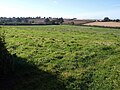
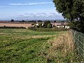
 Farmland, Rumwell - geograph.org.uk - 3461759.jpg 640 × 480; 64 KB
-
 Fideoak Mill - geograph.org.uk - 4923140.jpg 640 × 369; 40 KB
-
 Fideoak Mill - geograph.org.uk - 5102660.jpg 640 × 426; 50 KB
-
 Fideoak Mill - geograph.org.uk - 5223584.jpg 640 × 426; 60 KB
-
 Fideoak Mill - geograph.org.uk - 5395153.jpg 640 × 426; 44 KB
-
 Fideoak Mill - geograph.org.uk - 5536734.jpg 640 × 426; 58 KB
-
 Fideoak Mill - geograph.org.uk - 5815932.jpg 1,024 × 681; 145 KB
-
 Fideoak Mill - geograph.org.uk - 5847551.jpg 1,024 × 565; 88 KB
-
 Fideoak Mill - geograph.org.uk - 5942582.jpg 1,024 × 681; 106 KB
-
 Field by Frethey Road - geograph.org.uk - 1000404.jpg 640 × 480; 109 KB
-

-
 Field north of Upcott - geograph.org.uk - 1000719.jpg 640 × 480; 96 KB
-
 Field north of Upcott - geograph.org.uk - 1000738.jpg 640 × 480; 92 KB
-
 Field north of Upcott - geograph.org.uk - 1000758.jpg 640 × 480; 131 KB
-
 Field, Bishop's Hull - geograph.org.uk - 1000361.jpg 640 × 480; 101 KB
-
 Field, Bishop's Hull - geograph.org.uk - 1842679.jpg 640 × 480; 101 KB
-
 Field, Bishop's Hull - geograph.org.uk - 999050.jpg 640 × 480; 112 KB
-
 Footbridge, Netherclay - geograph.org.uk - 803450.jpg 640 × 480; 128 KB
-
 Footpath, leading north from Upcott Road - geograph.org.uk - 3742101.jpg 1,024 × 768; 217 KB
-
 Garden at Learning South West, Bishops Hull House - geograph.org.uk - 3178714.jpg 1,600 × 1,200; 613 KB
-
 Garden, Bishop's Hull House - geograph.org.uk - 2643262.jpg 1,600 × 1,200; 558 KB
-
 Garden, Bishop's Hull House - geograph.org.uk - 2643273.jpg 640 × 480; 117 KB
-
 Garden, Bishops Hull house - geograph.org.uk - 998968.jpg 640 × 480; 140 KB
-
 Gate onto Frethey Road - geograph.org.uk - 1000778.jpg 640 × 480; 123 KB
-
 Gate, Netherclay Community Woodland (geograph 1939641).jpg 640 × 493; 117 KB
-
 Gipsy Lane, Bishops Hull, Taunton - geograph.org.uk - 5581357.jpg 1,600 × 1,202; 703 KB
-
 Grasses in the Tone - geograph.org.uk - 1939663.jpg 640 × 480; 114 KB
-
 Grassland, Netherclay Community Woodland - geograph.org.uk - 803446.jpg 640 × 480; 118 KB
-

-
 Grazing near Roundhill - geograph.org.uk - 3461751.jpg 640 × 480; 56 KB
-
 Grazing, Norton Fitzwarren - geograph.org.uk - 4349536.jpg 640 × 415; 56 KB
-
 Griffin on pillar - Rumwell - geograph.org.uk - 1227639.jpg 449 × 640; 59 KB
-
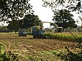 Harvesting maize, Longaller (1) - geograph.org.uk - 1000994.jpg 640 × 480; 148 KB
-
 Harvesting maize, Longaller (2) - geograph.org.uk - 1001003.jpg 640 × 480; 130 KB
-
 Harvesting maize, Longaller (3) - geograph.org.uk - 1001012.jpg 640 × 480; 128 KB
-
 Harvesting maize, Longaller (4) - geograph.org.uk - 1001019.jpg 640 × 448; 120 KB
-
 Horned sheep, Longaller - geograph.org.uk - 1000877.jpg 640 × 456; 125 KB
-
 Houses at Barr - geograph.org.uk - 1394709.jpg 640 × 480; 91 KB
-
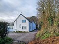
 Houses on Netherclay, Bishop's Hull - geograph.org.uk - 3742010.jpg 1,024 × 715; 139 KB
-
 Houses, Norton Fitzwarren - geograph.org.uk - 6232150.jpg 3,567 × 1,938; 373 KB
-
 Lane past Elms Farm - geograph.org.uk - 1206548.jpg 640 × 480; 100 KB
-

-
 Longaller Bridge - geograph.org.uk - 1000837.jpg 480 × 640; 105 KB
-
 Maize field, Longaller - geograph.org.uk - 1001645.jpg 640 × 480; 106 KB
-
 Malthouse Court, Bishop's Hull - geograph.org.uk - 1004624.jpg 480 × 640; 61 KB
-
 Meadow by River Tone - geograph.org.uk - 1000846.jpg 640 × 480; 100 KB
-
 Mill race, Longaller - geograph.org.uk - 1000902.jpg 640 × 480; 120 KB
-
 Millennium Garden - geograph.org.uk - 4265602.jpg 640 × 480; 113 KB
-
 Monument at Stonegallows - geograph.org.uk - 3741986.jpg 1,024 × 768; 194 KB
-
 New houses at Bishops Hull - geograph.org.uk - 4816474.jpg 4,608 × 3,456; 2.14 MB
-
 New housing on Stonegallows Hill - geograph.org.uk - 5148276.jpg 3,085 × 2,110; 2.94 MB
-
 Newley Farmhouse, Upcott Road - geograph.org.uk - 3742088.jpg 1,024 × 768; 179 KB
-
 Norton Fitzwarren Junction - geograph.org.uk - 4850869.jpg 640 × 426; 72 KB
-
 Norton Fitzwarren Junction - geograph.org.uk - 6046970.jpg 1,024 × 681; 195 KB
-
 Orchard, Rumwell - geograph.org.uk - 1207415.jpg 640 × 480; 85 KB
-
 Ordnance Survey benchmark - geograph.org.uk - 4265603.jpg 640 × 480; 125 KB
-
 Ordnance Survey benchmark - geograph.org.uk - 4265609.jpg 640 × 480; 127 KB
-
 Park and Ride outside Taunton - geograph.org.uk - 2343813.jpg 640 × 480; 55 KB
-
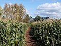 Path through the maize - geograph.org.uk - 1001808.jpg 640 × 480; 126 KB
-
 Paths, footbridge and maize field - geograph.org.uk - 1003693.jpg 480 × 640; 131 KB
-
 Pier of bridge, Netherclay - geograph.org.uk - 803436.jpg 481 × 640; 104 KB
-
 Potato field north of Longaller - geograph.org.uk - 1000937.jpg 640 × 480; 82 KB
-
 Pylon in a field - geograph.org.uk - 4929752.jpg 640 × 426; 36 KB
-
 Pylons - geograph.org.uk - 4983202.jpg 640 × 426; 39 KB
-
 Pylons - geograph.org.uk - 5102665.jpg 640 × 426; 35 KB
-
 Pylons, Norton Brook - geograph.org.uk - 5106366.jpg 640 × 426; 45 KB
-
 Pylons, The Tone Valley - geograph.org.uk - 4923136.jpg 640 × 426; 36 KB
-
 Railway footbridge, Norton Fitzwarren - geograph.org.uk - 2140072.jpg 1,024 × 768; 262 KB
-
 Railway junction - geograph.org.uk - 5309534.jpg 640 × 426; 67 KB
-
 Rain on the Tone - geograph.org.uk - 1394676.jpg 501 × 640; 84 KB
-
 Ritherden's Farm, Rumwell - geograph.org.uk - 4816471.jpg 4,608 × 3,456; 1.54 MB
-
 River Tone - geograph.org.uk - 803479.jpg 480 × 640; 122 KB
-
 Roses, Netherclay Community Woodland - geograph.org.uk - 1939650.jpg 482 × 640; 44 KB
-
 Roughmoor Farmhouse, Bishop's Hull 01.jpg 4,000 × 3,000; 3.15 MB
-
 Roughmoor Farmhouse, Bishop's Hull 02.jpg 4,000 × 3,000; 3.34 MB
-
 Roughmoor Farmhouse, Bishop's Hull 03.jpg 3,000 × 4,000; 4.9 MB
-
 Roughmoor Farmhouse, Bishop's Hull 04.jpg 4,000 × 3,000; 5.05 MB
-
 Roughmoor Farmhouse, Bishop's Hull 05.jpg 4,000 × 3,000; 4.48 MB
-
 Roughmoor House, Bishop's Hull 01.jpg 4,000 × 3,000; 4.61 MB
-
 Roughmoor House, Bishop's Hull 02.jpg 4,000 × 3,000; 4.5 MB
-
 Rumwell , Grant's Farmhouse - geograph.org.uk - 4641941.jpg 4,164 × 2,765; 4.75 MB
-
 Rumwell , Rumwell Lodge - geograph.org.uk - 4641944.jpg 4,193 × 2,785; 7.81 MB
-
 Rumwell , The A38 - geograph.org.uk - 4641938.jpg 4,288 × 2,848; 6.8 MB
-
 Rumwell - geograph.org.uk - 1227652.jpg 640 × 416; 83 KB
-
 Rumwell Farm and pond. - geograph.org.uk - 1227623.jpg 640 × 425; 103 KB
-
 Rumwell Farm Shop - geograph.org.uk - 3461754.jpg 640 × 480; 62 KB
-

-
 Rumwell Farm Shop, Bradford-on-Tone - geograph.org.uk - 4020679.jpg 640 × 425; 66 KB
-
 Rumwell Farm Shop, by A38 near Bradford-on-Tone - geograph.org.uk - 5581349.jpg 1,600 × 1,200; 679 KB
-
 Rumwell Manor Hotel - geograph.org.uk - 1227618.jpg 640 × 419; 83 KB
-
 Scots Guardsman at Norton Fitzwarren - geograph.org.uk - 5037046.jpg 1,024 × 810; 260 KB
-
 Service station on the A38 - geograph.org.uk - 3461774.jpg 640 × 480; 52 KB
-
 Shutewater Hill, Bishop's Hull - geograph.org.uk - 1000366.jpg 640 × 480; 86 KB
-
 South of Norton Fitzwarren - geograph.org.uk - 5102662.jpg 640 × 426; 38 KB
-
 Spindle-tree berries and leaves - geograph.org.uk - 1003843.jpg 640 × 466; 82 KB
-
 Stile and bridge near Upcott - geograph.org.uk - 1000708.jpg 640 × 480; 137 KB
-
 Stile, Longaller - geograph.org.uk - 1000919.jpg 480 × 640; 106 KB
-
 Stonegallows - geograph.org.uk - 1206530.jpg 480 × 640; 86 KB
-
 Stonegallows - geograph.org.uk - 2653380.jpg 640 × 480; 99 KB
-
 Storage barns, Newley Farm - geograph.org.uk - 3742066.jpg 1,024 × 768; 164 KB
-
 Taunton , Bishop's Hull ^ Silk Mills Road - geograph.org.uk - 4642046.jpg 4,288 × 2,848; 6.78 MB
-
 Taunton , China Capital - geograph.org.uk - 4642048.jpg 4,235 × 2,813; 7.68 MB
-
 Taunton , Crematorium - geograph.org.uk - 1135281.jpg 640 × 480; 49 KB
-
 Taunton , Footpath - geograph.org.uk - 4642054.jpg 4,288 × 2,848; 6.61 MB
-
 Taunton , Galmington Road - geograph.org.uk - 4642056.jpg 4,288 × 2,848; 5.65 MB
-
 Taunton , Lavender Grove - geograph.org.uk - 4642055.jpg 4,288 × 2,848; 4.96 MB
-
 Taunton , Northfields - geograph.org.uk - 4642051.jpg 4,288 × 2,848; 5.89 MB
-
 Taunton , Northfields - geograph.org.uk - 4642052.jpg 4,288 × 2,848; 5.07 MB
-
 Taunton , The River Tone - geograph.org.uk - 3587295.jpg 3,264 × 2,448; 3.74 MB
-
 Taunton , The Stone Gallows - geograph.org.uk - 3543248.jpg 4,214 × 2,730; 3.49 MB
-
 Taunton , Walnut Close - geograph.org.uk - 4642049.jpg 4,288 × 2,848; 5.82 MB
-
 Taunton , Wellington New Road A38 - geograph.org.uk - 4642057.jpg 4,288 × 2,848; 5.09 MB
-
 Taunton , Wellington Road - geograph.org.uk - 3543251.jpg 4,288 × 2,848; 5.2 MB
-
 Taunton Deane , Grassy Field - geograph.org.uk - 4641917.jpg 4,288 × 2,848; 7.99 MB
-
 Taunton Deane , Grassy Field ^ Tree - geograph.org.uk - 4641932.jpg 4,288 × 2,848; 7.47 MB
-
 Taunton Deane Crematorium - geograph.org.uk - 2658944.jpg 3,072 × 2,304; 1.79 MB
-
 Taunton Deane District , Country Lane - geograph.org.uk - 4641922.jpg 4,288 × 2,848; 6.17 MB
-
 Taunton Deane District , Countryside Scenery - geograph.org.uk - 4641911.jpg 4,288 × 2,848; 6.8 MB
-
 Taunton Deane District , Countryside Scenery - geograph.org.uk - 4641916.jpg 4,288 × 2,848; 6.18 MB
-
 Taunton Deane District , Grassy Field - geograph.org.uk - 4641927.jpg 4,288 × 2,848; 5.21 MB
-
 Taunton Deane District , Grassy Field - geograph.org.uk - 4642024.jpg 4,288 × 2,848; 5.81 MB
-
 Taunton Deane District , Grassy Field - geograph.org.uk - 4642027.jpg 4,288 × 2,848; 4.49 MB
-
 Taunton Deane District , Grassy Field ^ Pylons - geograph.org.uk - 4642029.jpg 4,195 × 2,787; 4.77 MB
-
 Taunton Deane District , Grassy Field ^ Sheep - geograph.org.uk - 4642003.jpg 4,288 × 2,848; 6.45 MB
-
 Taunton Deane District , Grassy Field ^ Sheep - geograph.org.uk - 4642008.jpg 4,288 × 2,848; 5.88 MB
-
 Taunton Deane District , Grassy Field ^ Sheep - geograph.org.uk - 4642010.jpg 4,288 × 2,848; 5.66 MB
-
 Taunton Deane District , Grassy Field ^ Sheep - geograph.org.uk - 4642011.jpg 4,288 × 2,848; 5.87 MB
-
 Taunton Deane District , Grassy Field ^ Sheep - geograph.org.uk - 4642014.jpg 4,213 × 2,798; 6.98 MB
-
 Taunton Deane District , Grassy Path - geograph.org.uk - 4642030.jpg 4,288 × 2,848; 6.27 MB
-
 Taunton Deane District , Grassy Path - geograph.org.uk - 4642031.jpg 4,288 × 2,848; 6.42 MB
-
 Taunton Deane District , Grassy Path - geograph.org.uk - 4642032.jpg 4,288 × 2,848; 6.42 MB
-
 Taunton Deane District , Netherclay Community Woodland - geograph.org.uk - 4642034.jpg 4,288 × 2,848; 6.77 MB
-
 Taunton Deane District , Netherclay Community Woodland - geograph.org.uk - 4642036.jpg 4,288 × 2,848; 6.8 MB
-
 Taunton Deane District , Netherclay Community Woodland - geograph.org.uk - 4642039.jpg 4,288 × 2,848; 6.21 MB
-
 Taunton Deane District , Netherclay Community Woodland - geograph.org.uk - 4642040.jpg 4,288 × 2,848; 6.78 MB
-
 Taunton Deane District , Railway - geograph.org.uk - 4642018.jpg 4,288 × 2,848; 6.01 MB
-
 Taunton Deane District , Rumwell Farm Shop - geograph.org.uk - 3543246.jpg 4,180 × 2,676; 2.78 MB
-
 Taunton Deane District , Silk Mills Road A3065 - geograph.org.uk - 4642043.jpg 4,025 × 2,674; 7.19 MB
-
 Taunton Deane District , Silk Mills Road A3065 - geograph.org.uk - 4642045.jpg 4,288 × 2,848; 6.57 MB
-
 Taunton Deane District , The A38 - geograph.org.uk - 4641935.jpg 4,288 × 2,848; 5.98 MB
-
 Taunton Deane District , West Deane Way - geograph.org.uk - 4642015.jpg 4,139 × 2,749; 7.1 MB
-
 Taunton United Reformed Church - geograph.org.uk - 999483.jpg 640 × 480; 69 KB
-
 Telephone box, Northfields, Bishops Hull - geograph.org.uk - 838252.jpg 640 × 480; 104 KB
-
 The Crown at Rumwell - geograph.org.uk - 5581350.jpg 1,600 × 1,065; 623 KB
-
 The Crown pub, Rumwell - geograph.org.uk - 3461757.jpg 640 × 480; 72 KB
-
 The Old Inn, Bishop's Hull - geograph.org.uk - 3279600.jpg 640 × 480; 58 KB
-
 The Stonegallows pub - geograph.org.uk - 3461767.jpg 640 × 480; 61 KB
-
 Towards Bishop's Hull from near Barr - geograph.org.uk - 1394721.jpg 640 × 422; 110 KB
-
 Traffic mirror, Bishop's Hull - geograph.org.uk - 999007.jpg 508 × 640; 53 KB
-
 Tree at Learning South West, Bishops Hull House - geograph.org.uk - 3178699.jpg 1,600 × 1,200; 705 KB
-
 Trees by the Tone - geograph.org.uk - 1745136.jpg 480 × 640; 112 KB
-
 Two pylons - geograph.org.uk - 5395152.jpg 640 × 426; 48 KB
-
 Tytherleigh Bridge - geograph.org.uk - 803470.jpg 480 × 640; 91 KB
-
 View west from Stonegallows Hill - geograph.org.uk - 5148287.jpg 3,648 × 2,432; 4.27 MB
-
 Village Stores, Bishop's Hull - geograph.org.uk - 3742033.jpg 1,024 × 773; 133 KB
-
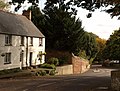
 Village street, Bishop's Hull - geograph.org.uk - 999632.jpg 640 × 480; 79 KB
-
 Warehouse, on Galmington trading estate, Taunton - geograph.org.uk - 2613394.jpg 1,024 × 768; 238 KB
-
 Waterfield Close, Bishop's Hull - geograph.org.uk - 2414762.jpg 640 × 480; 76 KB
-
 Weir, Norton Brook - geograph.org.uk - 1003817.jpg 480 × 640; 123 KB
-

-
 Wellington New Road (A38) - geograph.org.uk - 3461772.jpg 640 × 480; 86 KB
-
 West Deane Way near Longaller - geograph.org.uk - 1001200.jpg 640 × 480; 92 KB
-
 West Somerset Railway - geograph.org.uk - 5700837.jpg 640 × 426; 55 KB
-
 Wheatfield on the West Deane Way - geograph.org.uk - 1394642.jpg 640 × 480; 110 KB
-
 Wheatfield on the West Deane Way - geograph.org.uk - 1394693.jpg 640 × 480; 122 KB
-
 Willow branch in the Tone - geograph.org.uk - 1939672.jpg 505 × 640; 116 KB
-
 Willows by the River Tone - geograph.org.uk - 803483.jpg 640 × 480; 142 KB
-
 Bishop's Hull, lane to Longaller - geograph.org.uk - 159843.jpg 640 × 427; 163 KB


.jpg)


_-_geograph.org.uk_-_1000994.jpg)
_-_geograph.org.uk_-_1001003.jpg)
_-_geograph.org.uk_-_1001012.jpg)
_-_geograph.org.uk_-_1001019.jpg)


_-_geograph.org.uk_-_3461772.jpg)


