Category:Bishopsteignton
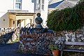
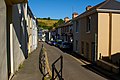
English: Bishopsteignton is a village in South Devon, England between Newton Abbot and Teignmouth, close to the River Teign Estuary. The village is on a steep hill, and has a post office, small pharmacy and a small, family-run supermarket. The village school has about 150 pupils.
village and civil parish in Devon, UK  | |||||
| Upload media | |||||
| Instance of | |||||
|---|---|---|---|---|---|
| Location | Teignbridge, Devon, South West England, England | ||||
| Said to be the same as | Bishopsteignton (Wikimedia duplicated page, civil parish) | ||||
| official website | |||||
 | |||||
Subcategories
This category has the following 11 subcategories, out of 11 total.
A
- Ashwell, Devon (3 F)
B
- Bishopsteignton War Memorial (3 F)
C
- Cross House, Bishopsteignton (4 F)
H
- Humber, Devon (2 F)
J
L
- Lindridge House (5 F)
T
- Teignmouth Golf Course (13 F)
Media in category "Bishopsteignton"
The following 200 files are in this category, out of 1,017 total.
(previous page) (next page)-
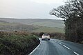
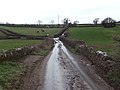
 A dip in the A381 past Bishopsteignton - geograph.org.uk - 1654910.jpg 640 × 427; 240 KB
-

-
 A dull day on The Teign Estuary - geograph.org.uk - 5712725.jpg 640 × 328; 22 KB
-
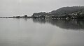 A dull day on The Teign Estuary - geograph.org.uk - 5712726.jpg 640 × 350; 24 KB
-
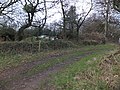 A little-used stile - geograph.org.uk - 2793499.jpg 800 × 600; 516 KB
-
 A misty Colley Lane - geograph.org.uk - 3309209.jpg 640 × 430; 24 KB
-
 A muddy track near Westhayes Farm - geograph.org.uk - 1320685.jpg 640 × 480; 95 KB
-
 A New Ditch - geograph.org.uk - 5006538.jpg 1,600 × 1,200; 584 KB
-
 A tight fit - geograph.org.uk - 3454092.jpg 640 × 430; 73 KB
-
 A380 Grass bank - geograph.org.uk - 5737641.jpg 1,600 × 1,069; 262 KB
-
 A380 Newton Road - Wear farm bus stop - geograph.org.uk - 5740256.jpg 800 × 686; 117 KB
-
 A381 - Newton Road, Bishopsteignton - geograph.org.uk - 6211340.jpg 1,600 × 1,200; 503 KB
-
 A381 Newton Road - geograph.org.uk - 3357584.jpg 640 × 449; 68 KB
-
 A381 roadside house - geograph.org.uk - 5740261.jpg 799 × 720; 227 KB
-
 A381 skid warning, approaching Forder Lane - geograph.org.uk - 5740290.jpg 1,143 × 659; 298 KB
-

-
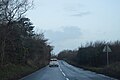
 A381 west of Bishopsteignton - geograph.org.uk - 139252.jpg 640 × 480; 85 KB
-

-
 Access to public footpath off A381 - geograph.org.uk - 6211350.jpg 1,600 × 1,200; 529 KB
-
 Across the Teign Estuary - geograph.org.uk - 5069561.jpg 3,072 × 1,672; 724 KB
-
 Across the Teign Estuary - geograph.org.uk - 5069597.jpg 3,072 × 1,467; 509 KB
-
 Across the Valley - geograph.org.uk - 970591.jpg 640 × 427; 73 KB
-

-
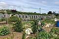 Allotments at Michaels Field, Bishopsteignton - geograph.org.uk - 5774230.jpg 1,280 × 853; 2.08 MB
-
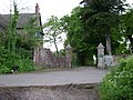 An entrance to Lindridge Park (and Jake) - geograph.org.uk - 1322352.jpg 640 × 480; 112 KB
-
 An entrance to Lindridge Park - geograph.org.uk - 2793170.jpg 800 × 600; 411 KB
-

-
 Arable land by Shepherds' Lane - geograph.org.uk - 1316098.jpg 640 × 427; 68 KB
-
 Arbours, Jack's Patch - geograph.org.uk - 1965406.jpg 640 × 480; 150 KB
-

-
 Ashill descends to Bishopsteignton - geograph.org.uk - 2090388.jpg 640 × 480; 507 KB
-
 Ashill meets Coombe Way - geograph.org.uk - 2090376.jpg 640 × 480; 344 KB
-
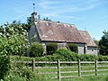
 Ashwell House (geograph 6029374).jpg 4,288 × 2,848; 1.91 MB
-
 Ashwell House - geograph.org.uk - 6034033.jpg 3,997 × 2,135; 1.89 MB
-
 Avenue House - geograph.org.uk - 5430625.jpg 4,320 × 3,240; 3.25 MB
-
 B3192 - geograph.org.uk - 5806330.jpg 640 × 364; 83 KB
-
 B3192 - geograph.org.uk - 5806345.jpg 640 × 426; 60 KB
-
 B3192 - geograph.org.uk - 5806348.jpg 640 × 426; 38 KB
-

-
 B3192 on Little Haldon - geograph.org.uk - 2795067.jpg 800 × 600; 293 KB
-
 B3192, Colley Lane Cross - geograph.org.uk - 5806346.jpg 640 × 384; 38 KB
-
 B3192, Haldon Hills - geograph.org.uk - 5806332.jpg 640 × 426; 46 KB
-
 B3192, Haldon Hills - geograph.org.uk - 5806338.jpg 640 × 401; 37 KB
-
 B3192, Little Haldon - geograph.org.uk - 5806334.jpg 640 × 399; 59 KB
-
 B3192, Little Haldon - geograph.org.uk - 5806336.jpg 640 × 426; 44 KB
-
 Bare field beside Humber Lane - geograph.org.uk - 3412648.jpg 640 × 480; 84 KB
-

-
 Barley field by The Lea - geograph.org.uk - 914945.jpg 640 × 480; 144 KB
-
 Barn beside Beacon Park Plantation - geograph.org.uk - 2793493.jpg 800 × 600; 432 KB
-

-
 Barn near Humber - geograph.org.uk - 676778.jpg 640 × 480; 101 KB
-
 Barn near Humber Barn - geograph.org.uk - 3454128.jpg 640 × 430; 59 KB
-
 Barn or shed beside Shepherds Lane - geograph.org.uk - 2804942.jpg 800 × 600; 511 KB
-
 Barn wall with Victorian letterbox - geograph.org.uk - 1320675.jpg 480 × 640; 106 KB
-
 Barn, Westhayes Farm - geograph.org.uk - 3440228.jpg 640 × 430; 61 KB
-
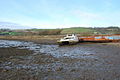 Beached and falling apart - geograph.org.uk - 1078210.jpg 640 × 429; 73 KB
-
 Beech tree by a track crossing a ridge - geograph.org.uk - 1322205.jpg 480 × 640; 129 KB
-
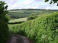 Bend in the lane to Hamblecombe Barton - geograph.org.uk - 1320542.jpg 640 × 480; 104 KB
-
 Bend on the A381 towards Newton Abbot - geograph.org.uk - 5740285.jpg 1,024 × 662; 141 KB
-
 Bend, B3192 - geograph.org.uk - 5806331.jpg 640 × 326; 44 KB
-
 Birds feeding, Teign Estuary - geograph.org.uk - 5801945.jpg 640 × 425; 95 KB
-
 Bishopsteignton (2022-07-09) 01.jpg 5,167 × 3,444; 15.18 MB
-
 Bishopsteignton (2022-07-09) 02.jpg 5,568 × 3,712; 15.65 MB
-
 Bishopsteignton (2022-07-09) 03.jpg 5,568 × 3,712; 21.38 MB
-
 Bishopsteignton (2022-07-09) 04.jpg 3,712 × 5,568; 20.01 MB
-
 Bishopsteignton (2022-07-09) 05.jpg 5,568 × 3,712; 18.65 MB
-
 Bishopsteignton (2022-07-09) 06.jpg 5,568 × 3,712; 21.5 MB
-
 Bishopsteignton (2022-07-09) 07.jpg 5,568 × 3,712; 16.9 MB
-
 Bishopsteignton (2022-07-09) 08.jpg 5,568 × 3,712; 16.66 MB
-
 Bishopsteignton (2022-07-09) 09.jpg 5,568 × 3,712; 15.45 MB
-
 Bishopsteignton (2022-07-09) 10.jpg 5,568 × 3,712; 14.6 MB
-
 Bishopsteignton (2022-07-09) 11.jpg 5,568 × 3,712; 20.11 MB
-
 Bishopsteignton (2022-07-09) 13.jpg 5,568 × 3,712; 18.77 MB
-
 Bishopsteignton (2022-07-09) 14.jpg 5,568 × 3,712; 18.34 MB
-
 Bishopsteignton (2022-07-09) 15.jpg 5,568 × 3,712; 21.46 MB
-
 Bishopsteignton (2022-07-09) 16.jpg 5,568 × 3,712; 16.56 MB
-
 Bishopsteignton (2022-07-09) 17.jpg 5,568 × 3,712; 14.13 MB
-
 Bishopsteignton (2022-07-09) 18.jpg 5,568 × 3,712; 13.98 MB
-
 Bishopsteignton (2022-07-09) 20.jpg 5,568 × 3,712; 16.65 MB
-
 Bishopsteignton (2022-07-09) 21.jpg 5,568 × 3,712; 13.55 MB
-
 Bishopsteignton (2022-07-09) 22.jpg 5,568 × 3,712; 17.03 MB
-
 Bishopsteignton (2022-07-09) 24.jpg 5,568 × 3,712; 17.71 MB
-
 Bishopsteignton (2022-07-09) 25.jpg 5,568 × 3,712; 19.08 MB
-
 Bishopsteignton (2022-07-09) 27.jpg 5,568 × 3,712; 15.33 MB
-
 Bishopsteignton (2022-07-09) 29.jpg 5,568 × 3,712; 16.82 MB
-
 Bishopsteignton (2022-07-09) 30.jpg 5,568 × 3,712; 19.71 MB
-
 Bishopsteignton (2022-07-09) 34.jpg 5,568 × 3,712; 18.01 MB
-
 Bishopsteignton (2022-07-09) 37.jpg 5,568 × 3,712; 18.59 MB
-
 Bishopsteignton (2022-07-09) 38.jpg 5,568 × 3,712; 16.29 MB
-
 Bishopsteignton (2022-07-09) 39.jpg 5,568 × 3,712; 14.89 MB
-
 Bishopsteignton (2022-07-09) 41.jpg 5,568 × 3,712; 18.63 MB
-
 Bishopsteignton (2022-07-09) 42.jpg 5,568 × 3,712; 14.83 MB
-
 Bishopsteignton (2022-07-09) 43.jpg 5,568 × 3,712; 15.74 MB
-
 Bishopsteignton (2022-07-09) 44.jpg 5,568 × 3,712; 16.06 MB
-
 Bishopsteignton (2022-07-09) 45.jpg 3,712 × 5,568; 16.42 MB
-
 Bishopsteignton (2022-07-09) 46.jpg 3,712 × 5,568; 16.93 MB
-
 Bishopsteignton (2022-07-09) 47.jpg 3,712 × 5,568; 14.43 MB
-
 Bishopsteignton (2022-07-09) 48.jpg 5,568 × 3,712; 13.51 MB
-
 Bishopsteignton (2022-07-09) 49.jpg 5,568 × 3,712; 13.81 MB
-
 Bishopsteignton (2022-07-09) 50.jpg 5,568 × 3,712; 14.67 MB
-
 Bishopsteignton (2022-07-09) 51.jpg 5,568 × 3,712; 15.19 MB
-
 Bishopsteignton (2022-07-09) 54.jpg 5,568 × 3,712; 19.23 MB
-
 Bishopsteignton (2022-07-09) 55.jpg 3,712 × 5,568; 16.45 MB
-
 Bishopsteignton (2022-07-09) 56.jpg 5,568 × 3,712; 17.38 MB
-
 Bishopsteignton (2022-07-09) 57.jpg 5,568 × 3,712; 16.86 MB
-
 Bishopsteignton (2022-07-09) 58.jpg 3,712 × 5,568; 18.04 MB
-
 Bishopsteignton (2022-07-09) 59.jpg 5,568 × 3,712; 18.23 MB
-
 Bishopsteignton (2022-07-09) 60.jpg 5,568 × 3,712; 15.87 MB
-
 Bishopsteignton (2022-07-09) 61.jpg 5,568 × 3,712; 14.39 MB
-
 Bishopsteignton (2022-07-09) 62.jpg 5,568 × 3,712; 18.73 MB
-
 Bishopsteignton (2022-07-09) 63.jpg 3,712 × 5,568; 16.45 MB
-
 Bishopsteignton (2022-07-09) 64.jpg 5,568 × 3,712; 15.36 MB
-
 Bishopsteignton (2022-07-09) 65.jpg 5,568 × 3,712; 17.93 MB
-
 Bishopsteignton (2022-07-09) 66.jpg 5,568 × 3,712; 14.47 MB
-
 Bishopsteignton (2022-07-09) 67.jpg 5,568 × 3,712; 19.38 MB
-
 Bishopsteignton (2022-07-09) 68.jpg 5,568 × 3,712; 18.19 MB
-
 Bishopsteignton (2022-07-09) 69.jpg 5,568 × 3,712; 18.88 MB
-
 Bishopsteignton (2022-07-09) 70.jpg 5,568 × 3,712; 19.72 MB
-
 Bishopsteignton (2022-07-09) 71.jpg 5,568 × 3,712; 19.13 MB
-
 Bishopsteignton (2022-07-09) 72.jpg 3,712 × 5,568; 15.82 MB
-
 Bishopsteignton (2022-07-09) 73.jpg 5,568 × 3,712; 17.78 MB
-
 Bishopsteignton (2022-07-09) 74.jpg 5,568 × 3,712; 16.22 MB
-
 Bishopsteignton (2022-07-09) 75.jpg 5,568 × 3,712; 20.49 MB
-
 Bishopsteignton (2022-07-09) 76.jpg 5,568 × 3,712; 15.47 MB
-
 Bishopsteignton (2022-07-09) 77.jpg 5,568 × 3,712; 13.81 MB
-
 Bishopsteignton (2022-07-09) 78.jpg 5,568 × 3,712; 17.96 MB
-
 Bishopsteignton (2022-07-09) 79.jpg 5,568 × 3,712; 16.11 MB
-
 Bishopsteignton (2022-07-09) 80.jpg 5,568 × 3,712; 18.13 MB
-
 Bishopsteignton (2022-07-09) 81.jpg 5,568 × 3,712; 19.29 MB
-
 Bishopsteignton - Stagecoach 19992 (LRV992).JPG 1,366 × 910; 385 KB
-
 Bishopsteignton - Teignmouth boundary - geograph.org.uk - 5754784.jpg 932 × 743; 348 KB
-
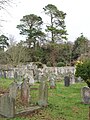
 Bishopsteignton Cemetery - geograph.org.uk - 970633.jpg 640 × 427; 111 KB
-

-
 Bishopsteignton field - geograph.org.uk - 22748.jpg 640 × 425; 144 KB
-
 Bishopsteignton footpath - geograph.org.uk - 1078084.jpg 640 × 429; 104 KB
-
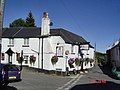 Bishopsteignton pub - geograph.org.uk - 20706.jpg 640 × 480; 120 KB
-
 Bishopsteignton Viewed from Arch Brook - geograph.org.uk - 13319.jpg 630 × 242; 66 KB
-
 Bishopsteignton, 19 March 2013.jpg 2,816 × 2,112; 1.15 MB
-

-
 Boat moored on Teign estuary - geograph.org.uk - 5838677.jpg 1,024 × 696; 120 KB
-
 Boating on the Teign - geograph.org.uk - 552910.jpg 480 × 640; 76 KB
-
-

-
 Bracken unfurling, Little Haldon - geograph.org.uk - 1326940.jpg 640 × 427; 118 KB
-
 Bridge beneath the Railway near Teignmouth - geograph.org.uk - 4039908.jpg 4,000 × 3,000; 2.83 MB
-
 Bridge over Moor Brook in Luton - geograph.org.uk - 2793080.jpg 800 × 600; 451 KB
-
 Broadmeadow valley - geograph.org.uk - 2904328.jpg 640 × 402; 80 KB
-
 Broadmeadow, Teignmouth, from The Lea - geograph.org.uk - 120007.jpg 640 × 484; 78 KB
-
 Broadmeadow, the house - geograph.org.uk - 2095558.jpg 640 × 480; 353 KB
-
 Broken boat at Luxtons Steps near Bishopsteignton (geograph 5742266).jpg 1,280 × 960; 2.73 MB
-
 Brook next to the road through Luton - geograph.org.uk - 2320797.jpg 640 × 480; 113 KB
-

-
 Bungalows, Coombe Way - geograph.org.uk - 2090745.jpg 640 × 480; 326 KB
-
 Bunkers, Teignmouth Golf Club - geograph.org.uk - 3426330.jpg 640 × 430; 38 KB
-
 Bus stop or lay-by on A381 - geograph.org.uk - 5754765.jpg 577 × 510; 139 KB
-
 Byway in Luton - geograph.org.uk - 3432890.jpg 640 × 430; 82 KB
-
 Byway off Humber Lane - geograph.org.uk - 3454085.jpg 640 × 430; 129 KB
-
 Byway to Lower Rixdale Farm - geograph.org.uk - 3432914.jpg 640 × 430; 95 KB
-
 Byway to Luton - geograph.org.uk - 3454119.jpg 640 × 430; 99 KB
-
 Caravan Park Near Kingsteignton - geograph.org.uk - 4686071.jpg 640 × 438; 50 KB
-
 Caravan Park, Wear Farm - geograph.org.uk - 5443712.jpg 640 × 426; 50 KB
-
 Caravan park, Weare Farm - geograph.org.uk - 5679458.jpg 640 × 426; 60 KB
-
 Caravan site, Weare Farm - geograph.org.uk - 5726174.jpg 640 × 366; 41 KB
-
 Cast iron inspection cover, West Street, Bishopsteignton - geograph.org.uk - 6240532.jpg 1,024 × 1,024; 491 KB
-
 Chalets and shanties, Luxton's Steps - geograph.org.uk - 3047508.jpg 640 × 480; 426 KB
-
 Chalets at Luxton’s Steps, near Bishopsteignton - geograph.org.uk - 5743192.jpg 1,280 × 960; 2.49 MB
-
 Chapel lychgate - geograph.org.uk - 5424725.jpg 4,213 × 3,160; 4.05 MB
-
 Chapel of ease - geograph.org.uk - 5424723.jpg 4,320 × 3,240; 3.96 MB
-
 Chapel of St John The Evangelist - geograph.org.uk - 3439950.jpg 640 × 430; 52 KB
-
 Chapel of St John The Evangelist - geograph.org.uk - 3439953.jpg 640 × 430; 75 KB
-
 Church in Bishopsteignton - geograph.org.uk - 4039828.jpg 3,000 × 4,000; 3.29 MB
-
 Church Rd - geograph.org.uk - 3439939.jpg 640 × 430; 60 KB
-
 Church Rd, Rixdale Rd junction - geograph.org.uk - 3432895.jpg 640 × 430; 95 KB
-
 Church Road, Bishopsteignton - geograph.org.uk - 2066236.jpg 640 × 480; 284 KB
-
-
 Clanage Cross, Bishopsteignton - geograph.org.uk - 970639.jpg 640 × 427; 83 KB
-
 Class 52 D1058 Western Nobleman, Teignmouth, 13 November 1976 (2).jpg 4,248 × 2,948; 2.22 MB
-

-
 Club house, Teignmouth Golf Course - geograph.org.uk - 3464729.jpg 640 × 430; 99 KB
-
 Club house, Teignmouth Golf Course - geograph.org.uk - 3464737.jpg 640 × 356; 68 KB
-
 Cockhaven Close play area, Bishopsteignton - geograph.org.uk - 6237450.jpg 1,024 × 682; 229 KB
-
 Collecting fishing bait at low tide in the River Teign - geograph.org.uk - 6211415.jpg 4,262 × 3,200; 2.41 MB
-
 Colley Lane - geograph.org.uk - 1167991.jpg 640 × 480; 75 KB
-
 Colley Lane - geograph.org.uk - 3309204.jpg 640 × 401; 31 KB
-
 Colley Lane - geograph.org.uk - 3309206.jpg 640 × 430; 47 KB
-
 Colley Lane Cross on B3192 - geograph.org.uk - 2795082.jpg 800 × 600; 239 KB
-
 Colley Lane entering Court Bottom - geograph.org.uk - 2795094.jpg 800 × 720; 392 KB
-
 Colley Lane with winter trees - geograph.org.uk - 2795090.jpg 800 × 666; 393 KB
-
 Colmansford Bridge - geograph.org.uk - 2793096.jpg 800 × 600; 353 KB
-
 Colmansford Bridge - geograph.org.uk - 3855336.jpg 1,536 × 1,152; 1.17 MB
-
 Combe Lane - geograph.org.uk - 3464858.jpg 640 × 430; 85 KB
-

-
 Commemorative hornbeam - geograph.org.uk - 6126360.jpg 1,280 × 857; 1.5 MB
-
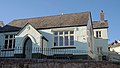 Community Centre, Bishopsteignton - geograph.org.uk - 988438.jpg 640 × 364; 55 KB
-
 Conifer plantation, Humber Down - geograph.org.uk - 1322581.jpg 640 × 480; 150 KB
-
 Conifers, Humber Down - geograph.org.uk - 3460987.jpg 640 × 430; 101 KB
-
 Conifers, Humber Down - geograph.org.uk - 3460991.jpg 640 × 430; 115 KB
-
 Conifers, Humber Down - geograph.org.uk - 3461077.jpg 640 × 430; 128 KB
-
 Conifers, Humber Down - geograph.org.uk - 3461080.jpg 640 × 430; 75 KB
-
 Coombe - geograph.org.uk - 3464839.jpg 640 × 430; 59 KB


_-_geograph.org.uk_-_1322352.jpg)


.jpg)


_01.jpg)
_02.jpg)
_03.jpg)
_04.jpg)
_05.jpg)
_06.jpg)
_07.jpg)
_08.jpg)
_09.jpg)
_10.jpg)
_11.jpg)
_13.jpg)
_14.jpg)
_15.jpg)
_16.jpg)
_17.jpg)
_18.jpg)
_20.jpg)
_21.jpg)
_22.jpg)
_24.jpg)
_25.jpg)
_27.jpg)
_29.jpg)
_30.jpg)
_34.jpg)
_37.jpg)
_38.jpg)
_39.jpg)
_41.jpg)
_42.jpg)
_43.jpg)
_44.jpg)
_45.jpg)
_46.jpg)
_47.jpg)
_48.jpg)
_49.jpg)
_50.jpg)
_51.jpg)
_54.jpg)
_55.jpg)
_56.jpg)
_57.jpg)
_58.jpg)
_59.jpg)
_60.jpg)
_61.jpg)
_62.jpg)
_63.jpg)
_64.jpg)
_65.jpg)
_66.jpg)
_67.jpg)
_68.jpg)
_69.jpg)
_70.jpg)
_71.jpg)
_72.jpg)
_73.jpg)
_74.jpg)
_75.jpg)
_76.jpg)
_77.jpg)
_78.jpg)
_79.jpg)
_80.jpg)
_81.jpg)
.JPG)


.jpg)


.jpg)


