Category:Bismarckturm (Plauen)
| Object location | | View all coordinates using: OpenStreetMap |
|---|
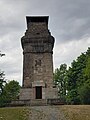
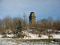
observation tower on Kemmler mountain near Plauen  ,_Innenansicht_(2).jpg) | |||||
| Upload media | |||||
| Instance of | |||||
|---|---|---|---|---|---|
| Named after | |||||
| Location | |||||
| Street address |
| ||||
| Heritage designation | |||||
| Inception |
| ||||
| Height |
| ||||
 | |||||
| (Wikidata) |
Media in category "Bismarckturm (Plauen)"
The following 20 files are in this category, out of 20 total.
-
 Bismarckturm (Kemmlerturm) (1).jpg 3,000 × 4,000; 1.91 MB
-
 Bismarckturm (Kemmlerturm) (2).jpg 3,000 × 4,000; 2.94 MB
-
 Bismarckturm (Kemmlerturm) (4).jpg 3,000 × 4,000; 3.29 MB
-
 Bismarckturm (Kemmlerturm) (5).jpg 3,000 × 4,000; 3.51 MB
-
 Bismarckturm (Kemmlerturm) (6).jpg 3,000 × 4,000; 3.3 MB
-
 Bismarckturm (Kemmlerturm) mit Triangulationssäule.jpg 3,000 × 4,000; 3.89 MB
-
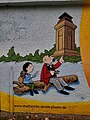 Bismarckturm (Kemmlerturm), Bild mit Vater und Sohn (2).jpg 3,000 × 4,000; 4.59 MB
-
 Bismarckturm (Kemmlerturm), Infotafel Erbauung.jpg 3,000 × 4,000; 1.64 MB
-
 Bismarckturm (Kemmlerturm), Infotafel Geschichte.jpg 2,635 × 3,513; 1.23 MB
-
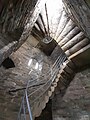
 Bismarckturm (Kemmlerturm), Innenansicht (1).jpg 3,000 × 4,000; 2.27 MB
-
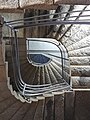
 Bismarckturm (Kemmlerturm), Innenansicht (2).jpg 1,932 × 2,576; 1.73 MB
-
 Kemmler Plauen Miniatur.JPG 1,488 × 1,691; 514 KB
-
 Plauen (Vgtl.), Sachsen - Bismarcksäule (back) (Zeno Ansichtskarten).jpg 2,169 × 1,383; 242 KB
-
 Plauen (Vgtl.), Sachsen - Bismarcksäule (Zeno Ansichtskarten).jpg 1,380 × 2,174; 450 KB
-
 Plauen Kemmler Bismarckturm.jpg 2,100 × 1,400; 727 KB
-
 Plauen Kemmler von Stadtgalerie.jpg 2,400 × 1,600; 688 KB
-
 Plauen Kemmler.jpg 2,592 × 1,944; 1.57 MB
-
 Plauen-Stöckigt Kemmlerturm IMG 1439.jpg 3,000 × 4,000; 7.22 MB
-
 Plauen-Stöckigt Kemmlerturm IMG 1441.jpg 4,000 × 3,000; 6.36 MB
-
 Plauen-Stöckigt Kemmlerturm IMG 1506.jpg 3,000 × 4,000; 4.65 MB
_(1).jpg)
_(2).jpg)
_(4).jpg)
_(5).jpg)
_(6).jpg)
_mit_Triangulationss%C3%A4ule.jpg)
,_Bild_mit_Vater_und_Sohn_(2).jpg)
,_Infotafel_Erbauung.jpg)
,_Infotafel_Geschichte.jpg)
,_Innenansicht_(1).jpg)

,_Sachsen_-_Bismarcks%C3%A4ule_(back)_(Zeno_Ansichtskarten).jpg)
,_Sachsen_-_Bismarcks%C3%A4ule_(Zeno_Ansichtskarten).jpg)


