Category:Blanchardstown (townland)
townland in Blanchardstown, County Dublin, Ireland | |||||
| Upload media | |||||
| Instance of | |||||
|---|---|---|---|---|---|
| Location |
| ||||
 | |||||
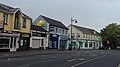
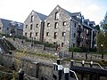
Blanchardstown is a townland in the civil parish of Castleknock, in the ancient barony of Castleknock. It is not co-terminous with the informal residential area known as Blanchardstown. Many of the residential areas in that district are actually located in the adjacent townland of Sheepmoor. Despite the name, Castleknock railway station is located in the townland of Blanchardstown. The townland is bordered to the north by the river Tolka, to the south by the townland of Castleknock (or roughly speaking the line of the M50 mothorway), to the southwest by the townland of Carpenterstown and to the northwest by the townland of Sheepmoor. The townland is bisected (from west to east) by the Royal Canal. The part that lies to the south of the canal contains much of the district informally known as "Laurel Lodge". The part lying to the north of the canal contains the village proper and surrounding housing estates. Despite the name, the Blanchardstown Shopping Centre lies outside the townland and is instead located in the townland of Coolmine.
Subcategories
This category has the following 7 subcategories, out of 7 total.
B
- Brady's Pub, Blanchardstown (1 F)
G
- Granard Bridge (6 F)
R
- Royal Canal (12th lock) (10 F)
T
- The Bell, Blanchardstown (2 F)
Media in category "Blanchardstown (townland)"
The following 16 files are in this category, out of 16 total.
-
 Blanchardstown crossroads 2020.jpg 3,264 × 1,836; 2.03 MB
-
 Blanchardstown Garda Station 2020.jpg 3,264 × 1,836; 1.75 MB
-

-
 Church Lane Blanchardstown Village (2021).jpg 4,128 × 3,096; 4.55 MB
-
 Justin's veg shop Blanchardstown.jpg 3,264 × 1,836; 1.98 MB
-
 National Famine Way, 12th Lock Royal Canal Dublin (2019).jpg 1,452 × 2,592; 1.48 MB
-
 Royal Canal, Carpenterstown, Co. Dublin - geograph.org.uk - 857725.jpg 640 × 480; 145 KB
-
 Scoil Bhríde buachaillí 2021.jpg 4,000 × 3,000; 2.35 MB
-
 Scoil Bhríde Cailíní sunset.jpg 4,000 × 3,000; 2.19 MB
-
 Slowest lights in Ireland 2020.jpg 3,264 × 1,836; 2.13 MB
-
 St Patricks's Day parade, March 2015, Blanchardstown.JPG 2,592 × 1,944; 1.25 MB
-
 Streamlet boundary of Castleknock & Blanchardstown.jpg 1,836 × 3,264; 3.33 MB
-
 Tolka bridge by Connolly Hospital (cropped).jpg 1,836 × 2,519; 2.78 MB
-
 Tolka bridge by Connolly Hospital.jpg 1,836 × 3,264; 3.42 MB
-
-
 Roselawn Shopping Centre - geograph.org.uk - 519238.jpg 640 × 480; 76 KB


.jpg)

.jpg)


.jpg)


