Category:Blokhuispoort
| Object location | | View all coordinates using: OpenStreetMap |
|---|
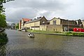
former prison in Leeuwarden, Netherlands .jpg) | |||||
| Upload media | |||||
| Instance of | |||||
|---|---|---|---|---|---|
| Location | Leeuwarden, Friesland, Netherlands | ||||
| Street address |
| ||||
| Architect | |||||
| Occupant |
| ||||
| Heritage designation |
| ||||
| Inception |
| ||||
 | |||||
|
This is a category about rijksmonument number 516486
|
| Address |
|
Subcategories
This category has the following 2 subcategories, out of 2 total.
D
- Dbieb Leeuwarden (21 F)
G
- Gedenkraam Blokhuispoort (1 F)
Media in category "Blokhuispoort"
The following 34 files are in this category, out of 34 total.
-
 20180720 313 leeuwarden.jpg 6,000 × 4,000; 12.55 MB
-
 20180721 476 leeuwarden.jpg 6,000 × 4,000; 11.08 MB
-
 20180721 477 leeuwarden.jpg 6,000 × 4,000; 10.36 MB
-
 20190227 Blokhuispoort Leeuwarden.jpg 5,184 × 3,456; 3.58 MB
-
 20190227 Zicht vanaf 1e Kanaalbrug Leeuwarden naar het westen.jpg 5,184 × 3,456; 3.39 MB
-
 20190227 Zicht2 vanaf 1e Kanaalbrug Leeuwarden naar het westen.jpg 5,184 × 3,456; 2.77 MB
-
 20200830 06 Leeuwarden - Blokhuispoort (50304671537).jpg 5,184 × 3,456; 7.93 MB
-
 Blokhuispoort Leeuwarden 2022.jpg 7,360 × 4,912; 13.53 MB
-
 Blokhuispoort Leeuwarden.jpg 3,264 × 4,928; 8.27 MB
-
 Blokhuispoort1499.jpg 291 × 329; 36 KB
-
 Executieburg.jpg 5,194 × 3,480; 2.23 MB
-
 Gevangenis, exterieur - Leeuwarden - 20133070 - RCE.jpg 1,200 × 806; 192 KB
-
 Gevel naast poortgebouw - Leeuwarden - 20132296 - RCE.jpg 1,190 × 1,200; 382 KB
-
 Gezicht op poortgebouw - Leeuwarden - 20132292 - RCE.jpg 1,186 × 1,200; 353 KB
-
 Leeuwarden Blokhuispoort 40 Voormalige Gevangenis Blokhuispoort vanuit het zuiden.JPG 1,600 × 1,200; 357 KB
-
 Leeuwarden Blokhuispoort 40 Voormalige Gevangenis Blokhuispoort.jpg 4,000 × 3,000; 1.51 MB
-
 Open deuren, Leeuwarden.jpg 3,910 × 2,932; 4.11 MB
-
 Overzicht - Leeuwarden - 20132297 - RCE.jpg 1,200 × 1,200; 268 KB
-
 Overzicht - Leeuwarden - 20132298 - RCE.jpg 1,190 × 1,200; 298 KB
-
 Poortgebouw - Leeuwarden - 20132291 - RCE.jpg 1,190 × 1,200; 321 KB
-
 Poortgebouw - Leeuwarden - 20132293 - RCE.jpg 1,188 × 1,200; 366 KB
-
 Vanaf voorplein - Leeuwarden - 20132294 - RCE.jpg 1,185 × 1,200; 359 KB
-
 Voormalige gevangenis Leeuwarden.jpg 2,592 × 1,695; 738 KB
-
 Voorplein - Leeuwarden - 20132295 - RCE.jpg 1,190 × 1,200; 436 KB
-
 WLM - mringenoldus - Blokhuispoort (1).jpg 683 × 1,024; 462 KB
-
 WLM - mringenoldus - Blokhuispoort (2).jpg 683 × 1,024; 377 KB
-
 WLM - mringenoldus - Blokhuispoort (3).jpg 683 × 1,024; 389 KB
-
 WLM - mringenoldus - Blokhuispoort (4).jpg 1,024 × 683; 447 KB
-
 WLM - mringenoldus - Blokhuispoort (5).jpg 683 × 1,024; 450 KB
-
 WLM - mringenoldus - Blokhuispoort.jpg 683 × 1,024; 356 KB
-
 WLM - mringenoldus - IMG 8050.jpg 683 × 1,024; 348 KB
-
 Zijgevel - Leeuwarden - 20132299 - RCE.jpg 1,200 × 1,200; 282 KB
-
 Zijgevel - Leeuwarden - 20132300 - RCE.jpg 1,197 × 1,200; 266 KB
-
 Zijkant Blokhuispoort Leeuwarden.JPG 4,032 × 3,024; 2.28 MB


.jpg)


.jpg)
.jpg)
.jpg)
.jpg)


