Category:Blorenge

hill (561m) in Monmouthshire  | |||||
| Upload media | |||||
| Instance of | |||||
|---|---|---|---|---|---|
| Located in protected area | |||||
| Location | Monmouthshire, Wales | ||||
| Heritage designation | |||||
| Mountain range | |||||
| Topographic prominence |
| ||||
| Elevation above sea level |
| ||||
| Parent peak | |||||
 | |||||
Subcategories
This category has the following 4 subcategories, out of 4 total.
Media in category "Blorenge"
The following 107 files are in this category, out of 107 total.
-
 A pair of houses, and Blorenge - geograph.org.uk - 1279642.jpg 640 × 480; 43 KB
-
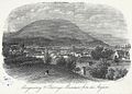 Abergavenny & Blorenge mountain from the asylum (1130790).jpg 1,000 × 716; 238 KB
-
 Abergavenny & Blorenge mountain from the asylum.jpeg 700 × 502; 190 KB
-
 Bench and the Blorenge.jpg 5,472 × 3,648; 10.58 MB
-
 Blorenge - geograph.org.uk - 43232.jpg 640 × 426; 115 KB
-
 Blorenge - view South - geograph.org.uk - 5653.jpg 640 × 480; 46 KB
-
 Blorenge - view west - geograph.org.uk - 221863.jpg 640 × 326; 50 KB
-

-
 Blorenge looms behind Llanfoist's moraine-by-Alan-Bowring.jpg 2,816 × 2,112; 2.5 MB
-
 Blorenge Quarries Tramroad, Llanfoist Fawr.jpg 3,968 × 2,406; 1.42 MB
-
 Blorenge trig point and cairn - geograph.org.uk - 901710.jpg 640 × 480; 87 KB
-
 Blorenge's North Slopes.jpg 5,472 × 3,648; 8.91 MB
-

-

-

-
 Blorenge, the Trig point (559m) - geograph.org.uk - 924847.jpg 600 × 450; 136 KB
-

-
 Blorenge, track on the north west flank - geograph.org.uk - 924842.jpg 600 × 450; 188 KB
-

-
 Blorenge.jpg 3,157 × 2,425; 3.43 MB
-

-

-
 Carn Blorenge and Trig Point, Llanfoist Fawr - geograph - 2710401.jpg 4,000 × 3,000; 2.75 MB
-

-
 Cefn y Galchen - geograph.org.uk - 492257.jpg 640 × 459; 68 KB
-
 Craig-y-dorth, view due west - geograph.org.uk - 337210.jpg 640 × 480; 67 KB
-
 Cwm Craf above Abergavenny - geograph.org.uk - 744409.jpg 640 × 480; 80 KB
-
 Cwm Craf, Blorenge - geograph.org.uk - 368718.jpg 640 × 480; 150 KB
-
-
 Figyn-fawr Pond - geograph.org.uk - 710734.jpg 640 × 480; 89 KB
-
 Footpath above Pwll Du quarry - geograph.org.uk - 498348.jpg 640 × 480; 174 KB
-

-
 Footpath marker post on Blorenge - geograph.org.uk - 553466.jpg 640 × 480; 56 KB
-
 Foxhunter's Carpark, Blorenge - geograph.org.uk - 1105375.jpg 640 × 480; 26 KB
-
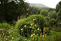
 Gardens and Mist - geograph.org.uk - 1773930.jpg 1,600 × 1,200; 513 KB
-
 Garnddyrys, ironworks remains and tramroad, Blorenge, Llanfoist Fawr.jpg 3,516 × 2,034; 1.03 MB
-
 Glebe Wood - panoramio - Jynto.jpg 2,411 × 3,244; 3.56 MB
-
 Glebe Wood - panoramio.jpg 2,387 × 3,251; 2.01 MB
-
 Grassed-over stubble - geograph.org.uk - 1631654.jpg 640 × 480; 244 KB
-
 Green lane - Lôn las - geograph.org.uk - 498330.jpg 480 × 640; 140 KB
-
-
 Lawns and the Blorenge - geograph.org.uk - 1773939.jpg 1,600 × 1,200; 488 KB
-
 Linda Vista and the Blorenge.jpg 5,472 × 3,648; 9.97 MB
-

-
 Monmouthshire Golf Club - geograph.org.uk - 5922845.jpg 3,264 × 2,448; 3.17 MB
-
 Near the Summit - panoramio.jpg 3,157 × 2,425; 2.35 MB
-
 Old wireless hut on Blorenge - geograph.org.uk - 901693.jpg 640 × 480; 73 KB
-
 Overlooking Abergavenny - geograph.org.uk - 1369675.jpg 640 × 391; 55 KB
-
 Panoramic view over Abergavenny from the lip of Blorenge by Alan Bowring.jpg 5,504 × 2,095; 1.71 MB
-

-
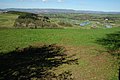
 Pasture land looking towards Blorenge - geograph.org.uk - 926015.jpg 600 × 450; 160 KB
-

-
 Pasture on the eastern flank of Blorenge - geograph.org.uk - 925998.jpg 600 × 450; 195 KB
-

-
 Path Towards the Blorenge.jpg 5,472 × 3,648; 9.89 MB
-

-
 Pool atop Llanelly Hill - geograph.org.uk - 701159.jpg 640 × 480; 90 KB
-
 Poppy and Grass - geograph.org.uk - 889546.jpg 640 × 481; 178 KB
-
 Quarried lip of Cwm Craf - geograph.org.uk - 634679.jpg 640 × 480; 85 KB
-

-
 River Usk near Llanellen - geograph.org.uk - 1288702.jpg 640 × 426; 83 KB
-
 River Usk near The Bryn - geograph.org.uk - 1287266.jpg 640 × 426; 79 KB
-
 Rocky outcrop on the Blorenge - geograph.org.uk - 1105396.jpg 640 × 480; 62 KB
-

-
 Sign post on Blorenge - geograph.org.uk - 1362183.jpg 640 × 480; 141 KB
-
 Slopes of the Blorenge.jpg 2,816 × 2,112; 3.41 MB
-
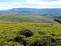
 Southern Slopes of Blorenge - geograph.org.uk - 164447.jpg 640 × 480; 81 KB
-
 Springtime at Raglan Castle - geograph.org.uk - 727742.jpg 640 × 426; 77 KB
-
 Sugar Loaf, Little & Great Skirrid & Blorenge Mountains.jpeg 750 × 547; 170 KB
-
 Summit cairn on Blorenge - geograph.org.uk - 284902.jpg 640 × 427; 58 KB
-

-
 The A40 towards Abergavenny - geograph.org.uk - 364389.jpg 640 × 480; 57 KB
-
 The B4233 at SO464145 - geograph.org.uk - 247479.jpg 640 × 480; 125 KB
-
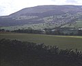
 The Blorenge and Gilwern.jpg 2,112 × 2,816; 5.31 MB
-
 The Lower Usk valley - geograph.org.uk - 1630637.jpg 640 × 480; 255 KB
-
 The Punchbowl, Blorenge - geograph.org.uk - 158142.jpg 640 × 480; 122 KB
-
 The Usk Valley - geograph.org.uk - 1253876.jpg 640 × 426; 84 KB
-
 The very edge of the Blorenge - geograph.org.uk - 158132.jpg 640 × 480; 73 KB
-
 Three layers of landscape - geograph.org.uk - 1300272.jpg 640 × 480; 108 KB
-
 To Blorenge - geograph.org.uk - 484862.jpg 640 × 480; 51 KB
-
 Tor y Foel viewed from Carn Pica - geograph.org.uk - 1106796.jpg 640 × 426; 34 KB
-
 Towards the Brecon Beacons - geograph.org.uk - 890991.jpg 640 × 481; 131 KB
-
 Tractor and rolls near New Hunthouse Farm - geograph.org.uk - 570985.jpg 640 × 426; 119 KB
-
 Trig point and cairn on Blorenge - geograph.org.uk - 1768027.jpg 640 × 480; 71 KB
-
 Under the Canal - panoramio.jpg 3,264 × 2,448; 2.86 MB
-
 Usk Bridge and Blorenge.jpg 5,472 × 3,648; 10.43 MB
-
 View across the Usk to The Blorenge - geograph.org.uk - 1409800.jpg 640 × 480; 110 KB
-
 View east from the Beacons Way - geograph.org.uk - 734313.jpg 640 × 480; 99 KB
-
 View from Blorenge - panoramio.jpg 4,600 × 2,750; 4.8 MB
-
 View from Blorenge.jpg 4,638 × 2,778; 7.59 MB
-

-
 View from the Punchbowl, Blorenge - geograph.org.uk - 1086529.jpg 640 × 480; 48 KB
-
 View to Beech Hill Farm - geograph.org.uk - 1657206.jpg 640 × 480; 46 KB
-
 View west from The Kymin - geograph.org.uk - 890847.jpg 640 × 376; 95 KB
-
 WT Station on Blorenge - geograph.org.uk - 6030.jpg 640 × 480; 78 KB
-
 Bridleway towards Dyffryn - geograph.org.uk - 492265.jpg 640 × 480; 83 KB
-
 Cefn y Galchen - geograph.org.uk - 492259.jpg 640 × 480; 66 KB
-
 Cerrig Calch - geograph.org.uk - 222150.jpg 640 × 480; 72 KB
-
 Descending Cefn Moel - geograph.org.uk - 737628.jpg 640 × 480; 101 KB
-
 Former tramway on Gilwern Hill - geograph.org.uk - 498368.jpg 640 × 480; 125 KB
-
 Leaving Crickhowell - geograph.org.uk - 373290.jpg 640 × 480; 115 KB
-
 Llanvair panorama - geograph.org.uk - 345206.jpg 640 × 480; 60 KB
-
 One of a pair - geograph.org.uk - 492260.jpg 480 × 640; 42 KB
-
 Path to Blorenge - geograph.org.uk - 492266.jpg 640 × 480; 61 KB
-
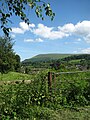
 The Blorenge from the B4598 at Ty'r-pwll - geograph.org.uk - 498684.jpg 640 × 427; 112 KB
-

-
 Valley around Littlemill Farm - geograph.org.uk - 245871.jpg 640 × 480; 98 KB

.jpg)


_-_geograph.org.uk_-_924847.jpg)


