Category:Blunham
village and civil parish in Bedfordshire, UK  | |||||
| Upload media | |||||
| Instance of | |||||
|---|---|---|---|---|---|
| Location | Central Bedfordshire, Bedfordshire, East of England, England | ||||
 | |||||
English: Blunham is a village and civil parish in the Central Bedfordshire district of Bedfordshire, England, about eight miles east of Bedford.
Subcategories
This category has the following 4 subcategories, out of 4 total.
Media in category "Blunham"
The following 81 files are in this category, out of 81 total.
-

-
 2-8 Tempsford Road, Blunham - geograph.org.uk - 2208260.jpg 640 × 480; 90 KB
-
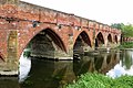 Barford Bridge - geograph.org.uk - 4497804.jpg 1,600 × 1,066; 483 KB
-
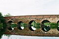
 Barford Bridge - geograph.org.uk - 4543387.jpg 3,264 × 2,448; 4.52 MB
-
 Barford Bridge - geograph.org.uk - 4988085.jpg 640 × 426; 61 KB
-
 Bedfordshire Walking Festival - geograph.org.uk - 1490569.jpg 640 × 480; 155 KB
-
 Blunham - thatched cottage (geograph 7265269).jpg 1,600 × 1,309; 882 KB
-
 Blunham 1960s - geograph.org.uk - 1988011.jpg 1,600 × 935; 166 KB
-
 Blunham gauging station - geograph.org.uk - 2815128.jpg 2,592 × 3,872; 2.96 MB
-
 Blunham Graveyard - geograph.org.uk - 2591479.jpg 768 × 1,024; 267 KB
-
 Blunham Navigation Bridge - geograph.org.uk - 2813875.jpg 3,872 × 2,592; 3.31 MB
-
 Blunham War Memorial, Blunham - geograph.org.uk - 5569079.jpg 1,065 × 1,600; 749 KB
-
 Blunham weir and gauging station - geograph.org.uk - 2815125.jpg 3,872 × 2,592; 3.13 MB
-
 Blunham.JPG 4,608 × 2,455; 1.19 MB
-
 BlunhamRout12GW.JPG 2,816 × 2,112; 2.74 MB
-
 Brickhill Close, Blunham - geograph.org.uk - 4698112.jpg 640 × 480; 63 KB
-

-
-
 By the River - geograph.org.uk - 2583868.jpg 768 × 1,024; 181 KB
-
 Canal boats moored by Barford Bridge - geograph.org.uk - 4543405.jpg 3,264 × 2,448; 3.93 MB
-
 Car crossing Blunham Bridges - geograph.org.uk - 3788369.jpg 4,320 × 3,240; 4.35 MB
-
 Cottages on High Street, Blunham - geograph.org.uk - 4698107.jpg 640 × 480; 52 KB
-
 Crossing Barford Bridge - geograph.org.uk - 4988089.jpg 640 × 352; 43 KB
-

-
 Entrance to Blunham recycling facility - geograph.org.uk - 5599105.jpg 640 × 480; 100 KB
-
 Farm track off The Hill, Blunham - geograph.org.uk - 4698105.jpg 640 × 480; 78 KB
-
 Farmland off Tempsford Road - geograph.org.uk - 4698129.jpg 640 × 480; 61 KB
-
 Footpath to Blunham - geograph.org.uk - 5067100.jpg 1,600 × 1,066; 439 KB
-
 Great Barford bridge again - geograph.org.uk - 4809825.jpg 3,091 × 2,048; 1.94 MB
-
 Great Barford lock - geograph.org.uk - 4810214.jpg 3,091 × 2,048; 2.2 MB
-
 Greenhouses north of Tempsford Road - geograph.org.uk - 4617166.jpg 640 × 480; 48 KB
-
 High Street, Blunham - geograph.org.uk - 4698113.jpg 640 × 480; 65 KB
-
 High Street, Blunham - geograph.org.uk - 5569081.jpg 1,600 × 1,065; 440 KB
-
 High Street, Blunham - geograph.org.uk - 5569222.jpg 1,600 × 1,065; 506 KB
-
 House on Station Road, Blunham - geograph.org.uk - 4617158.jpg 640 × 480; 67 KB
-
 Houses on Station Road, Blunham - geograph.org.uk - 4697789.jpg 640 × 480; 63 KB
-
 Kingfisher Way on the Ivel - geograph.org.uk - 1285331.jpg 640 × 480; 124 KB
-

-
 Long shot of St James and St Edmund, Blunham - geograph.org.uk - 3788312.jpg 4,320 × 3,240; 4.59 MB
-
 Lower School, Blunham - geograph.org.uk - 4698111.jpg 640 × 480; 55 KB
-
 Park Lane, Blunham - geograph.org.uk - 5569215.jpg 1,600 × 1,065; 543 KB
-
 Pyronia tithonus, Blunham, Bedfordshire (4804675507).jpg 3,616 × 2,712; 3.31 MB
-
 River Ivel north of Blunham - geograph.org.uk - 2813836.jpg 3,872 × 2,592; 3.01 MB
-
 River Ivel, Blunham - geograph.org.uk - 4698124.jpg 640 × 480; 108 KB
-
 Route 51 - geograph.org.uk - 176320.jpg 640 × 391; 49 KB
-
 Shoe cottage, Blunham - geograph.org.uk - 1285361.jpg 640 × 480; 66 KB
-
 Sign for the Horseshoes, Blunham - geograph.org.uk - 4617163.jpg 448 × 640; 56 KB
-
 St Edmunds or St James Church, Blunham - geograph.org.uk - 5564670.jpg 1,600 × 1,065; 476 KB
-
 St Edmunds or St James Church, Blunham - geograph.org.uk - 5569186.jpg 1,065 × 1,600; 370 KB
-
 St Edmunds or St James Church, Blunham - geograph.org.uk - 5569196.jpg 1,600 × 1,065; 417 KB
-
 St Edmunds or St James Church, Blunham - geograph.org.uk - 5569202.jpg 1,600 × 1,065; 415 KB
-
 St Edmunds or St James Church, Blunham - geograph.org.uk - 5569207.jpg 1,600 × 1,065; 903 KB
-
 St James ^ St Edmund, Blunham - East end - geograph.org.uk - 3263786.jpg 665 × 1,000; 176 KB
-
 St James ^ St Edmund, Blunham - geograph.org.uk - 3263785.jpg 798 × 1,000; 211 KB
-
 St James ^ St Edmund, Blunham - Reredos - geograph.org.uk - 3263787.jpg 1,000 × 671; 294 KB
-

-
 Station Road, Blunham - geograph.org.uk - 4617161.jpg 640 × 480; 63 KB
-
 Stubble field, Blunham - geograph.org.uk - 4698103.jpg 640 × 480; 59 KB
-
 Tempsford Road - geograph.org.uk - 4698126.jpg 640 × 480; 117 KB
-
 The Great Ouse at Great Barford - geograph.org.uk - 4497807.jpg 1,600 × 1,066; 426 KB
-
 The Horseshoes, Blunham - geograph.org.uk - 4617162.jpg 640 × 480; 57 KB
-

-
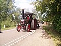 Traction engine in Blunham - geograph.org.uk - 191378.jpg 640 × 480; 133 KB
-
 Traffic calming, Barford Rd - geograph.org.uk - 4988082.jpg 640 × 334; 39 KB
-
 Two pubs and the Church, Blunham - geograph.org.uk - 1285350.jpg 640 × 480; 65 KB
-
 Varsity Line - geograph.org.uk - 5902997.jpg 1,024 × 682; 210 KB
-
 War memorial - geograph.org.uk - 2583854.jpg 768 × 1,024; 269 KB
-
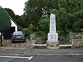 War Memorial, Blunham - geograph.org.uk - 4697791.jpg 640 × 480; 91 KB
-
 War Memorial, Blunham - geograph.org.uk - 5569083.jpg 1,600 × 1,065; 511 KB
-
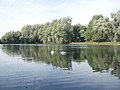 Willington Lake - geograph.org.uk - 3623726.jpg 640 × 480; 68 KB
-
 Willington Lake - geograph.org.uk - 3639896.jpg 640 × 482; 94 KB
-
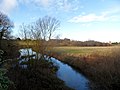 Winter time-the River Ivel near Blunham - geograph.org.uk - 3788306.jpg 4,320 × 3,240; 4.11 MB
-
 Woodland - geograph.org.uk - 176271.jpg 640 × 480; 137 KB
-

-
 Entrance to Abbey Corrugated Ltd - geograph.org.uk - 597956.jpg 640 × 480; 54 KB
-
-
 Housing in Moggerhanger - geograph.org.uk - 426075.jpg 640 × 480; 72 KB
-
 Industrial building - geograph.org.uk - 176325.jpg 640 × 385; 44 KB
-
 Microlight aircraft at Sandy airfield - geograph.org.uk - 19033.jpg 597 × 400; 78 KB
-
 Pony paddocks near Blunham - geograph.org.uk - 449707.jpg 640 × 480; 90 KB
-
 Seat at NCN51 and Footpath Crossing - geograph.org.uk - 390733.jpg 640 × 480; 109 KB


.jpg)


.jpg)


