Category:Boats on the Aire and Calder Navigation
Media in category "Boats on the Aire and Calder Navigation"
The following 58 files are in this category, out of 58 total.
-

-
 A walk from Glass Houghton ^66 - geograph.org.uk - 1997051.jpg 800 × 600; 304 KB
-
 Aire and Calder Navigation - geograph.org.uk - 2734302.jpg 640 × 480; 52 KB
-
 Aire and Calder Navigation at Woodlesford - geograph.org.uk - 5653258.jpg 4,608 × 3,456; 3.99 MB
-
 Aire and Calder Navigation, Whitley - geograph.org.uk - 579853.jpg 640 × 475; 79 KB
-
 Aire ^ Calder Navigation - geograph.org.uk - 4656685.jpg 640 × 480; 65 KB
-
 And then there were three (geograph 5649817).jpg 4,608 × 3,072; 3.34 MB
-
 Boat moored on the Aire and Calder Navigation - geograph.org.uk - 4829826.jpg 2,048 × 1,536; 948 KB
-
 Boats moored in Lemonroyd Marina - geograph.org.uk - 4832367.jpg 2,048 × 1,536; 1.04 MB
-
 Canal and River Trust boat Shipley - geograph.org.uk - 4445961.jpg 1,600 × 1,062; 507 KB
-
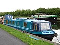
 Canal Boats at Castleford - geograph.org.uk - 4445968.jpg 1,600 × 1,062; 656 KB
-
 Canal Boats at Castleford. - geograph.org.uk - 3041557.jpg 3,084 × 1,952; 1.14 MB
-
 Canal craft Moby ^1 - geograph.org.uk - 4151004.jpg 1,600 × 1,200; 421 KB
-
 Canal craft Moby ^2 - geograph.org.uk - 4151008.jpg 1,600 × 1,200; 438 KB
-
 Canal Dry-Dock. - geograph.org.uk - 3028460.jpg 3,289 × 2,022; 883 KB
-

-
 Canal side moorings at Ramsdens Bridge - geograph.org.uk - 4907906.jpg 800 × 600; 110 KB
-
 Celeste on the Knottingley ^ Goole Navigation - geograph.org.uk - 4120409.jpg 1,600 × 1,064; 816 KB
-
 Christmas tree, Stanley Ferry Marina - geograph.org.uk - 2743940.jpg 1,024 × 768; 529 KB
-
 Coal drop, Aire ^ Calder Navigation, Castleford - geograph.org.uk - 4580349.jpg 1,024 × 768; 200 KB
-
 Contrails - geograph.org.uk - 3983596.jpg 1,600 × 1,200; 335 KB
-
 Converted barge - geograph.org.uk - 5663759.jpg 4,608 × 3,456; 3.04 MB
-
 Converted barge, Papillon - geograph.org.uk - 1828821.jpg 640 × 480; 223 KB
-
 Eskdale barge moored at Ferrybridge - geograph.org.uk - 6304180.jpg 4,608 × 3,072; 1.93 MB
-
 Goole Canal Knottingley - geograph.org.uk - 5650355.jpg 4,118 × 2,258; 1.98 MB
-
 Jubilee Venture, Scouts Narrow Boat - geograph.org.uk - 2729747.jpg 1,024 × 768; 857 KB
-

-
 Knostrop long term moorings - geograph.org.uk - 2766030.jpg 984 × 738; 152 KB
-
 Knottingley junction Aire and Calder canal - geograph.org.uk - 2773242.jpg 4,288 × 3,216; 2 MB
-
 Large barge leaving Bullhome Locks Castleford - geograph.org.uk - 5649815.jpg 4,608 × 3,072; 3.31 MB
-
 Marina at Rawcliffe Bridge.jpg 640 × 480; 149 KB
-
 Moored boats at Ferrybridge - geograph.org.uk - 5674657.jpg 1,600 × 1,055; 425 KB
-
 Narrow Boat entering Knottingley lock - geograph.org.uk - 4021917.jpg 4,608 × 3,456; 3.48 MB
-
 Narrow boat ‘Grumpy Git’ (1) - geograph.org.uk - 1856611.jpg 640 × 480; 250 KB
-
 Narrow boat ‘Grumpy Git’ (2) - geograph.org.uk - 1856614.jpg 640 × 480; 284 KB
-
 Narrowboat Fork‘andles - geograph.org.uk - 1828827.jpg 640 × 480; 318 KB
-
 Notice to dog walkers - geograph.org.uk - 2340061.jpg 1,024 × 765; 734 KB
-
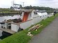
 Old Barges awaiting repair-renovation - geograph.org.uk - 6057136.jpg 4,608 × 3,072; 3.45 MB
-
 Peace Lily on the Aire ^ Calder Navigation at Castleford - geograph.org.uk - 4445876.jpg 1,600 × 1,062; 548 KB
-
 Pollington Bridge - geograph.org.uk - 489764.jpg 640 × 398; 56 KB
-
 Racca Green Knottingley - geograph.org.uk - 5656858.jpg 3,702 × 2,599; 1.81 MB
-
 Renovated barge - geograph.org.uk - 6354082.jpg 4,288 × 3,216; 1.63 MB
-

-
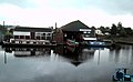
 Supreme Marine Boatyard Castleford - geograph.org.uk - 3041544.jpg 4,078 × 2,924; 1.89 MB
-
 The "Freda Carless" - geograph.org.uk - 6017653.jpg 4,608 × 3,072; 2.92 MB
-
 The 'Spirit of the Age' - geograph.org.uk - 3170454.jpg 1,024 × 661; 240 KB
-
 The barge "Eskdale" at twilight - geograph.org.uk - 6342683.jpg 4,288 × 3,216; 1.43 MB
-
 The Dolly Earle moored at Ferrybridge - geograph.org.uk - 5670012.jpg 3,241 × 2,018; 1.78 MB
-
 The former 'Spirit of the Age' (bow shot) - geograph.org.uk - 3034412.jpg 1,024 × 768; 667 KB
-
 The former 'Spirit of the Age' (stern shot) - geograph.org.uk - 3034414.jpg 1,024 × 768; 794 KB
-
 The Jolly Lamb Narrow boat - geograph.org.uk - 5650356.jpg 4,074 × 2,529; 2.96 MB
-
 View from Lock Lane bridge Castleford - geograph.org.uk - 5649821.jpg 4,053 × 2,503; 2.2 MB
-
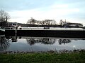
 View from Ramsdens bridge Stanley Ferry - geograph.org.uk - 5701927.jpg 4,608 × 3,072; 2.58 MB
-
 ‘Horizon’ - bow view - geograph.org.uk - 2666507.jpg 1,024 × 768; 547 KB
-
 ‘Horizon’ - stern view - geograph.org.uk - 2666514.jpg 1,024 × 768; 554 KB
-
 ‘Shamrock’ - bow view - geograph.org.uk - 2666499.jpg 1,024 × 768; 623 KB
-
 ‘Shamrock’ - stern view - geograph.org.uk - 2666501.jpg 1,024 × 768; 548 KB
-
 “Oo’da thow’t it” - geograph.org.uk - 2261976.jpg 1,024 × 768; 715 KB


.jpg)


_-_geograph.org.uk_-_1856611.jpg)
_-_geograph.org.uk_-_1856614.jpg)


_-_geograph.org.uk_-_3034412.jpg)
_-_geograph.org.uk_-_3034414.jpg)


