Category:Boltongate
village in Cumbria, United Kingdom  | |||||
| Upload media | |||||
| Instance of | |||||
|---|---|---|---|---|---|
| Location | Boltons, Allerdale, Cumbria, North West England, England | ||||
 | |||||
Subcategories
This category has only the following subcategory.
A
Media in category "Boltongate"
The following 18 files are in this category, out of 18 total.
-
 Bus shelter at Ruthwaite - geograph.org.uk - 577416.jpg 640 × 480; 202 KB
-
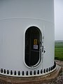 Open door - geograph.org.uk - 583712.jpg 480 × 640; 113 KB
-
 The Bell Church Institute, Boltongate - geograph.org.uk - 476187.jpg 640 × 480; 218 KB
-
 Carlislegate Lane - geograph.org.uk - 112796.jpg 640 × 427; 142 KB
-
 Catlands Hill - geograph.org.uk - 112786.jpg 640 × 427; 114 KB
-
 Drinking fountain or seat - geograph.org.uk - 475566.jpg 640 × 480; 174 KB
-
 Dual Carriageway - geograph.org.uk - 112802.jpg 640 × 427; 85 KB
-
 Duff Signpost - geograph.org.uk - 104935.jpg 640 × 480; 65 KB
-
 Ellen Bank Farm - geograph.org.uk - 112794.jpg 640 × 427; 94 KB
-
 Field Entrance - geograph.org.uk - 112798.jpg 640 × 427; 92 KB
-
 Hedge and Ditch - geograph.org.uk - 104929.jpg 480 × 640; 125 KB
-
 Pow Gill - geograph.org.uk - 112888.jpg 640 × 480; 169 KB
-
 Road to The Close - geograph.org.uk - 476188.jpg 640 × 480; 215 KB
-
 Road to Well Rash - geograph.org.uk - 476190.jpg 640 × 480; 159 KB
-
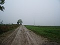 Service road, High Pow Wind Farm - geograph.org.uk - 583713.jpg 640 × 480; 250 KB
-
 Stone trough - geograph.org.uk - 577417.jpg 640 × 480; 124 KB
-
 Tight squeeze - geograph.org.uk - 475565.jpg 640 × 480; 226 KB
-
 Track and Scrubby Woodland - geograph.org.uk - 104922.jpg 640 × 480; 148 KB


