Category:Bonifatiuskerk (Cornwerd)
| Object location | | View all coordinates using: OpenStreetMap |
|---|
church in Friesland, Netherlands  | |||||
| Upload media | |||||
| Instance of | |||||
|---|---|---|---|---|---|
| Dedicated to | |||||
| Location | Cornwerd, Súdwest-Fryslân, Friesland, Netherlands | ||||
| Street address |
| ||||
| Located on street |
| ||||
| Heritage designation |
| ||||
| Inception |
| ||||
| Significant event |
| ||||
| Religion or worldview | |||||
| official website | |||||
 | |||||
|
This is a category about rijksmonument number 352026
|
| Address |
|
Media in category "Bonifatiuskerk (Cornwerd)"
The following 48 files are in this category, out of 48 total.
-
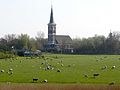
 20140530 Kerk van Cornwerd (Koarnwert) Fr NL.jpg 2,900 × 5,152; 5.55 MB
-
 2023 Koarnwert - Bonifatiustsjerke.jpg 1,599 × 1,600; 1.01 MB
-
 2023 Koarnwert, Bonifatiustsjerke.jpg 1,599 × 1,600; 1.02 MB
-
 Bonifatiuskerk1 Cornwerd.jpg 4,828 × 3,621; 915 KB
-
 Bonifatiuskerk2 Cornwerd.jpg 3,953 × 2,964; 795 KB
-
 Bonifatiuskerk3 Cornwerd.jpg 3,672 × 4,896; 3.37 MB
-
 Bonifatiustsjerke, Koarnwert.jpg 5,477 × 3,651; 21.85 MB
-
 Cornwerd sept 2008.jpg 1,950 × 1,300; 1.3 MB
-
 Cornwerd.jpg 2,309 × 1,732; 1.75 MB
-
 Detail noord-oost gevel - Cornwerd - 20047223 - RCE.jpg 1,200 × 1,192; 419 KB
-
 Detail toren zuidgevel - Cornwerd - 20047220 - RCE.jpg 1,200 × 1,197; 229 KB
-
 Detail zuid-west gevel toren - Cornwerd - 20047219 - RCE.jpg 1,200 × 1,184; 322 KB
-
 Detail zuidgevel - Cornwerd - 20047225 - RCE.jpg 1,197 × 1,200; 415 KB
-
 Detail zuidoostgevel - Cornwerd - 20047226 - RCE.jpg 1,200 × 1,200; 399 KB
-
 Exterieur zuidgevel oude situatie - Cornwerd - 20047215 - RCE.jpg 1,200 × 1,200; 166 KB
-
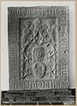
 Fragment retabel - Kornwerd - 20322453 - RCE.jpg 822 × 1,200; 181 KB
-
 Grafsteen - Cornwerd - 20047240 - RCE.jpg 1,200 × 1,190; 368 KB
-
 Grafsteen - Cornwerd - 20047241 - RCE.jpg 1,200 × 1,193; 319 KB
-
 Grafzerk - Kornwerd - 20322454 - RCE.jpg 865 × 1,200; 216 KB
-
 Herenbank - Cornwerd - 20047231 - RCE.jpg 946 × 1,200; 192 KB
-
 Hervormde kerk Conwerd.jpg 4,608 × 3,456; 2.6 MB
-
 Interieur beeldhouwwerk - Cornwerd - 20324362 - RCE.jpg 1,200 × 854; 186 KB
-
 Interieur detail muurwerk - Cornwerd - 20047242 - RCE.jpg 1,200 × 1,190; 377 KB
-
 Interieur grafstenen - Cornwerd - 20047239 - RCE.jpg 959 × 1,200; 168 KB
-
 Interieur naar het koor - Cornwerd - 20047227 - RCE.jpg 1,200 × 935; 178 KB
-
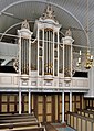
 Interieur naar het orgel - Cornwerd - 20047228 - RCE.jpg 1,200 × 966; 177 KB
-
 Interieur, aanzicht orgel, orgelnummer 268 - Cornwerd - 20370392 - RCE.jpg 856 × 1,200; 421 KB
-
 Makkum 2008 30.jpg 1,080 × 1,920; 504 KB
-
 Noord-oost gevel - Cornwerd - 20047221 - RCE.jpg 959 × 1,200; 252 KB
-
 Noord-west gevel - Cornwerd - 20047217 - RCE.jpg 951 × 1,200; 213 KB
-
 Noordgevel - Cornwerd - 20047222 - RCE.jpg 1,200 × 950; 282 KB
-
 Orgel - Cornwerd - 20047230 - RCE.jpg 950 × 1,200; 185 KB
-
 Preekstoel en doophek - Cornwerd - 20047229 - RCE.jpg 1,200 × 974; 183 KB
-
 Reproductie van oude foto uit 1890 - Kornwerd - 20127040 - RCE.jpg 1,200 × 960; 210 KB
-
 Rouwbord - Cornwerd - 20047234 - RCE.jpg 1,200 × 1,197; 221 KB
-
 Rouwbord - Cornwerd - 20047235 - RCE.jpg 1,200 × 1,195; 221 KB
-
 Rouwbord - Cornwerd - 20047236 - RCE.jpg 1,200 × 1,200; 199 KB
-
 Rouwbord - Cornwerd - 20047237 - RCE.jpg 1,200 × 1,200; 184 KB
-
 Rouwbord - Cornwerd - 20047238 - RCE.jpg 1,191 × 1,200; 246 KB
-
 Stenen thans Fries Museum Leeuwarden - Cornwerd - 20047213 - RCE.jpg 843 × 1,200; 170 KB
-
 Stenen thans Fries Museum Leeuwarden - Cornwerd - 20047214 - RCE.jpg 824 × 1,200; 206 KB
-
 Tiengebodenbord - Cornwerd - 20047233 - RCE.jpg 1,200 × 1,200; 282 KB
-
 Wapenbord van de herenbank - Cornwerd - 20047232 - RCE.jpg 1,195 × 1,200; 242 KB
-
 Westgevel - Cornwerd - 20047216 - RCE.jpg 956 × 1,200; 203 KB
-
 Zicht op Cornwerd.jpg 3,617 × 2,713; 275 KB
-
 Zicht op Cornwerd2.jpg 3,648 × 2,736; 205 KB
-
 Zuidgevel toren - Cornwerd - 20047218 - RCE.jpg 952 × 1,200; 198 KB
-
 Zuidoostgevel - Cornwerd - 20047224 - RCE.jpg 969 × 1,200; 208 KB
_Fr_NL.jpg)


