Category:Boreham (civil parish)
English: Boreham is a civil parish in Essex, England, and in the borough of Chelmsford and parliamentary constituency of West Chelmsford. The parish, which is dissected by the A12 road, includes the village of Boreham which is approximately 6 km (3 miles) northeast from the county town of Chelmsford, and the hamlet of Russell Green. New Hall School is at the west of the parish.

civil parish in Chelmsford, Essex, England | |||||
| Upload media | |||||
| Instance of | |||||
|---|---|---|---|---|---|
| Location | Chelmsford, Essex, East of England, England | ||||
 | |||||
Subcategories
This category has the following 4 subcategories, out of 4 total.
- Boreham House (1 F)
- Palace of Beaulieu (9 F)
B
Media in category "Boreham (civil parish)"
The following 122 files are in this category, out of 122 total.
-
 A pile of gravel - geograph.org.uk - 6309366.jpg 1,024 × 685; 196 KB
-
 A12 exit, Boreham interchange - geograph.org.uk - 3256348.jpg 640 × 428; 91 KB
-
 A12 Ipswich Road, Boreham - geograph.org.uk - 4348673.jpg 1,275 × 1,964; 481 KB
-
 A12 Ipswich Road, Boreham - geograph.org.uk - 4353286.jpg 2,362 × 1,811; 1.3 MB
-
 A12 slip road junction, Boreham - geograph.org.uk - 4348727.jpg 1,586 × 1,923; 832 KB
-
 A12 slip road, Boreham - geograph.org.uk - 4348677.jpg 1,467 × 1,798; 473 KB
-
 A12 slip road, Boreham - geograph.org.uk - 4348716.jpg 1,779 × 1,960; 754 KB
-
 A12 westbound - geograph.org.uk - 4224905.jpg 640 × 480; 35 KB
-
 A12 westbound - geograph.org.uk - 4224907.jpg 640 × 460; 31 KB
-
 A12 westbound - geograph.org.uk - 4224940.jpg 640 × 480; 32 KB
-
 A12, Boreham Interchange - geograph.org.uk - 3254425.jpg 640 × 402; 35 KB
-
 A12, Boreham Interchange - geograph.org.uk - 3254427.jpg 640 × 430; 52 KB
-
 A12, eastbound - geograph.org.uk - 3254436.jpg 640 × 430; 56 KB
-
 A12, layby - geograph.org.uk - 3254434.jpg 640 × 430; 52 KB
-
 A130 bridge over A12 at Boreham interchange - geograph.org.uk - 4048852.jpg 1,536 × 1,152; 882 KB
-
 A130, heavy traffic - geograph.org.uk - 4970565.jpg 640 × 297; 35 KB
-
 A138 Bridge, A12 - geograph.org.uk - 2675978.jpg 640 × 367; 52 KB
-
 A138 Chelmer Road, Boreham - geograph.org.uk - 4349046.jpg 2,247 × 1,906; 1.91 MB
-
 A138 Junction Bridge, A12 - geograph.org.uk - 2675982.jpg 640 × 412; 50 KB
-
 Anglia reclaimed building supplies - geograph.org.uk - 405767.jpg 640 × 428; 279 KB
-
 Barns at Bulls Lodge Farm - geograph.org.uk - 6309412.jpg 1,024 × 512; 201 KB
-
 Bird life on a flooded gravel pit - geograph.org.uk - 4851742.jpg 1,500 × 945; 170 KB
-
 Boreham ATC - geograph.org.uk - 269076.jpg 640 × 427; 93 KB
-
 Boreham church across the fields - geograph.org.uk - 2865676.jpg 640 × 480; 95 KB
-
 Boreham House - geograph.org.uk - 1889178.jpg 4,000 × 3,000; 2.95 MB
-
 Boreham House, Essex - geograph.org.uk - 3421837.jpg 640 × 480; 69 KB
-
 Boreham services, north of Chelmsford - geograph.org.uk - 6171912.jpg 1,600 × 1,200; 434 KB
-
 Boreham, butchers - geograph.org.uk - 2850383.jpg 1,024 × 768; 111 KB
-

-
 Brakey Wood - geograph.org.uk - 5898817.jpg 3,888 × 2,592; 1.67 MB
-
 Chantry Farm, near Boreham, Essex - geograph.org.uk - 233149.jpg 640 × 446; 71 KB
-
 Chelmer and Blackwater Navigation - geograph.org.uk - 4355235.jpg 2,048 × 1,536; 1.14 MB
-
 Chelmer Navigation at Little Baddow - geograph.org.uk - 3581214.jpg 1,600 × 1,064; 702 KB
-
 Chelmer Navigation east of Little Baddow Lock - geograph.org.uk - 3581218.jpg 1,600 × 1,064; 669 KB
-
 Chelmer ^ Blackwater Navigation - geograph.org.uk - 2670412.jpg 1,333 × 2,000; 2.19 MB
-
 Church Road, Boreham - geograph.org.uk - 5898786.jpg 3,888 × 2,592; 5.36 MB
-
 Concrete plant, Boreham - geograph.org.uk - 6309416.jpg 1,024 × 512; 135 KB
-
 Culvert's Farm and the Chelmer Valley - geograph.org.uk - 5898804.jpg 3,888 × 2,592; 1.17 MB
-
 Dilapidated barn near Old Hall, Boreham - geograph.org.uk - 4340923.jpg 3,360 × 2,240; 2 MB
-
 Disused rail bridge - geograph.org.uk - 2113688.jpg 3,264 × 2,176; 2.73 MB
-
 Essex in autumn - geograph.org.uk - 2670153.jpg 2,000 × 1,333; 1.94 MB
-
 Euromix, Boreham - geograph.org.uk - 3850038.jpg 1,306 × 979; 461 KB
-

-
 Exiting the A12 at the Boreham Interchange - geograph.org.uk - 2946049.jpg 1,600 × 1,200; 555 KB
-
 Farm Track and Brakey Wood - geograph.org.uk - 5898820.jpg 3,888 × 2,592; 5.35 MB
-
 Farm Track near Culvert's Farm - geograph.org.uk - 5898807.jpg 3,888 × 2,592; 5.06 MB
-
 Field entrance off Generals Lane - geograph.org.uk - 3247336.jpg 640 × 428; 179 KB
-
 Flood Depth Gauge - geograph.org.uk - 5898832.jpg 3,888 × 2,592; 6.7 MB
-
 Flooded Gravel Pit - geograph.org.uk - 2922641.jpg 640 × 472; 54 KB
-
 Footbridge over the Chelmer, near Little Baddow Lock - geograph.org.uk - 4340900.jpg 3,648 × 2,432; 3.11 MB
-
 Footpath and field next to Boreham House - geograph.org.uk - 1889180.jpg 2,816 × 2,112; 1.46 MB
-
 Footpath crossing of gravel quarry track - geograph.org.uk - 6309395.jpg 1,024 × 685; 239 KB
-
 Footpath entrance off Plantation Road, Boreham - geograph.org.uk - 4340928.jpg 1,024 × 1,024; 387 KB
-

-
 Footpath markers, near Little Baddow Lock - geograph.org.uk - 4340890.jpg 3,441 × 2,294; 2.85 MB
-
 Footpath on the grid line, Boreham - geograph.org.uk - 4340920.jpg 3,648 × 2,432; 2.15 MB
-
 Footpath signpost, near Boreham House - geograph.org.uk - 4347892.jpg 3,648 × 2,736; 4.3 MB
-
 Footpath T junction, Boreham - geograph.org.uk - 4340932.jpg 3,648 × 2,736; 3.3 MB
-
 Footpath through the Rape - geograph.org.uk - 405492.jpg 640 × 428; 227 KB
-
-
 Generals Lane - geograph.org.uk - 405753.jpg 640 × 428; 380 KB
-
 Gravel conveyor - geograph.org.uk - 405485.jpg 640 × 428; 346 KB
-
 Gravel conveyor belt from pits - geograph.org.uk - 6309381.jpg 1,024 × 685; 265 KB
-
 Gravel processing plant - geograph.org.uk - 405480.jpg 640 × 428; 220 KB
-
 Gridlock on the A12, Boreham - geograph.org.uk - 5344839.jpg 2,304 × 1,728; 961 KB
-
 Henry VIII coat of arms in New Hall Chapel - geograph.org.uk - 2857189.jpg 1,235 × 1,600; 381 KB
-
 In Little Baddow Lock - geograph.org.uk - 5981638.jpg 1,600 × 1,099; 471 KB
-
 Joining the A12 - geograph.org.uk - 4970580.jpg 640 × 323; 28 KB
-
 Lay-by by the A12 north of Boreham - geograph.org.uk - 4048861.jpg 1,536 × 1,152; 879 KB
-
 Little Baddow Lock - geograph.org.uk - 1979545.jpg 640 × 426; 98 KB
-
 Little Baddow Lock and Mill House - geograph.org.uk - 5700025.jpg 1,600 × 1,076; 533 KB
-
 Lodge, Boreham House - geograph.org.uk - 4970572.jpg 640 × 391; 79 KB
-
 Main Entrance, New Hall School - geograph.org.uk - 2838493.jpg 1,024 × 681; 171 KB
-
 Main Road, Boreham - geograph.org.uk - 4348714.jpg 1,556 × 1,957; 806 KB
-
 Main Road, Boreham - geograph.org.uk - 4349039.jpg 2,692 × 1,841; 1.83 MB
-
 Main Road, Boreham - geograph.org.uk - 4349134.jpg 2,016 × 1,996; 1.61 MB
-
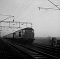 New Hall Crossing, Boreham , Chelmsford. July 1969.jpg 936 × 917; 40 KB
-
 New Hall School - geograph.org.uk - 2838489.jpg 1,600 × 1,200; 308 KB
-
 Old Hall - geograph.org.uk - 5898776.jpg 3,888 × 2,592; 4.9 MB
-
 Petrol station and M^S outlet - geograph.org.uk - 2602328.jpg 640 × 426; 63 KB
-
 Power line junction - geograph.org.uk - 405609.jpg 640 × 428; 281 KB
-
 Pylons aligned - geograph.org.uk - 4355230.jpg 2,048 × 1,536; 1.14 MB
-
 RAF - USAAF Boreham Airfield memorial - geograph.org.uk - 6336224.jpg 4,608 × 3,072; 3.66 MB
-
 RAF - USAAF Boreham Airfield memorial - geograph.org.uk - 6336225.jpg 3,072 × 4,608; 5.93 MB
-
 River Chelmer in flood, 1990 - geograph.org.uk - 4784790.jpg 640 × 427; 118 KB
-
 River Chelmer.jpg 640 × 427; 173 KB
-
 River Orchid - geograph.org.uk - 253282.jpg 800 × 532; 139 KB
-
 Road to Culvert's Farm - geograph.org.uk - 215542.jpg 640 × 426; 77 KB
-
 Road to Culvert's Farm - geograph.org.uk - 5898790.jpg 3,888 × 2,592; 6.71 MB
-
 Roundabout on the A12 exit heading for the A130 - geograph.org.uk - 2946032.jpg 1,600 × 1,200; 316 KB
-
 Roundabout, A130 - geograph.org.uk - 4970561.jpg 640 × 406; 44 KB
-
 Royal Mail Chelmsford Sorting Office - geograph.org.uk - 4814484.jpg 1,931 × 1,661; 941 KB
-
 Russell Green House from across the flooded gravel pit - geograph.org.uk - 4851762.jpg 1,500 × 1,001; 262 KB
-
 Service station - geograph.org.uk - 5153475.jpg 640 × 479; 117 KB
-
 Services on the A138 - geograph.org.uk - 5153477.jpg 640 × 479; 113 KB
-
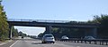
 Sign for Boreham (A130) interchange off the A12 - geograph.org.uk - 4048850.jpg 1,536 × 1,152; 847 KB
-
 Small stream - geograph.org.uk - 2865637.jpg 640 × 480; 147 KB
-
 South Of Boreham - geograph.org.uk - 1226606.jpg 428 × 640; 89 KB
-
 Stocks Farm - geograph.org.uk - 3295040.jpg 640 × 480; 109 KB
-
 Stonham's Lock - geograph.org.uk - 2670157.jpg 1,500 × 2,000; 1.5 MB
-
 Sunny Autumn Day - geograph.org.uk - 2670343.jpg 1,333 × 2,000; 2.68 MB
-
 Thatched cottages, Boreham - geograph.org.uk - 3295002.jpg 640 × 428; 85 KB
-
 The A12 north of Boreham, from the railway - geograph.org.uk - 5752508.jpg 1,600 × 815; 151 KB
-
 The Chelmer Near Boreham - geograph.org.uk - 2871130.jpg 640 × 446; 69 KB
-
 The railway running by the A12, Boreham - geograph.org.uk - 5336683.jpg 2,304 × 1,728; 980 KB
-
 The River Chelmer - geograph.org.uk - 2802726.jpg 640 × 480; 116 KB
-
 Toppinghoehall Wood - geograph.org.uk - 3247310.jpg 640 × 428; 173 KB
-
 Toppinghoehall Wood - geograph.org.uk - 405474.jpg 640 × 428; 444 KB
-
 Two Bridges - geograph.org.uk - 4011651.jpg 2,881 × 1,915; 1.74 MB
-
 Upstream of Paper Mill Lock - geograph.org.uk - 5699920.jpg 1,600 × 1,077; 488 KB
-

-

-

-
 Walford House - geograph.org.uk - 405490.jpg 640 × 428; 396 KB
-
 Wallace's Lane - geograph.org.uk - 6309421.jpg 1,024 × 685; 333 KB
-
 Waltham Road Bridge, A12 - geograph.org.uk - 2677783.jpg 640 × 282; 31 KB
-
 Weirs by former Little Baddow Mill, 1988 - geograph.org.uk - 4846851.jpg 640 × 427; 105 KB
-
 Willow Avenue - geograph.org.uk - 2670362.jpg 2,000 × 1,500; 2.55 MB
-
 Worked out gravel pits. - geograph.org.uk - 104062.jpg 640 × 419; 81 KB
-

-
 Essex Air Ambulance - geograph.org.uk - 745414.jpg 640 × 385; 130 KB
-
 Footpath through the gravel workings - geograph.org.uk - 405621.jpg 640 × 428; 314 KB


_-_geograph.org.uk_-_4647119.jpg)


_interchange_off_the_A12_-_geograph.org.uk_-_4048850.jpg)


