Category:Borough boundaries in London
Subcategories
This category has the following 30 subcategories, out of 30 total.
A
B
- Boundary Street, London E2 (9 F)
C
D
E
G
H
I
K
L
O
- Old Oak Road, London (3 F)
- Ossington Street (3 F)
P
S
T
W
Media in category "Borough boundaries in London"
The following 42 files are in this category, out of 42 total.
-
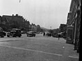
 A124 Longbridge Road Junction with Upney Lane - geograph.org.uk - 998315.jpg 3,072 × 2,304; 1.37 MB
-
 A214 Central Hill, Norwood SE19 - geograph.org.uk - 50527.jpg 640 × 481; 110 KB
-
 Addison Gardens, London W14 - geograph.org.uk - 1549023.jpg 640 × 427; 64 KB
-
 Beverley Brook in Motspur Park - geograph.org.uk - 689497.jpg 640 × 480; 144 KB
-
 Beverley Brook in West Barnes - geograph.org.uk - 689539.jpg 640 × 480; 144 KB
-
 Boundary footpath, Trewsbury Road - geograph.org.uk - 943288.jpg 640 × 480; 132 KB
-

-
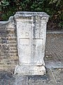
 Boundary stone, Deptford Wharf - geograph.org.uk - 1492558.jpg 480 × 640; 96 KB
-
 Bridge boundary marker - geograph.org.uk - 104099.jpg 640 × 480; 117 KB
-

-
 Brompton Road, Knightsbridge - geograph.org.uk - 480353.jpg 640 × 480; 88 KB
-
 Brompton Road, Knightsbridge - geograph.org.uk - 481142.jpg 640 × 480; 121 KB
-
 Brompton Road, looking North - geograph.org.uk - 480356.jpg 640 × 480; 81 KB
-
 Brompton road.jpg 2,048 × 1,536; 601 KB
-
 Cat Hill, Cockfosters (A110) - geograph.org.uk - 1226752.jpg 640 × 481; 106 KB
-
 Central Hill Upper Norwood.jpg 640 × 477; 78 KB
-

-
 Crown Lane - geograph.org.uk - 1599256.jpg 640 × 467; 268 KB
-
 Gipsy Hill, London SE19 - geograph.org.uk - 1336999.jpg 640 × 480; 73 KB
-
 Honeypot Lane, Queensbury - geograph.org.uk - 99158.jpg 640 × 480; 114 KB
-
 Kenton Road, Harrow, Middlesex - geograph.org.uk - 193884.jpg 640 × 476; 82 KB
-
 Kenton, Kenton Road - geograph.org.uk - 1780026.jpg 3,711 × 2,646; 1.93 MB
-
 Kingston Gate into Richmond Park - geograph.org.uk - 9780.jpg 640 × 480; 93 KB
-
 London Borough of Enfield street sign.jpg 1,817 × 3,217; 809 KB
-
 Morden, Love Lane - geograph.org.uk - 674761.jpg 640 × 480; 95 KB
-
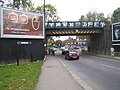 Northolt, Pett's Hill railway bridge - geograph.org.uk - 596249.jpg 640 × 480; 84 KB
-
 Old Oak Road, W3 - geograph.org.uk - 1037351.jpg 640 × 393; 54 KB
-
 Old Oak Road, W3 - geograph.org.uk - 679042.jpg 640 × 480; 82 KB
-

-

-
 River Crane - geograph.org.uk - 104088.jpg 640 × 480; 166 KB
-
 River Crane - geograph.org.uk - 726136.jpg 640 × 427; 93 KB
-

-
 St Paul's Deptford and St Mary's Rotherhithe boundary stone.jpg 3,024 × 4,032; 5.77 MB
-
 Surrey-Kent boundary near Addington - geograph.org.uk - 55036.jpg 640 × 429; 187 KB
-
 The Beck - geograph.org.uk - 33385.jpg 640 × 481; 191 KB
-
 The Broad Walk - geograph.org.uk - 840852.jpg 640 × 480; 84 KB
-
 The Broad Walk, Kensington Gardens - geograph.org.uk - 239983.jpg 640 × 480; 151 KB
-
 The Havering Stone - geograph.org.uk - 336996.jpg 640 × 480; 110 KB
-
 View down Crown Dale - geograph.org.uk - 1653989.jpg 522 × 640; 228 KB
-
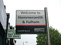 Welcome to Hammersmith and Fulham - geograph.org.uk - 892462.jpg 640 × 480; 55 KB
-
 Welcome to Haringey. N15.jpg 2,133 × 1,600; 410 KB


_-_geograph.org.uk_-_1226752.jpg)


_by_Barnes_Common._-_geograph.org.uk_-_27867.jpg)


