Category:Borough of Hinckley and Bosworth
non-metropolitan district in Leicestershire, United Kingdom  | |||||
| Upload media | |||||
| Instance of | |||||
|---|---|---|---|---|---|
| Location | Leicestershire, East Midlands, England | ||||
| Capital | |||||
| Legislative body |
| ||||
| Inception |
| ||||
| Population |
| ||||
| Area |
| ||||
| official website | |||||
 | |||||
Subcategories
This category has the following 26 subcategories, out of 26 total.
B
C
D
E
G
H
K
M
N
O
R
S
T
W
Media in category "Borough of Hinckley and Bosworth"
The following 200 files are in this category, out of 396 total.
(previous page) (next page)-

-
 A new Sainsbury's on site of former works - geograph.org.uk - 4710072.jpg 1,024 × 683; 157 KB
-
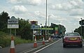
 A47 Normandy Way near Hinckley - geograph.org.uk - 4334151.jpg 1,600 × 1,069; 458 KB
-
 A47 towards Nuneaton - geograph.org.uk - 5296645.jpg 640 × 480; 44 KB
-
 A47, Hinckley - geograph.org.uk - 5296181.jpg 640 × 480; 60 KB
-
-

-
 A5 towards Coventry - geograph.org.uk - 5296654.jpg 640 × 480; 62 KB
-
 A5 Watling Street near Hinckley - geograph.org.uk - 4229262.jpg 1,600 × 1,044; 292 KB
-
 A5, southbound - geograph.org.uk - 4708609.jpg 640 × 426; 50 KB
-

-
 Arterial route out of Hinckley - geograph.org.uk - 5642390.jpg 1,600 × 900; 338 KB
-
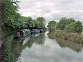
 Ashby Canal - geograph.org.uk - 5480918.jpg 640 × 427; 105 KB
-
 Ashby Canal in Hinckley - geograph.org.uk - 4334074.jpg 1,600 × 1,048; 411 KB
-
 Ashby Canal near Nutt's Bridge - geograph.org.uk - 5480912.jpg 640 × 427; 104 KB
-
 Ashby Canal south from bridge No. 19 - geograph.org.uk - 5480933.jpg 640 × 427; 66 KB
-
 Ashby Canal towards Bridge Number 17 - geograph.org.uk - 5704307.jpg 640 × 480; 83 KB
-
 Ashby Canal, Bridge Number 15A - geograph.org.uk - 3563208.jpg 640 × 480; 107 KB
-
 Ashby Canal, Bridge Number 16 - geograph.org.uk - 3563250.jpg 640 × 480; 83 KB
-
 Ashby Canal, Bridge Number 17 - geograph.org.uk - 3563265.jpg 640 × 474; 83 KB
-
 Ashby Canal, Bridge Number 17A - geograph.org.uk - 3563950.jpg 640 × 480; 62 KB
-
 Ashby Canal, Bridge Number 19 - geograph.org.uk - 3564081.jpg 640 × 480; 73 KB
-

-
 Ashby Canal, Hinckley - geograph.org.uk - 3590099.jpg 1,280 × 856; 281 KB
-
 Ashby Canal, Narrowboat manoeuvre - geograph.org.uk - 3563224.jpg 640 × 481; 74 KB
-
 Ashby Canal, Reach in Hinckley - geograph.org.uk - 3563939.jpg 640 × 480; 64 KB
-
 Ashby Canal, Reach in Hinckley - geograph.org.uk - 3564069.jpg 640 × 480; 87 KB
-

-
 Ashby Canal, Reach near Hinckley - geograph.org.uk - 3564880.jpg 640 × 480; 52 KB
-

-
 Ashby de la Zouch Canal northwards - geograph.org.uk - 6012678.jpg 640 × 414; 55 KB
-

-

-
 Ashby Road Cemetery, Hinckley - geograph.org.uk - 6277323.jpg 800 × 479; 150 KB
-
 B4666 Coventry Road in Hinckley - geograph.org.uk - 4229276.jpg 1,600 × 1,049; 443 KB
-
 B4667 Ashby Road in Hinckley - geograph.org.uk - 4334143.jpg 1,600 × 1,200; 753 KB
-
 Barn Lane Bridge, Ashby Canal - geograph.org.uk - 3588546.jpg 1,280 × 856; 266 KB
-
 Basketball court at Richmond Park - geograph.org.uk - 4812388.jpg 640 × 370; 62 KB
-
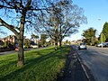
 Beaumont Avenue - geograph.org.uk - 6012763.jpg 640 × 379; 44 KB
-
 Beaumont Avenue sign - geograph.org.uk - 6012764.jpg 640 × 435; 125 KB
-

-
 Benchmark on buttress of St Mary's Church - geograph.org.uk - 4710122.jpg 683 × 1,024; 260 KB
-
 Benchmark on railway bridge, Rugby Road - geograph.org.uk - 4682780.jpg 683 × 1,024; 249 KB
-

-

-
 Bend on Strathmore Road from east - geograph.org.uk - 6012767.jpg 640 × 473; 50 KB
-
 Bend on Strathmore Road from west - geograph.org.uk - 6012766.jpg 640 × 465; 52 KB
-
 Blenheim Close, Hinckley - geograph.org.uk - 5812649.jpg 1,600 × 900; 289 KB
-
 Blue door and white windows - geograph.org.uk - 5480945.jpg 427 × 640; 69 KB
-

-
 Brascote Road - geograph.org.uk - 5383973.jpg 4,128 × 2,322; 3.51 MB
-
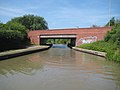
 Bridge No. 19 on the Ashby Canal - geograph.org.uk - 5480932.jpg 640 × 427; 93 KB
-

-
-

-

-

-

-
 Bridge WNS-4 Nutts Lane from north - geograph.org.uk - 6012724.jpg 640 × 437; 70 KB
-
 Bridge WNS-4 Nutts Lane from south - geograph.org.uk - 6012725.jpg 640 × 471; 87 KB
-
 Brook running under Ashby canal - geograph.org.uk - 2308879.jpg 2,000 × 1,504; 378 KB
-
 Burbage Common - geograph.org.uk - 5296123.jpg 640 × 480; 71 KB
-
 Burbage Common - geograph.org.uk - 5812151.jpg 1,600 × 900; 292 KB
-
 Burbage Common Road - geograph.org.uk - 5296128.jpg 640 × 480; 68 KB
-
 Burbage Common Road - geograph.org.uk - 5642394.jpg 1,600 × 900; 547 KB
-
 Bus shelter along the B4666 Coventry Road - geograph.org.uk - 4334103.jpg 1,600 × 1,104; 370 KB
-

-
 Bus stop on Stoke Road, Hinckley - geograph.org.uk - 5296163.jpg 640 × 480; 66 KB
-
 Cemetery toilets - geograph.org.uk - 2798161.jpg 640 × 480; 66 KB
-

-
 Close up, Elizabeth II postbox on Wykin Road, Hinckley - geograph.org.uk - 5296685.jpg 1,011 × 2,043; 390 KB
-
 Close up, Elizabeth II postbox on Wykin Road, Hinckley - geograph.org.uk - 5296695.jpg 1,322 × 2,506; 741 KB
-

-

-

-
 Convenience store - geograph.org.uk - 5642389.jpg 1,600 × 900; 257 KB
-

-
 Council offices, Argents Mead, Hinckley - geograph.org.uk - 3124005.jpg 640 × 346; 126 KB
-

-
 Cricket Match in progress - geograph.org.uk - 2056307.jpg 640 × 427; 107 KB
-
 Cycle path beside the A47 - geograph.org.uk - 5296628.jpg 640 × 480; 62 KB
-
 Cycle path beside the A47 - geograph.org.uk - 5296632.jpg 640 × 480; 51 KB
-
-

-

-

-

-

-

-

-
 Dodwell's Bridge No 17A - geograph.org.uk - 5563392.jpg 800 × 591; 177 KB
-
 Drake Way - Hinckley - geograph.org.uk - 3836816.jpg 3,405 × 1,787; 2.53 MB
-

-
 Eastwards to end of Westfield Road - geograph.org.uk - 6012862.jpg 640 × 417; 52 KB
-

-
 Elizabeth II postbox on Dodwells Road (A47), Hinckley - geograph.org.uk - 5296708.jpg 2,848 × 2,136; 1.23 MB
-

-
 Elizabeth II postbox on Wykin Road, Hinckley - geograph.org.uk - 5296683.jpg 2,848 × 2,136; 1.24 MB
-
 Elizabeth II postbox on Wykin Road, Hinckley - geograph.org.uk - 5296692.jpg 2,136 × 2,848; 1.18 MB
-

-
 Entering Hinckley - geograph.org.uk - 5296134.jpg 640 × 480; 82 KB
-
 Entrance to Westfield Junior School - geograph.org.uk - 6012867.jpg 640 × 438; 72 KB
-
 Factory redeveloped as apartments - geograph.org.uk - 5480964.jpg 427 × 640; 79 KB
-
 Factory Road - geograph.org.uk - 3764195.jpg 640 × 478; 59 KB
-
 FEED the HUNGRY - geograph.org.uk - 6012728.jpg 640 × 399; 51 KB
-
 Field entrance west of Normandy Way - geograph.org.uk - 5181093.jpg 640 × 458; 86 KB
-
 Field south of Rogue's Lane - geograph.org.uk - 5410674.jpg 640 × 475; 67 KB
-
 Field west of Stoke Road - geograph.org.uk - 5410648.jpg 640 × 478; 77 KB
-
 Fire Hydrant - geograph.org.uk - 5452868.jpg 640 × 388; 112 KB
-
 Fire Hydrant sign on telegraph pole - geograph.org.uk - 5452869.jpg 640 × 465; 53 KB
-
 Footpath crosses the A47 - geograph.org.uk - 4554518.jpg 450 × 600; 37 KB
-
 Footpath parallel to the canal - geograph.org.uk - 6012730.jpg 640 × 517; 82 KB
-
 Ford Transit Centre on the A5 - geograph.org.uk - 5296652.jpg 640 × 480; 51 KB
-
-

-
 Gateway off Stoke Lane - geograph.org.uk - 5181095.jpg 640 × 462; 98 KB
-

-
 Grazing off Leicester Road - geograph.org.uk - 5296132.jpg 640 × 480; 58 KB
-
 Grazing, Wykin Hall Farm - geograph.org.uk - 5296179.jpg 640 × 480; 55 KB
-

-
 Hardy Close, Hinckley - geograph.org.uk - 5812646.jpg 1,600 × 900; 302 KB
-
 Heavy rain on surface of Ashby Canal - geograph.org.uk - 5480913.jpg 640 × 427; 105 KB
-
 Hinckley - Bingo Club - geograph.org.uk - 3802368.jpg 1,600 × 1,143; 565 KB
-
 Hinckley - Cadet Centre - geograph.org.uk - 3802358.jpg 1,600 × 1,130; 488 KB
-
 Hinckley - Constitutional Club building - geograph.org.uk - 3802421.jpg 1,167 × 1,600; 583 KB
-
 Hinckley - east side of Hill Street - geograph.org.uk - 3802526.jpg 1,600 × 1,232; 737 KB
-
 Hinckley - former police station - geograph.org.uk - 3802498.jpg 1,600 × 1,231; 673 KB
-
 Hinckley - High Cross building - geograph.org.uk - 3802401.jpg 1,600 × 1,198; 547 KB
-
 Hinckley - Holy Trinity Church - geograph.org.uk - 3802485.jpg 1,600 × 1,202; 565 KB
-
 Hinckley - Methodist Church - geograph.org.uk - 3802503.jpg 1,600 × 1,262; 649 KB
-
 Hinckley - NatWest Bank - geograph.org.uk - 3802407.jpg 640 × 498; 95 KB
-
 Hinckley - Railway Inn - geograph.org.uk - 3794825.jpg 1,600 × 1,176; 543 KB
-
 Hinckley - school on Holliers Walk - geograph.org.uk - 3802510.jpg 640 × 478; 132 KB
-
 Hinckley - shops on west side of Rugby Road - geograph.org.uk - 3802361.jpg 1,600 × 1,221; 521 KB
-
 Hinckley - Station Road shops - geograph.org.uk - 3802476.jpg 1,600 × 1,205; 591 KB
-
 Hinckley - The Greyhound - geograph.org.uk - 3802513.jpg 1,600 × 1,233; 475 KB
-
 Hinckley - Trinity Lane Off-Licence - geograph.org.uk - 3802493.jpg 1,600 × 1,191; 531 KB
-
 Hinckley - United Reformed Church - geograph.org.uk - 3802411.jpg 1,600 × 1,232; 529 KB
-
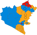
 Hinckley and Bosworth UK ward map 2015.svg 721 × 685; 301 KB
-
 Hinckley and Bosworth UK ward map 2019.svg 721 × 685; 301 KB
-
 Hinckley and Bosworth UK ward map 2023.svg 721 × 685; 301 KB
-
 Hinckley and District Museum - geograph.org.uk - 3219379.jpg 640 × 500; 77 KB
-
 Hinckley Fire Station - geograph.org.uk - 3222866.jpg 640 × 480; 75 KB
-
 Hinckley Free Library - geograph.org.uk - 3219359.jpg 640 × 480; 82 KB
-
 Hinckley Golf Club car park - geograph.org.uk - 3349764.jpg 640 × 476; 65 KB
-
 Hinckley Golf Club car park exit - geograph.org.uk - 3349760.jpg 640 × 464; 41 KB
-
 Hinckley Masonic Hall - geograph.org.uk - 3219324.jpg 640 × 480; 100 KB
-
 Hinckley National Spiritualist Church - geograph.org.uk - 3219326.jpg 640 × 480; 100 KB
-
 Hinckley Parish Church - geograph.org.uk - 3227609.jpg 640 × 560; 113 KB
-

-
 Hinckley Railway Station - geograph.org.uk - 3217487.jpg 640 × 480; 93 KB
-
 Hinckley Railway Station - geograph.org.uk - 3541562.jpg 640 × 480; 72 KB
-
 Hinckley Railway Station - geograph.org.uk - 5295440.jpg 640 × 480; 85 KB
-
 Hinckley Railway Station - geograph.org.uk - 5295444.jpg 640 × 480; 95 KB
-
 Hinckley Railway Station - geograph.org.uk - 5295447.jpg 640 × 480; 67 KB
-

-
 Hinckley Station - geograph.org.uk - 3227580.jpg 640 × 427; 52 KB
-
 Hinckley Station - geograph.org.uk - 3227586.jpg 640 × 480; 98 KB
-
 Hinckley Station - geograph.org.uk - 3227592.jpg 640 × 480; 82 KB
-
 Hinckley Station - geograph.org.uk - 3227598.jpg 640 × 480; 68 KB
-
 Hinckley United Reformed Church - geograph.org.uk - 3219369.jpg 640 × 518; 80 KB
-
 Hinckley Water Tower - geograph.org.uk - 3217298.jpg 640 × 517; 52 KB
-
 Hinckley-Baines Lane - geograph.org.uk - 3219376.jpg 480 × 640; 77 KB
-
 Hinckley-Bingo Flutters - geograph.org.uk - 3219351.jpg 640 × 530; 93 KB
-
 Hinckley-Brunel Road - geograph.org.uk - 3227618.jpg 640 × 480; 67 KB
-
 Hinckley-Brunel Road - geograph.org.uk - 3227629.jpg 640 × 480; 46 KB
-
 Hinckley-Brunel Road - geograph.org.uk - 3227635.jpg 640 × 480; 64 KB
-
 Hinckley-Druid Street - geograph.org.uk - 3222839.jpg 640 × 480; 59 KB
-
 Hinckley-Holliers Walk - geograph.org.uk - 3227565.jpg 640 × 480; 71 KB
-
 Hinckley-John Street - geograph.org.uk - 3222826.jpg 640 × 480; 53 KB
-
 Hinckley-Saint Peter's Church - geograph.org.uk - 3222874.jpg 640 × 480; 50 KB
-
 Hinckley-Tan"ya" Hyde - geograph.org.uk - 3219335.jpg 640 × 460; 67 KB
-
 Hinckley-The Black Horse - geograph.org.uk - 3222727.jpg 640 × 480; 80 KB
-
 Hinckley-The New Plough Inn - geograph.org.uk - 3227560.jpg 640 × 480; 74 KB
-
 Hinckley-The Princes Feathers - geograph.org.uk - 3219343.jpg 640 × 480; 79 KB
-
 Hinckley-The Queen's Head - geograph.org.uk - 3222715.jpg 640 × 480; 67 KB
-
 Hinckley-The Railway Hotel - geograph.org.uk - 3227574.jpg 640 × 480; 72 KB
-
 Hinckley-The Union Inn - geograph.org.uk - 3219373.jpg 640 × 480; 66 KB
-
 Hinckley-Upper Bond Street - geograph.org.uk - 3222708.jpg 640 × 480; 68 KB
-
 Holliers Walk Primary School - geograph.org.uk - 4682963.jpg 1,024 × 683; 161 KB
-
 Hollycroft Crescent - geograph.org.uk - 5289771.jpg 4,128 × 2,322; 3.61 MB
-
 Horse next to the A5 Watling Street - geograph.org.uk - 4229265.jpg 1,600 × 1,253; 599 KB
-
 Houses in Hollier's Walk - geograph.org.uk - 5480954.jpg 640 × 427; 94 KB
-

-

-
 Houses on Middlefield Lane, Hinckley - geograph.org.uk - 5296149.jpg 640 × 480; 62 KB
-

-
 Houses on Northfield Road, Hinckley - geograph.org.uk - 5294022.jpg 640 × 434; 52 KB
-
 Houses on Outlands Drive, Hinckley - geograph.org.uk - 5296183.jpg 640 × 480; 56 KB
-
 Houses on Sansome Drive - geograph.org.uk - 6012668.jpg 640 × 422; 67 KB
-
 Houses on Sansome Drive - geograph.org.uk - 6012733.jpg 640 × 445; 61 KB
-

-
 Houses on Torridon Way - geograph.org.uk - 5181106.jpg 640 × 458; 103 KB
-
 Houses on Westfield Road eastwards - geograph.org.uk - 6012772.jpg 640 × 478; 64 KB
-
 Houses on Westfield Road, Hinckley - geograph.org.uk - 5294026.jpg 640 × 480; 81 KB
-
 Houses on Wykin Road, Hinckley - geograph.org.uk - 5296698.jpg 2,464 × 1,741; 920 KB
-
-
 Hydes Lane from A5 junction - geograph.org.uk - 6012736.jpg 640 × 426; 90 KB
-
 Hydes Lane sign - geograph.org.uk - 6012737.jpg 640 × 515; 143 KB
-


_-_geograph.org.uk_-_5296662.jpg)


_-_geograph.org.uk_-_4710207.jpg)
_-_geograph.org.uk_-_4710173.jpg)


_Post_Office_at_Lancaster_Road_-_Station_Road_junction_-_geograph.org.uk_-_4710239.jpg)


,_Hinckley_-_geograph.org.uk_-_5296708.jpg)


