Category:Bossington, Hampshire
village and civil parish in Hampshire, UK  | |||||
| Upload media | |||||
| Instance of | |||||
|---|---|---|---|---|---|
| Location | Test Valley, Hampshire, South East England, England | ||||
 | |||||
English: Bossington is a village and civil parish in the Test Valley district of Hampshire, England. According to the 2001 census it had a population of 41. The village is located by the River Test, and is about 7 miles north of Romsey.
Subcategories
This category has only the following subcategory.
B
- St James' Church, Bossington (5 F)
Media in category "Bossington, Hampshire"
The following 20 files are in this category, out of 20 total.
-
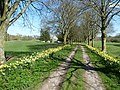
 Bossington - geograph.org.uk - 182354.jpg 640 × 480; 265 KB
-
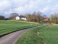
 Bossington House - geograph.org.uk - 1590945.jpg 640 × 455; 67 KB
-

-
-
 Electric moon - geograph.org.uk - 2830555.jpg 640 × 480; 45 KB
-
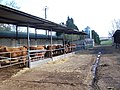
 Entrance to Pittleworth Dairy Farm - geograph.org.uk - 3921188.jpg 640 × 426; 79 KB
-
 Entrance to track off Horsebridge Road - geograph.org.uk - 3921184.jpg 640 × 450; 113 KB
-
 Evening view towards Broughton - geograph.org.uk - 4375971.jpg 640 × 427; 73 KB
-
-
 Horsebridge Lane south of Bossington - geograph.org.uk - 3109774.jpg 640 × 480; 76 KB
-
 Horsebridge Road at Pittleworth Farm - geograph.org.uk - 3109779.jpg 640 × 480; 65 KB
-
 Horsebridge Road near Bossington - geograph.org.uk - 3109140.jpg 640 × 481; 69 KB
-
 Horsebridge Road north of Clapgate Copse - geograph.org.uk - 3109795.jpg 640 × 481; 136 KB
-
 Horsebridge Road through Clapgate Copse - geograph.org.uk - 3921198.jpg 640 × 441; 112 KB
-

-
 Road junction near Bossington House - geograph.org.uk - 3921174.jpg 640 × 543; 111 KB
-
 Road towards Pittleworth Farm - geograph.org.uk - 2830538.jpg 640 × 480; 72 KB
-

-
 Test Valley roadside view - geograph.org.uk - 2830549.jpg 640 × 480; 89 KB
-
 Winding road and power lines - geograph.org.uk - 3921195.jpg 640 × 487; 40 KB


