Category:Bourton, Dorset
English: Bourton is a village in north Dorset, England, situated north of the A303 road on the border with Somerset between Mere and Wincanton. The village has a population of 772 (2001) and marks the northernmost point in Dorset.
Norsk bokmål: Bourton er en landsby i Dorset, England. Den ligger ved veien A303, ved grensen til Somerset.
village and civil parish in Dorset, UK  | |||||
| Upload media | |||||
| Instance of | |||||
|---|---|---|---|---|---|
| Location | Dorset, South West England, England | ||||
| Said to be the same as | Bourton (Wikimedia duplicated page, civil parish) | ||||
 | |||||
Subcategories
This category has the following 2 subcategories, out of 2 total.
B
- Bourton War Memorial (1 F)
G
- St George's Church, Bourton (40 F)
Media in category "Bourton, Dorset"
The following 62 files are in this category, out of 62 total.
-
 A lone sheep grazes near Penselwood - geograph.org.uk - 3442635.jpg 1,600 × 1,200; 511 KB
-
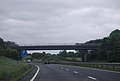
 A303 approaches West Bourton Road overbridge - geograph.org.uk - 3828852.jpg 3,648 × 2,736; 1.41 MB
-
 A303 heading west - geograph.org.uk - 6260555.jpg 1,024 × 684; 215 KB
-
 A303 near Bourton - geograph.org.uk - 188725.jpg 640 × 480; 77 KB
-
 A303 near Chaffeymoor Farm - geograph.org.uk - 3028459.jpg 640 × 430; 39 KB
-
 A303 West Bourton road bridge - geograph.org.uk - 3673509.jpg 1,785 × 1,122; 1,012 KB
-
 A303, eastbound - geograph.org.uk - 4780128.jpg 640 × 317; 32 KB
-
 A303, westbound - geograph.org.uk - 4745596.jpg 640 × 364; 27 KB
-
 A303, westbound - geograph.org.uk - 5297460.jpg 640 × 422; 48 KB
-
 A303, westbound - geograph.org.uk - 5297469.jpg 640 × 419; 50 KB
-
 B3081 heading north-west - geograph.org.uk - 5805923.jpg 1,024 × 684; 260 KB
-
 B3081 heading north-west - geograph.org.uk - 5805937.jpg 1,024 × 684; 185 KB
-
 Bourton - geograph.org.uk - 185442.jpg 640 × 480; 47 KB
-
 Bourton Telephone Exchange - geograph.org.uk - 1279705.jpg 628 × 315; 186 KB
-
 Bourton village sign - geograph.org.uk - 916160.jpg 640 × 581; 151 KB
-
 Bourton, a neat line of bales - geograph.org.uk - 2133993.jpg 640 × 480; 133 KB
-

-

-

-

-
 Bourton, postbox № SP8 75, Chaffeymoor - geograph.org.uk - 2128727.jpg 480 × 640; 163 KB
-
 Bourton, postbox № SP8 76, Mill Lane - geograph.org.uk - 2128726.jpg 480 × 640; 137 KB
-
 Bourton, postbox № SP8 79, Silton Road - geograph.org.uk - 2128717.jpg 480 × 640; 100 KB
-
 Bourton, postbox № SP8 80, West Bourton - geograph.org.uk - 2128730.jpg 480 × 640; 134 KB
-
 Bourton, signpost at Tinkers Hill - geograph.org.uk - 2133980.jpg 480 × 640; 78 KB
-
 Bourton, telephone box on the main road - geograph.org.uk - 3349423.jpg 640 × 480; 110 KB
-
 Bourton,Dorset,village,sign-w.jpg 284 × 425; 55 KB
-
 Chaffeymoor Farm - geograph.org.uk - 3477957.jpg 800 × 600; 141 KB
-
 Crossroads for West Bourton - geograph.org.uk - 3546026.jpg 1,024 × 577; 71 KB
-
 Entering Bourton from Zeals - geograph.org.uk - 3417806.jpg 640 × 429; 77 KB
-
 Entering Somerset, A303 - geograph.org.uk - 5297471.jpg 640 × 365; 79 KB
-
 Field of sheep near Penselwood (2) - geograph.org.uk - 3442633.jpg 1,600 × 1,067; 395 KB
-
 Field of sheep near Penselwood - geograph.org.uk - 3442630.jpg 1,600 × 1,200; 453 KB
-
 Footbridge, A303 - geograph.org.uk - 5297468.jpg 640 × 457; 50 KB
-
-
 Layby on the A303 near Bourton - geograph.org.uk - 3058214.jpg 640 × 480; 64 KB
-
 Layby on the A303, West Bourton - geograph.org.uk - 5952136.jpg 1,872 × 1,204; 853 KB
-
 Layby on the A303, West Bourton - geograph.org.uk - 5958560.jpg 1,920 × 1,280; 818 KB
-
 Long Lane - geograph.org.uk - 5334421.jpg 640 × 480; 211 KB
-
 Looking towards a Three Counties Meet - geograph.org.uk - 1734856.jpg 640 × 480; 245 KB
-
 Main road through Bourton - geograph.org.uk - 3417816.jpg 640 × 408; 52 KB
-

-

-
 Ordnance Survey Cut Mark - geograph.org.uk - 3375691.jpg 4,000 × 3,000; 4.56 MB
-

-
 Small fields near Bourton - geograph.org.uk - 2275094.jpg 640 × 480; 82 KB
-
 The A303, West Bourton - geograph.org.uk - 5958563.jpg 1,886 × 1,228; 1.06 MB
-
 The White Lion, Bourton - geograph.org.uk - 1145095.jpg 640 × 480; 154 KB
-
 Weather vane, Bourton - geograph.org.uk - 1145106.jpg 640 × 482; 102 KB
-
 West Bourton Road bridge over A303 - geograph.org.uk - 5448238.jpg 1,600 × 1,202; 738 KB
-
 West Bourton Road Bridge, A303 - geograph.org.uk - 3028464.jpg 640 × 430; 35 KB
-
 West Bourton Road Bridge, A303 - geograph.org.uk - 4780132.jpg 640 × 426; 40 KB
-
 West Bourton Road Bridge, A303 - geograph.org.uk - 5297464.jpg 640 × 405; 62 KB
-
 White cottages, Bourton - geograph.org.uk - 3442631.jpg 529 × 441; 88 KB
-
 Approaching Silton - geograph.org.uk - 169988.jpg 640 × 480; 79 KB
-
 Bourton, village sign - geograph.org.uk - 502273.jpg 375 × 640; 51 KB
-
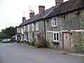
 Coombe Street - geograph.org.uk - 462541.jpg 640 × 480; 74 KB
-
 Farmland near Feltham Farm - geograph.org.uk - 466474.jpg 640 × 480; 79 KB
-
 Flambert's Farm - geograph.org.uk - 462546.jpg 640 × 480; 135 KB
-
 Footpath to West Bourton. - geograph.org.uk - 466478.jpg 640 × 480; 82 KB
-
 Grimsey Lane - geograph.org.uk - 466477.jpg 640 × 480; 72 KB
-
 Penmill Farm - geograph.org.uk - 462538.jpg 640 × 480; 86 KB


_-_geograph.org.uk_-_3442633.jpg)


