Category:Brampton, Lincolnshire
English: Brampton is a hamlet just north of the old Roman station at Torksey, in the administrative district of West Lindsey, and close to Torksey Golf Club.
village and civil parish in Lincolnshire, UK | |||||
| Upload media | |||||
| Instance of | |||||
|---|---|---|---|---|---|
| Location | West Lindsey, Lincolnshire, East Midlands, England | ||||
| Population |
| ||||
 | |||||
Media in category "Brampton, Lincolnshire"
The following 68 files are in this category, out of 68 total.
-
 A156 Heading south - geograph.org.uk - 3533340.jpg 640 × 480; 67 KB
-
 A156 Heading south - geograph.org.uk - 3533344.jpg 640 × 480; 78 KB
-
 A156 towards Marton - geograph.org.uk - 5780801.jpg 1,600 × 1,087; 416 KB
-

-
 Bailey House, Brampton - geograph.org.uk - 3196382.jpg 1,024 × 768; 203 KB
-
 Beech House, Brampton - geograph.org.uk - 3196390.jpg 1,024 × 768; 195 KB
-
 Beech in autumn, Brampton - geograph.org.uk - 3196379.jpg 768 × 1,024; 233 KB
-
 Birds on the Trent - geograph.org.uk - 3158892.jpg 640 × 427; 183 KB
-
 Brampton farmland - geograph.org.uk - 1297184.jpg 640 × 426; 67 KB
-
 Clubhouse at Lincoln Golf Club - geograph.org.uk - 5343065.jpg 800 × 483; 113 KB
-
 Cowdale Lane - geograph.org.uk - 857559.jpg 640 × 480; 134 KB
-
 Crop Fields off A156 - geograph.org.uk - 3071299.jpg 2,256 × 1,504; 716 KB
-
 Disused Railway - geograph.org.uk - 92084.jpg 640 × 427; 96 KB
-
 Drain near Bellwood Grange Farm - geograph.org.uk - 3067720.jpg 1,331 × 2,000; 2.73 MB
-
 Drain near Brampton - geograph.org.uk - 3533347.jpg 640 × 480; 80 KB
-
 Drain next to the A156 - geograph.org.uk - 5343175.jpg 800 × 558; 117 KB
-
 Drain off the A156 - geograph.org.uk - 3533337.jpg 640 × 480; 74 KB
-
 Entrance to Stow Park Farm - geograph.org.uk - 857550.jpg 640 × 480; 62 KB
-
 Farm track off the A156 - geograph.org.uk - 3533343.jpg 640 × 480; 72 KB
-
 Farmland off the A156 - geograph.org.uk - 3533339.jpg 640 × 480; 78 KB
-

-
 Hermitage House, Brampton - geograph.org.uk - 3196355.jpg 1,024 × 768; 236 KB
-
 Lane heading east - geograph.org.uk - 3533348.jpg 640 × 480; 76 KB
-
 Lincoln Golf Club - geograph.org.uk - 663680.jpg 640 × 427; 57 KB
-
 Lincoln Golf Club - geograph.org.uk - 663683.jpg 640 × 427; 65 KB
-
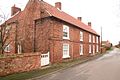
 Manor Farm, Brampton - geograph.org.uk - 3196365.jpg 1,024 × 768; 180 KB
-
 North along the A156 towards Marton - geograph.org.uk - 5343139.jpg 800 × 621; 181 KB
-
 North along the A156 towards Marton - geograph.org.uk - 5343159.jpg 800 × 573; 155 KB
-
 Over grown Field gateway - geograph.org.uk - 1337093.jpg 640 × 480; 57 KB
-
 Overgrown farm track - geograph.org.uk - 3035693.jpg 1,024 × 768; 203 KB
-
 Power on the Trent - geograph.org.uk - 3158893.jpg 640 × 430; 168 KB
-
 Priory Cottage, Brampton - geograph.org.uk - 3196359.jpg 1,024 × 768; 142 KB
-
 Public footpath to Trent Port - geograph.org.uk - 1337112.jpg 640 × 480; 42 KB
-
 Raised pavement, Brampton - geograph.org.uk - 3196392.jpg 1,024 × 768; 295 KB
-
 River Trent - geograph.org.uk - 4862144.jpg 1,024 × 683; 177 KB
-
 River Trent in flood from Torksey southwards, aerial 2019 - geograph.org.uk - 6287979.jpg 1,664 × 2,496; 1.05 MB
-
 To Trent Port - geograph.org.uk - 1297189.jpg 640 × 426; 86 KB
-
 Torksey - geograph.org.uk - 209073.jpg 640 × 427; 44 KB
-
 Torksey Lock - geograph.org.uk - 3117.jpg 640 × 396; 40 KB
-
 Track and farmland next to the A156 - geograph.org.uk - 5343131.jpg 800 × 511; 118 KB
-
 Track to Celebration Wood - geograph.org.uk - 3071303.jpg 2,256 × 1,504; 1.08 MB
-
 Trent floodbank - geograph.org.uk - 4862140.jpg 1,024 × 683; 166 KB
-
 Trent floodbank footpath - geograph.org.uk - 4862116.jpg 1,024 × 683; 239 KB
-
 Unnamed drain, Brampton - geograph.org.uk - 3196375.jpg 1,024 × 768; 136 KB
-
 Up the Trent - geograph.org.uk - 3158877.jpg 640 × 471; 145 KB
-
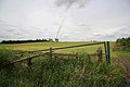
 View towards Cottam Power Station - geograph.org.uk - 2561776.jpg 1,024 × 768; 219 KB
-
 View towards Cottam Power Station - geograph.org.uk - 3196370.jpg 1,024 × 768; 158 KB
-
 Wildlife on the Trent - geograph.org.uk - 3158902.jpg 640 × 367; 182 KB
-
 Arable land west of Highwood Farm - geograph.org.uk - 845060.jpg 640 × 480; 79 KB
-
 Brampton - geograph.org.uk - 663710.jpg 640 × 427; 80 KB
-
 Brampton - geograph.org.uk - 663716.jpg 640 × 427; 86 KB
-
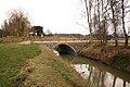
 Cowdale Lane Bridge - geograph.org.uk - 92088.jpg 640 × 427; 122 KB
-
 Dismantled railway - geograph.org.uk - 663976.jpg 640 × 427; 118 KB
-
 Dismantled railway - geograph.org.uk - 663979.jpg 640 × 427; 104 KB
-
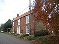
 Hermitage House - geograph.org.uk - 663711.jpg 640 × 427; 88 KB
-
 High Wood view - geograph.org.uk - 630360.jpg 640 × 427; 68 KB
-
 Highwood Farm - geograph.org.uk - 630371.jpg 640 × 427; 46 KB
-
 Horse on Sand Lane - geograph.org.uk - 663980.jpg 640 × 427; 56 KB
-
 Jumps off Sand Lane - geograph.org.uk - 663985.jpg 640 × 427; 74 KB
-
 New bridge - geograph.org.uk - 663635.jpg 640 × 427; 84 KB
-
 Sand Lane - geograph.org.uk - 303287.jpg 640 × 427; 77 KB
-
 Sand Lane - geograph.org.uk - 663989.jpg 640 × 427; 101 KB
-
 Storm brewing - geograph.org.uk - 630365.jpg 640 × 427; 44 KB
-
 Sykes Lane - geograph.org.uk - 630368.jpg 640 × 427; 64 KB
-
 The Fairways - geograph.org.uk - 663991.jpg 640 × 427; 64 KB
-
 The Fairways - geograph.org.uk - 663993.jpg 640 × 427; 55 KB
-
 Thumper's field - geograph.org.uk - 663987.jpg 640 × 427; 100 KB
-
 Towards Torksey from Sand Lane - geograph.org.uk - 303286.jpg 640 × 427; 79 KB


