Category:Brampton Valley Way
English: The Brampton Valley Way is a 14-mile (22.5 km) linear park based on the former railway line in England.
rail trail in Leicestershire, England, UK  | |||||
| Upload media | |||||
| Instance of | |||||
|---|---|---|---|---|---|
| Location | Leicestershire, East Midlands, England | ||||
| Terminus | |||||
 | |||||
Subcategories
This category has the following 2 subcategories, out of 2 total.
K
- Kelmarsh Tunnel (7 F)
O
- Oxendon Tunnels (14 F)
Media in category "Brampton Valley Way"
The following 76 files are in this category, out of 76 total.
-
 Approaching A14 from north - geograph.org.uk - 446272.jpg 640 × 477; 99 KB
-
 Approaching Oxendon Tunnel - geograph.org.uk - 301429.jpg 640 × 480; 138 KB
-
-
 Boughton junction on NLR.jpg 1,600 × 1,200; 676 KB
-
 Brampton Halt Public House - geograph.org.uk - 1565925.jpg 640 × 480; 145 KB
-
 Brampton Valley - geograph.org.uk - 1765174.jpg 640 × 480; 55 KB
-
 Brampton Valley Way at Boughton looking north in April 2018.jpg 3,264 × 2,448; 2.49 MB
-
 Brampton Valley Way, near Lamport - geograph.org.uk - 335063.jpg 640 × 428; 102 KB
-
 Brampton Valley Way.jpg 800 × 600; 270 KB
-
 Bridge 17 - geograph.org.uk - 224583.jpg 640 × 480; 103 KB
-
 Bridge on Brampton Valley Way - geograph.org.uk - 446210.jpg 640 × 477; 103 KB
-
 Bridge with Serious Cyclists - geograph.org.uk - 224991.jpg 640 × 480; 90 KB
-

-
 Bridleway to Great Oxendon - geograph.org.uk - 301423.jpg 640 × 480; 118 KB
-
 Brixworth - geograph.org.uk - 325433.jpg 640 × 480; 116 KB
-
 Brixworth Station 1910762 f63b11d2.jpg 640 × 371; 130 KB
-
 Class 31 - geograph.org.uk - 1765153.jpg 640 × 480; 91 KB
-
 Class 4DD double decker coach.jpg 1,176 × 1,136; 163 KB
-
 Clipston & Oxendon station site geograph-3150520-by-Ben-Brooksbank.jpg 2,394 × 1,141; 2.95 MB
-
 Crossing the track - geograph.org.uk - 1565934.jpg 640 × 480; 173 KB
-
 Dismantled Railway - geograph.org.uk - 223095.jpg 640 × 480; 127 KB
-

-
 Disused Railway Bridge. - geograph.org.uk - 327999.jpg 640 × 480; 124 KB
-
 Entrance to the Brampton Valley Way - geograph.org.uk - 223423.jpg 640 × 480; 86 KB
-
 Farm track from Boughton Mill Farm - geograph.org.uk - 1765161.jpg 640 × 480; 89 KB
-
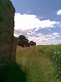
 Fields in Brampton Valley - geograph.org.uk - 395048.jpg 640 × 480; 85 KB
-

-
 Fording a stream on Brampton Valley Way - geograph.org.uk - 54068.jpg 640 × 480; 121 KB
-
 Former railway access to Kelmarsh depot - geograph.org.uk - 446263.jpg 640 × 477; 114 KB
-
 Green Lane Crossing - geograph.org.uk - 446293.jpg 640 × 477; 137 KB
-

-
 Lamport - geograph.org.uk - 325090.jpg 640 × 480; 129 KB
-
 Lamport station site geograph-3742636-by-Ben-Brooksbank.jpg 2,324 × 1,507; 3.51 MB
-
 Level crossing on Brampton Valley Way - geograph.org.uk - 446227.jpg 640 × 477; 93 KB
-
 Maidwell - geograph.org.uk - 324814.jpg 640 × 480; 131 KB
-

-
 Merry Tom Crossing - geograph.org.uk - 224998.jpg 640 × 480; 115 KB
-
 Northampton & Lamport Railway - Flickr - mick - Lumix(1).jpg 3,051 × 2,038; 1.51 MB
-
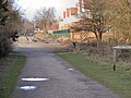
 Off Brampton Valley Way - geograph.org.uk - 1755921.jpg 480 × 640; 65 KB
-
 Old Railway Trackbed near Great Oxendon - geograph.org.uk - 301348.jpg 480 × 640; 171 KB
-
 Peckett 2104 at Boughton railway station May 2012.jpg 4,320 × 3,240; 1.44 MB
-
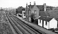
 Pitsford and Brampton Station - geograph.org.uk - 1565916.jpg 640 × 480; 129 KB
-
 Pitsford Sidings - geograph.org.uk - 223105.jpg 640 × 480; 90 KB
-
 Pitsford Sidings Signal Box - geograph.org.uk - 1565963.jpg 480 × 640; 191 KB
-
 Rail-97651-amoswolfe.jpg 2,048 × 1,536; 1.24 MB
-
 Rail-class-117-51402-amoswolfe.jpg 2,048 × 1,536; 577 KB
-

-
 Railway in the Snow December 2009 (91).jpg 3,072 × 2,304; 1.32 MB
-
 Restored Railway Bridge. - geograph.org.uk - 708543.jpg 640 × 480; 99 KB
-
 Site of Boughton railway station February 2011.jpg 3,072 × 2,304; 2.71 MB
-
 Site of Boughton railway station.jpg 1,280 × 960; 390 KB
-
 The End of the Line - geograph.org.uk - 225694.jpg 640 × 480; 134 KB
-
 Track to Arthingworth - geograph.org.uk - 194637.jpg 640 × 480; 126 KB
-

-
 Trail along the Old Track. - geograph.org.uk - 328045.jpg 640 × 480; 118 KB
-
 Trains at Pitsford and Brampton Station - geograph.org.uk - 225724.jpg 640 × 480; 107 KB
-
 Underpass under A14. - geograph.org.uk - 365629.jpg 640 × 480; 105 KB
-
 View to Pitsford Sidings - geograph.org.uk - 226148.jpg 640 × 429; 117 KB
-
 A14 goes over Brampton Valley Way - geograph.org.uk - 375235.jpg 640 × 406; 53 KB
-

-
 Benches for People of Different Heights - geograph.org.uk - 224543.jpg 640 × 461; 127 KB
-
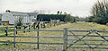
 Boughton Mill - geograph.org.uk - 223444.jpg 640 × 480; 119 KB
-

-
 Brampton Valley Way south of A14 - geograph.org.uk - 446278.jpg 640 × 477; 113 KB
-
 Bridge 14 - geograph.org.uk - 225684.jpg 640 × 429; 99 KB
-
 Bridleway to Clipston - geograph.org.uk - 446235.jpg 640 × 477; 115 KB
-
 Copse on Clint Hill - geograph.org.uk - 395053.jpg 640 × 480; 123 KB
-
 Detour available - geograph.org.uk - 446255.jpg 640 × 477; 99 KB
-
 Draughton Road car park - geograph.org.uk - 446322.jpg 640 × 477; 101 KB
-
 Green Lane Crossing - geograph.org.uk - 446281.jpg 477 × 640; 140 KB
-

-
 Lamport - geograph.org.uk - 325516.jpg 640 × 480; 118 KB
-
 Leywell Spinney - geograph.org.uk - 395093.jpg 640 × 480; 103 KB
-
 Looking east towards Arthingworth Lodge - geograph.org.uk - 446247.jpg 640 × 477; 103 KB
-
 Straw Bales - geograph.org.uk - 224977.jpg 640 × 480; 123 KB
-
 The Brampton Valley Way - geograph.org.uk - 224555.jpg 640 × 458; 87 KB


.jpg)


.jpg)
.jpg)


