Category:Brandstorps kyrka
| Object location | | View all coordinates using: OpenStreetMap |
|---|
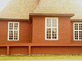
Church of Sweden church building in Brandstorp, Sweden  Brandstorp Church  | |||||
| Upload media | |||||
| Instance of | |||||
|---|---|---|---|---|---|
| Made from material | |||||
| Location | Brandstorp, Västergötland, Västra Götaland County, Sweden | ||||
| Diocese | |||||
| Connects with |
| ||||
| Has use |
| ||||
| Occupant |
| ||||
| Heritage designation |
| ||||
| Inception |
| ||||
| Date of official opening |
| ||||
| Adjacent building |
| ||||
 | |||||
Svenska: Brandstorps kyrka tillhör Brandstorps församling, Hökensås kontrakt, Skara stift / Diocese of Skara.
|
This is a category about an ecclesiastical monument in Sweden, number 21300000005599 in the RAÄ buildings database.
|
|
This is a category about a protected building in Sweden, number 21400000549620 in the RAÄ buildings database.
|
Subcategories
This category has only the following subcategory.
Media in category "Brandstorps kyrka"
The following 16 files are in this category, out of 16 total.
-
 Brandstorp kyrka.jpg 708 × 472; 318 KB
-
 Brandstorps kyrka - KMB - 16000200152776.jpg 838 × 600; 62 KB
-
 Brandstorps kyrka - KMB - 16000200152778.jpg 821 × 600; 84 KB
-
 Brandstorps kyrka - KMB - 16000200152779.jpg 438 × 600; 51 KB
-
 Brandstorps kyrka - KMB - 16000200152781.jpg 598 × 600; 55 KB
-
 Brandstorps kyrka - KMB - 16000200152782.jpg 918 × 600; 82 KB
-
 Brandstorps kyrka - KMB - 16000200152784.jpg 601 × 600; 66 KB
-
 Brandstorps kyrka - KMB - 16000200152785.jpg 583 × 600; 77 KB
-
 Brandstorps kyrka - KMB - 16000200152786.jpg 581 × 600; 92 KB
-
 Brandstorps kyrka - KMB - 16000200152787.jpg 848 × 600; 182 KB
-
 Brandstorps kyrka 2014-05-31-68.jpg 5,760 × 3,840; 6.75 MB
-
 Brandstorps kyrka 2014-05-31-71.jpg 5,760 × 3,840; 4.89 MB
-
 Brandstorps kyrka 28 juni 2013.jpg 2,048 × 1,536; 584 KB
-
 Brandstorps kyrka old1.jpg 597 × 600; 71 KB
-
 Brandstorps kyrka old2.jpg 3,368 × 2,480; 1.05 MB
-
 Brandstorps kyrka old3.jpg 589 × 600; 104 KB


