Category:Breadsall
village and civil parish in Erewash district, Derbyshire, England  | |||||
| Upload media | |||||
| Instance of | |||||
|---|---|---|---|---|---|
| Location | Erewash, Derbyshire, East Midlands, England | ||||
 | |||||
Subcategories
This category has the following 3 subcategories, out of 3 total.
Media in category "Breadsall"
The following 86 files are in this category, out of 86 total.
-
 "Lamp Cabin" in reconstruction of Breadsall Station - geograph.org.uk - 1844197.jpg 2,048 × 1,536; 1.38 MB
-
 A footpath from Moor Lane - geograph.org.uk - 5403164.jpg 2,000 × 1,333; 2.74 MB
-
 A Garden Centre - geograph.org.uk - 5403150.jpg 2,000 × 1,333; 2.19 MB
-
 A Rural Scene near Morley - geograph.org.uk - 3110552.jpg 4,000 × 3,000; 2.2 MB
-
 A38 approaching roadworks at A61 junction - geograph.org.uk - 4046722.jpg 1,600 × 1,058; 366 KB
-

-
 A38 from A61 roundabout - geograph.org.uk - 4566289.jpg 640 × 337; 43 KB
-

-
 A608 and Great Northern Greenway - geograph.org.uk - 2498666.jpg 3,648 × 2,736; 5.8 MB
-
 Abbot Close, Oakwood - geograph.org.uk - 5877385.jpg 1,024 × 768; 143 KB
-
 Aitons Stores Road - geograph.org.uk - 80292.jpg 640 × 418; 44 KB
-
 All Saints Church, Breadsall - geograph.org.uk - 4330122.jpg 1,062 × 1,600; 464 KB
-
 All Saints Church, Breadsall - geograph.org.uk - 4330124.jpg 1,600 × 1,062; 819 KB
-
 All Saints parish church, Breadsall - the churchyard - geograph.org.uk - 1844221.jpg 2,048 × 1,536; 1.35 MB
-
 Almshouses, Morleymoor - geograph.org.uk - 1844256.jpg 2,048 × 1,536; 1.39 MB
-
 BASFC.png 416 × 600; 42 KB
-
 Bench mark on All Saints Church - geograph.org.uk - 4389024.jpg 2,560 × 1,920; 1.04 MB
-
 Bishop's Drive, Oakwood - geograph.org.uk - 5877386.jpg 1,024 × 768; 136 KB
-
 Bishops Drive at Breadsall Hilltop - geograph.org.uk - 4385163.jpg 4,000 × 3,000; 2.44 MB
-
 Boarded-up Cafe off the A38 Road - geograph.org.uk - 2877253.jpg 3,202 × 2,340; 1.02 MB
-
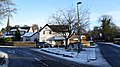
 Breadsall - geograph.org.uk - 3611969.jpg 1,280 × 856; 286 KB
-
 Breadsall pre-school playgroup - geograph.org.uk - 2498659.jpg 3,648 × 2,736; 5.38 MB
-
 Breadsall Priory Hotel - geograph.org.uk - 5752276.jpg 2,000 × 1,333; 2.87 MB
-
 Breadsall Priory, aerial 2014 - geograph.org.uk - 3926006.jpg 640 × 427; 58 KB
-
-
 Breadsall School - geograph.org.uk - 1844218.jpg 2,048 × 1,536; 1.28 MB
-
 Breadsall Village - geograph.org.uk - 5403158.jpg 2,000 × 1,333; 2.51 MB
-
 Breadsall Village - geograph.org.uk - 5403162.jpg 1,333 × 2,000; 2.03 MB
-
 Breadsall Village Shop - geograph.org.uk - 3611968.jpg 856 × 1,280; 272 KB
-
 Breadsall village shop - geograph.org.uk - 4301871.jpg 640 × 360; 73 KB
-
-
 Calver Close - geograph.org.uk - 5434402.jpg 2,000 × 1,333; 2.53 MB
-
 Croft Lane - geograph.org.uk - 5403156.jpg 2,000 × 1,333; 2.98 MB
-
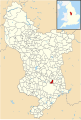 Derbyshire UK parish map highlighting Breadsall.svg 888 × 1,308; 2.34 MB
-
 Farmland and a view of Breadsall Lodge - geograph.org.uk - 2498757.jpg 3,648 × 2,736; 5.88 MB
-
 Farmland near the A38 - geograph.org.uk - 2964797.jpg 1,024 × 642; 119 KB
-

-
 Field entrance from Moor Road, near Breadsall - geograph.org.uk - 1844168.jpg 2,048 × 1,536; 1.34 MB
-
 Field north of Breadsall Hilltop (1) - geograph.org.uk - 5876608.jpg 1,024 × 768; 164 KB
-
 Field north of Breadsall Hilltop (2) - geograph.org.uk - 5876612.jpg 1,024 × 768; 234 KB
-

-
 Glebe Farm from Moor Road, near Breadsall - geograph.org.uk - 1844235.jpg 2,048 × 1,536; 1.3 MB
-
 Great Northern Greenway - geograph.org.uk - 2498664.jpg 3,648 × 2,736; 5.97 MB
-
 Hill Top, Breadsall Hilltop - geograph.org.uk - 5876609.jpg 1,024 × 768; 178 KB
-
 Keep off the grass - geograph.org.uk - 2031969.jpg 640 × 480; 45 KB
-
 Little Eaton Boundary Stone - geograph.org.uk - 2653437.jpg 1,024 × 768; 256 KB
-
 Lodge at entrance to Breadsall Priory - geograph.org.uk - 2498771.jpg 3,648 × 2,736; 5.4 MB
-
 Looking along Ryknild Street - geograph.org.uk - 5752274.jpg 2,000 × 1,333; 2.89 MB
-
 Looking north towards Morleymoor - geograph.org.uk - 2498754.jpg 3,648 × 2,736; 5.83 MB
-
 Main entrance, Breadsall Priory Hotel - geograph.org.uk - 1844274.jpg 1,536 × 2,048; 1.35 MB
-
-
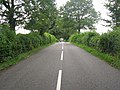
 Moor Road near Breadsall - geograph.org.uk - 3110530.jpg 4,000 × 3,000; 3.43 MB
-
 New housing development, Breadsall Hilltop - geograph.org.uk - 5876622.jpg 1,024 × 768; 161 KB
-
 Old line of Porter's Lane - geograph.org.uk - 5999888.jpg 1,280 × 960; 605 KB
-
 Old section of Croft Road - geograph.org.uk - 5077392.jpg 1,280 × 960; 533 KB
-
 Part of Breadsall Priory - geograph.org.uk - 5752275.jpg 2,000 × 1,333; 2.21 MB
-
 Path Crossing a Field of Wheat near Breadsall - geograph.org.uk - 3110540.jpg 4,000 × 3,000; 2.77 MB
-
 Path junction on the dismantled railway, Breadsall - geograph.org.uk - 1844187.jpg 2,048 × 1,536; 1.37 MB
-
 Ploughed field, Derwent Valley - geograph.org.uk - 4759389.jpg 640 × 330; 39 KB
-

-
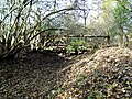
 Railway Footbridge near Breadsall - geograph.org.uk - 3110521.jpg 4,000 × 3,000; 2.43 MB
-
 Road junction, Breadsall - geograph.org.uk - 1844173.jpg 2,048 × 1,536; 1.35 MB
-
 Roundabout at Breadsall - geograph.org.uk - 2031939.jpg 640 × 480; 80 KB
-
 Roundabout under construction, Breadsall Hilltop - geograph.org.uk - 5876619.jpg 1,024 × 768; 142 KB
-
 Rye Close - geograph.org.uk - 5434408.jpg 2,000 × 1,333; 2.27 MB
-

-
 Site of a former railway over-bridge - geograph.org.uk - 5118336.jpg 1,280 × 960; 754 KB
-
 Telephone box near the almshouses, Morelymoor - geograph.org.uk - 1844263.jpg 1,536 × 2,048; 1.37 MB
-
 The end of a goods train - geograph.org.uk - 5403147.jpg 2,000 × 1,333; 2.93 MB
-
 The former Derby Canal Little Eaton Branch - geograph.org.uk - 5077406.jpg 1,280 × 960; 634 KB
-
 The pond in the grounds of Breadsall Priory Hotel - geograph.org.uk - 1844143.jpg 2,048 × 1,024; 593 KB
-
 The River Derwent at Holme Nook - geograph.org.uk - 2654365.jpg 1,024 × 768; 286 KB
-
 The Windmill - geograph.org.uk - 5077410.jpg 1,280 × 960; 395 KB
-
 Towards Breadsall - geograph.org.uk - 5403167.jpg 2,000 × 1,333; 3.18 MB
-
 Turf nursery beside the River Derwent - geograph.org.uk - 2654357.jpg 1,024 × 768; 176 KB
-
 UK 40 Speed Sign - geograph.org.uk - 5162705.jpg 1,200 × 1,600; 130 KB
-
 UK Bus Stop Sign - geograph.org.uk - 5162702.jpg 1,200 × 1,600; 97 KB
-

-
 View over Breadsall golf course, towards Breadsall - geograph.org.uk - 2498776.jpg 3,648 × 2,736; 5.59 MB
-
 War Memorial, Breadsall - geograph.org.uk - 4330117.jpg 1,062 × 1,600; 656 KB
-
 West end of Bishop's Drive, Breadsall Hilltop - geograph.org.uk - 5876625.jpg 1,024 × 768; 154 KB
-
 Allestree Ford Bridge - geograph.org.uk - 1012332.jpg 640 × 426; 175 KB
-
 Allestree Ford Bridge - geograph.org.uk - 1012764.jpg 426 × 640; 204 KB
-
 Car Garage Site - geograph.org.uk - 80407.jpg 640 × 409; 64 KB
-
 Chaddesden Cemetery - geograph.org.uk - 6910.jpg 610 × 343; 86 KB
-


_-_geograph.org.uk_-_5876608.jpg)
_-_geograph.org.uk_-_5876612.jpg)


_-_near_Breadsall_-_geograph.org.uk_-_214298.jpg)


_except_for_loading_and_unloading_%5E_30_Speed_Sign_-_geograph.org.uk_-_5136348.jpg)


