Category:Breamore
Village and civil parish in Hampshire, England  | |||||
| Upload media | |||||
| Instance of | |||||
|---|---|---|---|---|---|
| Location | New Forest, Hampshire, South East England, England | ||||
| Said to be the same as | Breamore (Wikimedia duplicated page, civil parish) | ||||
| official website | |||||
 | |||||
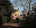
English: Breamore is a village and civil parish in Hampshire, England, located near to Fordingbridge. Nearby, there is a notable stately home, Breamore House. The name of the village is pronounced "Bremmer", not "Bree-moor" as might be supposed.
Subcategories
This category has the following 10 subcategories, out of 10 total.
B
- Breamore Great Bridge (5 F)
- Breamore House (28 F)
- Breamore Methodist Church (4 F)
- Breamore Mill (11 F)
- Breamore Mizmaze (8 F)
- Breamore railway station (14 F)
M
N
- North Charford (6 F)
S
- South Charford (9 F)
W
Media in category "Breamore"
The following 200 files are in this category, out of 262 total.
(previous page) (next page)-
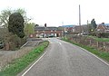
 A338 at Breamore - geograph.org.uk - 5195468.jpg 3,072 × 2,048; 1.37 MB
-
 A338 junction in Breamore - geograph.org.uk - 2876931.jpg 3,418 × 2,390; 1.47 MB
-
 A338 north of Breamore - geograph.org.uk - 2877757.jpg 3,386 × 2,333; 1.21 MB
-
 Avon floodplain near Upper Burgate - geograph.org.uk - 5196618.jpg 3,072 × 2,048; 1.58 MB
-
 Avon valley from Castle Hill - geograph.org.uk - 5046522.jpg 2,179 × 949; 445 KB
-
 Avon Valley view - geograph.org.uk - 1287810.jpg 640 × 428; 76 KB
-
 Barns at Topp's Farm - geograph.org.uk - 5819298.jpg 1,600 × 1,200; 675 KB
-
 Bat and Ball - geograph.org.uk - 2042311.jpg 640 × 480; 98 KB
-
 Bat and Ball PH - geograph.org.uk - 5821586.jpg 1,600 × 1,200; 441 KB
-
 Bench Mark, The Rookery - geograph.org.uk - 2019293.jpg 480 × 640; 181 KB
-
 Bench Mark, Topps Farm - geograph.org.uk - 2118538.jpg 480 × 640; 107 KB
-
 Benchmark, Meadow View Cottage - geograph.org.uk - 2793539.jpg 650 × 800; 195 KB
-
 Bluebells in Breamore Wood - geograph.org.uk - 401770.jpg 640 × 480; 172 KB
-
 Bluebells in Breamore Wood - geograph.org.uk - 411994.jpg 640 × 480; 128 KB
-
 Barn Conversion, Breamore - geograph.org.uk - 375514.jpg 640 × 480; 96 KB
-
 Barns by the Avon at Breamore Mill - geograph.org.uk - 375444.jpg 640 × 480; 102 KB
-

-
 Junction on A338 at Breamore - geograph.org.uk - 291586.jpg 640 × 480; 108 KB
-
 Pontins Cottage - geograph.org.uk - 409567.jpg 640 × 480; 123 KB
-
 Tudor Lodge - Breamore - geograph.org.uk - 623912.jpg 640 × 435; 190 KB
-
 Upper Street, Breamore - geograph.org.uk - 160746.jpg 640 × 481; 103 KB
-
 Wall, Breamore - geograph.org.uk - 1280015.jpg 640 × 480; 198 KB
-
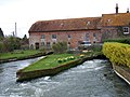
 Breamore - Breamore Mill on the River Avon - geograph.org.uk - 4281289.jpg 1,024 × 768; 178 KB
-
 Breamore Bridge - geograph.org.uk - 4200952.jpg 1,024 × 768; 192 KB
-
 Breamore Cottage - geograph.org.uk - 623908.jpg 640 × 470; 170 KB
-
 Breamore Great Bridge - geograph.org.uk - 4200988.jpg 1,024 × 768; 173 KB
-
 Breamore House - geograph.org.uk - 5392975.jpg 3,678 × 2,456; 5.89 MB
-
 Breamore House - geograph.org.uk - 5819274.jpg 1,600 × 1,200; 456 KB
-
 Breamore House - geograph.org.uk - 5847681.jpg 1,024 × 683; 206 KB
-
 Breamore House - geograph.org.uk - 5847683.jpg 1,024 × 683; 178 KB
-
 Breamore Mill (geograph 5048856).jpg 3,072 × 2,048; 1.31 MB
-
 Breamore Mill - geograph.org.uk - 4200971.jpg 1,024 × 768; 132 KB
-
 Breamore Mill - geograph.org.uk - 5048849.jpg 3,072 × 2,048; 1.38 MB
-
 Breamore Mill - geograph.org.uk - 5819905.jpg 1,600 × 1,200; 576 KB
-
 Breamore Park - geograph.org.uk - 3452371.jpg 1,024 × 768; 251 KB
-
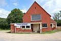
 Breamore Village Hall - geograph.org.uk - 2276081.jpg 1,024 × 732; 150 KB
-
 Breamore Wood - geograph.org.uk - 1276590.jpg 640 × 479; 242 KB
-
 Breamore Wood, bluebells - geograph.org.uk - 3452469.jpg 1,024 × 768; 373 KB
-
 Breamore Wood, bluebells - geograph.org.uk - 3452485.jpg 1,024 × 768; 357 KB
-
 Breamore Wood, South Charford Drove - geograph.org.uk - 3452479.jpg 1,024 × 768; 331 KB
-
 Breamore Wood, track junction - geograph.org.uk - 3452501.jpg 1,024 × 768; 292 KB
-

-
 Breamore, badger setts - geograph.org.uk - 4005384.jpg 1,024 × 768; 262 KB
-
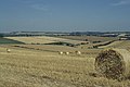
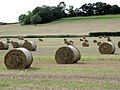
 Breamore, barley field - geograph.org.uk - 4005473.jpg 1,024 × 768; 132 KB
-
 Breamore, barn - geograph.org.uk - 3452899.jpg 1,024 × 768; 234 KB
-
 Breamore, barns - geograph.org.uk - 4005442.jpg 1,024 × 750; 120 KB
-
 Breamore, Bat and Ball - geograph.org.uk - 2276108.jpg 1,024 × 747; 140 KB
-
 Breamore, boundary sign - geograph.org.uk - 4005507.jpg 1,024 × 768; 196 KB
-
 Breamore, bridleway junction - geograph.org.uk - 3452863.jpg 1,024 × 768; 183 KB
-
 Breamore, cornfield - geograph.org.uk - 4005391.jpg 1,024 × 768; 189 KB
-
 Breamore, cornfield - geograph.org.uk - 4005453.jpg 1,024 × 768; 126 KB
-
 Breamore, cornfield - geograph.org.uk - 4005559.jpg 1,024 × 768; 141 KB
-
 Breamore, cowslips - geograph.org.uk - 3452824.jpg 1,024 × 768; 268 KB
-
 Breamore, disused chalk pit - geograph.org.uk - 4005483.jpg 1,024 × 768; 294 KB
-
 Breamore, Down Barn Cottage - geograph.org.uk - 4005437.jpg 1,024 × 768; 130 KB
-
 Breamore, Down Farm - geograph.org.uk - 1870079.jpg 1,024 × 768; 203 KB
-
 Breamore, farm buildings - geograph.org.uk - 4005447.jpg 1,024 × 768; 166 KB
-
 Breamore, farm track - geograph.org.uk - 4005401.jpg 1,024 × 768; 230 KB
-
 Breamore, farm track - geograph.org.uk - 4005413.jpg 1,024 × 768; 162 KB
-
 Breamore, fingerpost - geograph.org.uk - 1823528.jpg 1,024 × 768; 265 KB
-
 Breamore, footpath - geograph.org.uk - 3452895.jpg 1,024 × 768; 187 KB
-
 Breamore, granary - geograph.org.uk - 3452285.jpg 1,024 × 768; 183 KB
-

-
 Breamore, kissing gate - geograph.org.uk - 3452885.jpg 1,024 × 768; 145 KB
-
 Breamore, lay-by - geograph.org.uk - 4005492.jpg 1,024 × 768; 143 KB
-
 Breamore, lodges - geograph.org.uk - 4005594.jpg 1,024 × 768; 161 KB
-
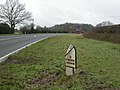 Breamore, milepost - geograph.org.uk - 2276072.jpg 1,024 × 768; 236 KB
-
 Breamore, North Charford Drove - geograph.org.uk - 4005007.jpg 1,024 × 768; 282 KB
-
 Breamore, North Charford Drove - geograph.org.uk - 4005376.jpg 1,024 × 768; 226 KB
-
 Breamore, North Charford Drove - geograph.org.uk - 4005431.jpg 1,024 × 768; 198 KB
-
 Breamore, North Charford Drove - geograph.org.uk - 4005462.jpg 1,024 × 768; 187 KB
-
 Breamore, North Charford Drove - geograph.org.uk - 4005543.jpg 1,024 × 768; 168 KB
-
 Breamore, permissive footpath - geograph.org.uk - 4201038.jpg 1,024 × 768; 304 KB
-
 Breamore, postbox No. SP6 184 - geograph.org.uk - 1238719.jpg 480 × 640; 66 KB
-

-
 Breamore, primary school - geograph.org.uk - 2276122.jpg 1,024 × 768; 167 KB
-
 Breamore, rape field - geograph.org.uk - 4005425.jpg 1,024 × 768; 150 KB
-
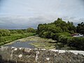
 Breamore, River Avon - geograph.org.uk - 4201002.jpg 1,024 × 762; 88 KB
-

-

-
 Breamore, Salisbury Road - geograph.org.uk - 4005610.jpg 1,024 × 768; 206 KB
-
 Breamore, Shallows - geograph.org.uk - 4201013.jpg 1,024 × 768; 189 KB
-
 Breamore, South Charford Down - geograph.org.uk - 3452873.jpg 1,024 × 768; 158 KB
-
 Breamore, South Charford Drove - geograph.org.uk - 3452454.jpg 1,024 × 768; 336 KB
-
 Breamore, St. Mary's Church 1 - geograph.org.uk - 5392979.jpg 3,678 × 2,456; 5.81 MB
-
 Breamore, St. Mary's Church 2 - geograph.org.uk - 5392983.jpg 4,259 × 2,803; 7.6 MB
-
 Breamore, St. Mary's Church 3 - geograph.org.uk - 5392986.jpg 3,581 × 2,294; 4.19 MB
-
 Breamore, St. Mary's Church 4 - geograph.org.uk - 5392989.jpg 4,651 × 2,696; 6.51 MB
-

-

-

-
 Breamore, St. Mary's Church, Great War memorial plaque - geograph.org.uk - 5393087.jpg 3,678 × 2,455; 3.97 MB
-

-
 Breamore, St. Mary's Church, One of the many hatchments - geograph.org.uk - 5393056.jpg 3,167 × 2,890; 3.82 MB
-
 Breamore, St. Mary's Church, Sir Edward Hulse window - geograph.org.uk - 5393065.jpg 3,535 × 3,502; 5.99 MB
-
 Breamore, St. Mary's Church, St. Christopher window - geograph.org.uk - 5393069.jpg 2,947 × 5,088; 7.26 MB
-
 Breamore, St. Mary's Church, Stained glass window - geograph.org.uk - 5393081.jpg 3,078 × 4,242; 7.48 MB
-
 Breamore, St. Mary's Church, Sundial on the south porch - geograph.org.uk - 5393010.jpg 3,678 × 2,455; 5.6 MB
-

-

-

-

-
-

-

-

-
 Breamore, St. Mary's Church, The c12th south porch - geograph.org.uk - 5393035.jpg 3,282 × 4,224; 7.74 MB
-
 Breamore, St. Mary's Church, The chancel from the tower arch - geograph.org.uk - 5393019.jpg 4,770 × 3,309; 7.62 MB
-
 Breamore, St. Mary's Church, The east window in the chancel - geograph.org.uk - 5393074.jpg 2,518 × 4,866; 6.35 MB
-
 Breamore, St. Mary's Church, The font - geograph.org.uk - 5393060.jpg 3,179 × 4,261; 5.65 MB
-
-
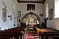 Breamore, St. Mary's Church, The nave - geograph.org.uk - 5393029.jpg 3,679 × 2,456; 4.14 MB
-
 Breamore, St. Mary's Church, The pulpit - geograph.org.uk - 5393089.jpg 5,520 × 3,680; 7.25 MB
-
 Breamore, stile - geograph.org.uk - 3452588.jpg 1,024 × 768; 300 KB
-
 Breamore, stile ^ signpost - geograph.org.uk - 4201005.jpg 1,024 × 768; 202 KB
-
 Bridge at Breamore Mill - geograph.org.uk - 5048862.jpg 2,048 × 3,072; 1.29 MB
-
 Bridge over the Avon, Woodgreen - geograph.org.uk - 5815632.jpg 1,972 × 1,459; 1.46 MB
-
 Charford Down, cropland - geograph.org.uk - 3452576.jpg 1,024 × 768; 193 KB
-
 Charford Downs, north of Breamore - geograph.org.uk - 2891173.jpg 1,600 × 1,067; 546 KB
-
 Charford Downs, north of Breamore - geograph.org.uk - 2909584.jpg 1,600 × 1,067; 407 KB
-
 Charford Downs, north of Breamore - geograph.org.uk - 2909619.jpg 1,600 × 1,067; 573 KB
-
 Christmas lunch, Breamore - geograph.org.uk - 2118506.jpg 640 × 481; 73 KB
-
 Combine harvester at work near Breamore House - geograph.org.uk - 5847709.jpg 1,024 × 683; 164 KB
-
 Crossing the River Avon in Woodgreen - geograph.org.uk - 5815583.jpg 1,993 × 1,494; 1.74 MB
-
 Dairy House - geograph.org.uk - 409552.jpg 640 × 480; 95 KB
-
 Detail on hatch - geograph.org.uk - 273564.jpg 640 × 480; 199 KB
-
 Dodington House - Breamore - geograph.org.uk - 623903.jpg 640 × 497; 194 KB
-
 Downland north of Breamore Wood - geograph.org.uk - 2891162.jpg 1,600 × 1,067; 548 KB
-
 Downland north of Breamore Wood - geograph.org.uk - 2891167.jpg 1,600 × 1,067; 602 KB
-
 Drainage channel in old water meadows - geograph.org.uk - 273537.jpg 640 × 480; 118 KB
-

-
 Farm buildings at Outwick - geograph.org.uk - 5819384.jpg 1,600 × 1,200; 559 KB
-
 Farm buildings, Upper Street - geograph.org.uk - 2118517.jpg 640 × 480; 68 KB
-
 Farmland near Upper Burgate - geograph.org.uk - 5196607.jpg 3,072 × 2,048; 1.4 MB
-
 Field near Upper Burgate - geograph.org.uk - 5196614.jpg 3,072 × 2,048; 1.54 MB
-
 Fields and pylon by the former railway line - geograph.org.uk - 5196498.jpg 3,072 × 2,048; 1.48 MB
-
 Flush Bracket S9945, Bat and Ball - geograph.org.uk - 1825277.jpg 480 × 640; 196 KB
-
 Footpath towards Lions Lodge - geograph.org.uk - 5847711.jpg 1,024 × 683; 288 KB
-
 Former dairy, Breamore Station - geograph.org.uk - 5195867.jpg 2,868 × 1,747; 1.07 MB
-
 Former railway line, Breamore - geograph.org.uk - 5195021.jpg 2,037 × 2,530; 1.35 MB
-
 Former railway line, Breamore - geograph.org.uk - 5195878.jpg 3,072 × 2,048; 1.34 MB
-
 Former railway line, Breamore - geograph.org.uk - 5195925.jpg 3,072 × 2,048; 1.73 MB
-
 Former railway line, Breamore - geograph.org.uk - 5195967.jpg 3,072 × 2,048; 1.56 MB
-
 Former railway line, Breamore - geograph.org.uk - 5196002.jpg 1,514 × 1,975; 1.27 MB
-
 Former railway line, Upper Burgate - geograph.org.uk - 5196605.jpg 2,048 × 3,072; 1.21 MB
-
 Former railway line, Upper Burgate - geograph.org.uk - 5196622.jpg 2,048 × 3,072; 1.79 MB
-
 Gate and wall, The Rookery, Breamore - geograph.org.uk - 2019279.jpg 640 × 480; 149 KB
-
 George VI Postbox, Breamore - geograph.org.uk - 1280027.jpg 480 × 640; 197 KB
-
 Giants grave long barrow breamore.jpg 3,346 × 1,132; 537 KB
-
 Green's Farm, Breamore - geograph.org.uk - 5195054.jpg 3,072 × 2,048; 1.23 MB
-
 Hale, irrigation channel - geograph.org.uk - 4179225.jpg 1,024 × 768; 183 KB
-
 Hale, sluice - geograph.org.uk - 4179218.jpg 1,024 × 768; 245 KB
-
 Hale, stile - geograph.org.uk - 4179210.jpg 1,024 × 768; 215 KB
-
 Hampshire Gate at entry to meadows - geograph.org.uk - 273568.jpg 640 × 480; 108 KB
-
 House and lane, Breamore - geograph.org.uk - 5195465.jpg 3,064 × 1,550; 943 KB
-
 Houses at Breamore (geograph 5195213).jpg 2,203 × 1,210; 665 KB
-
 Hulse Hall, Breamore - geograph.org.uk - 4591315.jpg 3,872 × 2,592; 4.63 MB
-
 Into the New Forest - geograph.org.uk - 5048888.jpg 1,994 × 2,024; 1.02 MB
-
 Jadeite axe from Breamore, Hampshire.jpg 2,560 × 1,920; 1.24 MB
-
 Junction of tracks in Breamore Wood - geograph.org.uk - 5847722.jpg 1,024 × 683; 305 KB
-
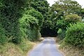
 Lane on the Breamore Estate - geograph.org.uk - 3141661.jpg 1,024 × 768; 289 KB
-
 Lane, Breamore - geograph.org.uk - 5195477.jpg 1,829 × 1,176; 469 KB
-
 Listed building, Breamore - geograph.org.uk - 5195798.jpg 2,183 × 1,525; 613 KB
-
 Lonely bench - geograph.org.uk - 1287816.jpg 428 × 640; 77 KB
-
 Long House, Breamore (geograph 5195077).jpg 3,072 × 2,048; 1.16 MB
-
 Long Steeple Lane (Track) - geograph.org.uk - 1281299.jpg 479 × 640; 178 KB
-

-
 Milepost near Breamore - geograph.org.uk - 1864845.jpg 640 × 480; 107 KB
-
 Milepost near Breamore - geograph.org.uk - 1864865.jpg 480 × 640; 206 KB
-
 Mill at Breamore - geograph.org.uk - 1775313.jpg 640 × 480; 89 KB
-
 Mill stream, Breamore - geograph.org.uk - 5048819.jpg 2,048 × 3,072; 1.56 MB
-
 North Charford Drove - geograph.org.uk - 5847714.jpg 1,024 × 683; 286 KB
-
 North Charford Drove - geograph.org.uk - 5847718.jpg 1,024 × 683; 209 KB
-

-
 Old station building, Breamore Halt - geograph.org.uk - 5195808.jpg 3,072 × 2,048; 1.26 MB
-
 Old station building, Breamore Halt - geograph.org.uk - 5195822.jpg 3,072 × 2,048; 1,011 KB
-
 Orchids and bluebells - geograph.org.uk - 411983.jpg 640 × 480; 145 KB
-
 Ordnance Survey Flush Bracket S9945 - geograph.org.uk - 5345294.jpg 3,909 × 2,933; 3.12 MB
-
 Outwick Cross - geograph.org.uk - 1039298.jpg 640 × 480; 99 KB
-
 Outwick, bird feeders - geograph.org.uk - 4207116.jpg 1,024 × 768; 271 KB
-
 Outwick, cereal field - geograph.org.uk - 4207072.jpg 1,024 × 768; 141 KB
-
 Outwick, country lane - geograph.org.uk - 4207075.jpg 1,024 × 768; 147 KB
-
 Outwick, Flood Street Farmhouse - geograph.org.uk - 4207129.jpg 1,024 × 768; 184 KB
-
 Outwick, kissing gate ^ signpost - geograph.org.uk - 4207081.jpg 1,024 × 768; 247 KB
-
 Outwick, maize field - geograph.org.uk - 4207089.jpg 1,024 × 768; 166 KB
-
 Outwick, postbox № SP6 373 - geograph.org.uk - 2171315.jpg 640 × 480; 110 KB
-
 Outwick, stile ^ signpost - geograph.org.uk - 4207123.jpg 1,024 × 768; 247 KB
-

-
 Pillbox, Breamore Mill - geograph.org.uk - 2793639.jpg 640 × 480; 119 KB
-
 Postbox beside River Avon at Breamore - geograph.org.uk - 2295626.jpg 1,600 × 1,200; 509 KB
-
 River Avon - geograph.org.uk - 485970.jpg 640 × 480; 109 KB
-
 River Avon flood plain - geograph.org.uk - 99085.jpg 640 × 480; 62 KB
-
 River Avon from Castle Hill - geograph.org.uk - 5046511.jpg 2,166 × 1,040; 517 KB
-
 River Avon near Breamore - geograph.org.uk - 5048230.jpg 1,920 × 1,208; 887 KB
-
 River Avon near Breamore - geograph.org.uk - 5048667.jpg 3,072 × 2,048; 1.33 MB
-
 River Avon near Breamore - geograph.org.uk - 5048773.jpg 2,048 × 3,072; 1.05 MB
-
 Road bridge over the River Avon, Hampshire - geograph.org.uk - 2295627.jpg 1,600 × 1,200; 594 KB
-

-
 Roly Poly straw bales - geograph.org.uk - 2042306.jpg 640 × 480; 116 KB
-
 Salisbury Road, Upper Burgate - geograph.org.uk - 5830068.jpg 1,930 × 1,362; 1.8 MB


.jpg)


.jpg)


.jpg)
_-_geograph.org.uk_-_1281299.jpg)


