Category:Bredbury
suburban town within the Metropolitan Borough of Stockport, in Greater Manchester, England  | |||||
| Upload media | |||||
| Instance of | |||||
|---|---|---|---|---|---|
| Location | Stockport, Greater Manchester, North West England, England | ||||
 | |||||
Subcategories
This category has the following 11 subcategories, out of 11 total.
B
- Bunkers Hill, Bredbury (1 F)
G
M
- M60 Junction 25, Bredbury (1 F)
N
- New Bridge, Bredbury (1 F)
O
- Otterspool Bridge (6 F)
S
T
Media in category "Bredbury"
The following 200 files are in this category, out of 250 total.
(previous page) (next page)-
 103 Carrington Road - geograph.org.uk - 4994707.jpg 1,000 × 750; 771 KB
-
 175 Stockport Road West - geograph.org.uk - 3748052.jpg 1,000 × 981; 289 KB
-
 A C Electrical - geograph.org.uk - 3964844.jpg 1,000 × 717; 225 KB
-
 A last look at the railway cutting - geograph.org.uk - 5551663.jpg 1,280 × 1,158; 1.6 MB
-
 A site for 60 houses - geograph.org.uk - 5551652.jpg 1,280 × 1,006; 764 KB
-
 Another sixty new houses - geograph.org.uk - 6089856.jpg 1,280 × 960; 946 KB
-
 Arch Bridge 13 detail, Peak Forest Canal 27 September 2020.jpg 4,032 × 3,024; 5.83 MB
-
 Arch Bridge 13, from the Woodley side, Peak Forest Canal 27 September 2020 (1).jpg 4,032 × 3,024; 5.53 MB
-
 Arch Bridge 13, from the Woodley side, Peak Forest Canal 27 September 2020 (2).jpg 4,032 × 3,024; 5.37 MB
-
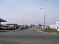
 Ashton Road (A6017) - geograph.org.uk - 3345676.jpg 800 × 516; 50 KB
-
 Ashton Road (A6017), Bredbury - geograph.org.uk - 2448113.jpg 1,280 × 960; 423 KB
-
 Ashton Road - geograph.org.uk - 2437485.jpg 640 × 453; 124 KB
-
 Ashton Road - geograph.org.uk - 2437497.jpg 640 × 563; 150 KB
-
 Ashton Road - geograph.org.uk - 3624365.jpg 640 × 480; 132 KB
-
 Ashton Road railway bridge - geograph.org.uk - 2437516.jpg 640 × 576; 151 KB
-
 Ashton Road, Bredbury - geograph.org.uk - 4455166.jpg 1,000 × 736; 536 KB
-
 Ashton Road, Castle Hill - geograph.org.uk - 2448075.jpg 1,280 × 960; 1.03 MB
-
 Back Road Behind Viridor IVC Site, Bredbury - geograph.org.uk - 3307639.jpg 2,560 × 1,920; 2.67 MB
-
 Bankfield Road - geograph.org.uk - 5552177.jpg 1,280 × 960; 1.09 MB
-
 Baytree Drive, Bredbury - geograph.org.uk - 632671.jpg 640 × 480; 55 KB
-
 Beetham Tower from Bredbury railway station - panoramio.jpg 3,072 × 2,304; 1.4 MB
-
 Beight Bridge - A6017 Crosses The River Tame - geograph.org.uk - 2835750.jpg 3,598 × 2,299; 3.03 MB
-
 Bredbury and Romiley , Daisyfield Recreation Ground - geograph.org.uk - 2233649.jpg 3,008 × 2,000; 1.53 MB
-
 Bredbury and Romiley , Daisyfield Recreation Ground - geograph.org.uk - 2233650.jpg 3,008 × 2,000; 1.44 MB
-
 Bredbury and Romiley , Goyt Valley - geograph.org.uk - 2233653.jpg 3,008 × 2,000; 1.52 MB
-
 Bredbury and Romiley , Goyt Valley - geograph.org.uk - 2233666.jpg 3,008 × 2,000; 1.34 MB
-
 Bredbury and Romiley , Goyt Valley - geograph.org.uk - 2233667.jpg 3,008 × 2,000; 1.53 MB
-
 Bredbury and Romiley , Middle Farm - geograph.org.uk - 2233655.jpg 3,008 × 2,000; 1.37 MB
-
 Bredbury and Romiley , Middle Farm - geograph.org.uk - 2233656.jpg 3,008 × 2,000; 1.48 MB
-
 Bredbury and Romiley , Middle Farm - geograph.org.uk - 2233657.jpg 3,008 × 2,000; 1.48 MB
-
 Bredbury and Romiley , Middle Farm - geograph.org.uk - 2233668.jpg 2,000 × 3,008; 1.11 MB
-
 Bredbury Delivery Office - geograph.org.uk - 5691961.jpg 1,280 × 960; 962 KB
-
 Bredbury electricity sub-station from the air - geograph.org.uk - 5954978.jpg 1,024 × 633; 281 KB
-
 Bredbury Esso - geograph.org.uk - 2739900.jpg 640 × 418; 110 KB
-
 Bredbury from the air - geograph.org.uk - 5955002.jpg 1,024 × 651; 328 KB
-
 Bredbury Green - geograph.org.uk - 1934542.jpg 640 × 535; 132 KB
-
 Bredbury Industrial Estate - geograph.org.uk - 2437390.jpg 640 × 504; 146 KB
-
 Bredbury Junction - geograph.org.uk - 1577320.jpg 640 × 595; 150 KB
-
 Bredbury Library - geograph.org.uk - 4489075.jpg 1,000 × 750; 652 KB
-
 Bredbury McDonalds - geograph.org.uk - 1034513.jpg 640 × 506; 114 KB
-

-
 Bredbury Park Industrial Estate - geograph.org.uk - 3376645.jpg 640 × 480; 40 KB
-
 Bredbury Park Industrial Estate - geograph.org.uk - 3376649.jpg 640 × 480; 45 KB
-
 Bredbury Park roundabout - geograph.org.uk - 2437577.jpg 640 × 382; 97 KB
-
 Bredbury Park Way - geograph.org.uk - 6171781.jpg 1,280 × 1,141; 1.06 MB
-
 Bredbury Park Way, Bredbury - geograph.org.uk - 3376675.jpg 640 × 480; 67 KB
-
 Bredbury Park Way, Bredbury - geograph.org.uk - 3377021.jpg 640 × 480; 71 KB
-
 Bredbury Parkway - geograph.org.uk - 2437411.jpg 640 × 471; 148 KB
-
 Bredbury Recreation Ground - geograph.org.uk - 3377096.jpg 640 × 480; 63 KB
-
 Bredbury Sunset - geograph.org.uk - 1705313.jpg 640 × 622; 108 KB
-
 Bredbury, River Goyt bank 3393.JPG 3,488 × 2,616; 2.08 MB
-
 Brinnington Road - geograph.org.uk - 6176387.jpg 1,280 × 960; 1.06 MB
-
 Bunkers Hill, Bredbury c.1900.jpg 660 × 457; 124 KB
-
 Bus at Bredbury Morrisons - geograph.org.uk - 3478328.jpg 640 × 421; 162 KB
-
 Car park restored - geograph.org.uk - 4813076.jpg 1,000 × 721; 548 KB
-
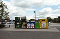
 Car Wash and re-cycling point - geograph.org.uk - 2813215.jpg 640 × 534; 125 KB
-
 Carrington Road - geograph.org.uk - 5571862.jpg 1,280 × 1,025; 1,009 KB
-
 Carrington Road Bridge - geograph.org.uk - 5660018.jpg 1,280 × 960; 955 KB
-
 Castle Hill Industrial Park , Bredbury - geograph.org.uk - 3376699.jpg 640 × 480; 126 KB
-
 Chamberlain Gardens, Bredbury - geograph.org.uk - 3377382.jpg 640 × 480; 59 KB
-
 Cherry blossom in Bredbury - geograph.org.uk - 5551703.jpg 1,280 × 876; 771 KB
-
 Cherry tree and building site - geograph.org.uk - 5898959.jpg 1,280 × 960; 1.04 MB
-
 Christmas Tree Recycling - geograph.org.uk - 1128546.jpg 640 × 480; 131 KB
-
 Christmas Trees at Morrisons - geograph.org.uk - 3773234.jpg 1,000 × 750; 222 KB
-
 Christmas Trees at Morrisons - geograph.org.uk - 5399970.jpg 1,024 × 708; 522 KB
-
 Construction at Bredbury Curve - geograph.org.uk - 6046371.jpg 1,280 × 960; 883 KB
-
 Copage Drive - geograph.org.uk - 4488692.jpg 1,000 × 750; 653 KB
-
 Crescent Road - geograph.org.uk - 3390937.jpg 640 × 640; 152 KB
-
 Cromwell Road, Bredbury - geograph.org.uk - 3376639.jpg 640 × 480; 49 KB
-
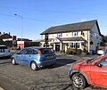 Crown Inn and Bredbury Hand Car Wash - geograph.org.uk - 5277783.jpg 1,000 × 840; 634 KB
-
 Demolition at the Lowes Arms - geograph.org.uk - 5552191.jpg 1,280 × 1,025; 1.2 MB
-
 Demolition of Lowes Arms - geograph.org.uk - 6176805.jpg 1,280 × 960; 1.08 MB
-
 Egerton Park Community Orchard - geograph.org.uk - 2691688.jpg 2,869 × 1,854; 1.3 MB
-
 Egerton Park Community Orchard - geograph.org.uk - 2691708.jpg 640 × 480; 151 KB
-
 Egerton Park Community Orchard - geograph.org.uk - 3489883.jpg 640 × 488; 238 KB
-
 Elm Tree Road - geograph.org.uk - 2739904.jpg 640 × 795; 234 KB
-
 Exit from Bredbury Morrisons - geograph.org.uk - 3295625.jpg 640 × 640; 180 KB
-
 Exit from Morrisons - geograph.org.uk - 2793581.jpg 640 × 494; 141 KB
-
 Fallen Tree - geograph.org.uk - 1318126.jpg 640 × 510; 198 KB
-
 Far Cromwell Road, Bredbury - geograph.org.uk - 3376611.jpg 640 × 480; 46 KB
-
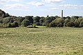
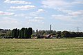
 Farmland and woodland near Bredbury - geograph.org.uk - 3345663.jpg 800 × 513; 84 KB
-
 Fenced off cutting - geograph.org.uk - 5551670.jpg 1,280 × 960; 1.23 MB
-
 Fencing on Stockport Road East - geograph.org.uk - 5551646.jpg 1,280 × 960; 782 KB
-
 Finland Park Farm - geograph.org.uk - 5904167.jpg 1,600 × 1,067; 374 KB
-
 Firemen on Oldmoor Road - geograph.org.uk - 3624347.jpg 640 × 480; 129 KB
-
 Footpath from Elm Street - geograph.org.uk - 2793680.jpg 640 × 480; 140 KB
-
-
-
 Footpath to Bredbury Industrial Estate - geograph.org.uk - 2437324.jpg 640 × 546; 240 KB
-
 Footpath to Elm Street - geograph.org.uk - 2691699.jpg 640 × 480; 156 KB
-
 Footpath to Woodley - geograph.org.uk - 1279413.jpg 640 × 480; 187 KB
-
 Footpath ^52 - geograph.org.uk - 2436821.jpg 640 × 480; 199 KB
-
 Footpath ^52 - geograph.org.uk - 2437457.jpg 640 × 593; 253 KB
-
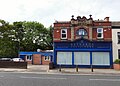
 Former Lloyds Bank - geograph.org.uk - 6085463.jpg 1,280 × 960; 944 KB
-
 Former Lloyds Bank - geograph.org.uk - 6255906.jpg 1,280 × 892; 823 KB
-
 Former toilets - geograph.org.uk - 5898986.jpg 1,280 × 960; 1.1 MB
-
 Go North to Go South - geograph.org.uk - 1034524.jpg 640 × 480; 132 KB
-
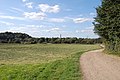
 Grazing at Bredbury - geograph.org.uk - 2813063.jpg 640 × 480; 225 KB
-
 Grazing at Bredbury - geograph.org.uk - 5724120.jpg 1,280 × 960; 1.49 MB
-
 Grazing land off Welkin Road - geograph.org.uk - 5723451.jpg 1,280 × 960; 1.02 MB
-
 Grazing off Welkin Lane - geograph.org.uk - 2262555.jpg 640 × 480; 132 KB
-
 Grazing off Welkin Lane - geograph.org.uk - 2262565.jpg 640 × 480; 160 KB
-
 Harrytown - geograph.org.uk - 1934554.jpg 640 × 520; 140 KB
-
 Harrytown Catholic High School - geograph.org.uk - 3220256.jpg 640 × 480; 153 KB
-
 Harrytown Court - Bredbury Green - geograph.org.uk - 2301882.jpg 4,224 × 3,168; 3.31 MB
-
 Hatherlow, Bredbury Green - geograph.org.uk - 2699778.jpg 640 × 434; 103 KB
-
 Heavy rain at Morrisons - geograph.org.uk - 3954465.jpg 1,000 × 1,000; 291 KB
-
 Heavy traffic on Stockport Road West - geograph.org.uk - 5030160.jpg 1,000 × 608; 453 KB
-
 Higher Bents Lane - geograph.org.uk - 3220230.jpg 640 × 480; 117 KB
-
 Highfield Cemetery - geograph.org.uk - 2301855.jpg 4,224 × 3,168; 3.2 MB
-
 Homebase, Bredbury - geograph.org.uk - 4919741.jpg 1,000 × 750; 582 KB
-
 Homebase, Bredbury - geograph.org.uk - 5994073.jpg 1,280 × 960; 890 KB
-
 House construction on Stockport Road West - geograph.org.uk - 3747957.jpg 1,000 × 724; 232 KB
-
 Housing construction at Bredbury Curve - geograph.org.uk - 6046342.jpg 1,280 × 960; 984 KB
-
 Industrial Landscape - geograph.org.uk - 1279419.jpg 640 × 480; 110 KB
-
 Industrial site, Bredbury - geograph.org.uk - 3345673.jpg 800 × 488; 84 KB
-
 Industrial Swamp - geograph.org.uk - 1279229.jpg 640 × 508; 239 KB
-
 Industrial Works - geograph.org.uk - 1413550.jpg 640 × 480; 98 KB
-
 Levelling the Bredbury Curve - geograph.org.uk - 5724860.jpg 1,280 × 960; 1.05 MB
-
 Lime Street - geograph.org.uk - 2195801.jpg 640 × 480; 100 KB
-
 Lines over the A560 - geograph.org.uk - 1567407.jpg 640 × 584; 206 KB
-
 Lines to Bredbury Waste - geograph.org.uk - 2436829.jpg 640 × 518; 180 KB
-
 Lines to Woodley - geograph.org.uk - 2436827.jpg 640 × 596; 210 KB
-
 Lingard Lane, Bredbury - geograph.org.uk - 3376655.jpg 640 × 480; 38 KB
-
 Lloyds pharmacy and the New Empire - geograph.org.uk - 3964881.jpg 1,000 × 705; 233 KB
-
 Looking over Bredbury - geograph.org.uk - 1385177.jpg 640 × 457; 127 KB
-
 Low Bridge at Bredbury - geograph.org.uk - 5551679.jpg 1,280 × 1,074; 914 KB
-
 Low bridge over Stockport Road East - geograph.org.uk - 4919669.jpg 1,000 × 750; 760 KB
-
 Lower Bredbury - geograph.org.uk - 1034508.jpg 640 × 614; 157 KB
-
 Lower Bredbury - geograph.org.uk - 1034510.jpg 640 × 480; 126 KB
-
 Lower Bredbury - geograph.org.uk - 1318165.jpg 640 × 555; 173 KB
-
 Lower Bredbury from the air - geograph.org.uk - 5954966.jpg 1,024 × 716; 331 KB
-
 Lower Bredbury Post Box - geograph.org.uk - 2739907.jpg 604 × 800; 163 KB
-
 Lower Bredbury, Annable Road - geograph.org.uk - 2570909.jpg 640 × 480; 192 KB
-
 Lower Bredbury, Path Behind Sargent Road - geograph.org.uk - 2570904.jpg 640 × 480; 323 KB
-
 Lower Bredbury, Path Behind Sargent Road - geograph.org.uk - 2570905.jpg 640 × 480; 302 KB
-
 Lyndhurst Avenue - geograph.org.uk - 2793691.jpg 640 × 480; 169 KB
-
 Machines at work - geograph.org.uk - 5724881.jpg 1,280 × 1,130; 1.5 MB
-
 Middle Farm, Lower Bredbury - geograph.org.uk - 2570892.jpg 1,280 × 960; 715 KB
-
 Middle Farm, Lower Bredbury - geograph.org.uk - 2570895.jpg 1,280 × 960; 809 KB
-
 Mill Lane - geograph.org.uk - 5898981.jpg 1,280 × 960; 1.02 MB
-
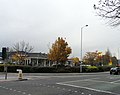
 Morrisons at Bredbury - geograph.org.uk - 2502695.jpg 640 × 545; 124 KB
-
 Morrisons car park - geograph.org.uk - 2793590.jpg 640 × 501; 147 KB
-
 Morrisons, Bredbury - geograph.org.uk - 3148532.jpg 640 × 353; 118 KB
-
 Morrisons, Bredbury - geograph.org.uk - 4954539.jpg 1,000 × 750; 608 KB
-
 National Grid Pylon Bredbury 275kV Cable B 6639.JPG 2,448 × 3,264; 3.7 MB
-
 National Grid Pylon Bredbury 275kV Cable B 6640.JPG 2,448 × 3,264; 3.44 MB
-
 National Grid Pylon Bredbury 275kV Cable B 6641.JPG 3,264 × 2,448; 3.6 MB
-
 National Grid Pylon Bredbury 275kV Cable B 6642.JPG 3,264 × 2,448; 3.52 MB
-
 National Grid Pylon Bredbury 275kV Cable B 6643.JPG 3,264 × 2,448; 3.77 MB
-
 New Bridge - geograph.org.uk - 2880108.jpg 640 × 480; 249 KB
-
 New Bridge Lane - geograph.org.uk - 3057885.jpg 640 × 542; 177 KB
-
 New build house on Stockport Road West - geograph.org.uk - 3824283.jpg 1,000 × 857; 219 KB
-
 New Construction on Stockport Road West - geograph.org.uk - 3737698.jpg 1,000 × 655; 211 KB
-
 New homes under construction - geograph.org.uk - 5902250.jpg 1,280 × 960; 943 KB
-
 New house foundations - geograph.org.uk - 5898910.jpg 1,280 × 960; 1.1 MB
-
 New houses at Bredbury Curve - geograph.org.uk - 6046350.jpg 1,280 × 960; 1,023 KB
-
 New houses at Bredbury Curve - geograph.org.uk - 6046362.jpg 1,280 × 960; 1.11 MB
-
 New houses on the Bredbury Curve development - geograph.org.uk - 6256767.jpg 1,280 × 864; 846 KB
-
 No cash at Bredbury Morrisons - geograph.org.uk - 4319612.jpg 1,000 × 1,000; 645 KB
-
 On my way home ! (7031760113).jpg 4,050 × 1,696; 816 KB
-
 Park Gate Close, Bredbury - geograph.org.uk - 3376686.jpg 640 × 480; 64 KB
-
 Part of the Bredbury roundabout - geograph.org.uk - 2019841.jpg 3,872 × 2,592; 3.31 MB
-

-
 Path to Goyt Valley, Lower Bredbury - geograph.org.uk - 2570894.jpg 1,280 × 960; 920 KB
-
 Pear Mill under the Pylon - geograph.org.uk - 4141211.jpg 1,000 × 1,000; 760 KB
-

-
 Please Pass Wide and Slow - geograph.org.uk - 4351285.jpg 1,000 × 1,000; 1.04 MB
-
 Pollarded Trees at Bredbury - geograph.org.uk - 3815533.jpg 1,000 × 851; 332 KB
-
 Princess Road, Bredbury - geograph.org.uk - 3377426.jpg 640 × 480; 61 KB
-
 Putting the car park back - geograph.org.uk - 4768655.jpg 1,000 × 800; 568 KB
-
 Queens Avenue, Bredbury - geograph.org.uk - 3377405.jpg 640 × 480; 64 KB
-
 Queens Road, Bredbury - geograph.org.uk - 3377400.jpg 640 × 480; 75 KB
-
 Railway Bridge - Bredbury - geograph.org.uk - 2108178.jpg 4,224 × 3,168; 3.05 MB
-
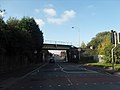
 Railway Bridge, Ashton Road - geograph.org.uk - 2448099.jpg 1,280 × 960; 631 KB
-
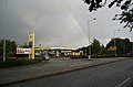 Rainbow over Morrisons Petrol Station - geograph.org.uk - 2019822.jpg 3,760 × 2,461; 2.2 MB
-
 Rebuilt house on Stockport Road West - geograph.org.uk - 4615484.jpg 1,000 × 750; 559 KB
-
 Recycling Bins - geograph.org.uk - 3534355.jpg 640 × 421; 124 KB
-
 Redhouse Lane - geograph.org.uk - 1725471.jpg 640 × 560; 120 KB
-
 Redhouse Lane, Bredbury - geograph.org.uk - 3377386.jpg 640 × 480; 54 KB
-
 Refurbished former bank building - geograph.org.uk - 6255889.jpg 1,280 × 960; 917 KB
-
 Reynards Solicitors - geograph.org.uk - 4994773.jpg 1,000 × 715; 565 KB
-
 River Goyt - geograph.org.uk - 1128510.jpg 640 × 480; 173 KB
-
 River Goyt - geograph.org.uk - 1207845.jpg 640 × 520; 180 KB
-
 River Goyt - geograph.org.uk - 4141198.jpg 1,000 × 750; 1.14 MB
-
 River Goyt - geograph.org.uk - 5660019.jpg 1,280 × 960; 1.49 MB
-
 Roadworks at Bredbury - geograph.org.uk - 3642497.jpg 640 × 480; 134 KB
-
 Roadworks in Bredbury - geograph.org.uk - 3634550.jpg 640 × 480; 151 KB
-
 Roadworks in Bredbury - geograph.org.uk - 5276412.jpg 1,000 × 750; 575 KB
-
 Roadworks on Hyde Road - geograph.org.uk - 5855987.jpg 1,280 × 960; 922 KB
-
 Rodney Drive, Bredbury - geograph.org.uk - 3377072.jpg 640 × 480; 69 KB
-
 Roundabout artwork - geograph.org.uk - 2437591.jpg 640 × 326; 100 KB
-
 Sandiway, Bredbury - panoramio.jpg 3,072 × 2,304; 1.82 MB
-
 Shops at Bredbury - geograph.org.uk - 3964951.jpg 1,000 × 802; 230 KB
-
 Sidebottom Street, Bredury - geograph.org.uk - 3377102.jpg 640 × 480; 74 KB
-
 Sign of The Rising Sun - geograph.org.uk - 4482711.jpg 1,000 × 1,000; 681 KB
-
 Site entrance at Bredbury Curve - geograph.org.uk - 6046358.jpg 1,280 × 960; 903 KB
-
 Site entrance to Bredbury Curve - geograph.org.uk - 5658127.jpg 1,280 × 850; 788 KB
-
 Slow traffic on the A560 - geograph.org.uk - 6148851.jpg 1,280 × 960; 1.15 MB
-
 Sorry some trees have gone - geograph.org.uk - 4224130.jpg 1,000 × 720; 487 KB


.jpg)
.jpg)
_-_geograph.org.uk_-_3345676.jpg)
,_Bredbury_-_geograph.org.uk_-_2448113.jpg)


.jpg)


