Category:Breestraat 47, Leiden
| Object location | | View all coordinates using: OpenStreetMap |
|---|
 | |||||
| Upload media | |||||
| Instance of |
| ||||
|---|---|---|---|---|---|
| Location | Leiden, South Holland, Netherlands | ||||
| Heritage designation |
| ||||
 | |||||
|
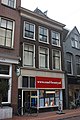
This is a category about rijksmonument number 24603
|
| Address |
|
Media in category "Breestraat 47, Leiden"
The following 6 files are in this category, out of 6 total.
-
 Gevel - Leiden - 20135703 - RCE.jpg 806 × 1,200; 188 KB
-
 Interieur schouw - Leiden - 20135706 - RCE.jpg 952 × 1,200; 223 KB
-
 Leiden - Breestraat 47 v2.jpg 3,024 × 4,032; 1.58 MB
-
 Leiden - Breestraat 47.JPG 3,056 × 4,592; 4 MB
-
 Overzicht - Leiden - 20135704 - RCE.jpg 1,200 × 957; 213 KB
-
 Voorgevel - Leiden - 20135705 - RCE.jpg 951 × 1,200; 236 KB


