Category:Bridgend, Perth and Kinross
residential area of Perth, Scotland, UK  | |||||
| Upload media | |||||
| Instance of | |||||
|---|---|---|---|---|---|
| Location | Perth, Perth and Kinross, Scotland | ||||
 | |||||
Media in category "Bridgend, Perth and Kinross"
The following 33 files are in this category, out of 33 total.
-
 Ardchoille Lodge, Bridgend, Perth (geograph 3497736).jpg 1,600 × 1,200; 1,017 KB
-
 Bridge over the River Tay - geograph.org.uk - 4241544.jpg 800 × 533; 99 KB
-
 Bridgend Inn - geograph.org.uk - 515351.jpg 640 × 413; 172 KB
-
 Bridgend Kinross - geograph.org.uk - 1720712.jpg 640 × 427; 98 KB
-
 Commercial Street, Bridgend, Perth.jpg 640 × 480; 107 KB
-
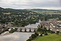
 Isla Road, Perth, from the air - geograph.org.uk - 3605724.jpg 1,024 × 681; 252 KB
-
 J.S.Lees Fish & Poultry Shop.jpg 1,200 × 1,200; 638 KB
-
 Perth Bridge (Smeaton's Bridge) - geograph.org.uk - 2674009.jpg 1,280 × 960; 533 KB
-
 Perth Bridge (Smeaton's Bridge) Floodlit - geograph.org.uk - 2674088.jpg 1,280 × 960; 578 KB
-
 Perth Bridge - geograph.org.uk - 3239664.jpg 2,592 × 1,936; 2 MB
-
 Perth Bridge - geograph.org.uk - 5349965.jpg 640 × 480; 52 KB
-
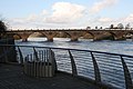
 Perth Bridge and the River Tay - geograph.org.uk - 4576075.jpg 640 × 473; 86 KB
-
 Perth Bridge crossing the River Tay - geograph.org.uk - 3573720.jpg 640 × 480; 41 KB
-
 Perth Bridge from Bridgend.jpg 640 × 406; 65 KB
-
 Perth Bridge from the North Inch - geograph.org.uk - 3727316.jpg 640 × 480; 88 KB
-
 Perth Bridge over the River Tay - geograph.org.uk - 4891245.jpg 3,264 × 2,448; 1.36 MB
-
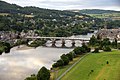 Perth Bridge over the Tay, from the air - geograph.org.uk - 3605718.jpg 1,024 × 681; 201 KB
-
 Perth Bridge over the Tay, from the air - geograph.org.uk - 3605720.jpg 1,024 × 681; 180 KB
-
 Perth Bridge, looking downstream - geograph.org.uk - 6184092.jpg 2,592 × 1,944; 1.45 MB
-
 Perth Bridge, Perth - geograph.org.uk - 6143028.jpg 1,600 × 1,200; 405 KB
-
 Reflections on the Tay - geograph.org.uk - 4190819.jpg 640 × 427; 286 KB
-
 River Tay - geograph.org.uk - 4144842.jpg 1,600 × 974; 350 KB
-
 River Tay and St Matthew's Church - geograph.org.uk - 2683009.jpg 1,280 × 960; 507 KB
-
 River Tay at Perth - geograph.org.uk - 5745518.jpg 640 × 480; 103 KB
-
 River Tay from Perth Old Bridge - geograph.org.uk - 4143065.jpg 3,888 × 2,592; 1.8 MB
-
 River Tay, Perth - geograph.org.uk - 2674095.jpg 1,280 × 960; 667 KB
-
 River Tay, Smeaton's Bridge - geograph.org.uk - 2674037.jpg 1,280 × 960; 599 KB
-
 The cultural city of Perth (33325478701).jpg 1,746 × 3,104; 278 KB
-
 The River Tay in full flow at Perth - geograph.org.uk - 2919411.jpg 640 × 640; 137 KB
-
 The River Tay in Perth - geograph.org.uk - 6184054.jpg 2,592 × 1,944; 1.28 MB
-
 The river Tay, looking south - geograph.org.uk - 6017257.jpg 1,024 × 768; 317 KB
-
 The Tay at Perth - geograph.org.uk - 3444133.jpg 640 × 480; 69 KB
-
 The Tay at Perth from the air - geograph.org.uk - 3605744.jpg 681 × 1,024; 201 KB
.jpg)


_-_geograph.org.uk_-_2674009.jpg)
_Floodlit_-_geograph.org.uk_-_2674088.jpg)


.jpg)


