Category:Bridges in the United States photographed in 2013
Media in category "Bridges in the United States photographed in 2013"
The following 170 files are in this category, out of 170 total.
-
 17th Street Bridge open for boats - Fort Lauderdale (2013).jpg 4,554 × 3,036; 2.92 MB
-
 17th Street Bridge open for boats - Fort Lauderdale, Florida.jpg 2,555 × 1,684; 1.04 MB
-
 35W - Minneapolis, MN - panoramio (1).jpg 2,130 × 1,524; 839 KB
-
 35W - Minneapolis, MN - panoramio (5).jpg 3,016 × 2,154; 1.96 MB
-
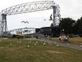 Aerial Lift Bridge in Duluth, Minnesota.jpg 4,608 × 3,440; 5.33 MB
-
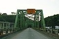 AL77nRoad-SingleLaneGreenBridge (35060804761).jpg 2,400 × 1,600; 1.78 MB
-
 Aldridge and Bryant.jpeg 2,592 × 1,458; 849 KB
-
 Azalea Festival 2013 17.JPG 3,072 × 2,304; 2.69 MB
-

-
 Bay Blue - Flickr - Joe Parks.jpg 3,198 × 2,132; 2.82 MB
-
 Bay Bridge Trail.JPG 3,083 × 2,940; 1.57 MB
-
 Beautiful landing into SFO.jpg 3,264 × 2,448; 2.55 MB
-
 Berlin Footbridge.JPG 3,072 × 2,304; 3.09 MB
-
 Blakeman Bridge.jpg 2,816 × 1,584; 1.64 MB
-
 Brereton Road Bridge.jpg 360 × 257; 57 KB
-
 Bridge on N Patterson St. over Two Mile Branch.JPG 3,072 × 2,304; 2.58 MB
-
 Bridge over the Ten Mile River (9404280988).jpg 3,264 × 1,840; 2.22 MB
-
 Bridge Park, FSCJ.JPG 3,264 × 2,448; 2.13 MB
-
 Bridge Street, Sheridan.jpg 3,767 × 3,014; 1.49 MB
-
 Canal Point FL US 441-98 SR 15-700 Old Connors Hwy north01.jpg 4,288 × 3,216; 1.8 MB
-
 Cannon Creek Bridge 001.jpg 3,273 × 2,179; 3.26 MB
-
 Cannon Creek Bridge 002.jpg 4,128 × 2,322; 4.79 MB
-
 Chicago Celebrates the Blackhawks' Stanley Cup (9181658278).jpg 4,000 × 3,000; 3.5 MB
-
 Clinton Presidential Park Bridge Little Rock AR 2013-06-07 001.jpg 768 × 1,024; 637 KB
-
 Clinton Presidential Park Bridge Little Rock AR 2013-06-07 002.jpg 768 × 1,024; 651 KB
-
 Clinton Presidential Park Bridge Little Rock AR 2013-06-07 003.jpg 1,024 × 768; 781 KB
-
 Clinton Presidential Park Bridge Little Rock AR 2013-06-07 004.jpg 1,024 × 768; 695 KB
-
 Clinton Presidential Park Bridge Little Rock AR 2013-06-07 005.jpg 768 × 1,024; 687 KB
-
 Clinton Presidential Park Bridge Little Rock AR 2013-06-07 006.jpg 768 × 1,024; 627 KB
-
 Clinton Presidential Park Bridge Little Rock AR 2013-06-07 007.jpg 1,024 × 768; 641 KB
-
 Clinton Presidential Park Bridge Little Rock AR 2013-06-07 013.jpg 1,024 × 768; 751 KB
-
 Clinton Presidential Park Bridge Little Rock AR 2013-06-07 014.jpg 768 × 1,024; 756 KB
-
 Clinton Presidential Park Bridge Little Rock AR 2013-06-07 015.jpg 1,024 × 768; 725 KB
-
 Clinton Presidential Park Bridge Little Rock AR 2013-06-07 016.jpg 768 × 1,024; 656 KB
-
 Clinton Presidential Park Bridge Little Rock AR 2013-06-07 017.jpg 1,024 × 768; 733 KB
-
 Crescent City Connection Bridge - panoramio.jpg 4,824 × 1,602; 980 KB
-
 Dartmouth Bridge 1.JPG 4,608 × 3,456; 5.52 MB
-
 Dartmouth Bridge 2.JPG 4,608 × 3,456; 5.84 MB
-
 Dartmouth Bridge 3.JPG 4,608 × 3,456; 5.85 MB
-
 Duct tape on Hwy 5 - St Paul, MN - panoramio.jpg 2,962 × 2,116; 2.65 MB
-
 Earl Wetherington Foot Bridge over Sugar Creek.jpg 3,072 × 2,304; 2.9 MB
-
 EB Hillsborough CR 580 over Hillsborough River.JPG 4,000 × 3,000; 2.38 MB
-
 Echols County Border sign on GA SR 94.JPG 3,072 × 2,304; 3.04 MB
-
 Flint River Boat Ramp, GA 32.JPG 4,320 × 3,240; 4.44 MB
-
 Flint River looking north, GA 32 bridge overhead.JPG 4,320 × 3,240; 4.39 MB
-
 Flooded Chicago River (8661065387).jpg 4,608 × 3,456; 3.46 MB
-
 Flowers and Liquor - Mills Ruins Park - Minneapolis, MN - panoramio.jpg 2,966 × 2,120; 2.38 MB
-
 Fog At The Golden Gate (36805214).jpeg 2,048 × 1,365; 537 KB
-
 Footbridge 2, McKey Park.JPG 3,072 × 2,304; 3.11 MB
-
 Footbridge crossing Lamoille River Main Street Hardwick VT March 2013.jpg 2,048 × 1,536; 3.92 MB
-
 Georgia I75nb Exit 62.JPG 4,320 × 3,240; 4.46 MB
-
 Gfp-georgia-high-falls-state-park-waterfalls-other-side.jpg 2,500 × 1,620; 914 KB
-
 Golden Gate 1 (32898509).jpeg 2,048 × 1,365; 567 KB
-
 Golden Gate Bridge (68340171).jpeg 2,048 × 1,152; 364 KB
-
 Golden Gate Bridge - panoramio (18).jpg 4,320 × 3,240; 6.12 MB
-
 Golden Gate bridge 1.jpg 4,608 × 3,072; 3.3 MB
-
 Golden Gate Bridge 14.jpg 3,264 × 2,448; 3.32 MB
-
 Golden Gate bridge 2.jpg 4,608 × 3,072; 3.54 MB
-
 Golden Gate Bridge from Tiburon, 2013-12-17.jpg 4,081 × 2,720; 4.97 MB
-
 Golden Gate Bridge in fog from Pier 39 2013.jpg 4,870 × 1,416; 1.62 MB
-
 Golden-gate-bridge-lincoln-park-a.JPG 4,320 × 3,240; 3.47 MB
-
 Golden-gate-bridge-lincoln-park-b.JPG 4,320 × 3,240; 3.58 MB
-
 Golden-gate-bridge-lincoln-park-c.JPG 3,240 × 4,320; 4.48 MB
-
 Golden-gate-bridge-lincoln-park-d.JPG 3,240 × 4,320; 4.26 MB
-
 Hennepin Ave Bridge from St Anthony Falls lock and dam.jpg 2,048 × 1,463; 834 KB
-
 Hennepin Canal Lock 29 Bridge.JPG 4,608 × 3,456; 5.17 MB
-
 Hoiwaandaaikiu2.JPG 3,264 × 2,448; 2.77 MB
-
 Hwy 5 - St Paul, MN - panoramio (3).jpg 2,760 × 1,971; 2.02 MB
-
 I 94 - Minneapolis, MN - panoramio (10).jpg 1,096 × 783; 343 KB
-
 I 94 - Minneapolis, MN - panoramio (11).jpg 2,092 × 1,497; 1.25 MB
-
 I 94 - Minneapolis, MN - panoramio (12).jpg 2,913 × 2,082; 2 MB
-
 I 94 - Minneapolis, MN - panoramio (14).jpg 2,880 × 2,060; 1.77 MB
-
 I 94 - Minneapolis, MN - panoramio (15).jpg 3,073 × 2,196; 2.2 MB
-
 I 94 - Minneapolis, MN - panoramio (18).jpg 2,710 × 1,936; 1.79 MB
-
 I 94 - Minneapolis, MN - panoramio (19).jpg 3,264 × 2,330; 2.21 MB
-
 I 94 - Minneapolis, MN - panoramio (24).jpg 2,405 × 1,719; 1.29 MB
-
 I 94 - Minneapolis, MN - panoramio (25).jpg 1,270 × 907; 458 KB
-
 I 94 - Minneapolis, MN - panoramio (26).jpg 3,264 × 2,330; 2.1 MB
-
 I 94 - Minneapolis, MN - panoramio (27).jpg 2,951 × 2,108; 2.7 MB
-
 I 94 - Minneapolis, MN - panoramio (28).jpg 2,762 × 1,976; 1.84 MB
-
 I 94 - Minneapolis, MN - panoramio (31).jpg 3,264 × 2,330; 2.66 MB
-
 I-459 South - Exit 32 - US11 (34804697150).jpg 2,400 × 1,600; 2.01 MB
-
 I-475 I-75 Split Sign.jpg 960 × 716; 76 KB
-
 I-95 St. Augustine Road Jacksonville Welcome Bridge.JPG 4,000 × 3,000; 2.51 MB
-
 Int285wRoad-Exit58-Int75 (34436098736).jpg 2,400 × 1,600; 1.47 MB
-
 Int294nRoad-IL50-SixMiles (40156984011).jpg 2,400 × 1,600; 1.6 MB
-
 Int85nRoad-Int75nsUS19US41-GA85 (34317444642).jpg 2,400 × 1,600; 1.28 MB
-
 Interstate 35E - St Paul, MN - panoramio (16).jpg 2,539 × 1,817; 1.33 MB
-
 Interstate 35E - St Paul, MN - panoramio (18).jpg 2,547 × 1,823; 1.35 MB
-
 Interstate 35E - St Paul, MN - panoramio (19).jpg 2,707 × 1,932; 1.86 MB
-
 Interstate 35E - St Paul, MN - panoramio (2).jpg 2,754 × 1,971; 1.18 MB
-
 Interstate 35E - St Paul, MN - panoramio (20).jpg 2,315 × 1,654; 1.12 MB
-
 Interstate 35E - St Paul, MN - panoramio (21).jpg 2,584 × 1,847; 1.43 MB
-
 Interstate 35E - St Paul, MN - panoramio (22).jpg 2,583 × 1,846; 1.69 MB
-
 Interstate 35E - St Paul, MN - panoramio (23).jpg 2,106 × 1,506; 960 KB
-
 Interstate 35E - St Paul, MN - panoramio (26).jpg 2,265 × 1,618; 1.02 MB
-
 Interstate 35E - St Paul, MN - panoramio (27).jpg 2,025 × 1,447; 732 KB
-
 Interstate 35E - St Paul, MN - panoramio (28).jpg 2,423 × 1,730; 1.17 MB
-
 Interstate 35E - St Paul, MN - panoramio (29).jpg 2,971 × 2,123; 1.82 MB
-
 Interstate 35E - St Paul, MN - panoramio (32).jpg 2,440 × 1,746; 1.41 MB
-
 Interstate 35E - St Paul, MN - panoramio (33).jpg 2,759 × 1,970; 2.19 MB
-
 Interstate 35E - St Paul, MN - panoramio (4).jpg 3,264 × 2,448; 1.78 MB
-
 Interstate 35E - St Paul, MN - panoramio (5).jpg 3,247 × 2,325; 1.55 MB
-
 Interstate 35E - St Paul, MN - panoramio (6).jpg 3,263 × 2,332; 1.73 MB
-
 Interstate 35W - Minneapolis, MN - panoramio (2).jpg 3,264 × 2,333; 2.01 MB
-
 Interstate 35W - Minneapolis, MN - panoramio (21).jpg 2,485 × 1,776; 1.12 MB
-
 Interstate 35W - Minneapolis, MN - panoramio (24).jpg 2,811 × 2,008; 1.62 MB
-
 Interstate 35W - Minneapolis, MN - panoramio (5).jpg 3,264 × 2,333; 2.53 MB
-
 Interstate 35W - Minneapolis, MN - panoramio (9).jpg 3,133 × 2,240; 1.98 MB
-
 Interstate 494 - Maple Grove, MN - panoramio (10).jpg 2,878 × 2,055; 3.67 MB
-
 Interstate 94 - Minneapolis, MN - panoramio (10).jpg 3,264 × 2,333; 2.2 MB
-
 Interstate 94 - Minneapolis, MN - panoramio (6).jpg 3,071 × 2,193; 2.19 MB
-
 Interstate 94 - St Paul, MN - panoramio (1).jpg 2,752 × 1,967; 1.84 MB
-
 Interstate 94 - St Paul, MN - panoramio (11).jpg 2,683 × 1,918; 1.49 MB
-
 Interstate 94 - St Paul, MN - panoramio (13).jpg 3,020 × 2,158; 2.02 MB
-
 Interstate 94 - St Paul, MN - panoramio (17).jpg 1,412 × 1,974; 1.46 MB
-
 Interstate 94 - St Paul, MN - panoramio (18).jpg 2,249 × 1,608; 1.16 MB
-
 Interstate 94 - St Paul, MN - panoramio (19).jpg 3,264 × 2,400; 2.9 MB
-
 Interstate 94 - St Paul, MN - panoramio (3).jpg 2,920 × 2,089; 1.99 MB
-
 Interstate 94 - St Paul, MN - panoramio (4).jpg 2,793 × 1,999; 1.72 MB
-
 Interstate 94 - St Paul, MN - panoramio (5).jpg 2,728 × 1,949; 1.26 MB
-
 Interstate 94 - St Paul, MN - panoramio.jpg 3,178 × 2,274; 1.5 MB
-
 Jones Bridge Remaining Structure.jpg 4,889 × 3,264; 21.06 MB
-
 Legacy Trail Overpass.jpg 3,264 × 2,448; 579 KB
-
 Lift Bridge, Duluth, MN. (10163605806).jpg 1,061 × 708; 77 KB
-
 Looking across Flint River, GA 32 bridge overhead.JPG 4,320 × 3,240; 4.45 MB
-
 Marina Embarcadero - panoramio (16).jpg 4,272 × 2,848; 2.37 MB
-
 Meriwether Bridge, Griffin.JPG 4,320 × 3,240; 4.47 MB
-
 Mills Ruins Park - Minneapolis, MN - panoramio (3).jpg 3,255 × 2,326; 2.57 MB
-
 Minneapolis Waterfront - panoramio.jpg 4,000 × 3,000; 2.15 MB
-
 Minneapolis, MN - panoramio (106).jpg 3,264 × 2,339; 2.44 MB
-
 Minneapolis, MN - panoramio (107).jpg 2,691 × 1,921; 1.6 MB
-
 Minnesota State Highway 280 - St Paul, MN - panoramio (10).jpg 2,470 × 1,764; 1,010 KB
-
 Minnesota State Highway 280 - St Paul, MN - panoramio (11).jpg 2,260 × 1,615; 998 KB
-
 Minnesota State Highway 280 - St Paul, MN - panoramio (2).jpg 2,715 × 1,942; 1.33 MB
-
 Minnesota State Highway 280 - St Paul, MN - panoramio (3).jpg 3,023 × 2,162; 1.86 MB
-
 Minnesota State Highway 280 - St Paul, MN - panoramio (5).jpg 2,520 × 1,803; 1.37 MB
-
 Minnesota State Highway 280 - St Paul, MN - panoramio (6).jpg 2,356 × 1,681; 1.07 MB
-
 Minnesota State Highway 280 - St Paul, MN - panoramio.jpg 2,970 × 2,120; 1.86 MB
-
 Moar Bryant bike bridge.jpeg 2,592 × 1,944; 725 KB
-
 NB I-95 on top of Lake Marion Bridge in South Carolina.jpg 979 × 736; 339 KB
-
 Oakland bay bridge - below (9328895401).jpg 3,568 × 2,255; 2.04 MB
-
 OAKLAND, CA, USA - Night Skyline with Bay Bridge.jpg 5,184 × 2,916; 6.51 MB
-
 Ocala, FL, USA - panoramio (16).jpg 2,592 × 1,944; 852 KB
-
 Open house at Lock and Dam 1 (9417678371).jpg 4,928 × 3,264; 4.01 MB
-
 Roadway view of Cass Street Bridge during a drawbridge opening (2013).jpg 2,400 × 1,600; 2.09 MB
-
 Robert Street Bridge - St Paul, MN - panoramio.jpg 3,264 × 2,448; 3.32 MB
-
 Roswell Mill Park.jpg 3,456 × 2,304; 2.45 MB
-
 Roswell Road Bridge over the Chattahoochee - panoramio.jpg 4,000 × 3,000; 6.15 MB
-
-
 San Francisco–Oakland Bay Bridge- New and Old bridges.jpg 4,914 × 3,100; 6.94 MB
-
 SC5-End-Blacksburg.jpg 5,520 × 3,684; 4.03 MB
-
 Scare 71 - Hwy 5 - St Paul, MN - panoramio.jpg 3,142 × 2,242; 2.89 MB
-
 South Coast Plaza (2013) 27.JPG 4,313 × 2,658; 1.01 MB
-
 St. Cloud Rail Bridge.jpg 1,024 × 640; 150 KB
-
 State highway 3a bridge plum creek 2013.jpg 2,174 × 1,449; 3.49 MB
-
 Subway on Manhattan Bridge 2 vc.jpg 4,200 × 2,781; 8.93 MB
-
 Sugar Creek, Gornto Rd.JPG 3,072 × 2,304; 3.15 MB
-
 Sunset under memorial causeway bridge clearwater february 2013 04b.jpg 1,500 × 986; 69 KB
-
 Sunset under memorial causeway bridge february 2013 04.jpg 1,785 × 1,173; 298 KB
-
 US1sUS9sRoad-IronBridgeBlack (34425673345).jpg 2,400 × 1,600; 1.76 MB
-
 Vadnais Blvd Bridge - Vadnais Heights, MN - panoramio.jpg 3,264 × 2,448; 3.54 MB
-
 View of Golden Gate Bridge from Battery Spencer in Marin Headlands.png 2,412 × 2,449; 24.2 MB
-
 Wabasha Street Bridge - St Paul, MN - panoramio.jpg 3,264 × 2,448; 4.81 MB
-
 Washington Avenue bridge panorama with downtown Minneapolis.jpg 2,048 × 554; 242 KB
-
 William E Clark Presidential Park Wetlands Little Rock AR 2013-06-07 015.jpg 1,024 × 768; 737 KB
-
 William E Clark Presidential Park Wetlands Little Rock AR 2013-06-07 017.jpg 1,024 × 768; 720 KB
-
 William E Clark Presidential Park Wetlands Little Rock AR 2013-06-07 018.jpg 1,024 × 768; 674 KB
-
 William E Clark Presidential Park Wetlands Little Rock AR 2013-06-07 019.jpg 1,024 × 768; 819 KB
-
 William E Clark Presidential Park Wetlands Little Rock AR 2013-06-07 024.jpg 1,024 × 768; 813 KB
.jpg)

.jpg)
.jpg)

.jpg)


.jpg)


.jpg)


.jpg)


.jpg)

.jpeg)


.jpeg)
.jpeg)
.jpg)


.jpg)
.jpg)
.jpg)
.jpg)
.jpg)
.jpg)
.jpg)
.jpg)
.jpg)
.jpg)
.jpg)
.jpg)
.jpg)
.jpg)
.jpg)


.jpg)
.jpg)
.jpg)
.jpg)
.jpg)
.jpg)
.jpg)
.jpg)
.jpg)
.jpg)
.jpg)
.jpg)
.jpg)
.jpg)
.jpg)
.jpg)
.jpg)
.jpg)
.jpg)
.jpg)
.jpg)
.jpg)
.jpg)
.jpg)
.jpg)
.jpg)
.jpg)
.jpg)
.jpg)
.jpg)
.jpg)
.jpg)
.jpg)
.jpg)
.jpg)
.jpg)
.jpg)


.jpg)

.jpg)

.jpg)

.jpg)
.jpg)
.jpg)
.jpg)
.jpg)
.jpg)
.jpg)
.jpg)


.jpg)

.jpg)
.jpg)
.jpg)


.jpg)


_27.JPG)


.jpg)


